Tadami River Scenic Viewpoints - Fukushima, Japan
My main goal today was simple: explore the scenic viewpoints along the Tadami River in Fukushima Prefecture. This area is best known for the JR Tadami Line—a railway that winds through deep valleys, crosses dramatic bridges, and transforms completely with the seasons. Whether it’s autumn foliage, winter snow, or early summer mist, it’s often described as one of Japan’s most romantic train journeys.
While many people come just for the train ride, I wanted to experience it differently by chasing the viewpoints instead. I started my day in Aizu-Wakamatsu, catching an early train toward Aizu-Kawaguchi Station in the small town of Kaneyama. The town itself is known for its natural carbonated water and onsen, but that wasn’t why I was here. I was here for Oshi Village.
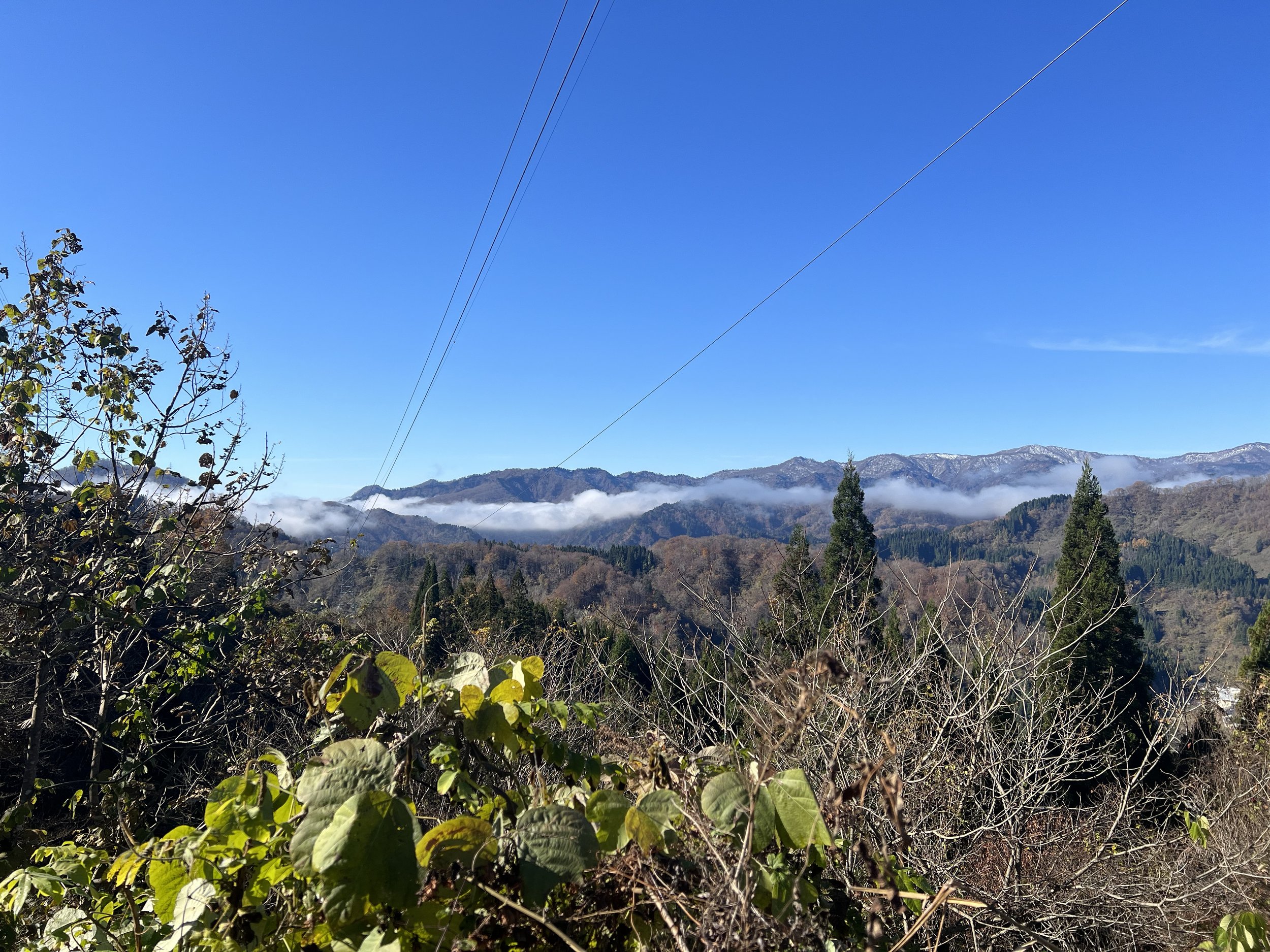
As soon as I arrived, I began the uphill walk toward a viewpoint overlooking the village. And right away—it was a climb. Most of the elevation gain came in this first stretch, making it the most physically demanding part of the day. The road gradually shifted from paved streets to a narrow mountain path, and eventually into a forest trail. Along the way, I passed a couple of workers clearing fallen trees. They warned me about recent bear sightings in the area and told me to be careful as I continued up. Not exactly comforting but also not entirely surprising in a place this remote. I thanked them and kept going.
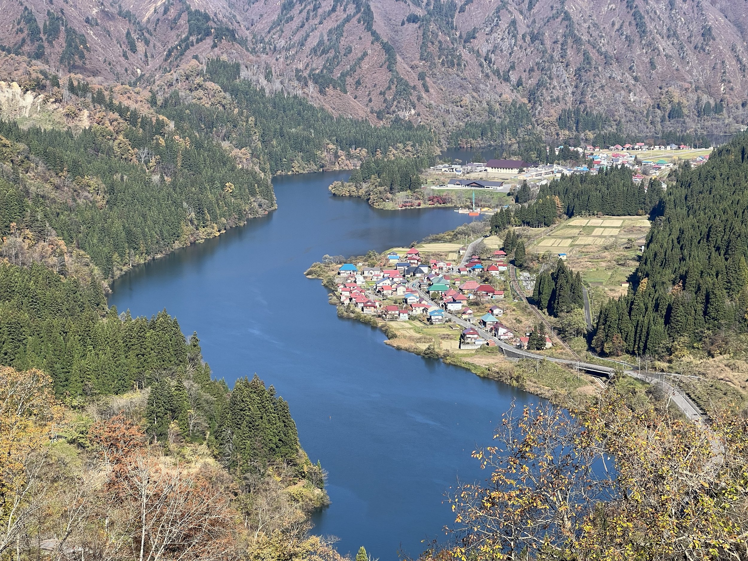
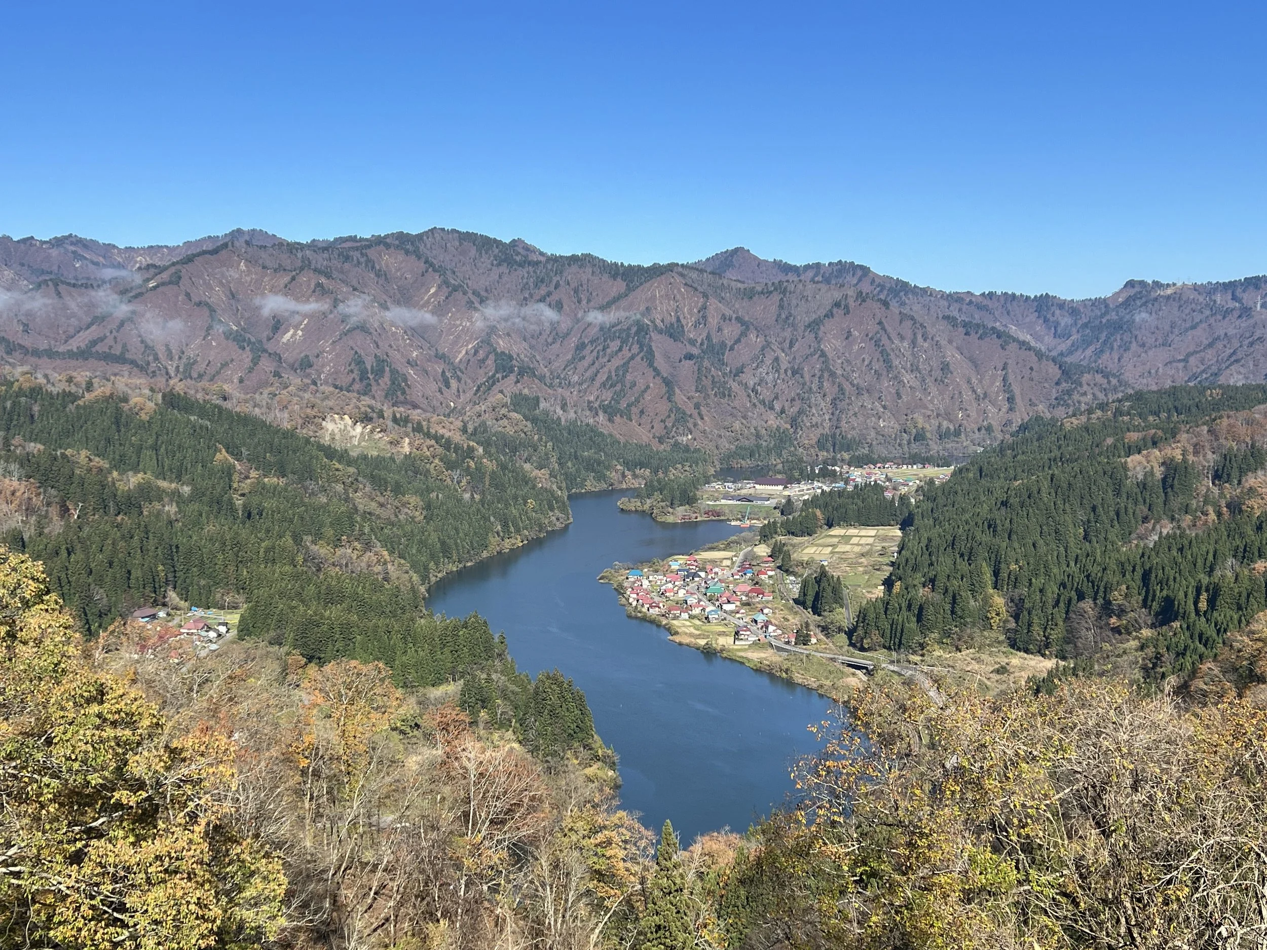
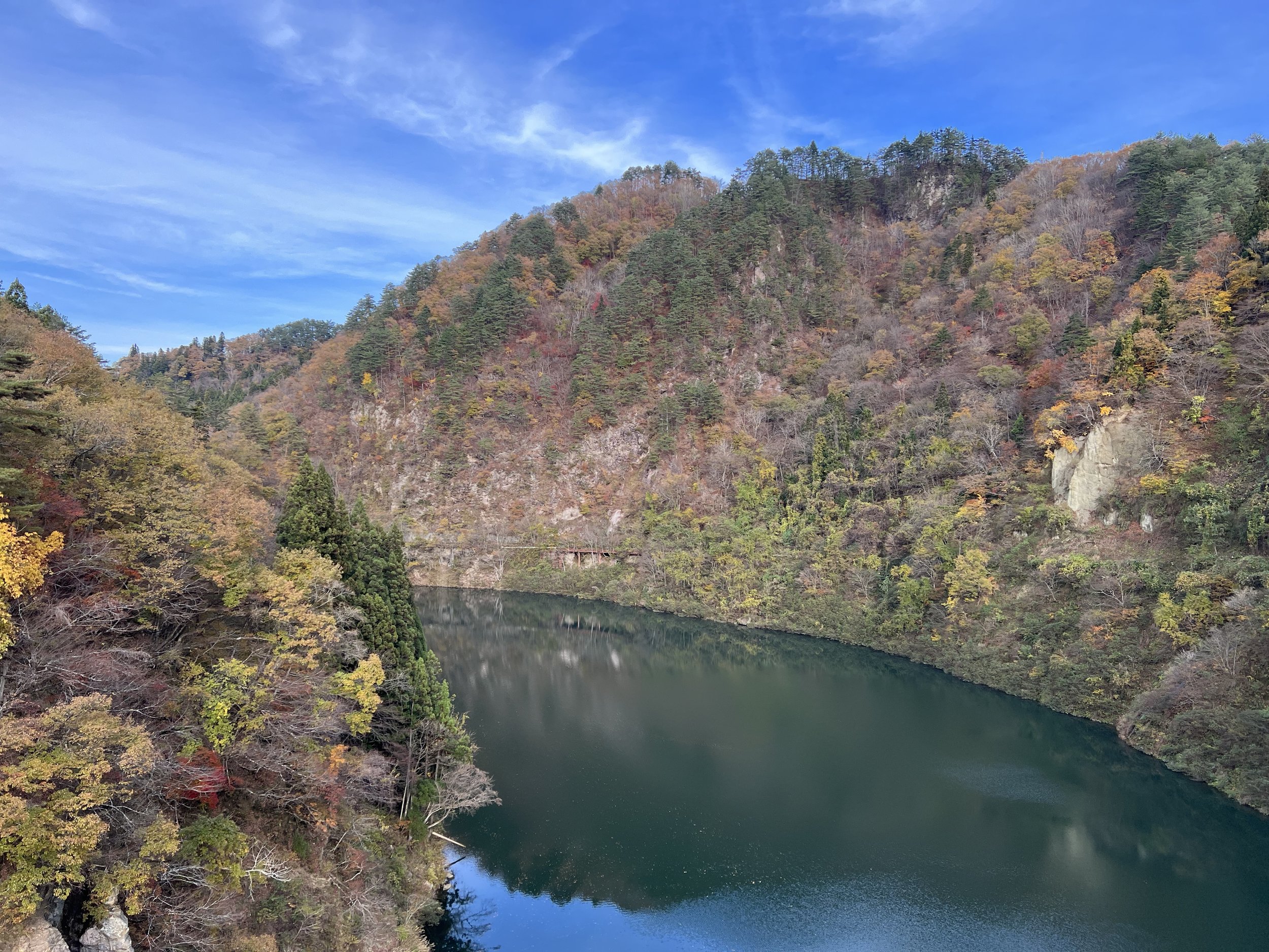
The viewpoint itself isn’t marked, which made it feel a bit like a hidden find. I had only discovered it while browsing maps beforehand. But once I got there, it was immediately clear why it was worth the effort. Below me sat Oshi Village—tucked between mountains and the river, with its distinct red and blue rooftops standing out against the landscape. The houses are designed to withstand heavy snowfall, and the entire setting has earned comparisons to alpine villages in Switzerland. After taking it all in (and a few photos), I made my way back down the mountain. I passed the workers again and let them know—no bears spotted.
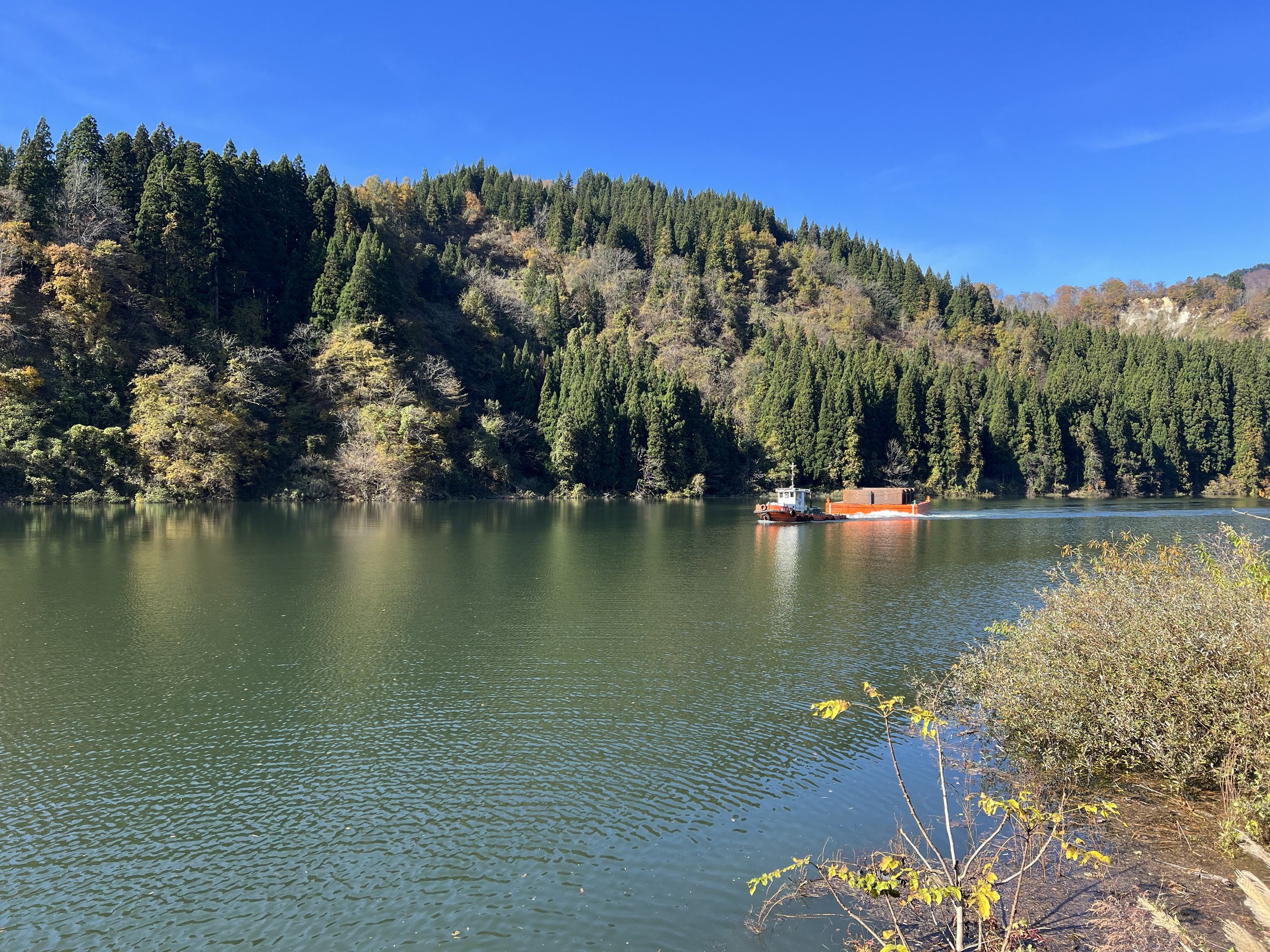
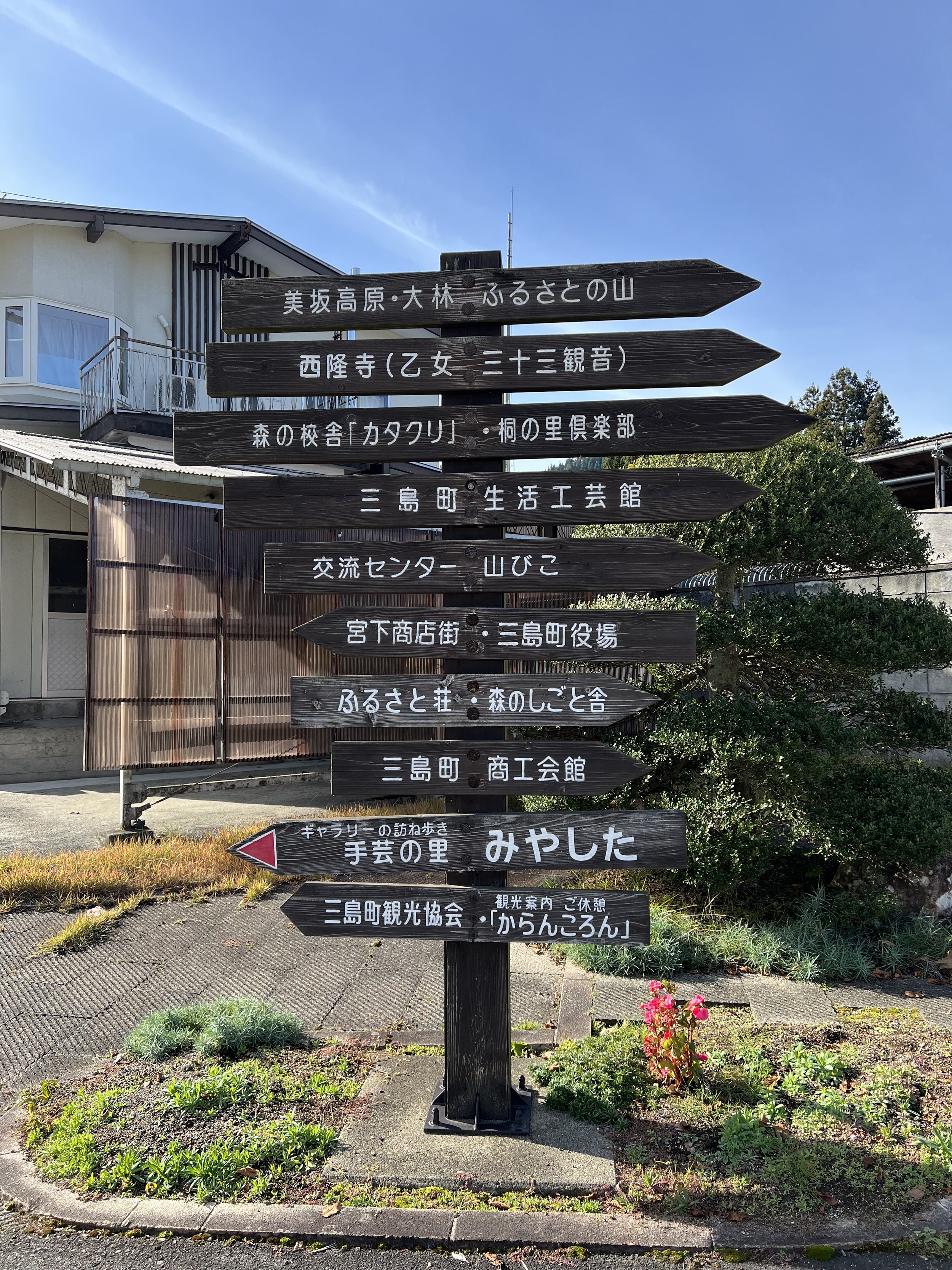
From here, the walk became much easier. Mostly downhill, with a few flat stretches. I followed the road into Oshi Village itself. Seeing it up close felt different than from above but still interesting in its own way. There’s something about walking through a place that gives it a different kind of depth. I continued on toward a roadside station to grab some lunch, keeping an eye on the train schedule to make sure I wouldn’t miss my next connection.
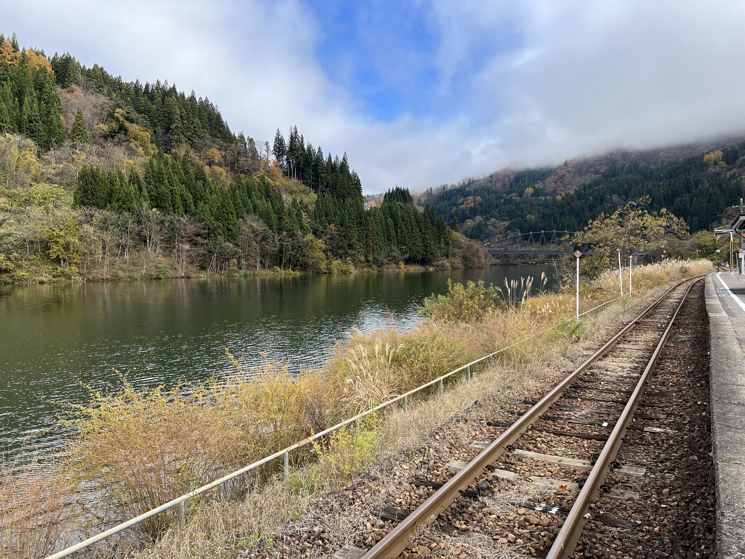
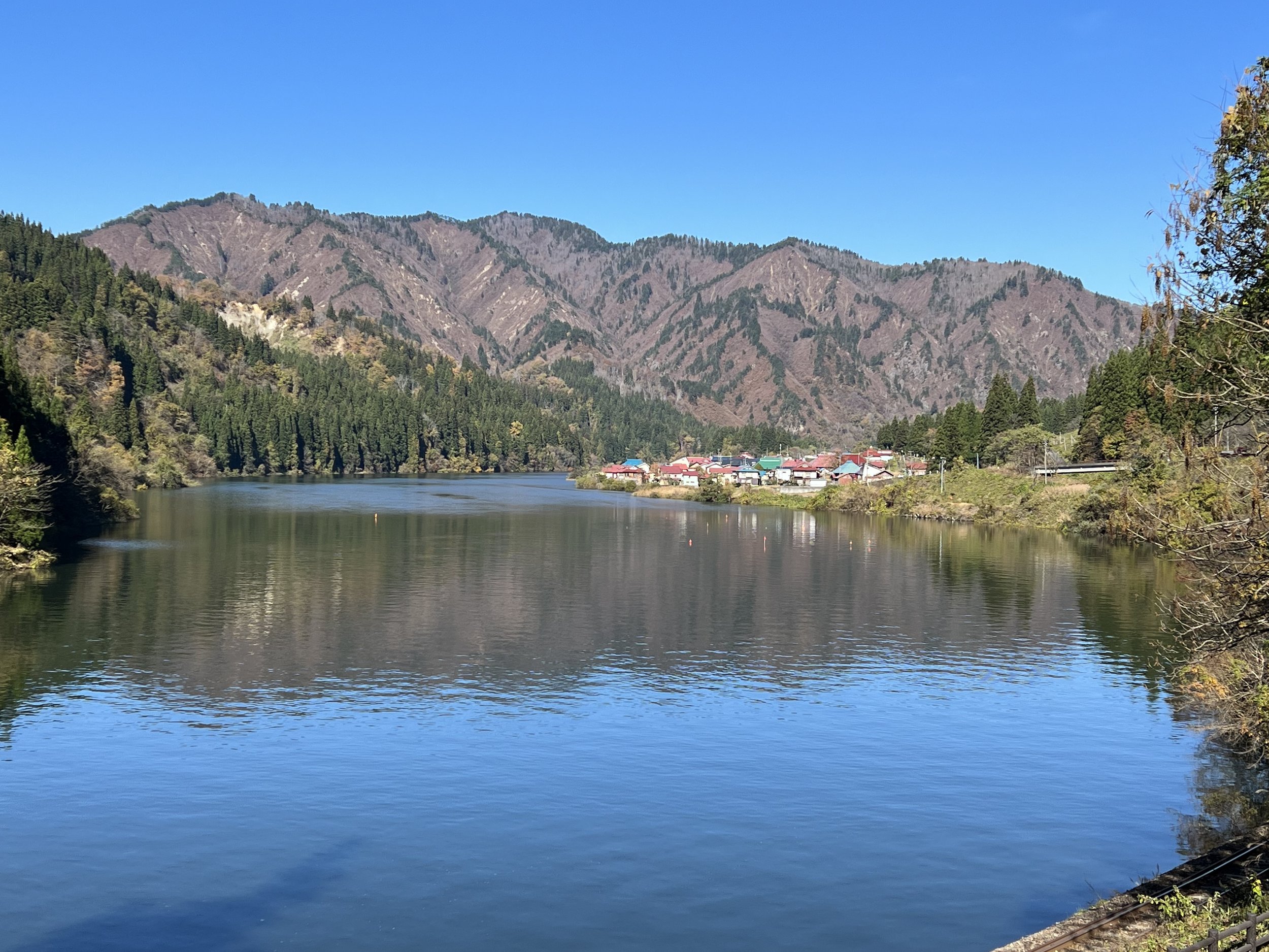
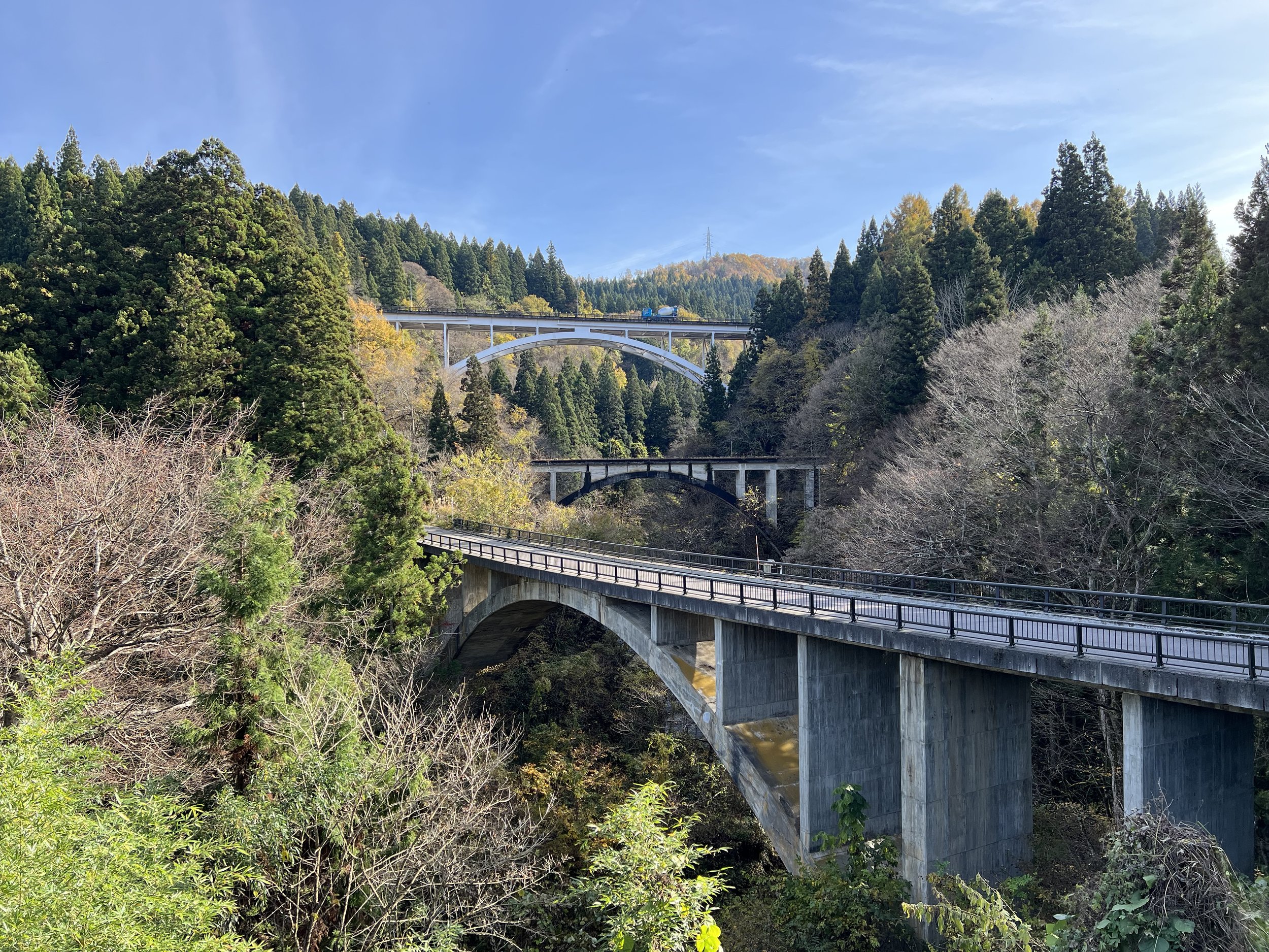
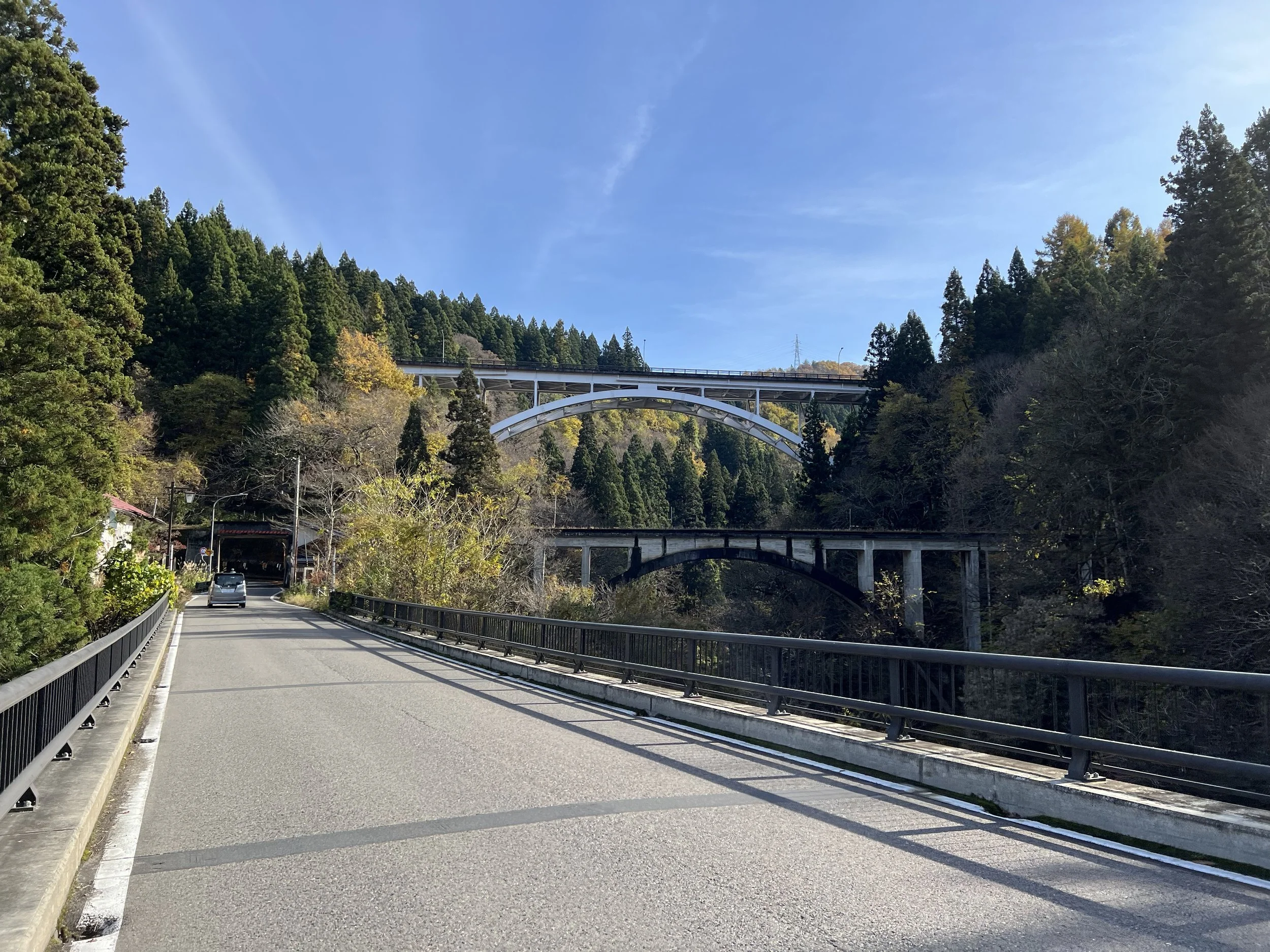
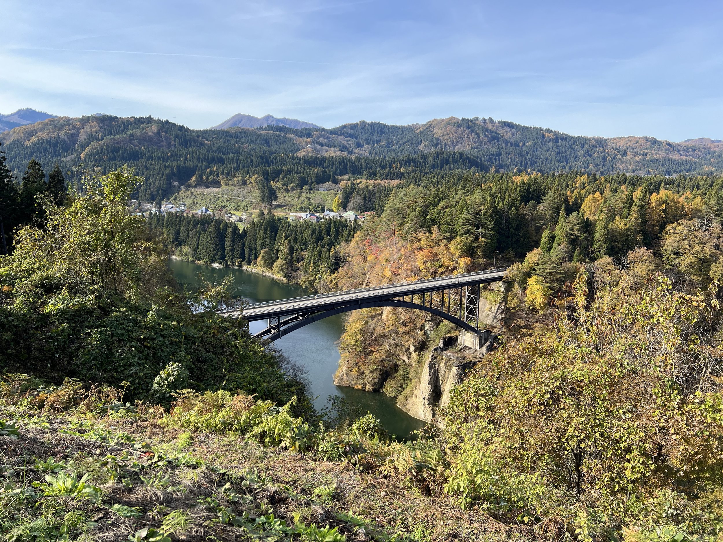
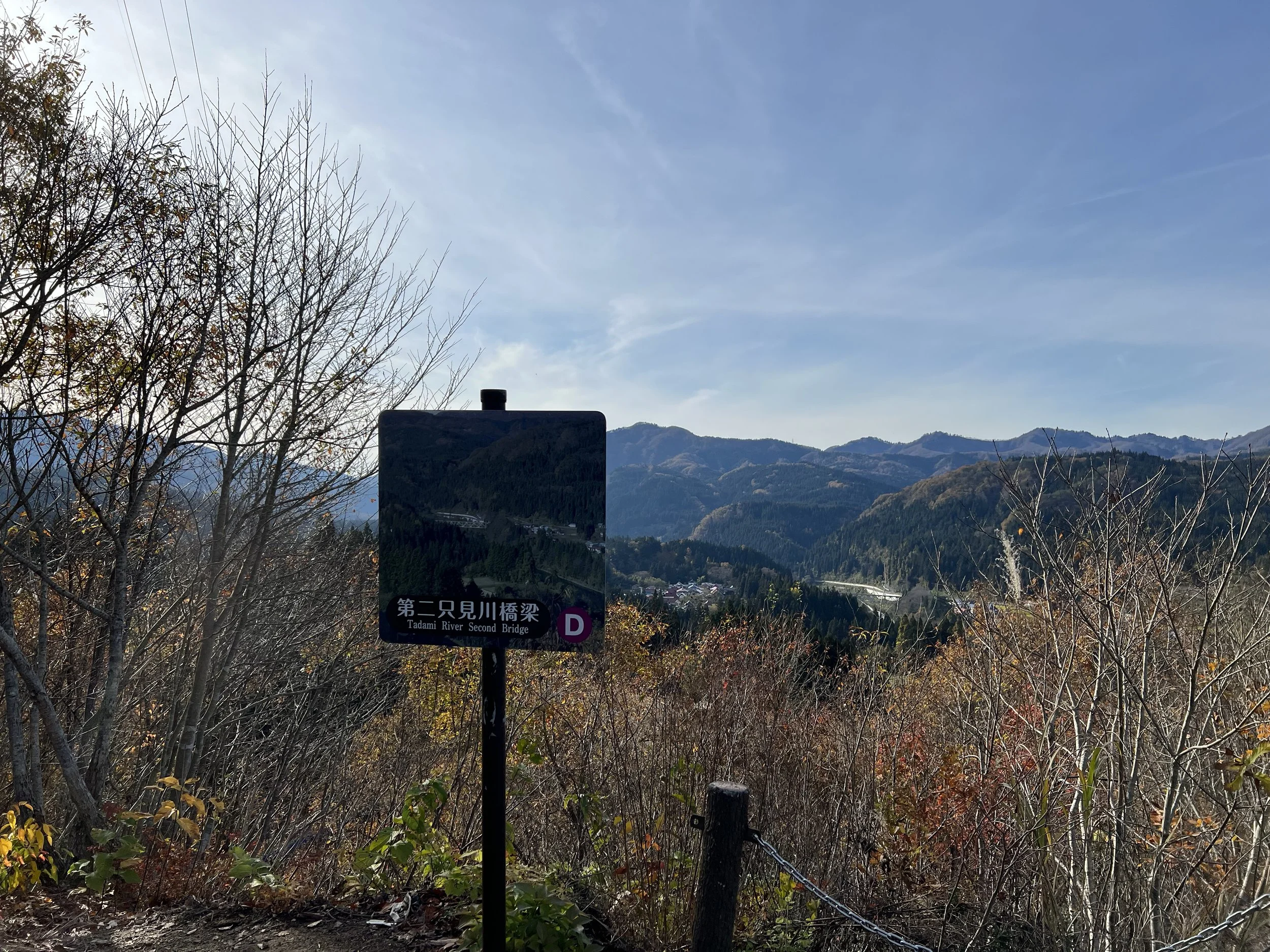
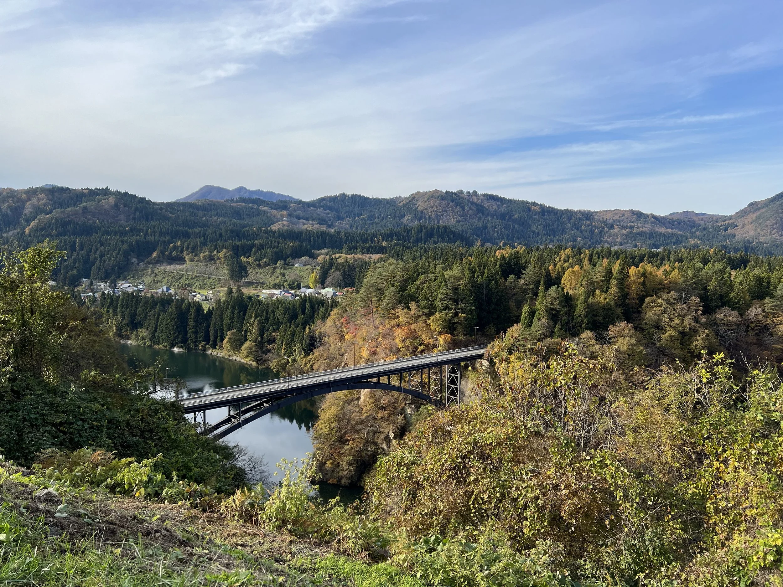
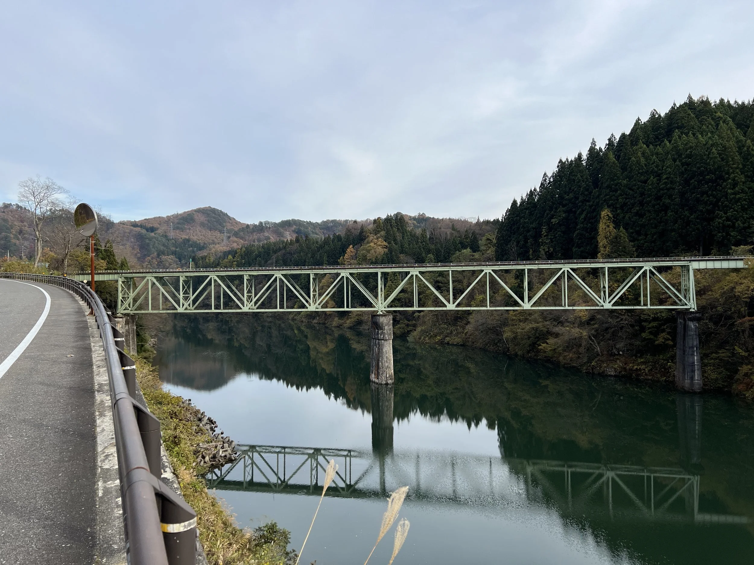
From Aizu-Nakagawa Station, I boarded the train and rode four stops to Aizu-Miyashita Station. This was where the second half of the day really began. From here, I set out on foot again, heading toward one of the more unique viewpoints in the area—the Miyashita Arch Sankyodai Bridges. This spot offers a view of three concrete arch bridges side by side: two road bridges and one railway bridge. Because of their different sizes, they’re often nicknamed “the three brothers.” After spending some time there, I crossed one of the bridges and continued toward my main objective: the iconic Tadami Line train viewpoints.
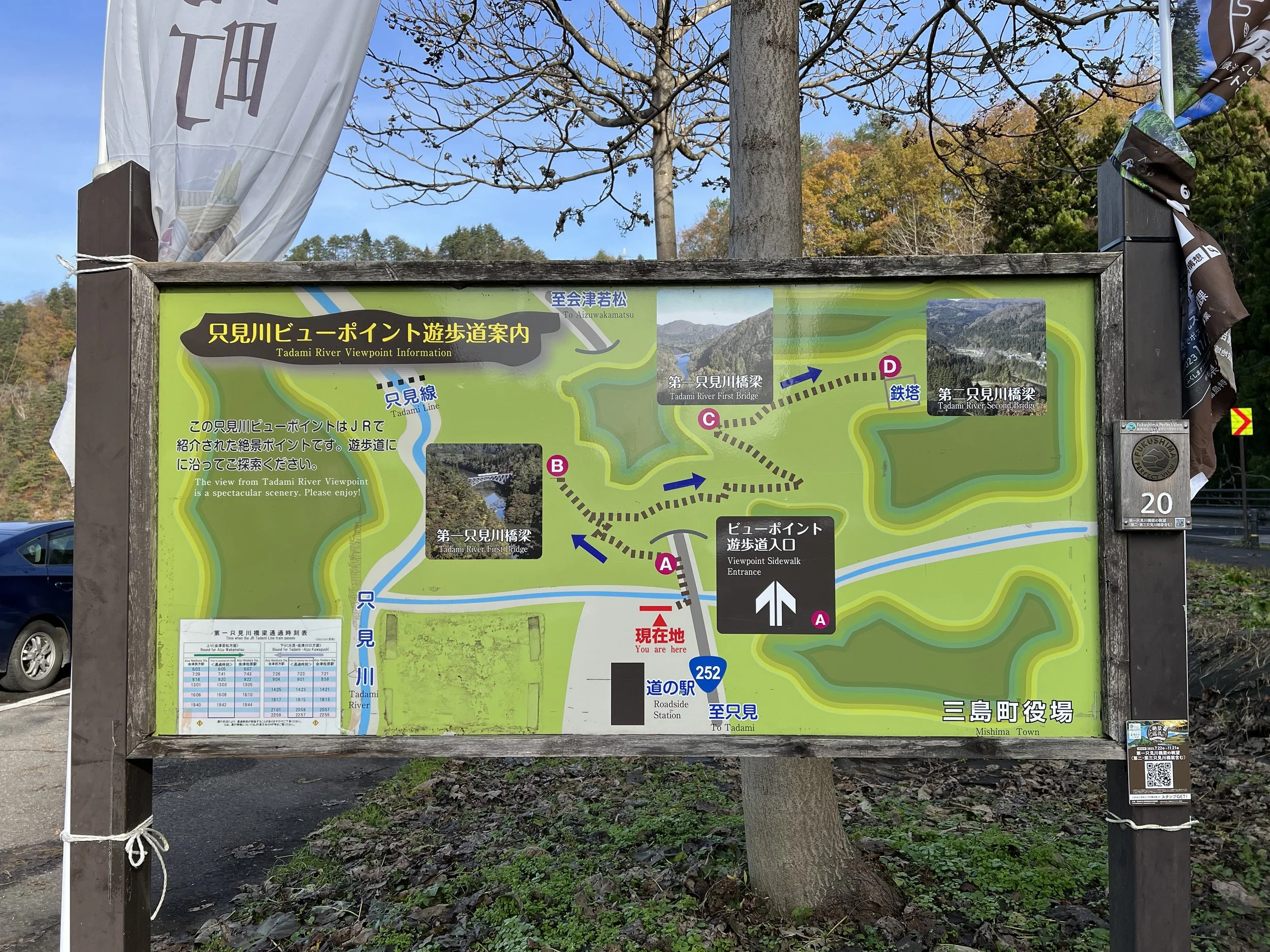
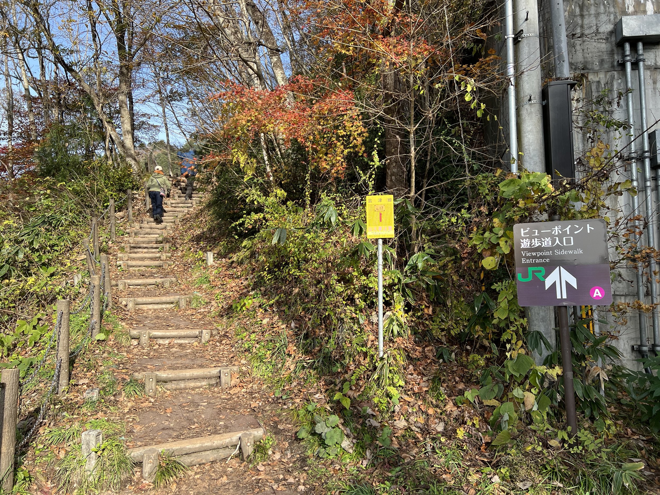
The trailhead is located near Ozekaido Mishima Juku Roadside Station, about a 30-minute walk from the bridges. As I approached the area, I started to notice more people—cameras in hand, clearly there for the same reason. This was the most “popular” part of the day. I checked the train schedule on my phone, only to realize it was posted right there at the roadside station. From here, the trail leads up to multiple viewpoints, each at a different elevation depending on how far you want to climb.
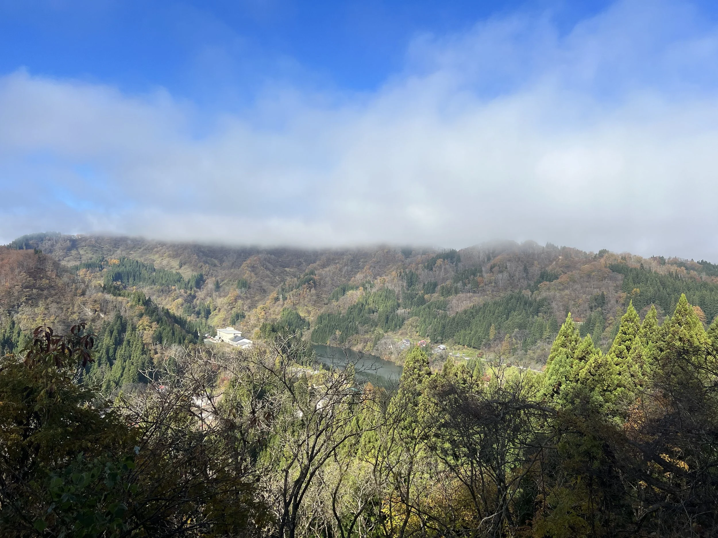
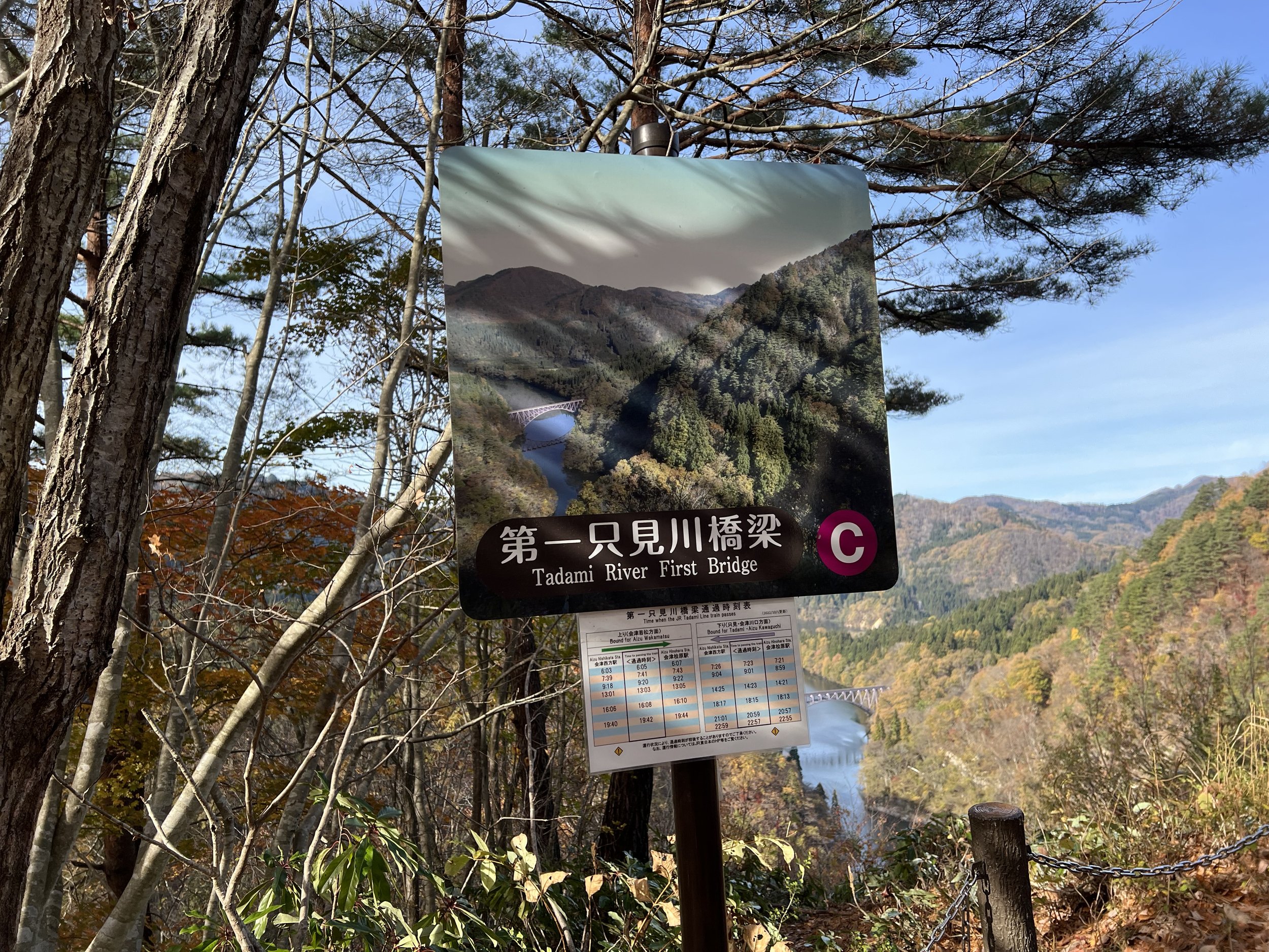
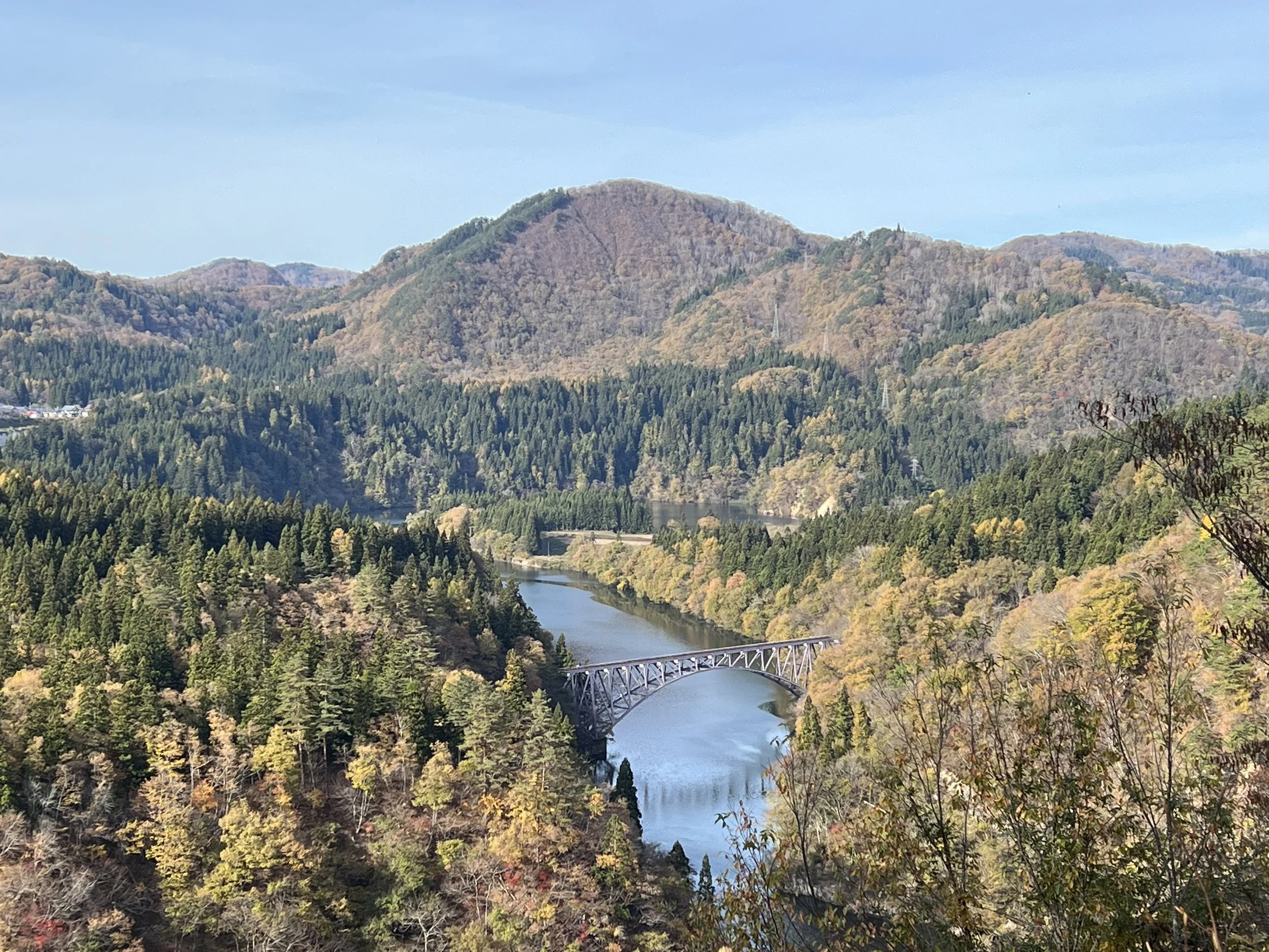
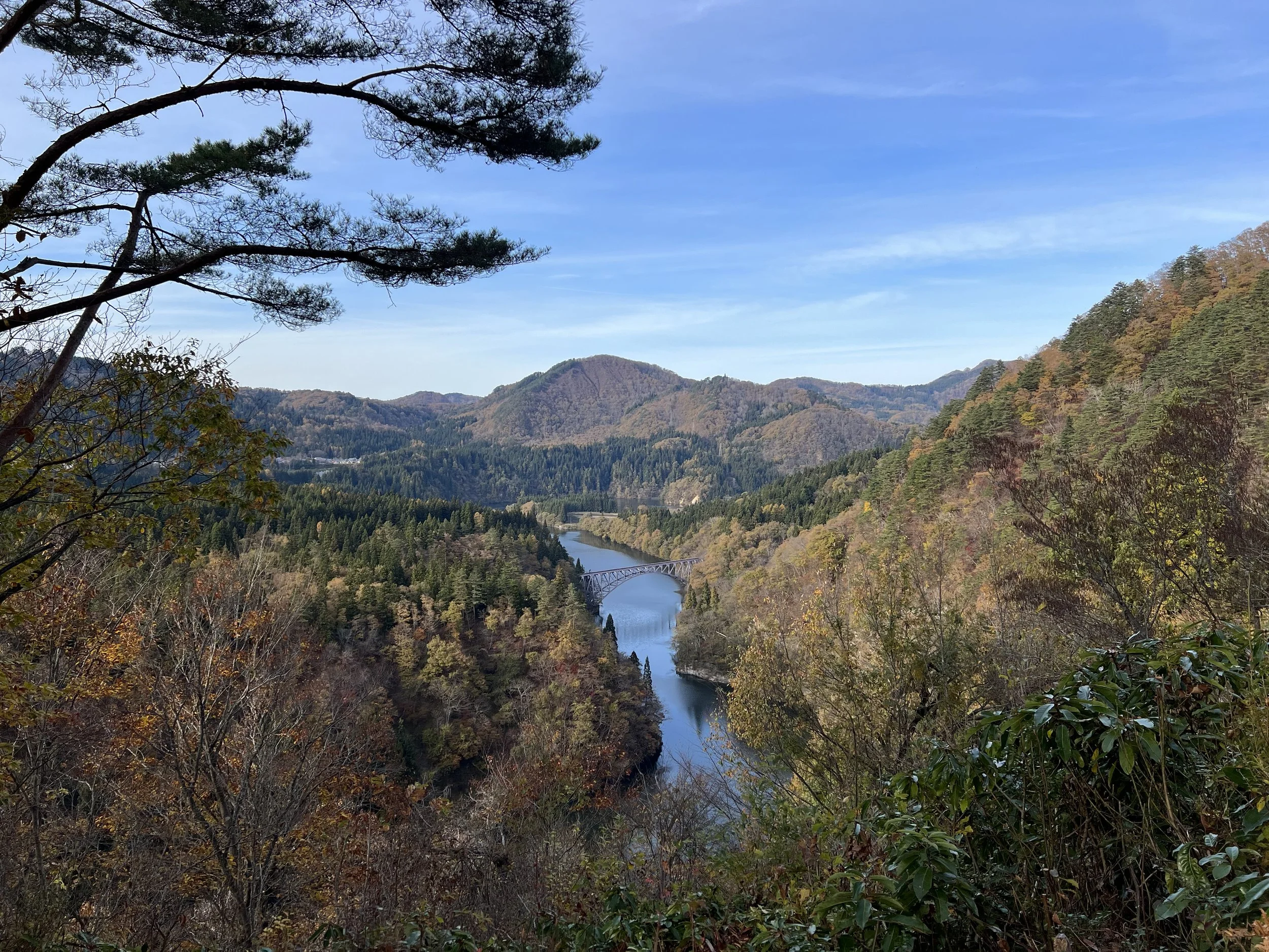
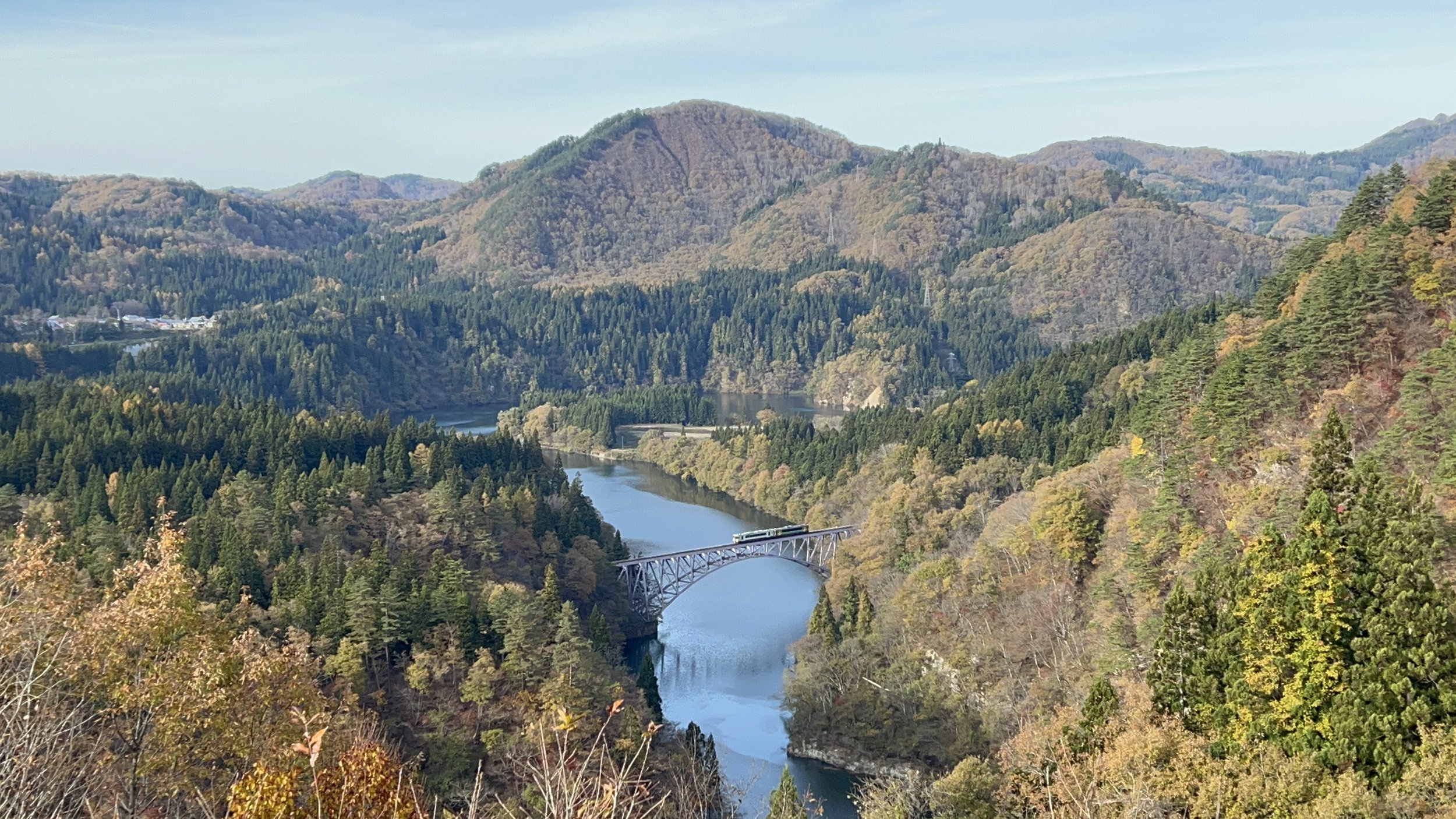
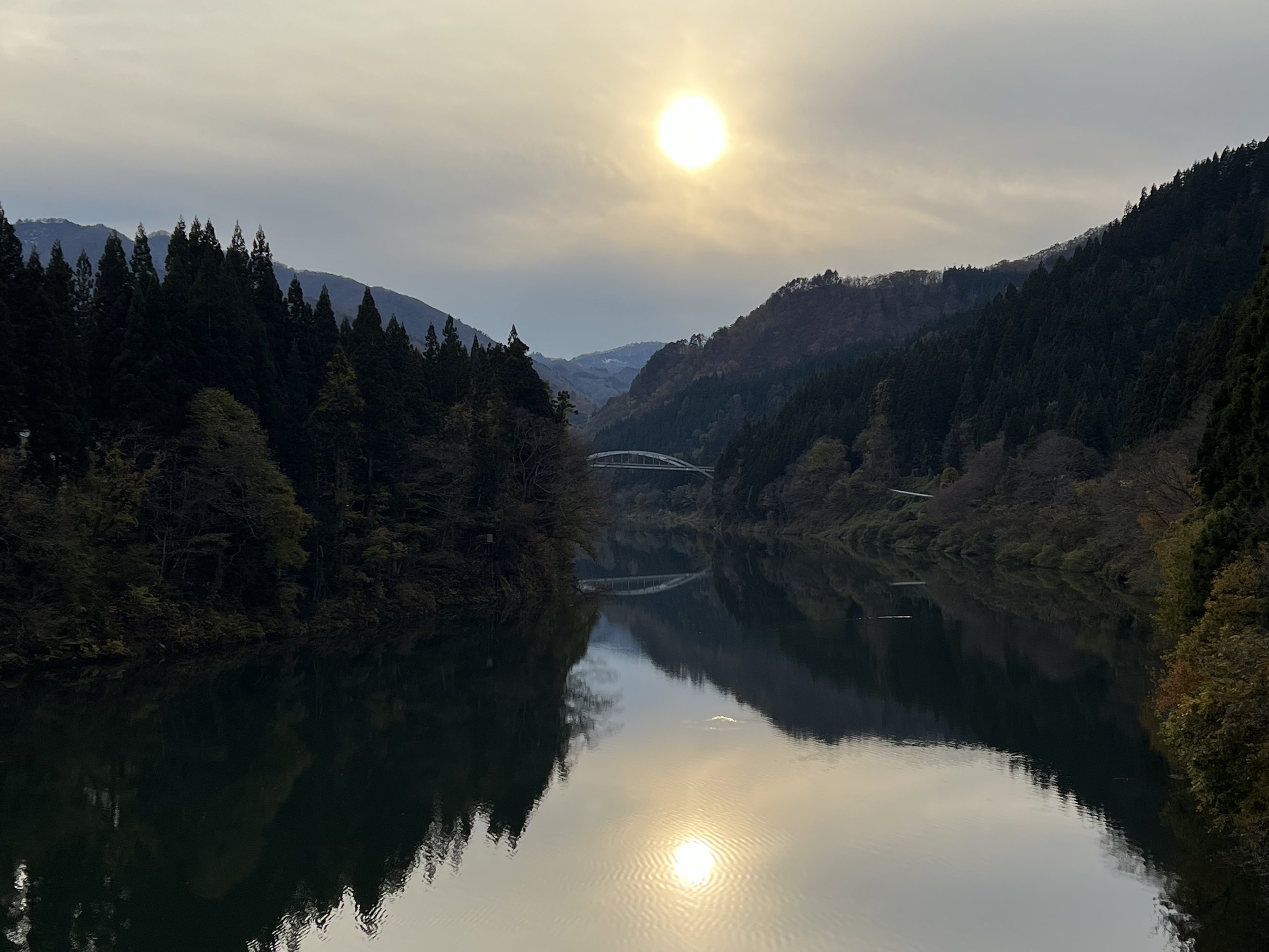
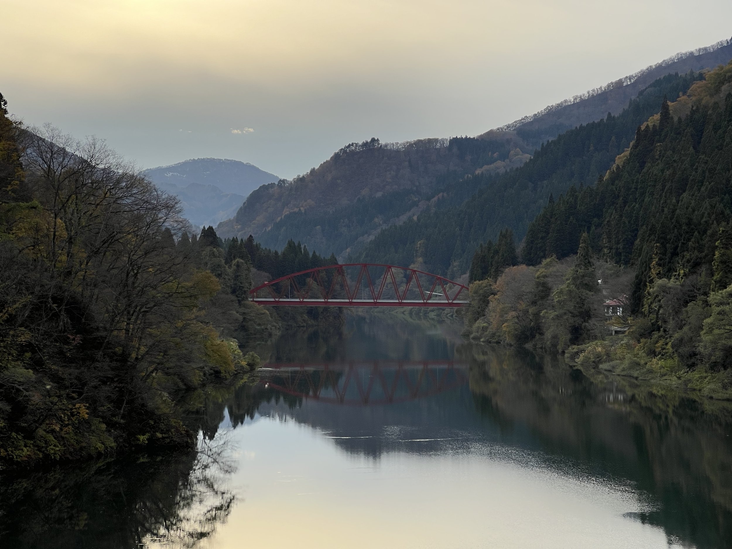
The first viewpoint was a short and easy walk. I stopped briefly, took a few photos, and then continued upward. Eventually, I reached the highest viewpoint and found a bench to sit and wait. I still had about 15 minutes before the train. Even without peak autumn colours, the view was still impressive—layers of mountains, the river cutting through the valley, and the railway line tracing its way across the landscape.
When the train finally approached, you could feel the shift. Everyone stood up, cameras ready. And it was over almost as quickly as it began. The train crossed the bridge in what felt like seconds. After all that anticipation, it was almost a bit anti-climactic—but at the same time, that’s part of the experience.
I considered staying for the next train, but it would’ve meant waiting another hour, and that would’ve made getting back much more difficult. So instead, I packed up and made my way to the nearest station to catch my return train to Aizu-Wakamatsu.
It might not seem like the most efficient day as I spent hours walking for brief moments at viewpoints—but honestly, that was kind of the point. Exploring these quiet corners of Fukushima, learning about the small towns, and seeing the landscape from different perspectives—it all added up to something that felt worth it.
History & Background
The JR Tadami Line (只見線) is widely considered one of Japan’s most scenic railway routes. Originally opened in stages between the 1920s and 1970s, the line was built to connect remote mountain communities across Fukushima and Niigata Prefectures.
The railway follows the Tadami River (只見川), crossing numerous bridges and weaving through steep valleys. Its isolation and dramatic setting have made it especially popular among photographers and railway enthusiasts.
Seasonality plays a huge role in its appeal. Autumn brings vibrant foliage, winter transforms the landscape into a snow-covered panorama, and early summer often blankets the valley in mist—creating the “floating train” effect seen in many photographs.
In recent years, parts of the line were damaged by severe flooding, leading to closures and restoration efforts. Its full reopening has only increased its popularity as both a cultural and scenic experience.
Getting There
To explore the Tadami River viewpoints, travellers typically start from Aizu-Wakamatsu, which is accessible via train from Tokyo in approximately 3–4 hours using a combination of Shinkansen and local lines.
From Aizu-Wakamatsu, take the JR Tadami Line toward stations such as Aizu-Kawaguchi Station or Aizu-Miyashita Station, depending on which viewpoints you plan to visit. Train frequency is limited, so careful planning is essential. Many viewpoints, including those near the roadside stations, require walking from the nearest station, often between 20 to 45 minutes.
Driving is an alternative option and allows greater flexibility in visiting multiple viewpoints in one day.
Route Overview
Part I
Distance: 7.85 km (Aizu-Kawaguchi Station → Aizu-Nakagawa Station)
Total elevation gain: 274 m
Duration: 1 hr 37 min (with breaks 2 hr 08 min)
Difficulty: Intermediate
Part II
Distance:8.06 km out & back (Aizu-Miyashita Station)
Total elevation gain: 131 m
Duration: 1 hr 38 min (with breaks 2 hr 28 min)
Difficulty: Intermediate
Cost Breakdown
Train: Aizu-Wakamatsu Station → Aizu-Kawaguchi Station — ¥1,230
Train: Aizu-Kawaguchi Station→ Aizu-Miyashita Station — ¥260
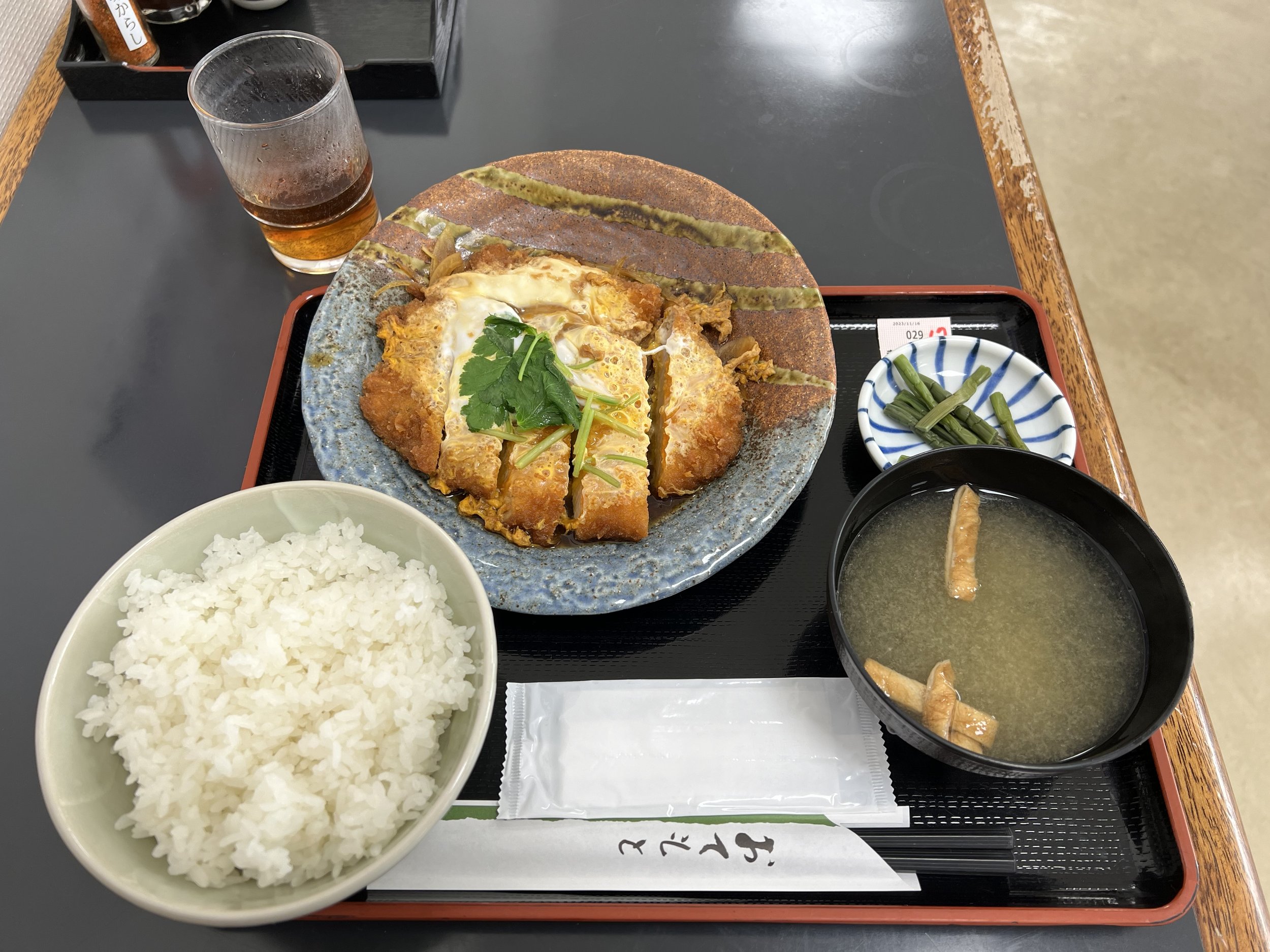
Food: ¥1,050