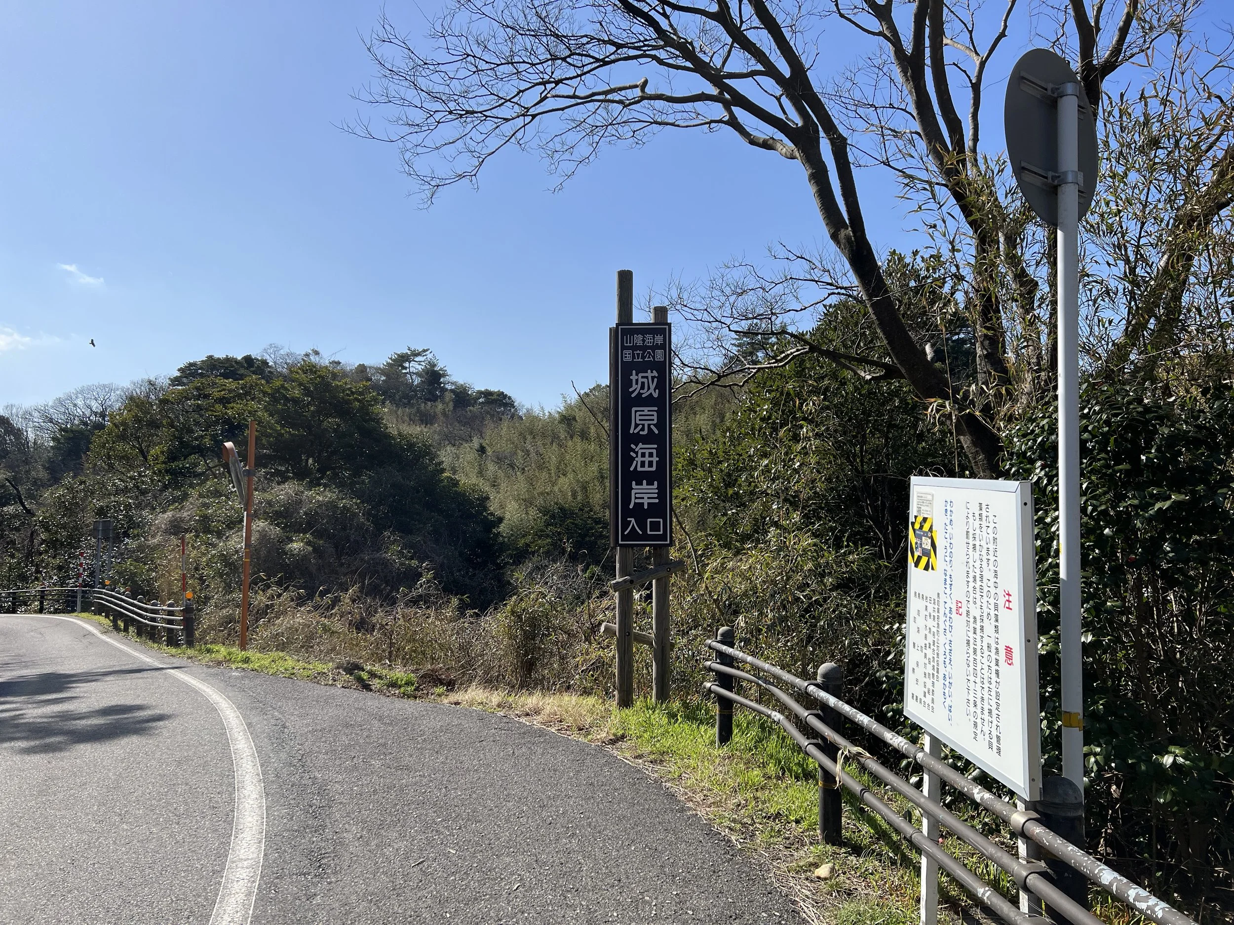
San'in Kaigan Geopark Trail - Uradome Coast to Otani Beach - Tottori, Japan
San’in Kaigan Geopark is a UNESCO Global Geopark stretching across three prefectures—Tottori, Hyogo, and Kyoto—following roughly 120 kilometres of dramatic coastline along the Sea of Japan. Known for its rugged cliffs, sea caves, and sweeping ocean views, the trail also passes through some of Tottori’s most iconic landscapes, including the vast sand dunes. Since I was already based in the Tottori area, I decided to hike a short coastal section between Uradome Coast and Otani Beach to experience this lesser-visited side of Japan’s shoreline.
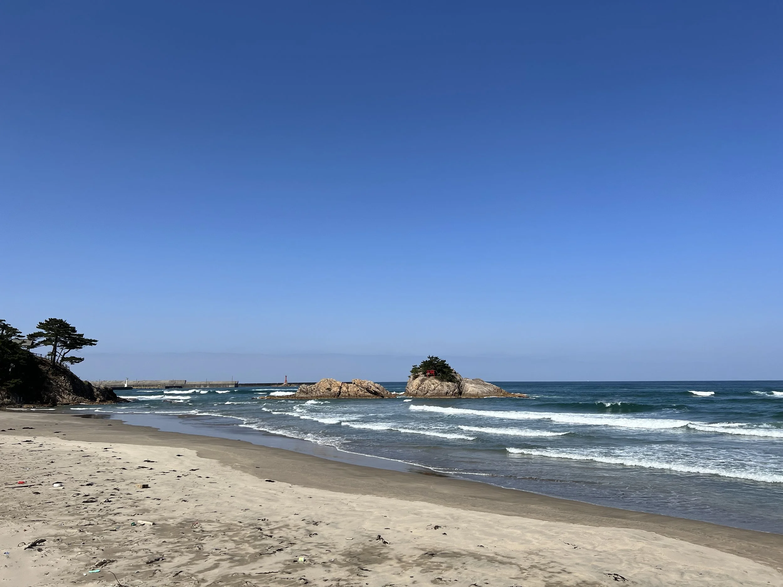
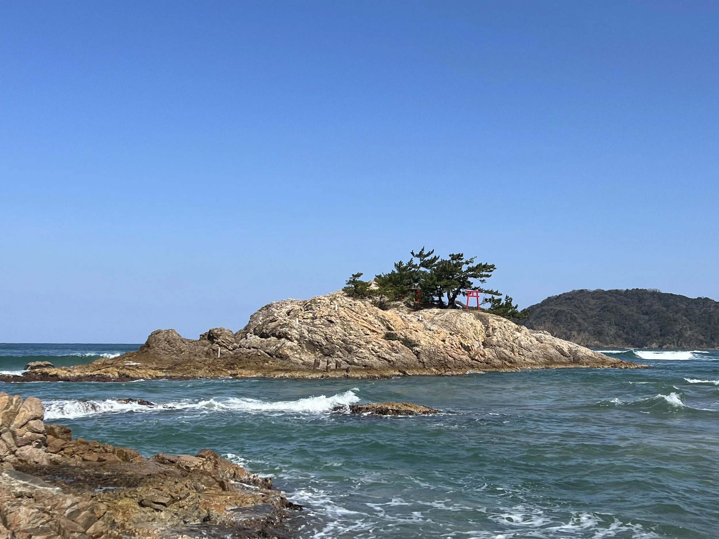
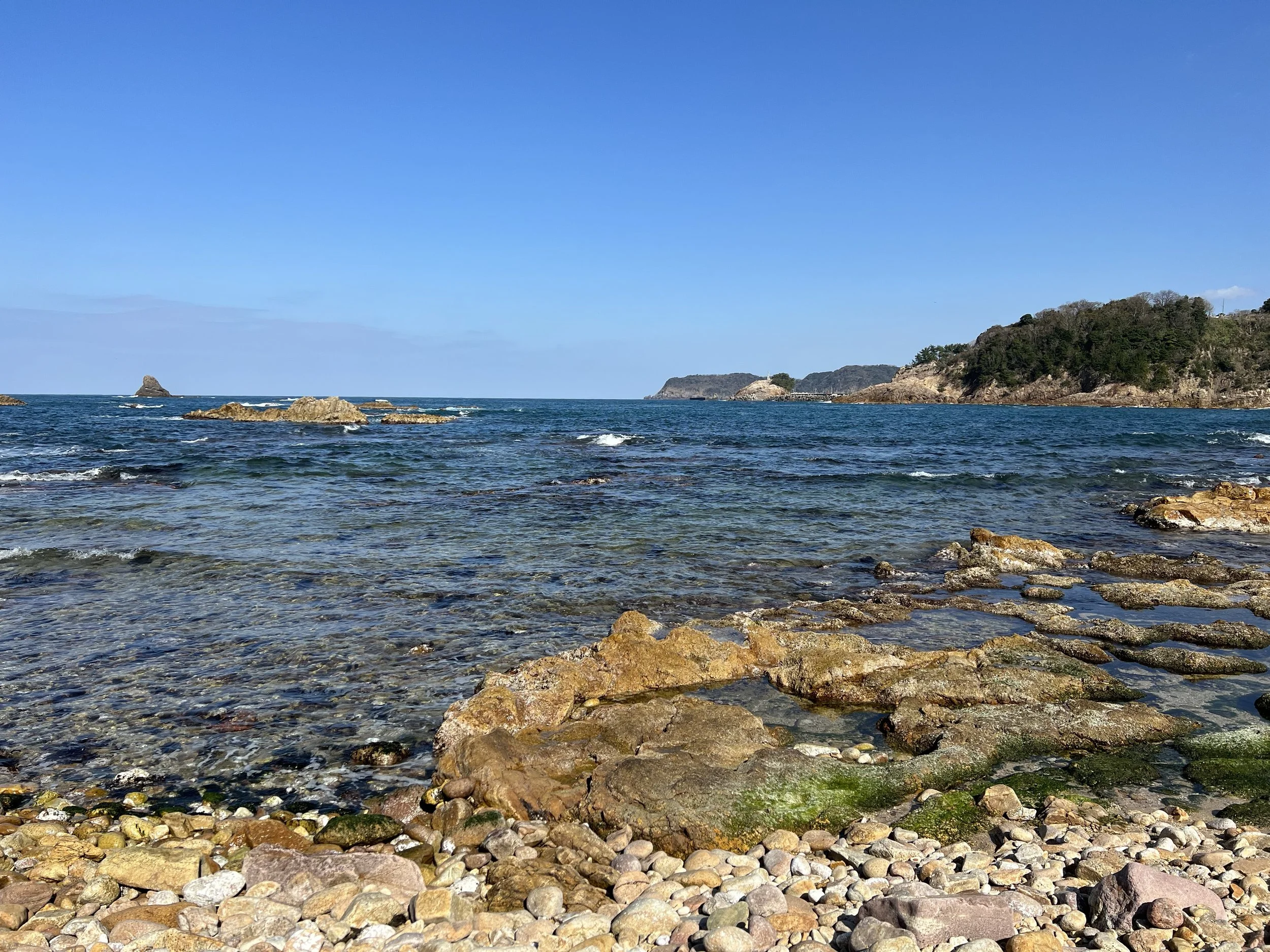
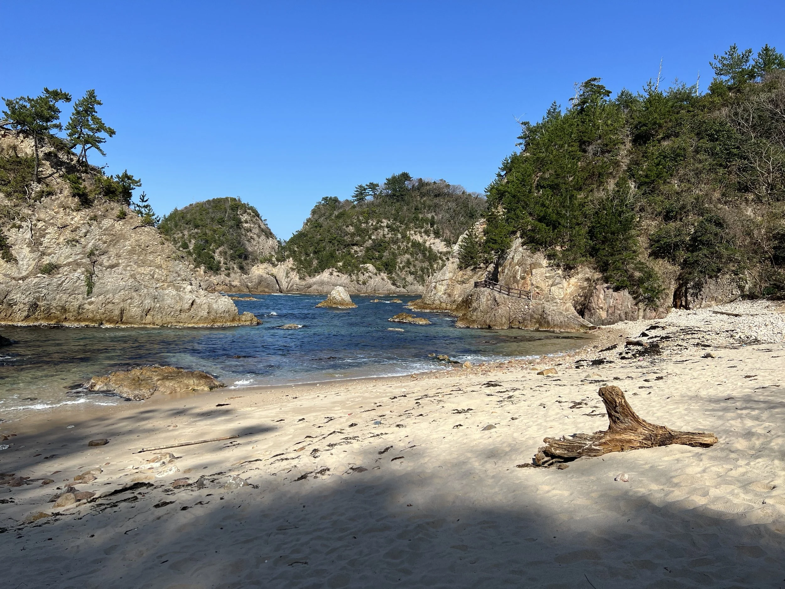
I took the bus from the Tottori Sand Dunes area toward Uradome Coast, where I planned to begin the hike. When I arrived, the beach was quiet and nearly empty, the winter air crisp and clear. I took a few moments to take in the coastline before starting westward along the trail. My first stop was an observatory at the far end of the coast overlooking Mukojima Ebisu Shrine—a tiny rock island topped with a small torii gate and windswept pine trees. Set against the deep blue of the Sea of Japan, it was a striking and peaceful sight.
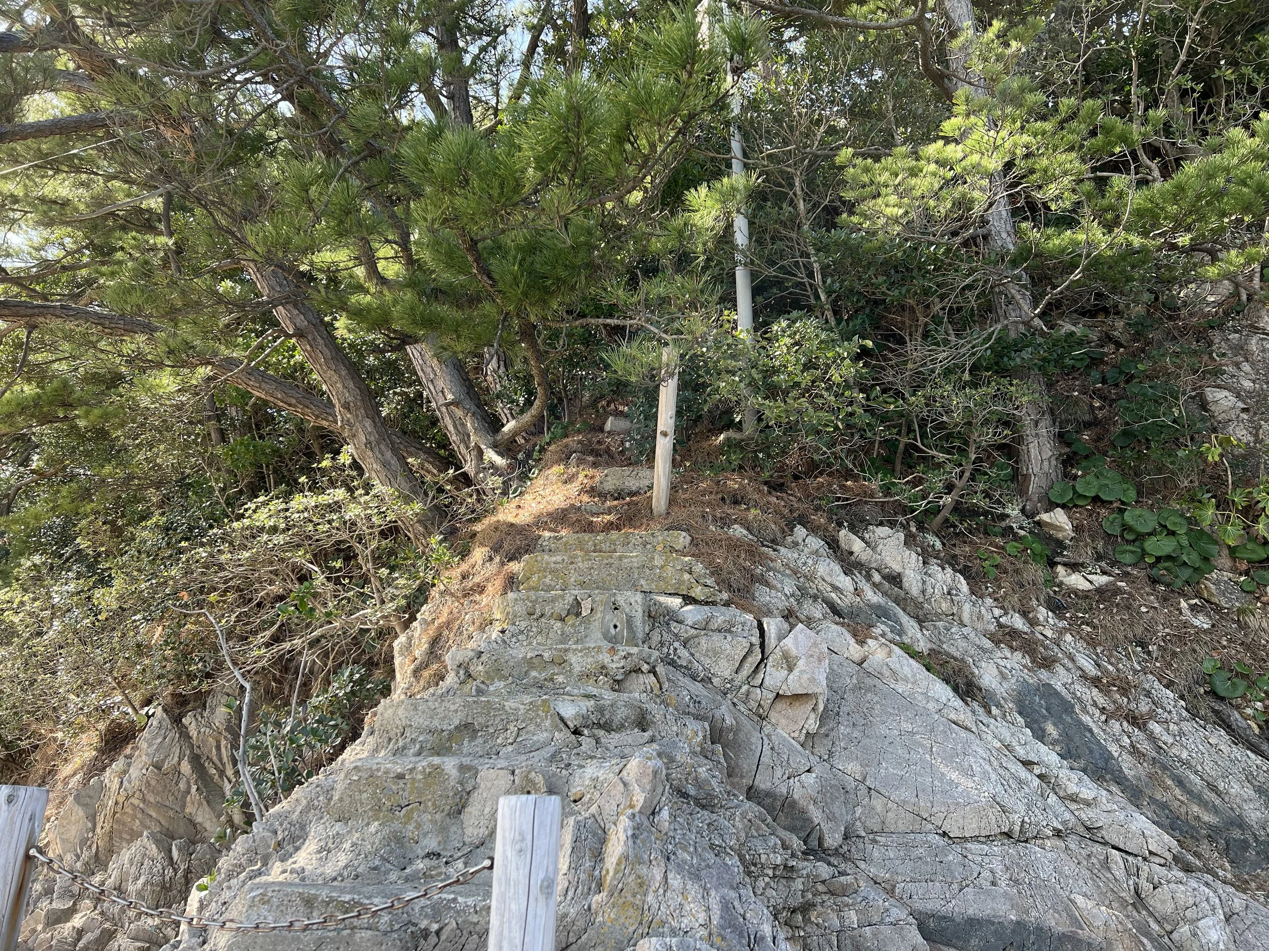
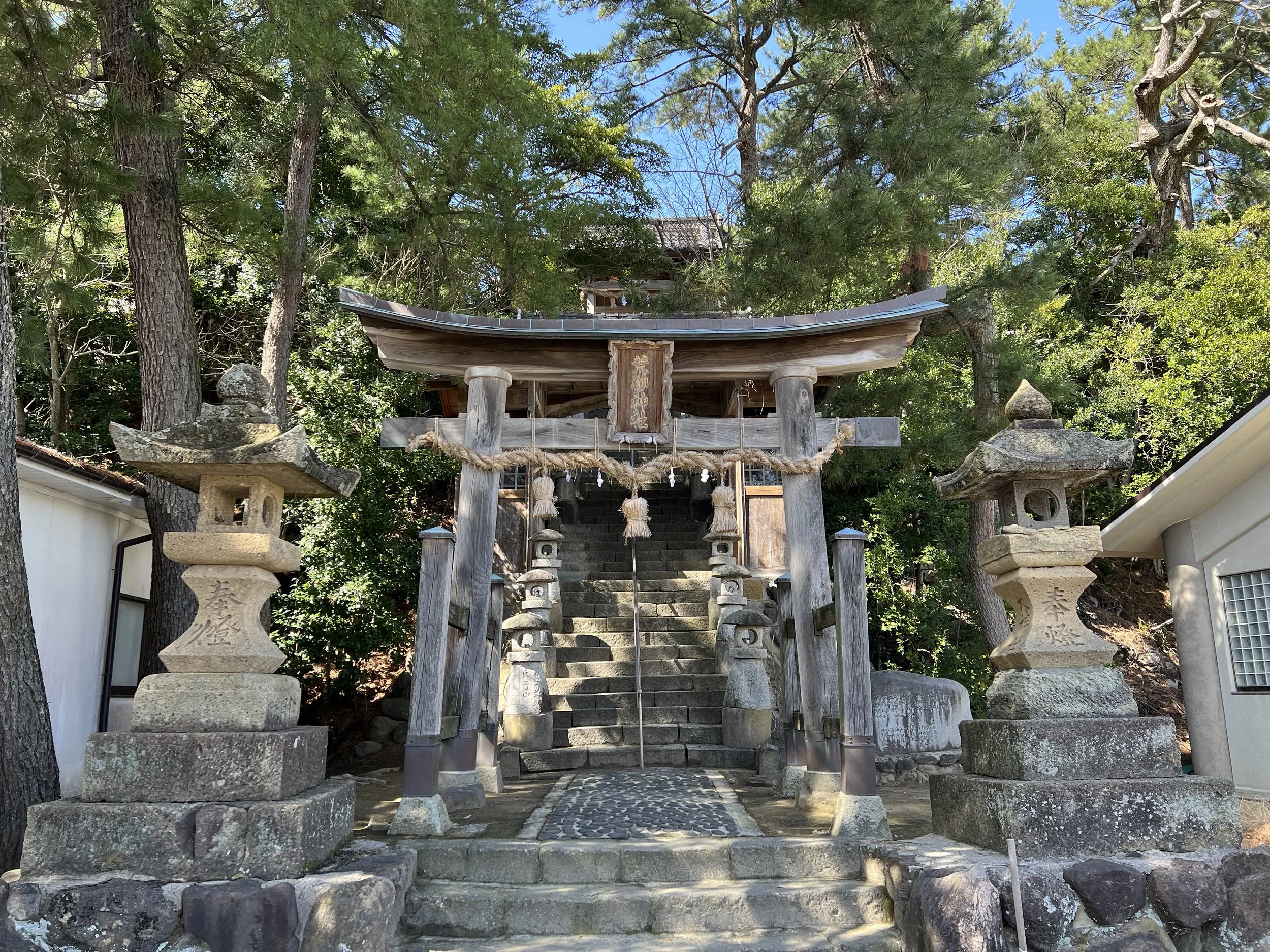
Nearby, I made a brief detour to Arasuna Shrine, hoping for sweeping ocean views. After climbing the steep stone steps, however, the view was largely obscured by trees. While slightly underwhelming, the climb itself added a quiet, contemplative pause to the walk before I descended and continued on toward Tajiri Port.
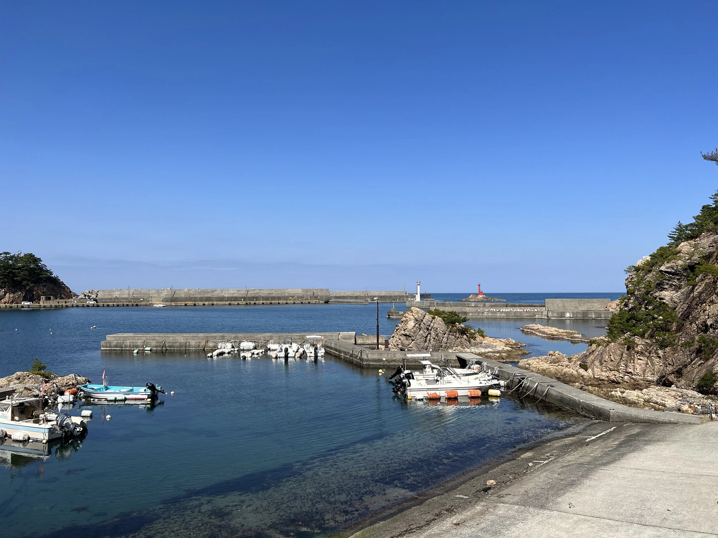
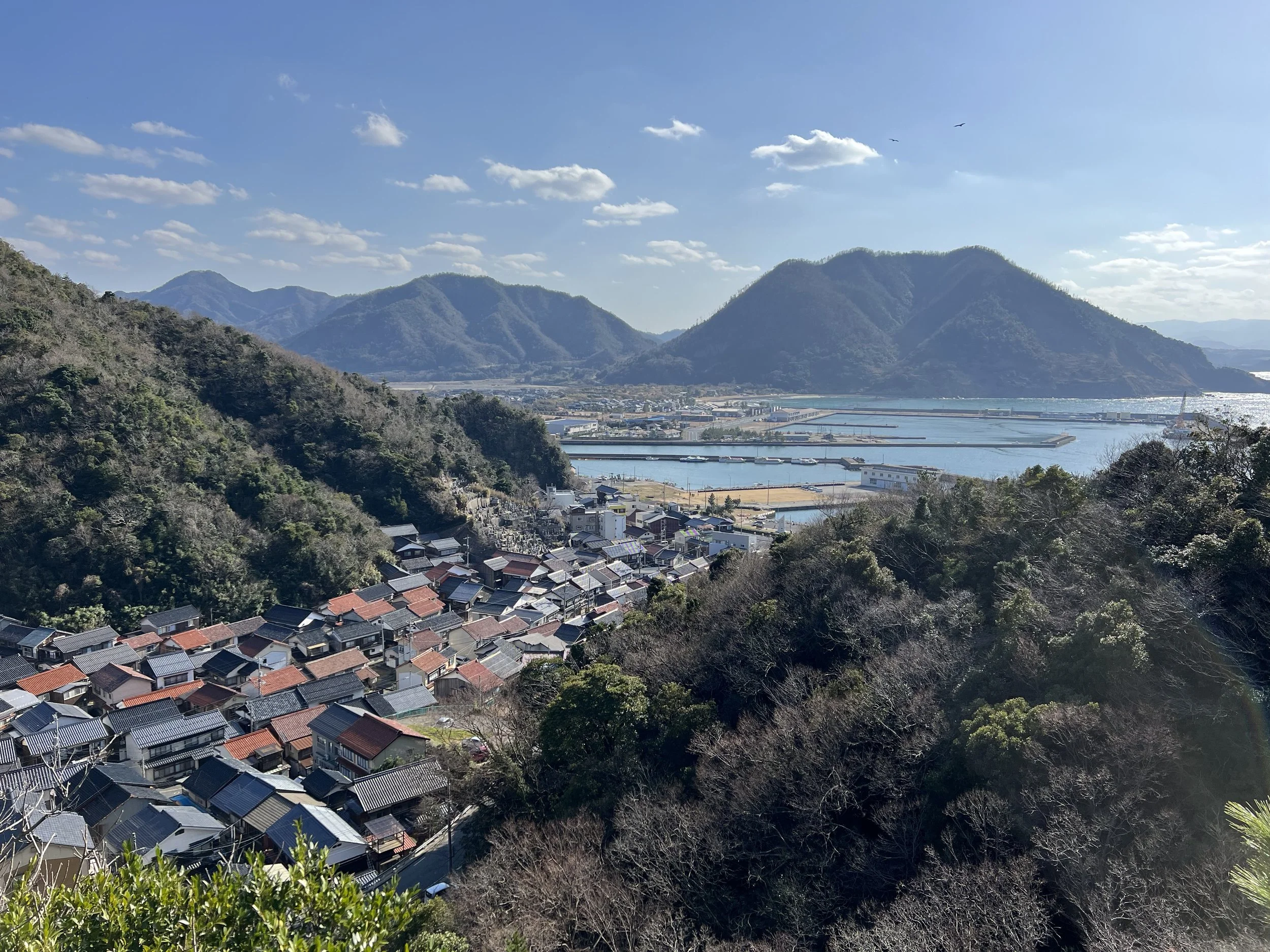
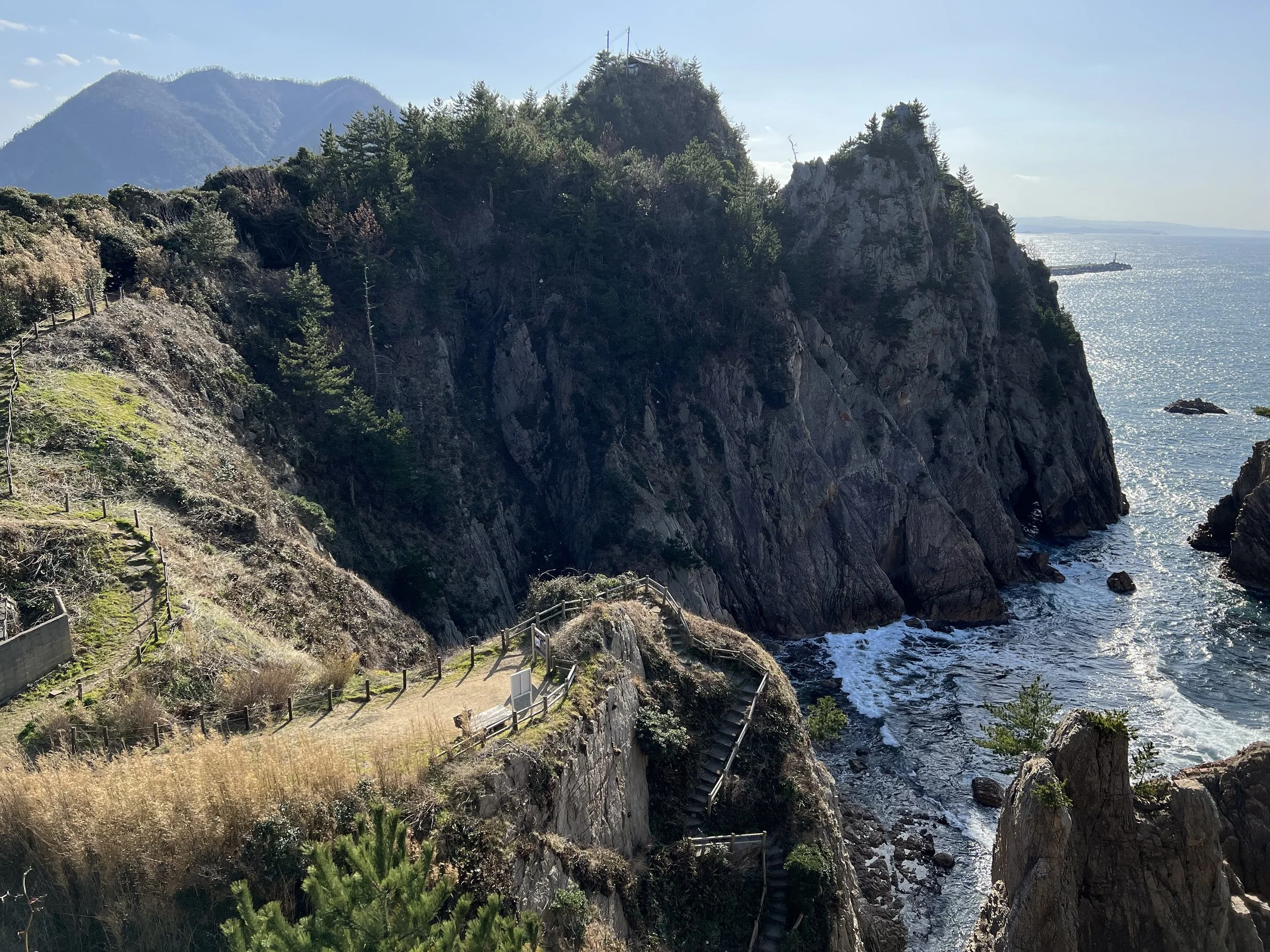
The road leading to Tajiri Port was calm, with little activity during the winter months. Fishing boats sat docked in neat rows, hinting at a busier season ahead. One of my planned stops here was the Tajiri Park Observation Deck, which offered a panoramic view of the ocean, the town below, the fishing harbour, and a small lantern-style lighthouse. From the cliffside, the rock formations along the coast were especially impressive. I briefly visited nearby Tajiri Shrine before rejoining the trail.
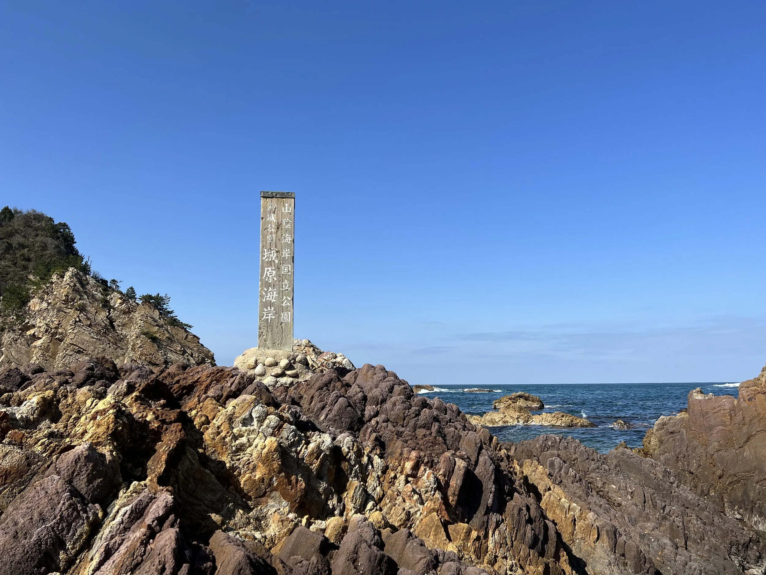
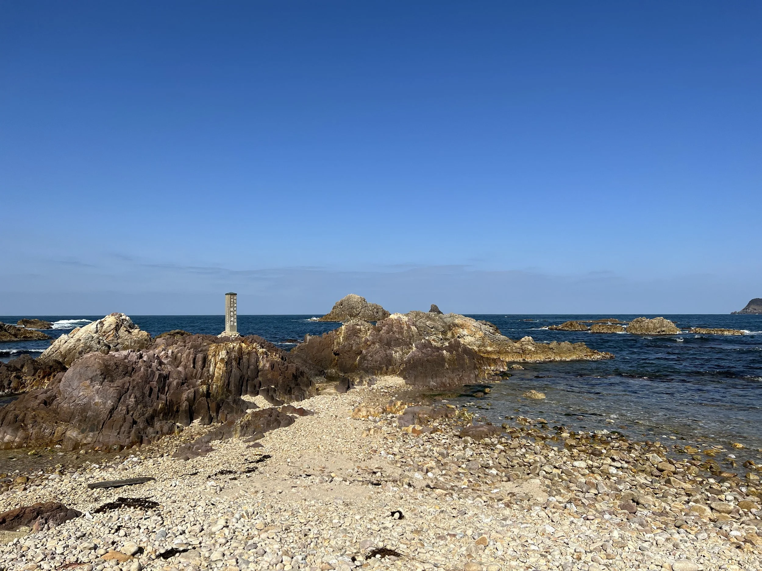
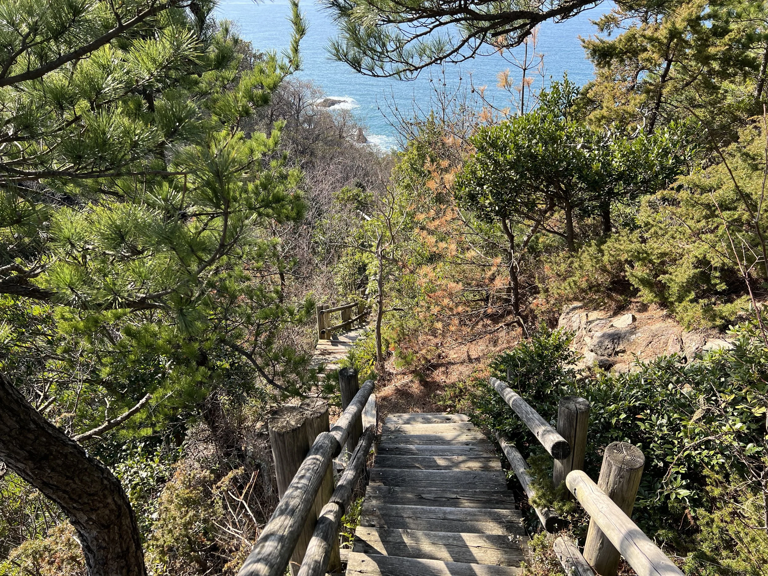
My next major stop was Shirawara Observation Deck. Unlike the sandy beaches earlier on the route, Shirawara Beach is made up of fist-sized, smooth granite stones. These stones are found throughout the area and are believed to have formed more than 60 million years ago, back when the Japanese islands were still part of the Asian continent. After taking in the view from above, I carefully descended the long staircase down to the beach itself. Walking on the rounded stones was challenging, but taking it slow, I eventually reached the water’s edge. Sitting there alone, listening to the waves and watching the crystal-clear water, felt incredibly serene. In summer, this area is popular with divers, as sunlight filtering through the clear water and seaweed reveals abundant marine life beneath the surface.
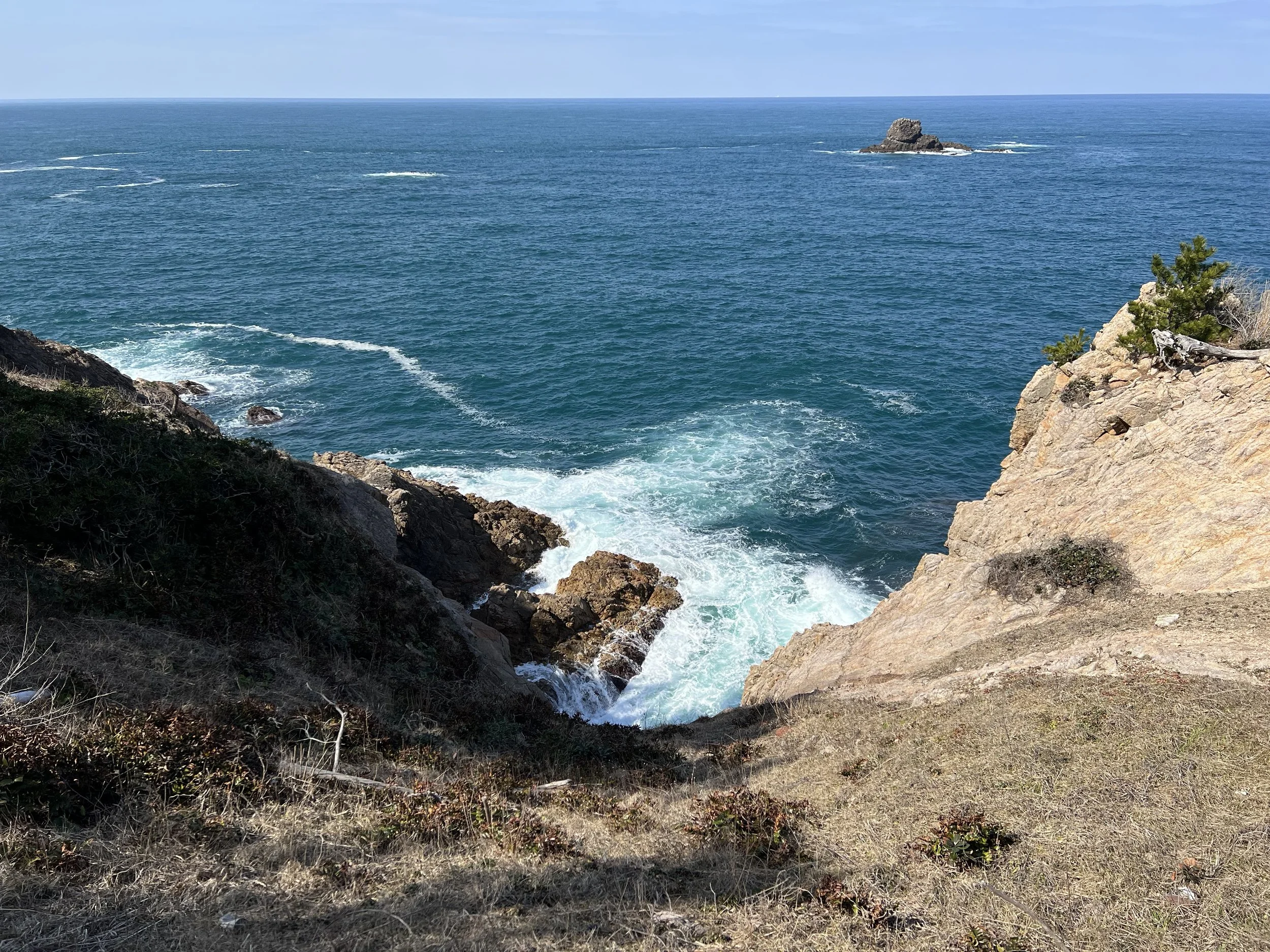
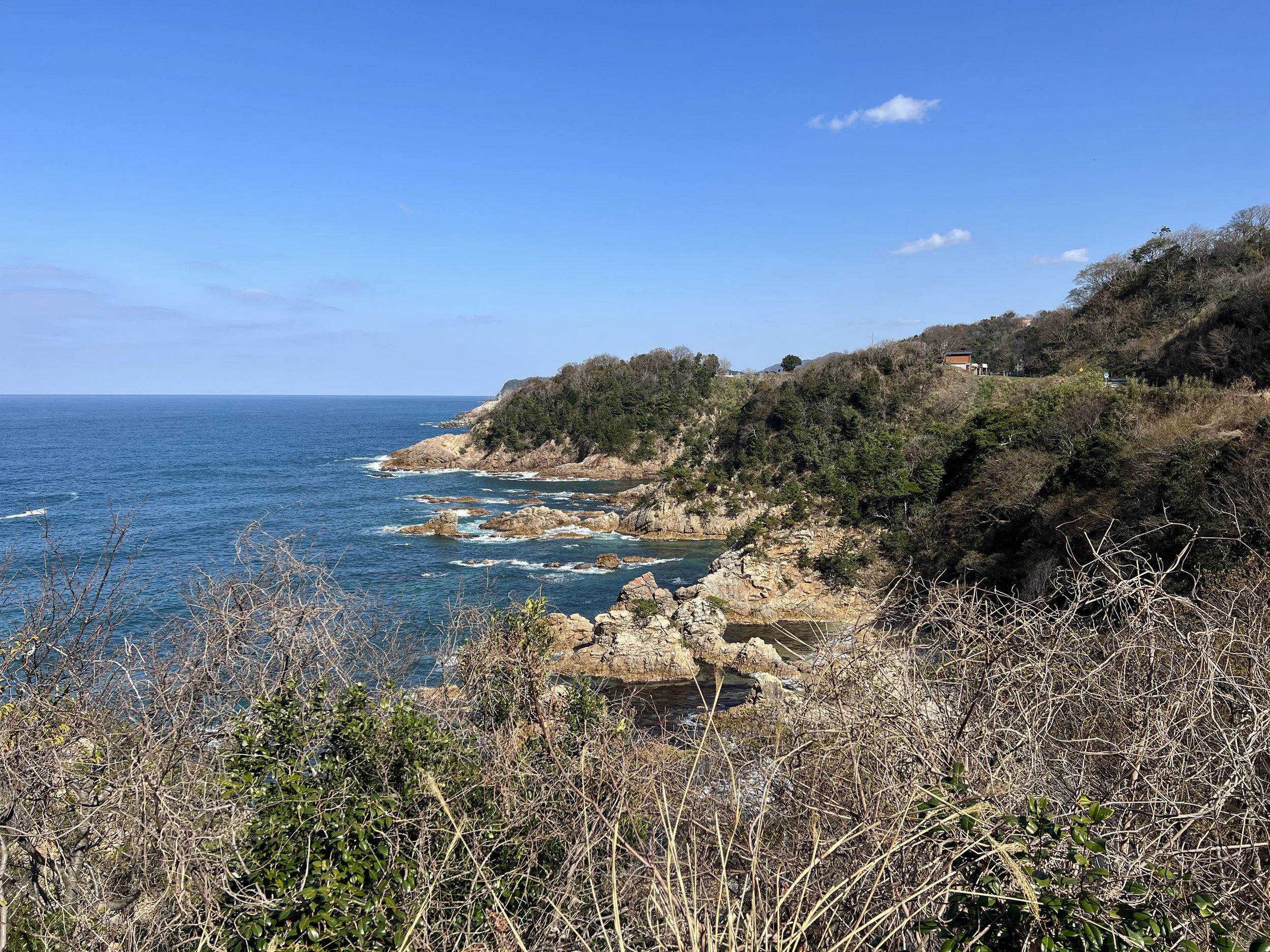
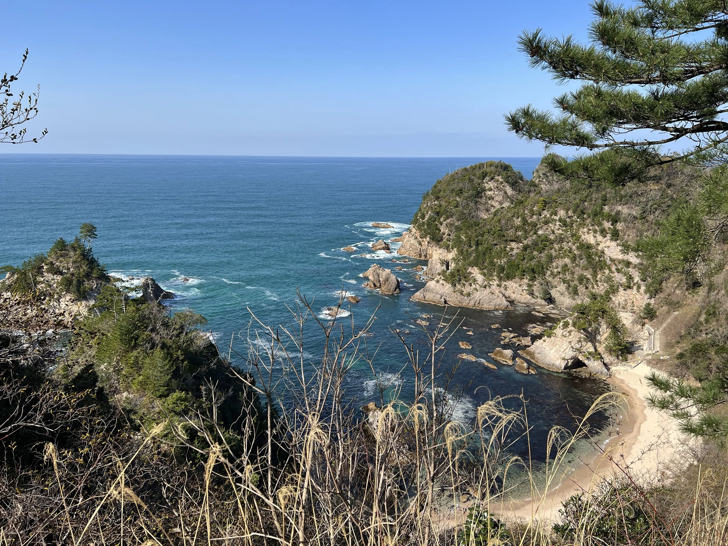
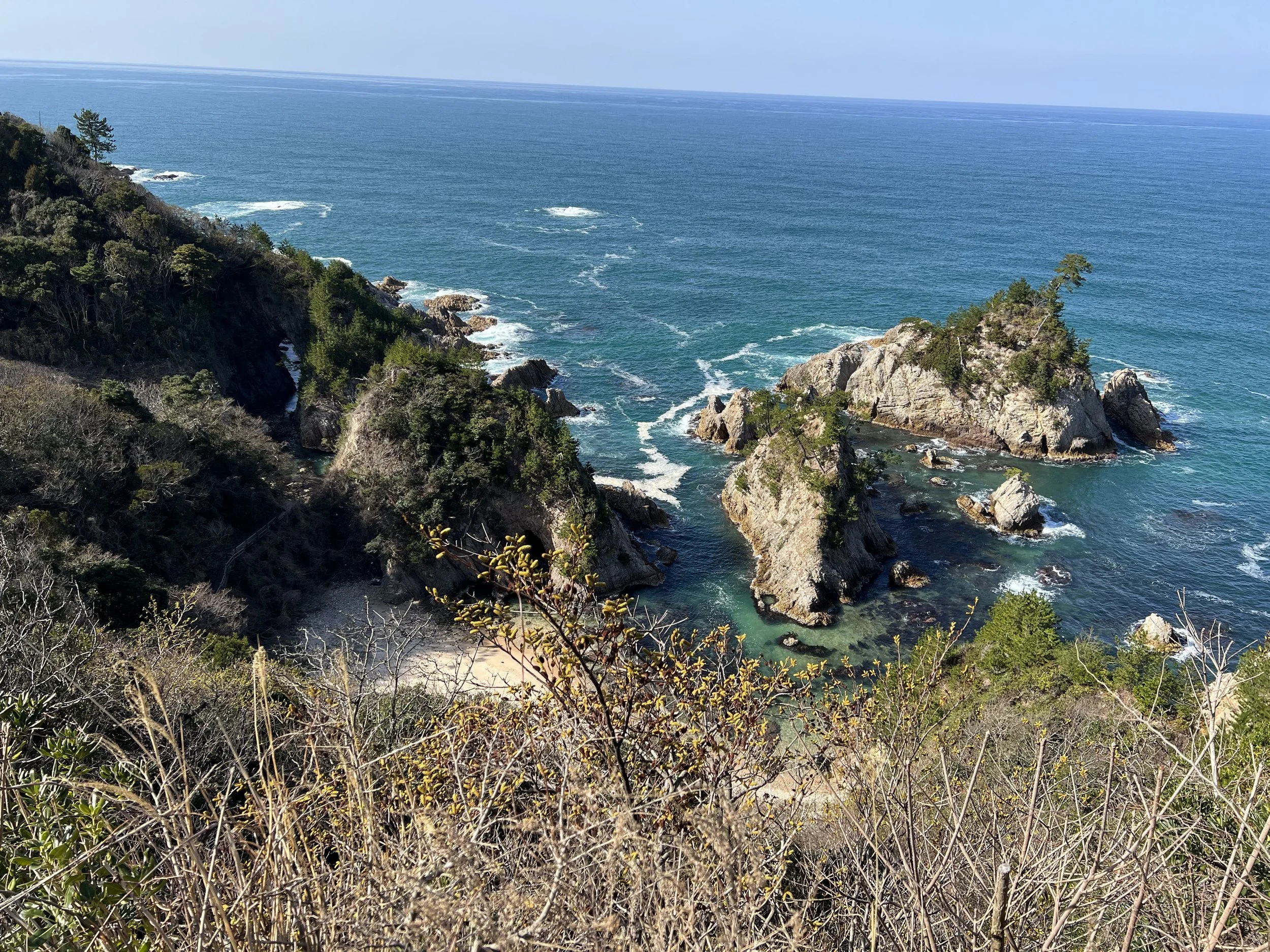
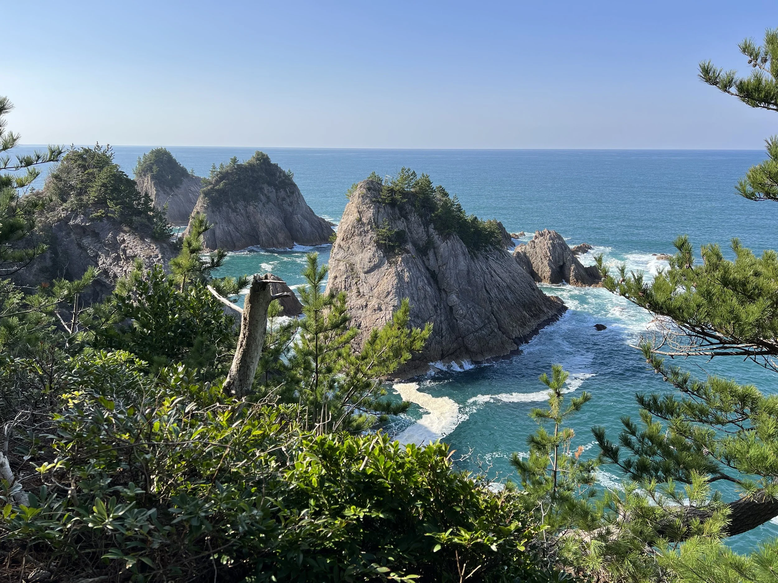
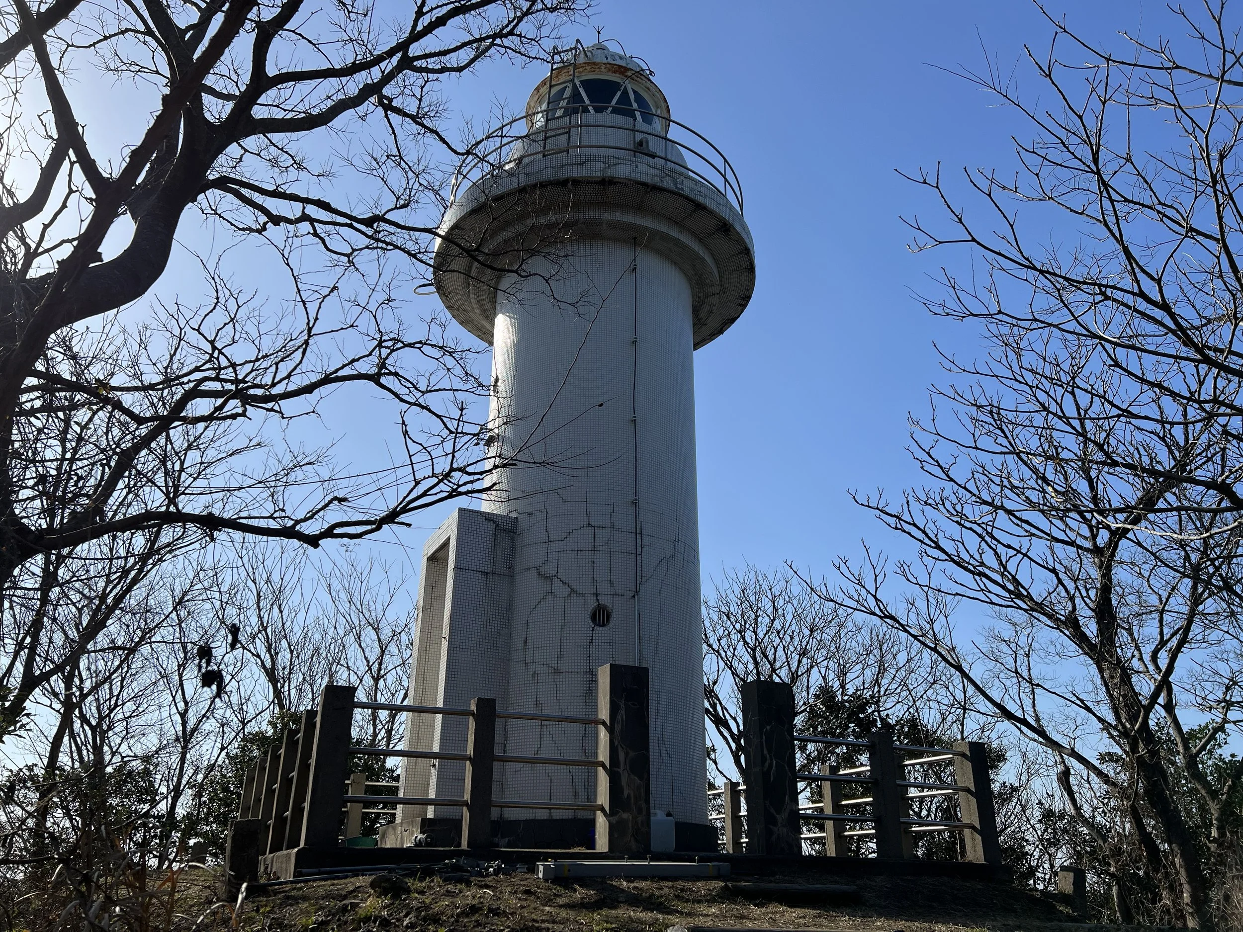
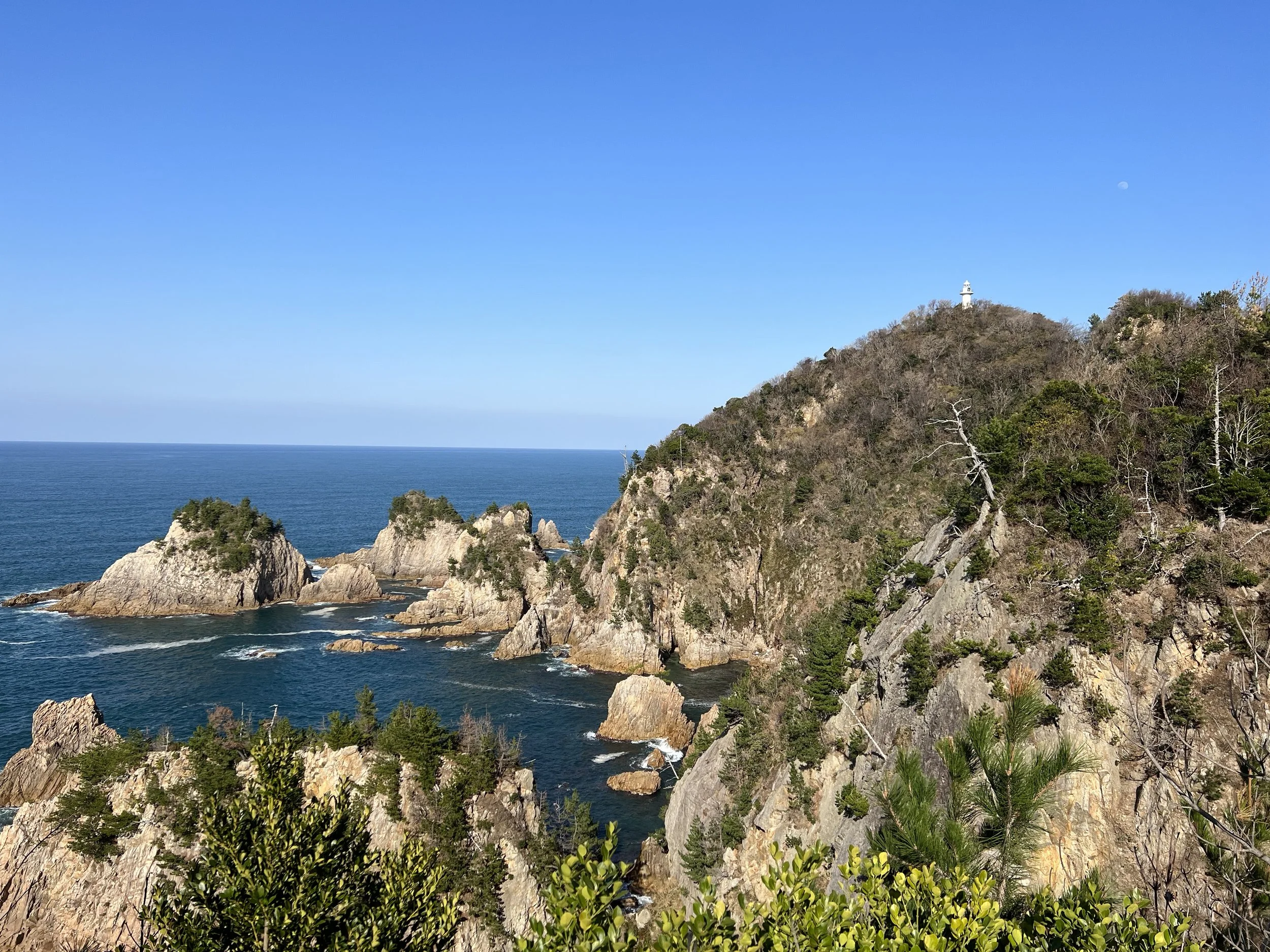
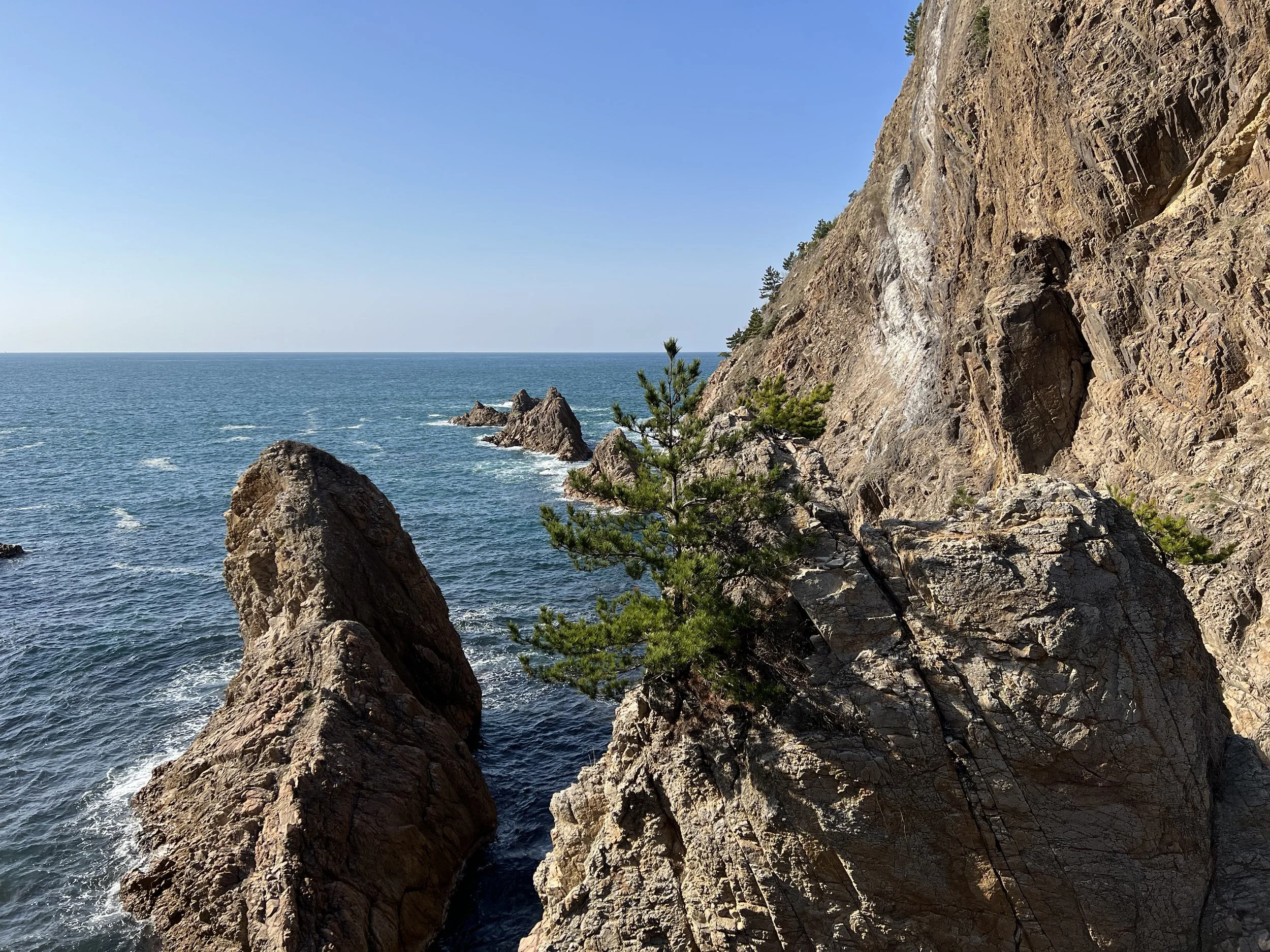
Continuing along the trail, the water gradually turned a deeper, more vivid blue, and the rock formations became increasingly dramatic. I stopped often for photos, with numerous observation decks along the route highlighting different coastal features. I eventually reached Ajirosaki Lighthouse, an active lighthouse built in the 1950s and standing about 11 metres tall. While the immediate area around the lighthouse didn’t offer much of a view, the walk leading up to it provided beautiful ocean scenery. I didn’t linger long and continued on to Ajiro Observation Deck.
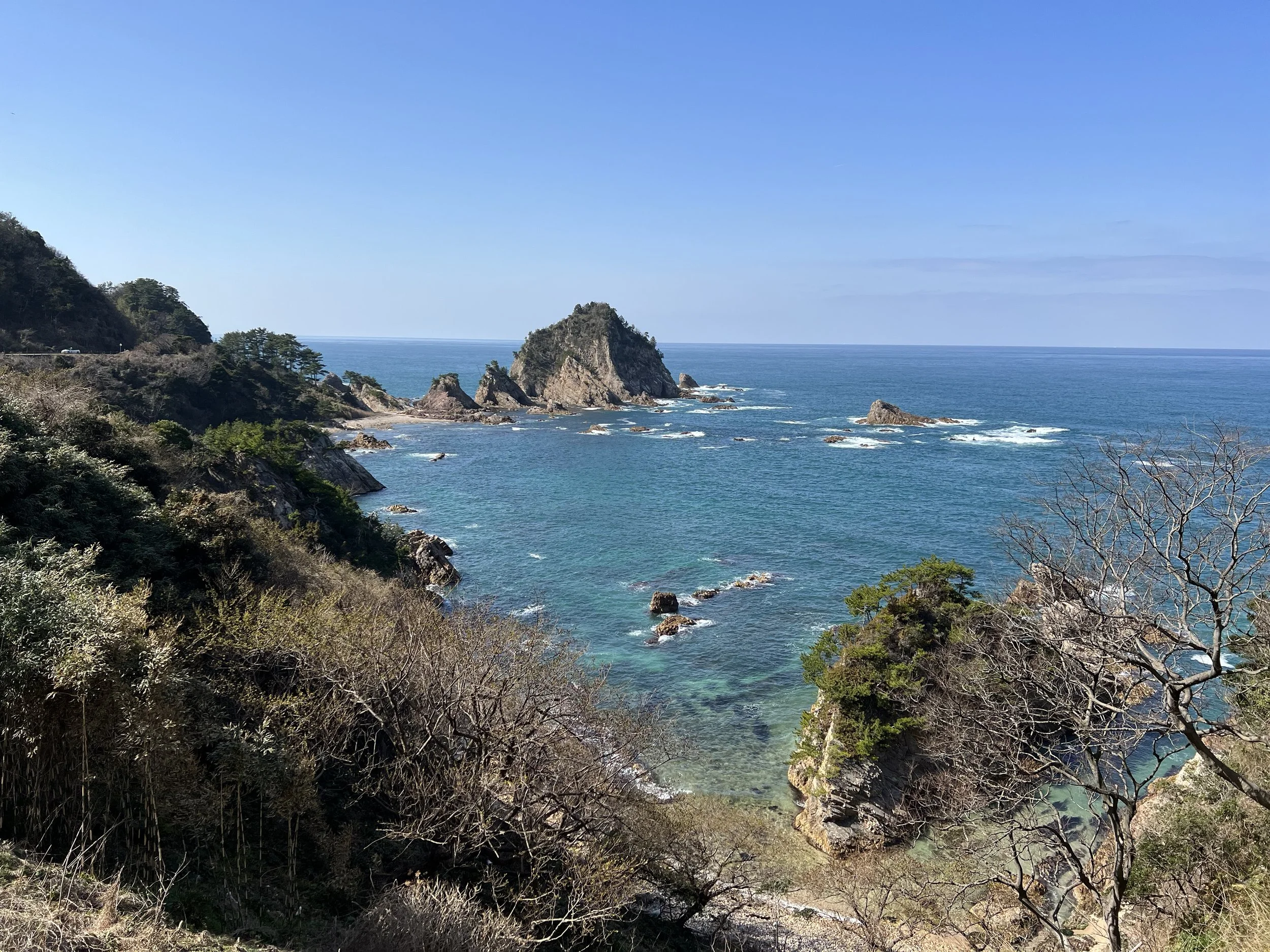
Ajiro Observation Deck was easily the most scenic viewpoint along this section of the trail. The turquoise-coloured ocean, unique rock formations, and surrounding pine trees made this spot especially memorable. There’s a local story tied to this area: it’s said that the Tottori lord Ikeda once sailed through here and was so taken by the pine trees that he offered a reward to anyone who could bring similar ones to his garden.
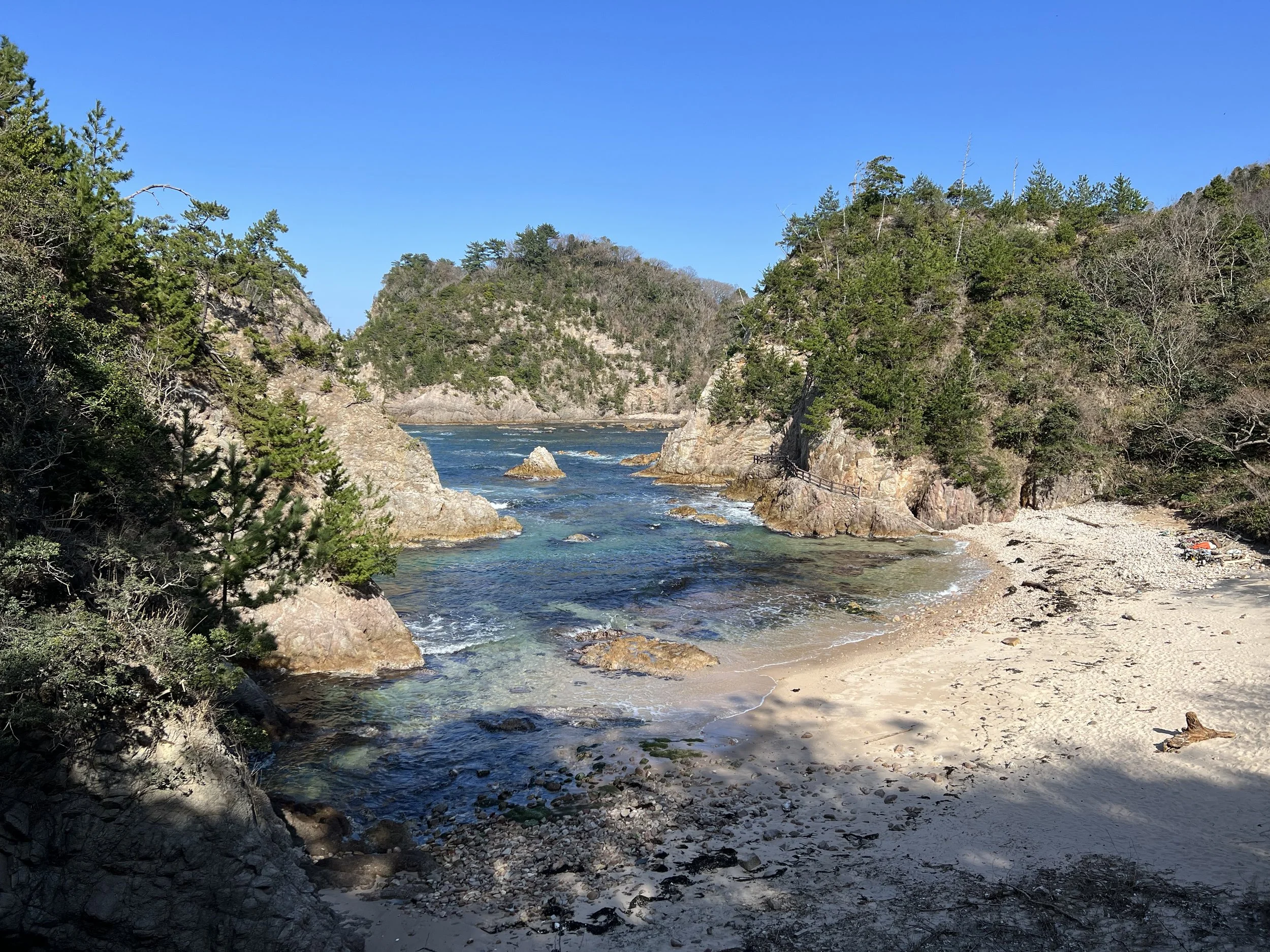
Shortly after the observation deck, I left the trail and entered the small coastal town of Ajiro. During the summer months, the town sees more visitors thanks to the Uradome Coast island cruises, but in winter it was quiet. After checking the bus schedule and realizing I had some extra time, I walked over to nearby Otani Beach. The peaceful shoreline made for a relaxing place to sit and reflect as I waited for my bus.
As I wrapped up this short stretch of the San’in Kaigan Geopark Trail, I couldn’t help but think about returning someday to walk the full 120 kilometres. Even this brief section offered stunning scenery at every turn, and it left a lasting impression of just how beautiful Japan’s Sea of Japan coastline can be.
History & Background
San’in Kaigan Geopark (山陰海岸ジオパーク) was designated a UNESCO Global Geopark for its exceptional geological history, shaped over millions of years by volcanic activity, tectonic movement, and coastal erosion. The dramatic cliffs, sea caves, and rock formations found along the trail reveal layers of Earth’s history dating back more than 60 million years. This coastline formed when the Japanese archipelago separated from the Asian continent, creating the Sea of Japan and exposing granite and volcanic rock now visible along the shore.
Beyond its geology, the area has long supported fishing communities, coastal shrines, and maritime travel. Small shrines like Mukojima Ebisu Shrine reflect the region’s deep connection to the sea, where deities were worshipped for safe voyages and abundant catches. Today, the geopark preserves both the natural landscape and the cultural stories tied to it, allowing hikers to experience a blend of science, history, and living coastal traditions.
Getting There
To reach the starting point at Uradome Coast, I took the local bus from the Tottori Sand Dunes area to Uradome Kaiganguchi Bus Stop. The route is straightforward and convenient, making it easy to access even without a car. From Uradome Coast, the trail follows the shoreline westward toward Otani Beach. At the end of the hike, buses from the Otani/Ajiro area connect back toward Tottori City, allowing for a simple one-way hike without needing to backtrack.
Route Overview
Distance: 10.01 km (Uradome Beach → Otani Beach)
Total elevation gain: 325 m
Duration: 2 hr 23 min (with breaks 2 hr 57 min)
Difficulty: Intermediate
Cost Breakdown
Bus: Sakyu East Entrance Bus Stop → Uradome Kaiganguchi Bus Stop — ¥510
Food: ¥390