Mount Eboshi - Kumamoto, Japan
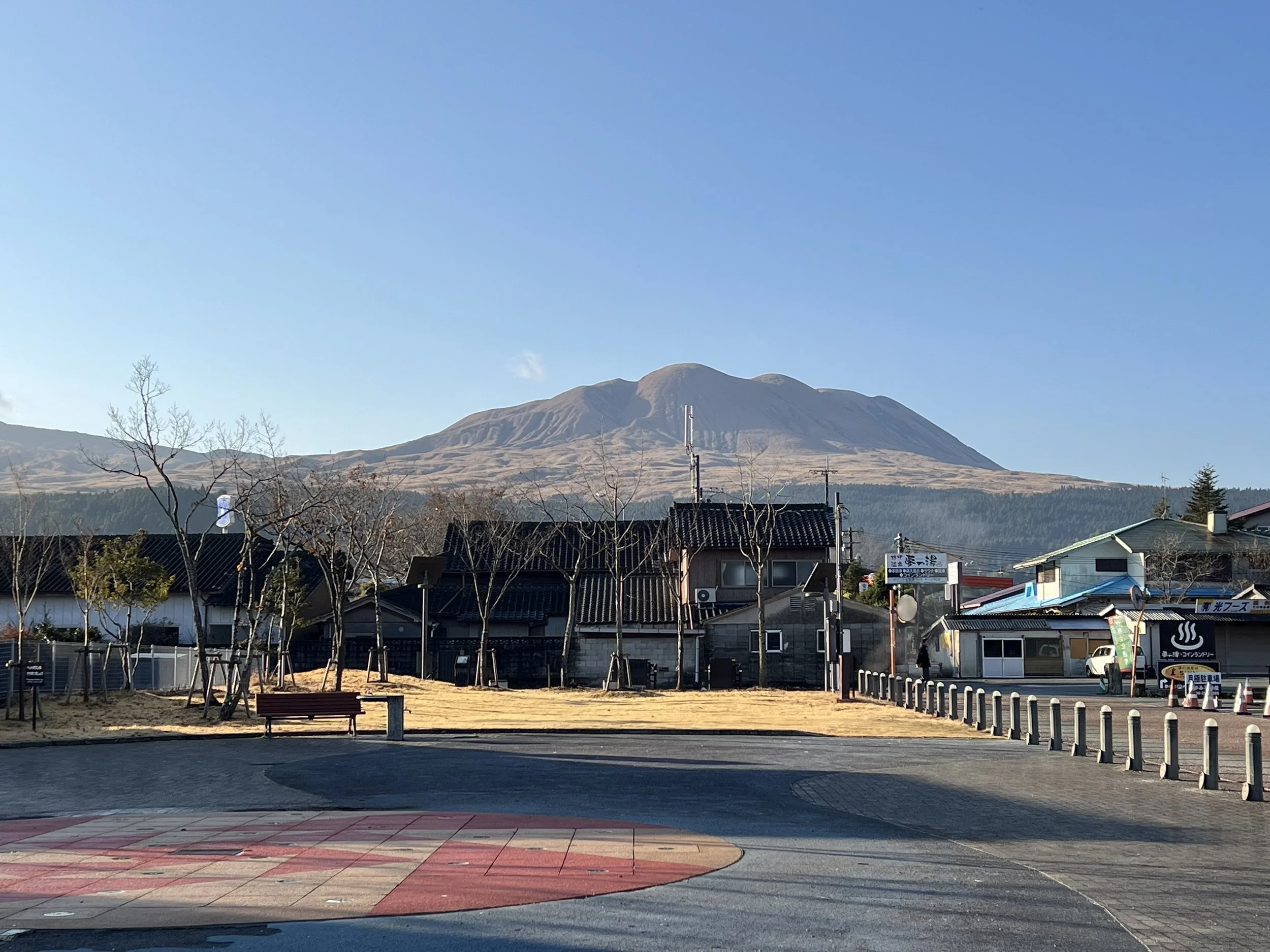
I had asked a friend for a trail recommendation in the Mount Aso area, and she suggested Mount Eboshi. I began my day by traveling from Aso Station to the crater bus stop, as I wanted to visit the Nakadake crater first. While the bus fare was quite expensive for such a short ride—and the route is hikeable—I chose to take the bus to save time and energy for the hike later in the day.
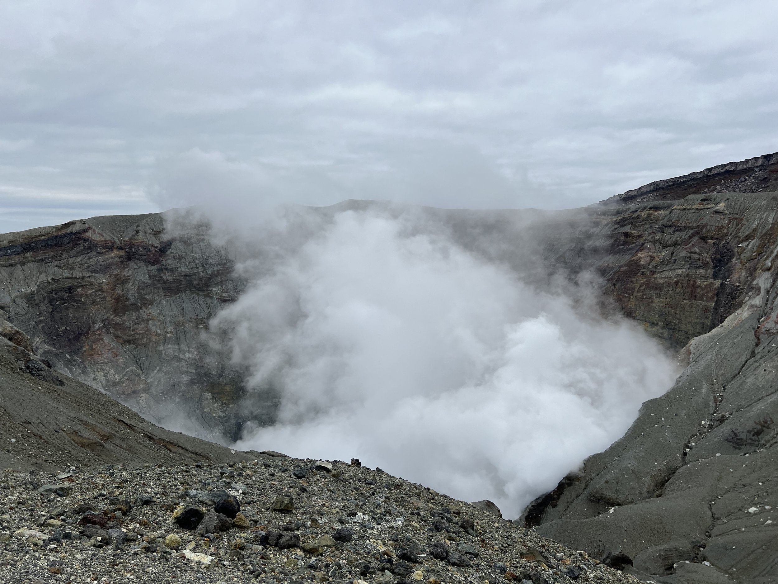
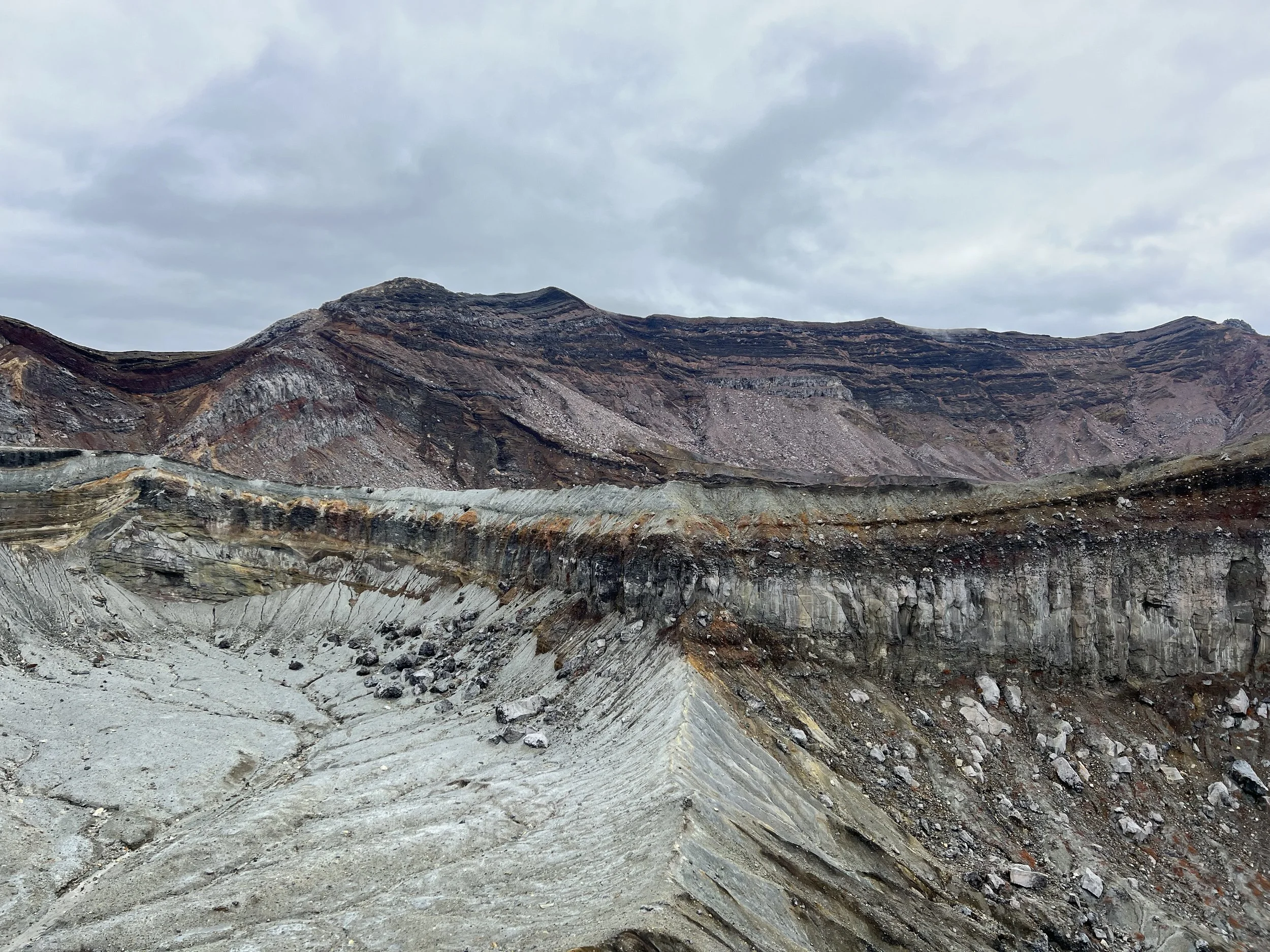
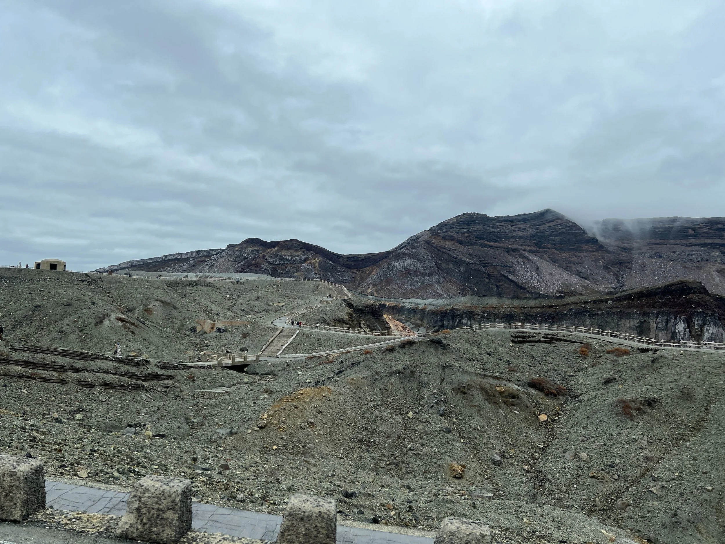
Mount Aso’s caldera is one of the largest in the world, measuring up to 25 kilometres in diameter and more than 100 kilometres in circumference. It is an extraordinary geological feature and not something I wanted to miss. Upon arrival, I walked around the crater area, viewing it from several designated viewpoints. Shelters are scattered throughout the area in case of falling volcanic ash, as this is an extremely active volcano. The crater is closely monitored by on-site staff who regularly patrol the area and are prepared to initiate evacuations if necessary.
Before boarding the bus to the crater, I was given a safety pamphlet warning that the area is not recommended for visitors with respiratory conditions. On some days, access is restricted entirely due to high levels of volcanic gas. Fortunately, during my visit, gas levels were within the acceptable range and the crater was open. Seeing the crater up close was intense—the amount of smoke continuously rising from it was striking, and it was easy to understand why the health warnings are taken so seriously.
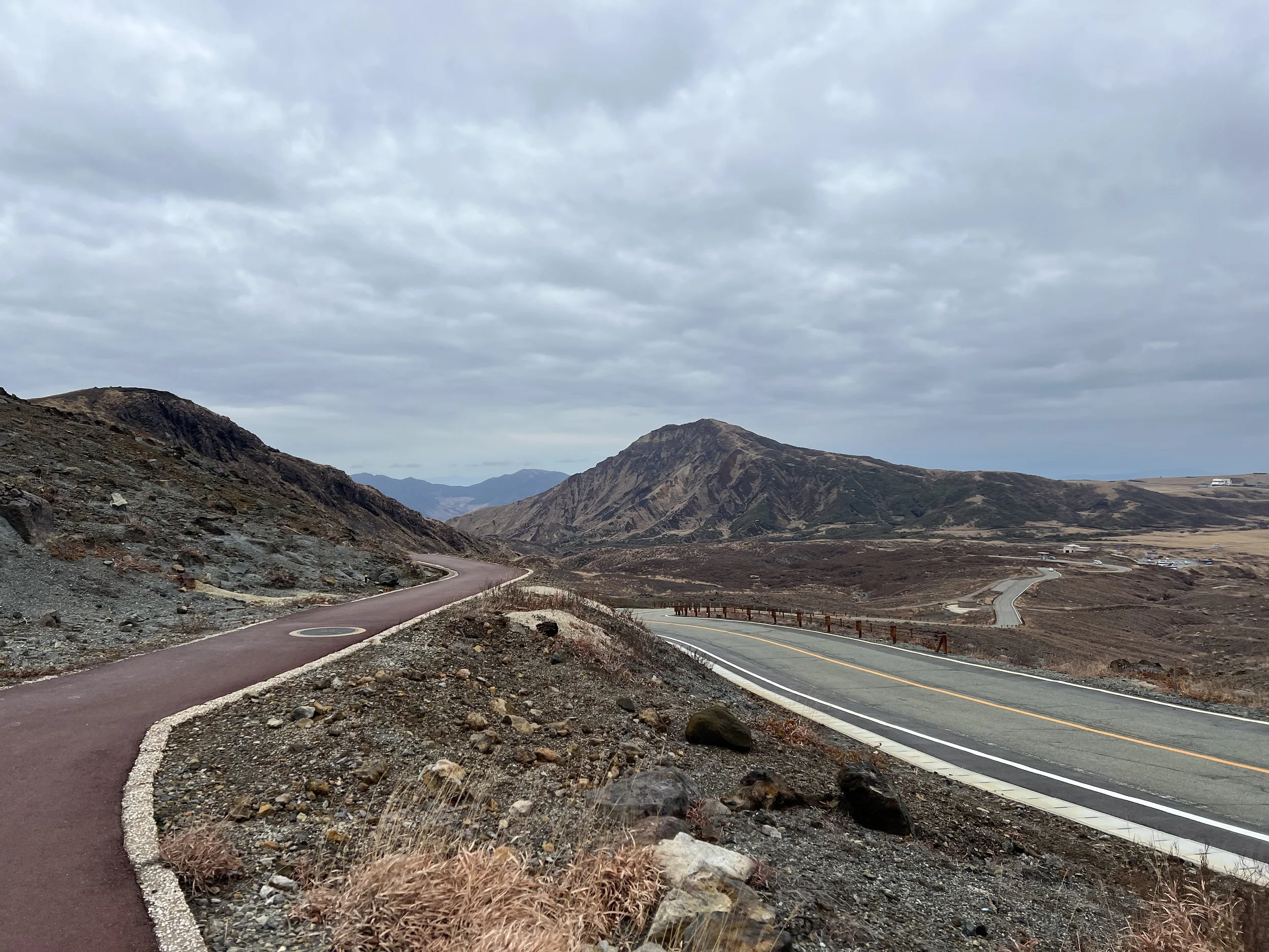
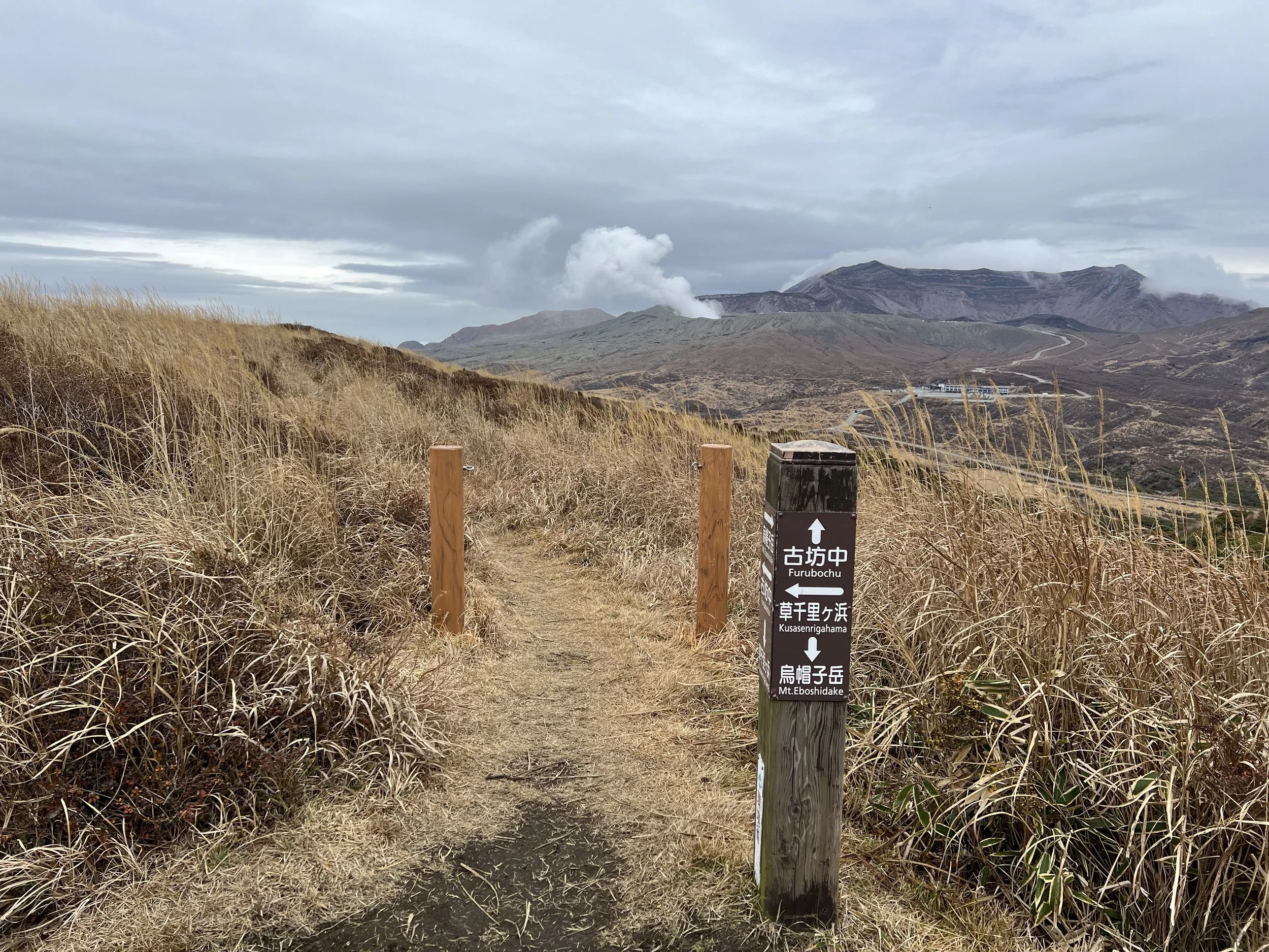
To avoid paying for another bus ride, I decided to hike down from the crater toward the Aso Volcano Museum, continuing on to Kusasenrigahama before joining the trail up Mount Eboshi. The route from the crater to the museum follows a paved road, making for an easy walk. After arriving at the museum, I spent some time at the nearby viewpoints before continuing on toward Kusasenrigahama.
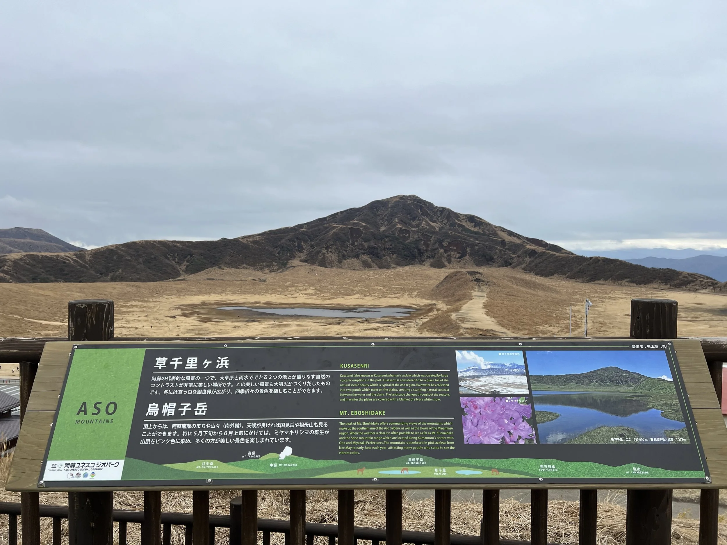
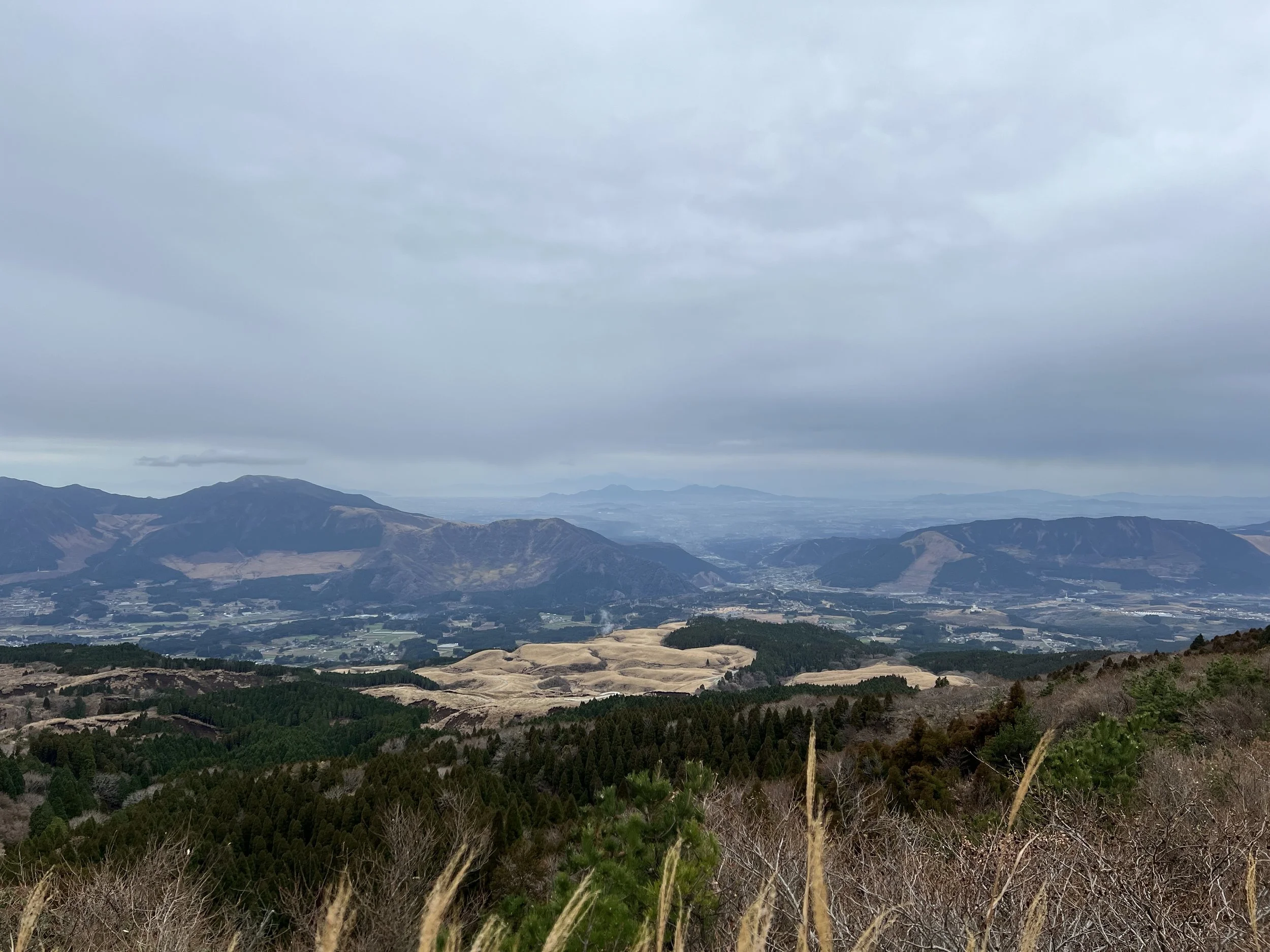
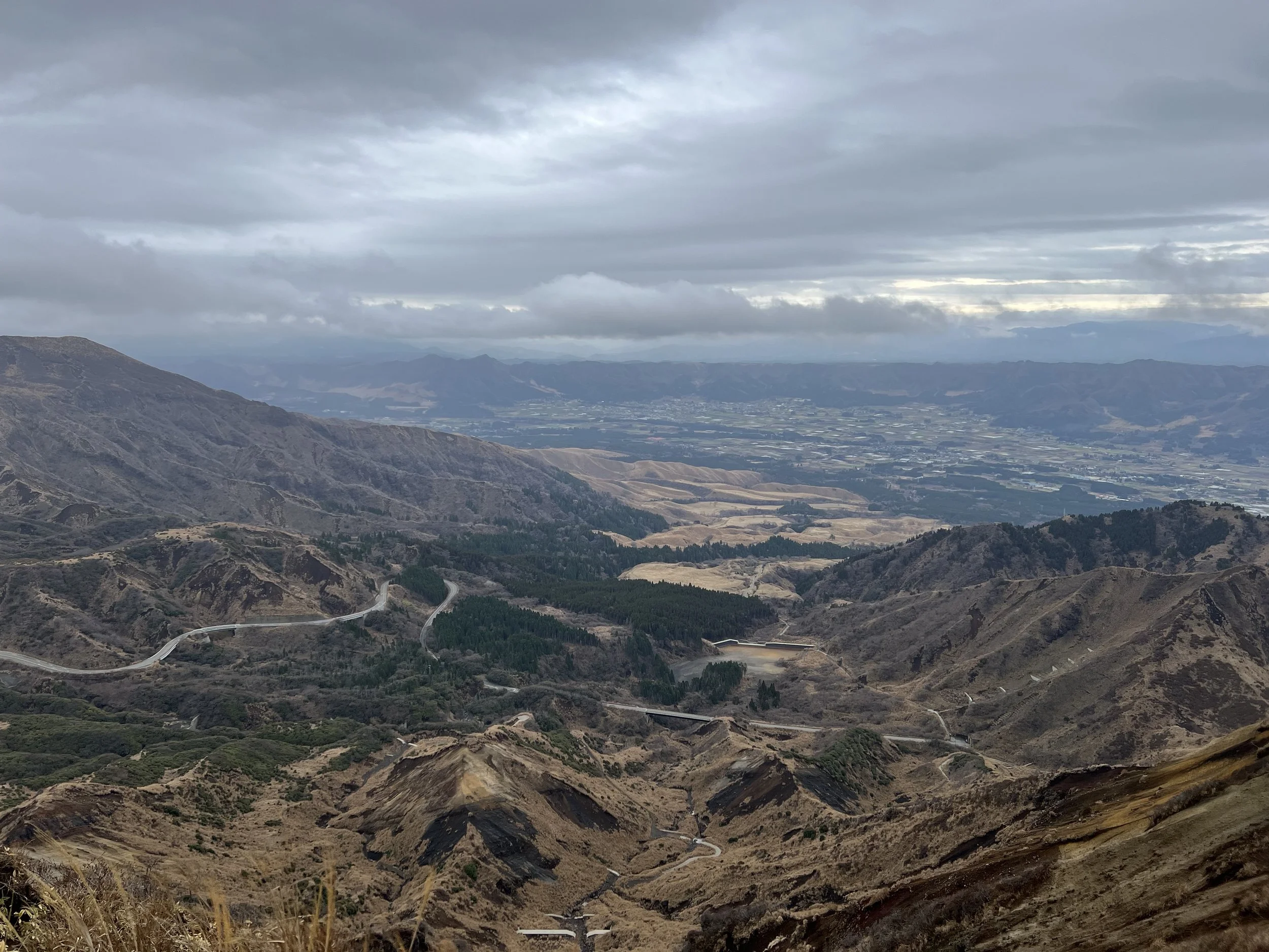
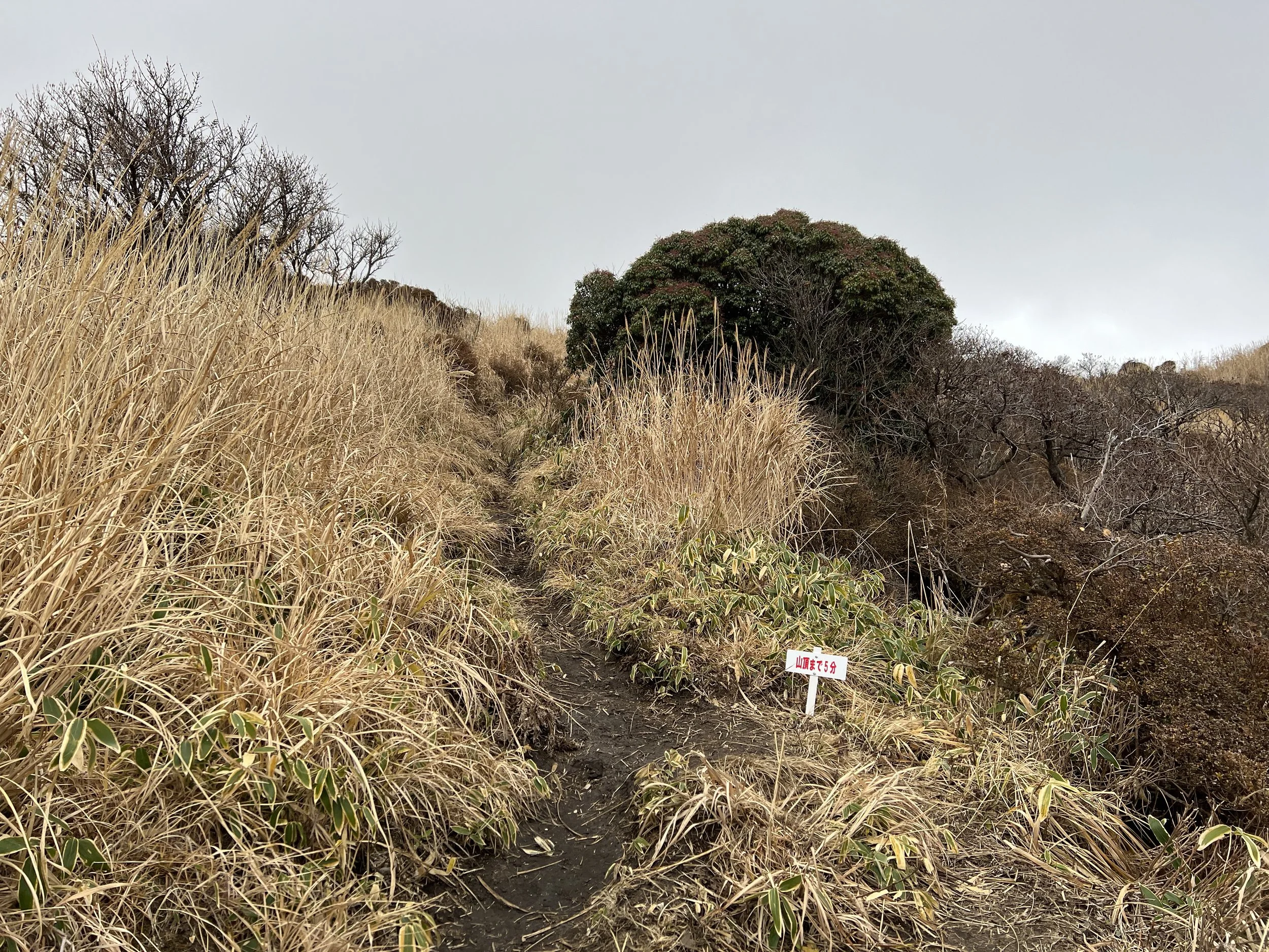
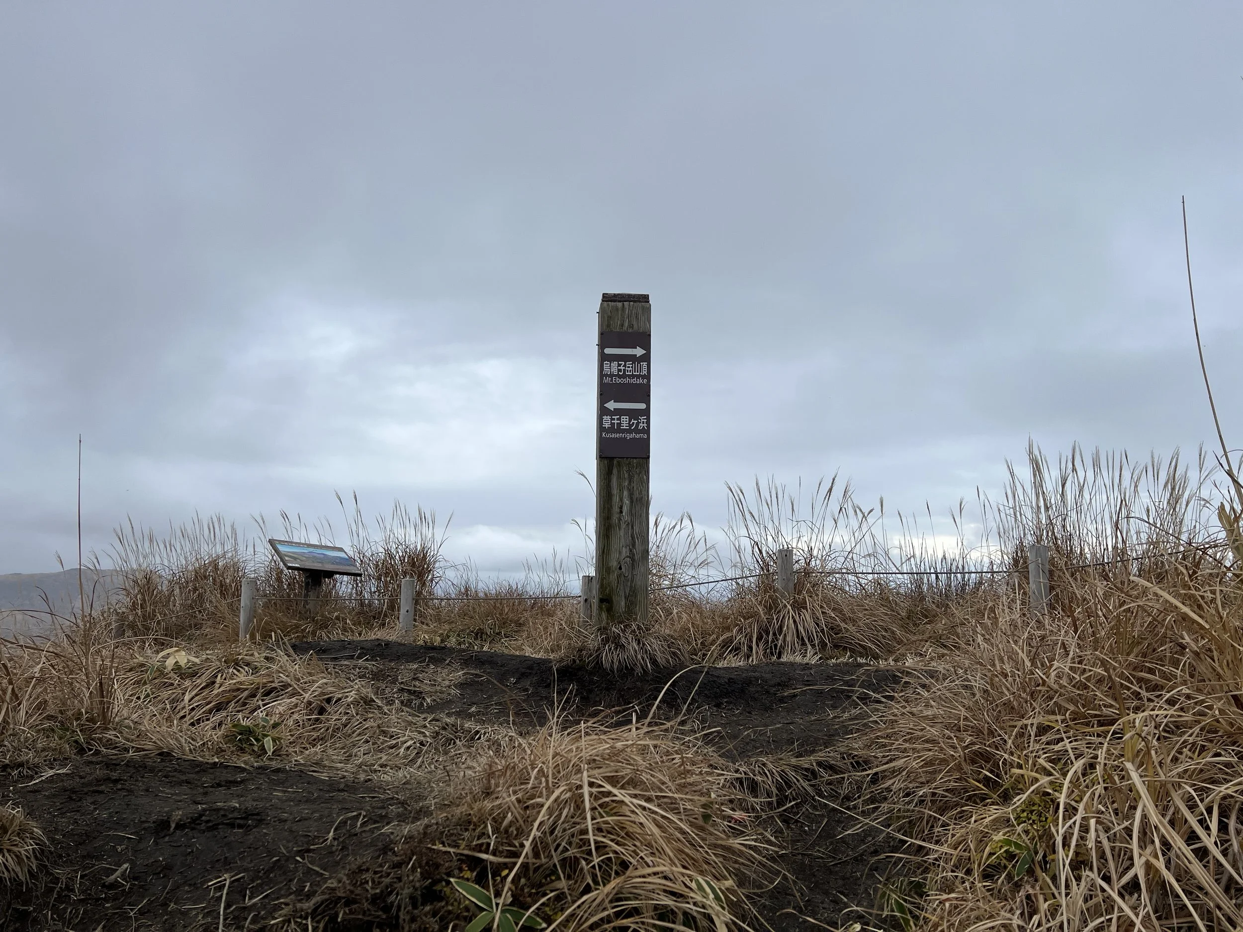
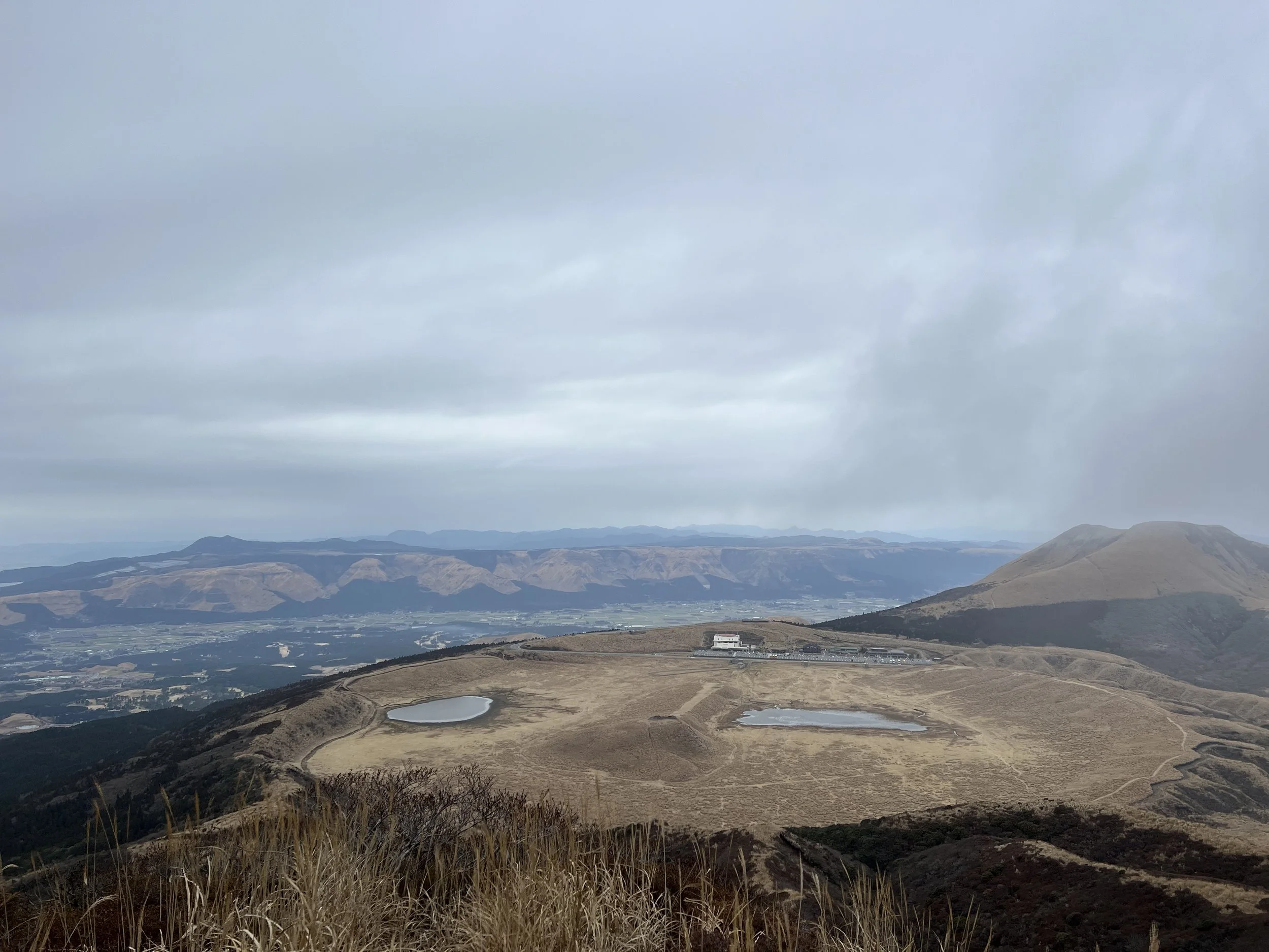
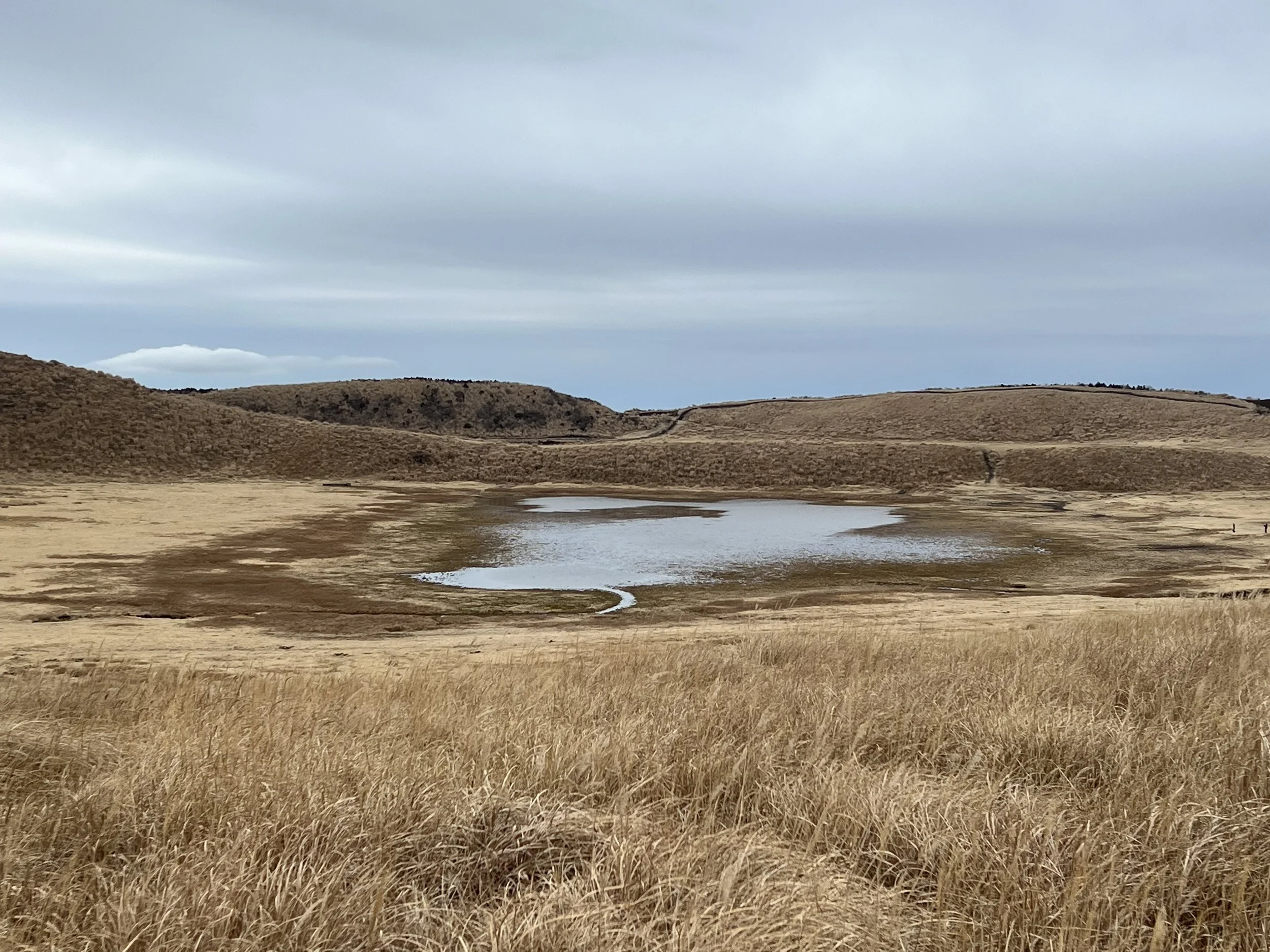
Kusasenrigahama is a wide, grass-covered plain known for its grazing horses during the warmer months, when visitors can also enjoy horseback riding. In winter, however, the landscape is mostly brown, and the small pond there had begun to freeze along the edges. After a brief stop, I continued toward the Mount Eboshi trailhead. The trail itself was narrow and muddy, with slippery sections that required careful footing.
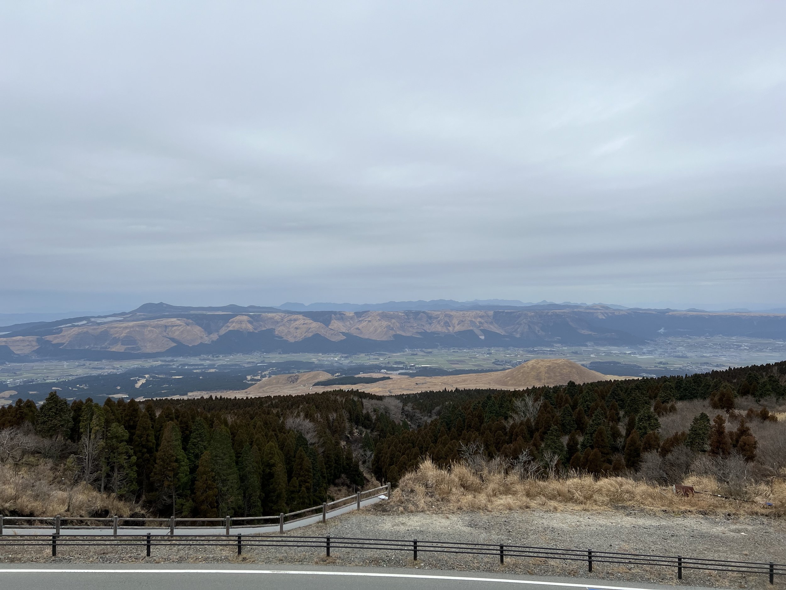
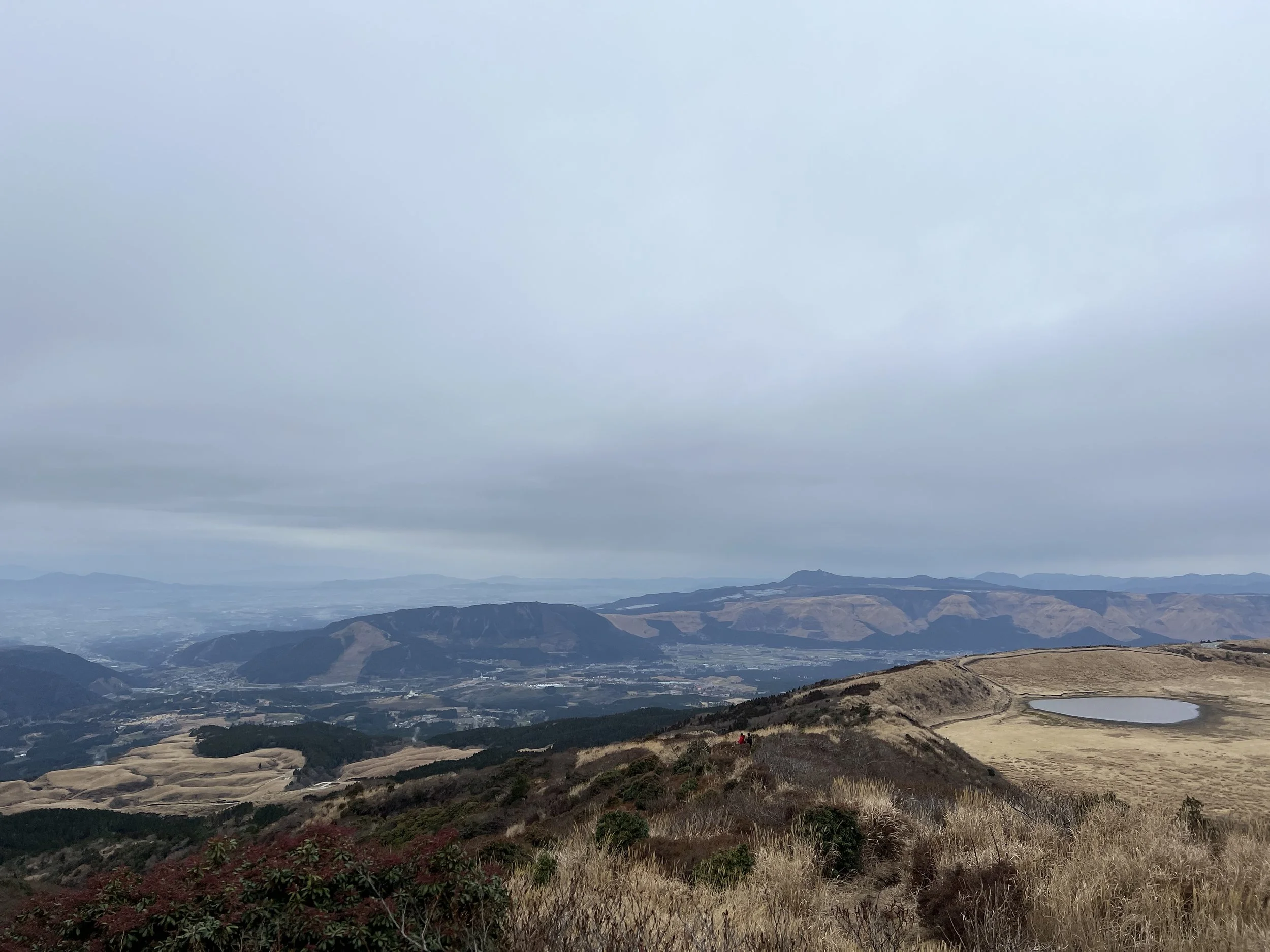
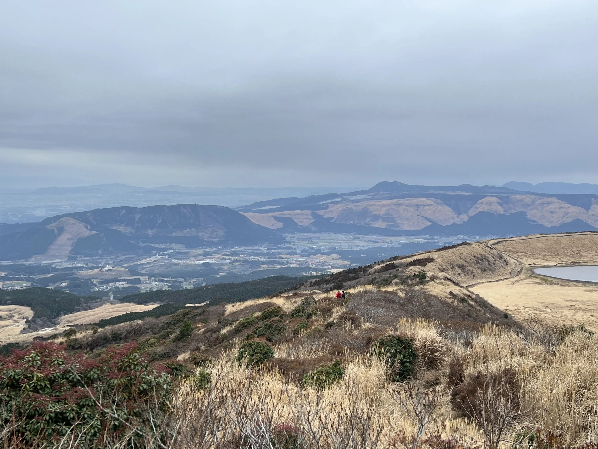
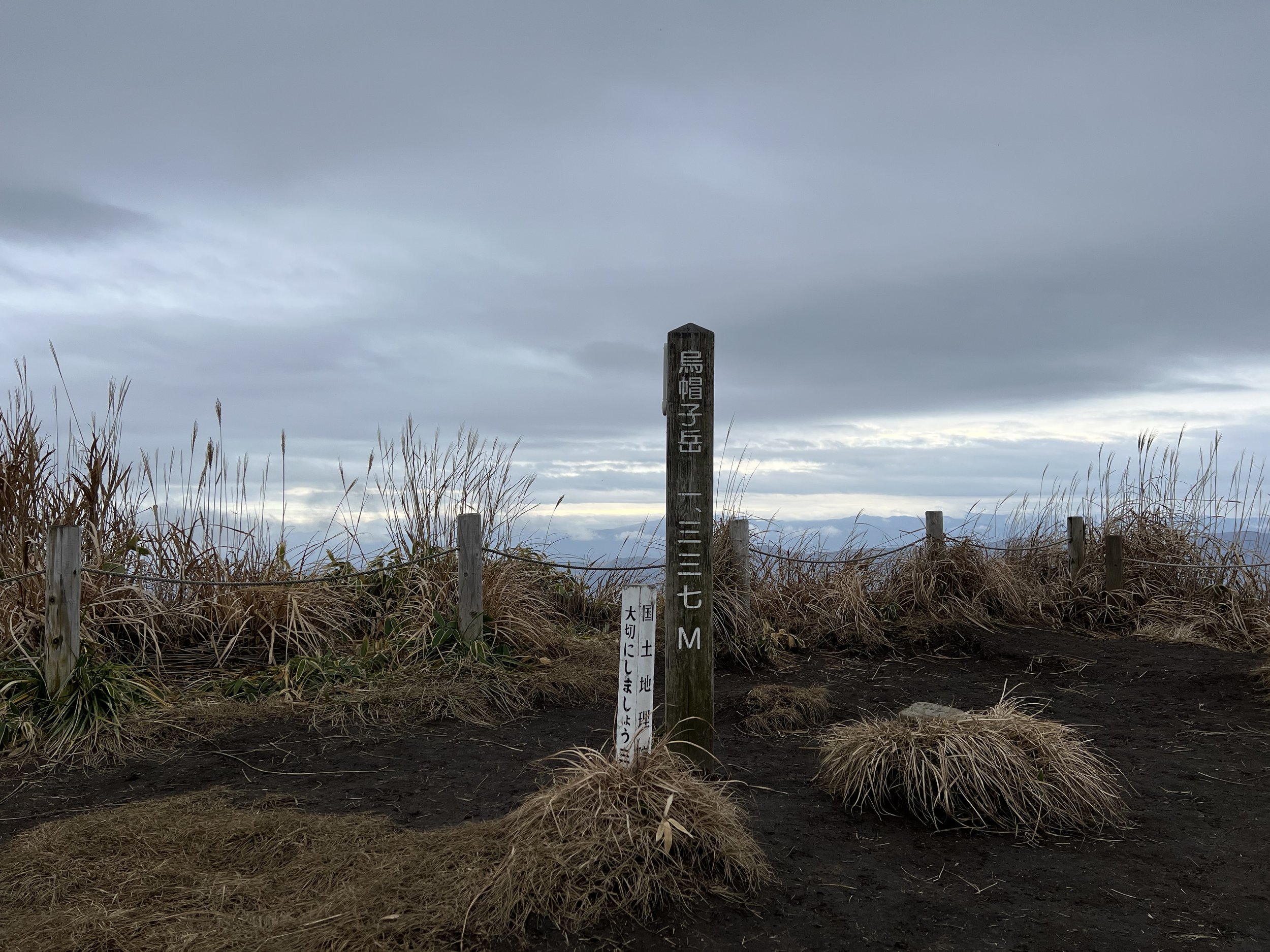
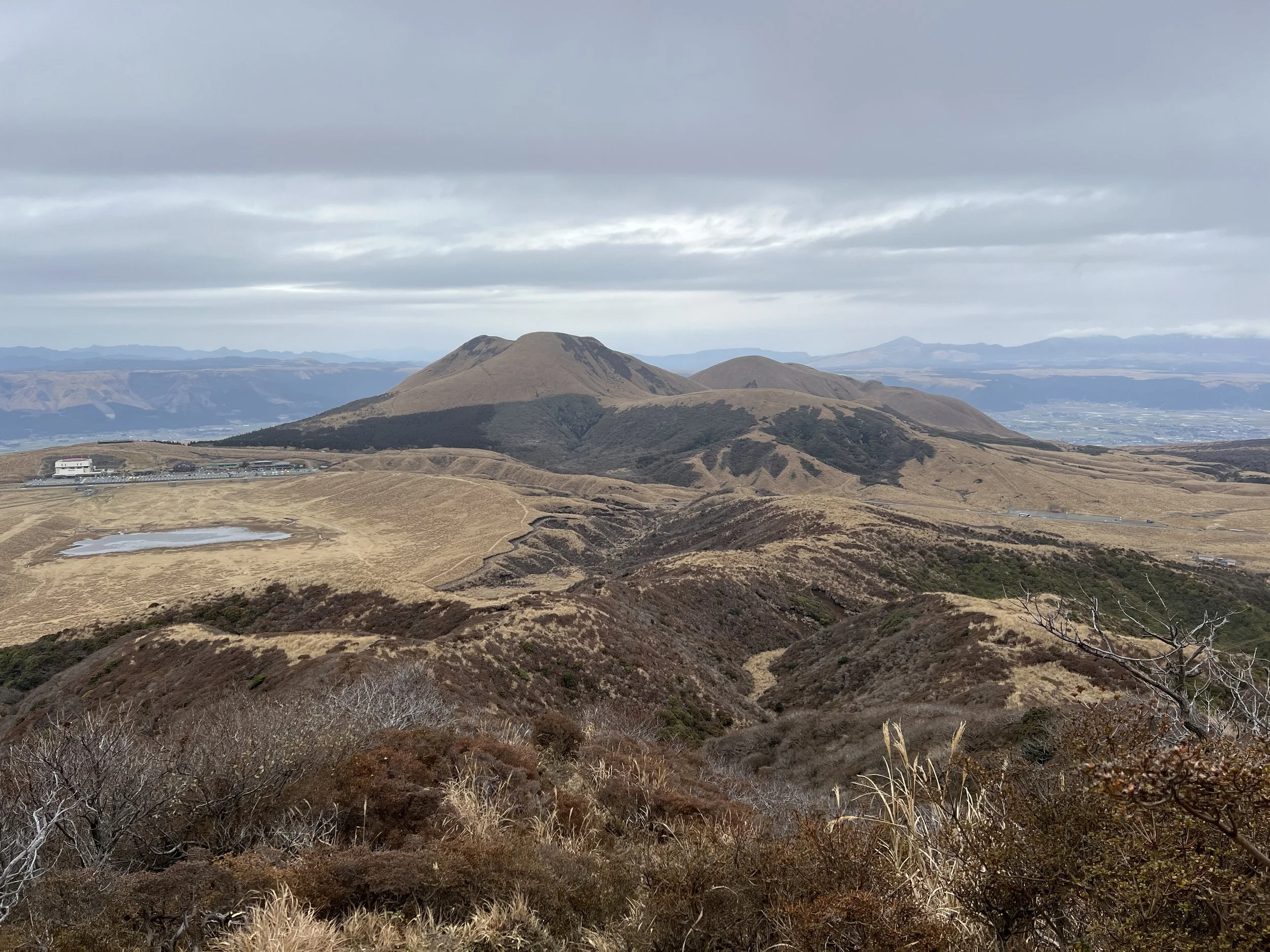
A few hundred metres before the summit, a warning sign noted the poor trail conditions ahead. While the ascent was manageable, it was clear that descending the same route could be challenging. The views along the trail and at the summit made the effort worthwhile, offering sweeping panoramas of the town below, surrounding mountain ranges, and the vast caldera landscape. Once at the summit, I spent time taking photos and enjoying the scenery. After checking my trail app, I chose to descend via an alternate route to form a loop, rather than returning the way I came.
This turned out to be the right decision, as the alternate trail was in much better condition and provided a gentler descent. It also offered different perspectives of the surrounding terrain, which made the return even more enjoyable. I eventually made my way back to the Aso Volcano Museum, where I stopped at the café for a late lunch before browsing the souvenir shops. Afterward, I boarded the bus back to Aso Station. I left the area wishing I had planned more time around Mount Aso, as there were several other trails I would have liked to explore.
History & Background
Mount Eboshi (烏帽子岳) is one of the outer peaks of the Mount Aso volcanic complex, located within Aso Kuju National Park in Kumamoto Prefecture. Mount Aso is among the most active volcanoes in Japan and has shaped the surrounding landscape for thousands of years through repeated eruptions. The caldera itself is the result of massive volcanic activity that occurred approximately 90,000 years ago, forming one of the largest calderas in the world.
The area surrounding Mount Eboshi has long been used for grazing and agriculture, with Kusasenrigahama serving as pastureland for centuries. Today, Mount Aso remains an important geological site and a major destination for visitors interested in volcanology, hiking, and natural scenery. Due to its ongoing volcanic activity, access to certain areas—including the crater—can change frequently depending on safety conditions.
Getting There
Mount Eboshi is accessed from the Mount Aso area in Kumamoto Prefecture. The nearest major rail hub is Aso Station, which is served by the JR Hohi Main Line from Kumamoto Station. From Kumamoto Station, the train journey to Aso Station takes approximately 1 hour and 30 minutes.
From Aso Station, local buses operated by Sanko Bus run to Asosanjo Terminal, the main access point for Mount Aso. From Asosanjo Terminal, a shuttle bus operates to the Nakadake Crater when conditions permit. The Aso Volcano Museum and Kusasenrigahama are also accessible by bus from Asosanjo Terminal, making them convenient starting points for hiking Mount Eboshi.
Volcano Status & Safety
Mount Aso is an active volcano. Before visiting, it is important to check the latest volcanic activity updates from the Japan Meteorological Agency or a local visitor centre. Certain areas and trails may be temporarily closed due to safety concerns. Even when access is permitted, volcanic gases may still pose health risks, particularly for those with respiratory issues, so planning ahead is essential for a safe visit.
Route Overview
Distance: 12.78 km (Aso Nakadake Crater → Aso Volcano Museum)
Total elevation gain: 357 m
Duration: 2 hr 01 min (with breaks 2 hr 20 min)
Difficulty: Intermediate
Peak: Mt Eboshi 1,337 m
Cost Breakdown
Bus: Aso Station → Asosanjo Terminal — ¥1,000
Bus: Asosanjo Terminal → Crater — ¥700
Food: ¥1,850