Chomonkyo - Yamaguchi, Japan
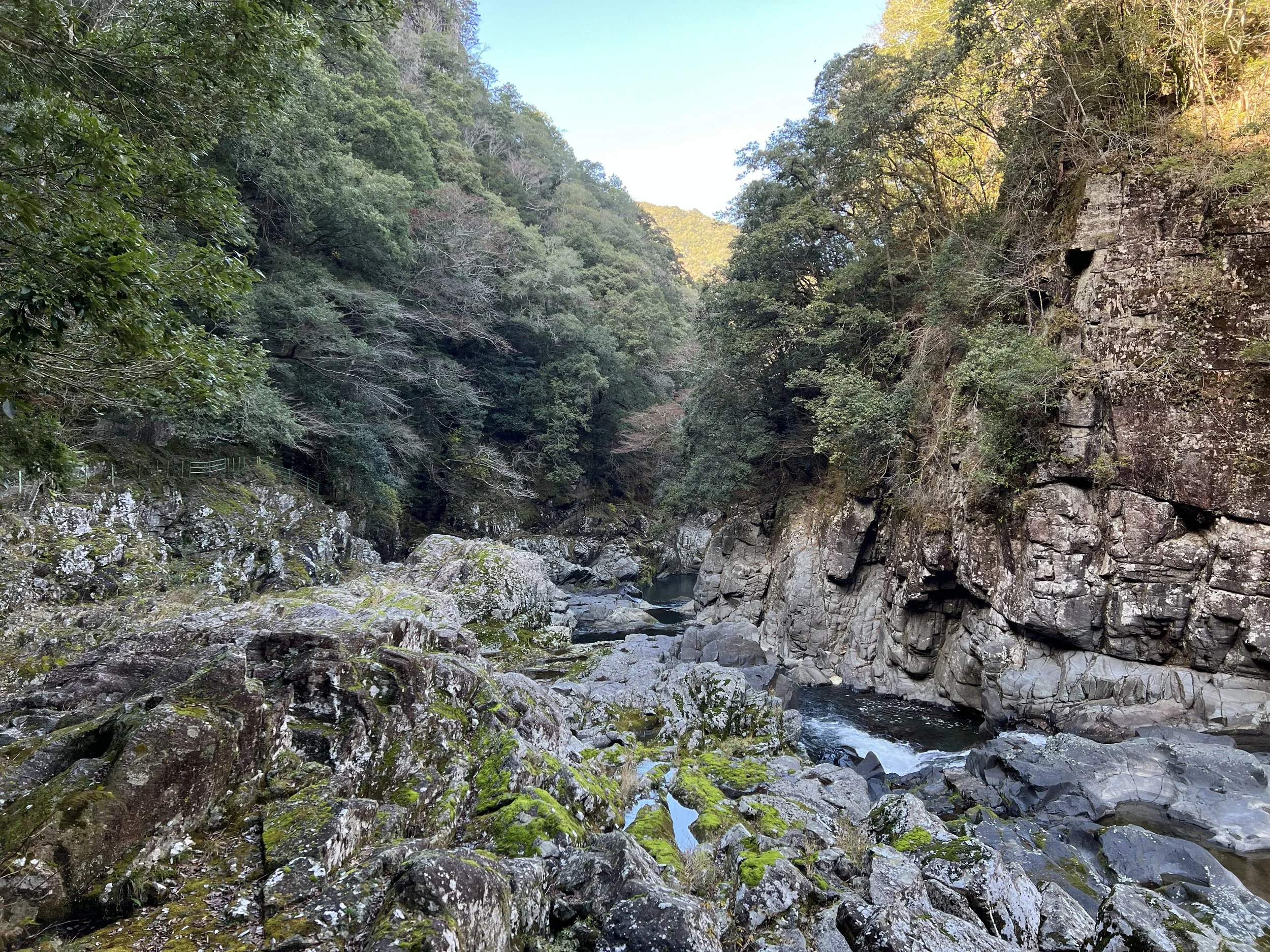
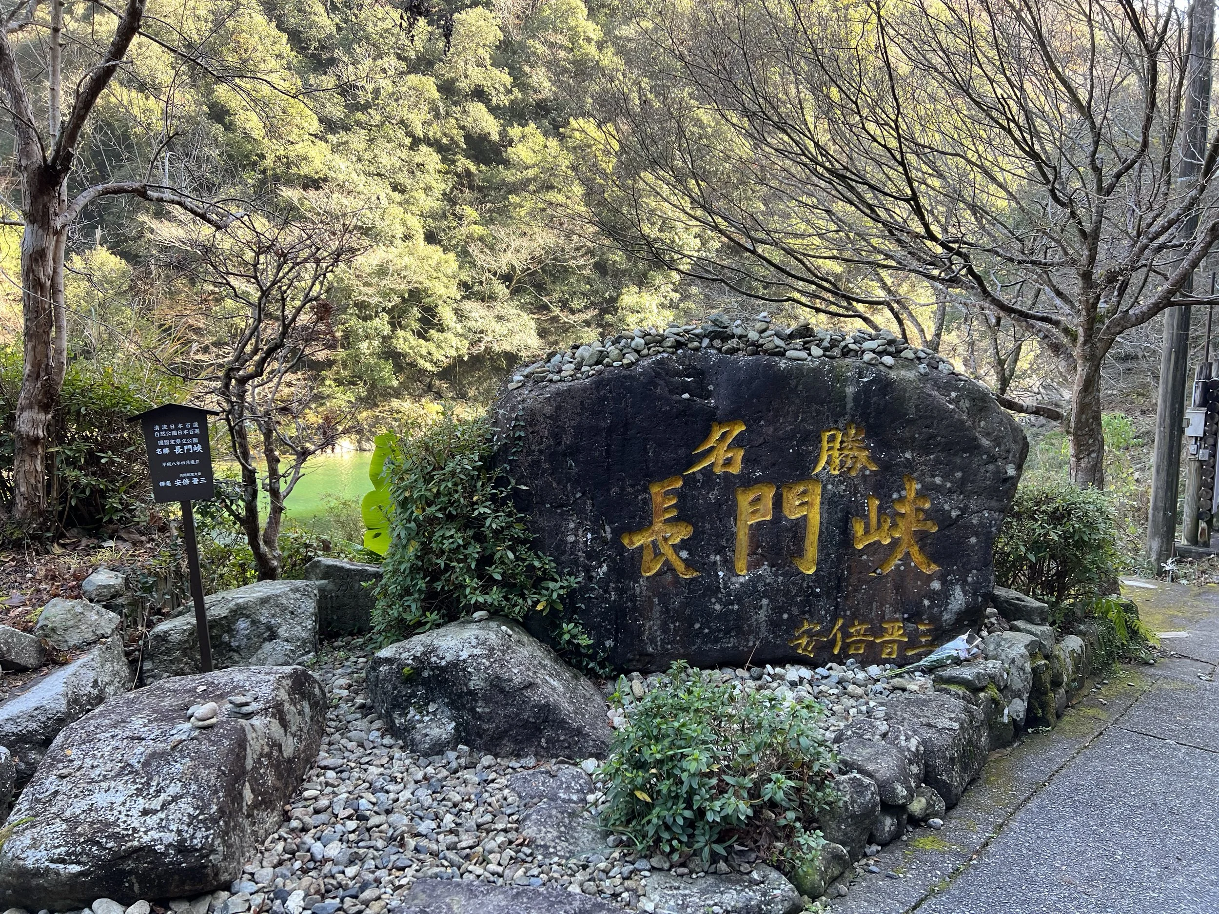
Chomonkyo is a scenic gorge stretching roughly 12 kilometres through Yamaguchi Prefecture, carved by the Abu River. It was designated a National Place of Scenic Beauty in 1923 for its dramatic ravines, rock formations, waterfalls, and the clear river known for its rich fish population. The gorge is beautiful year-round, with seasonal changes dramatically altering the scenery along the trail.
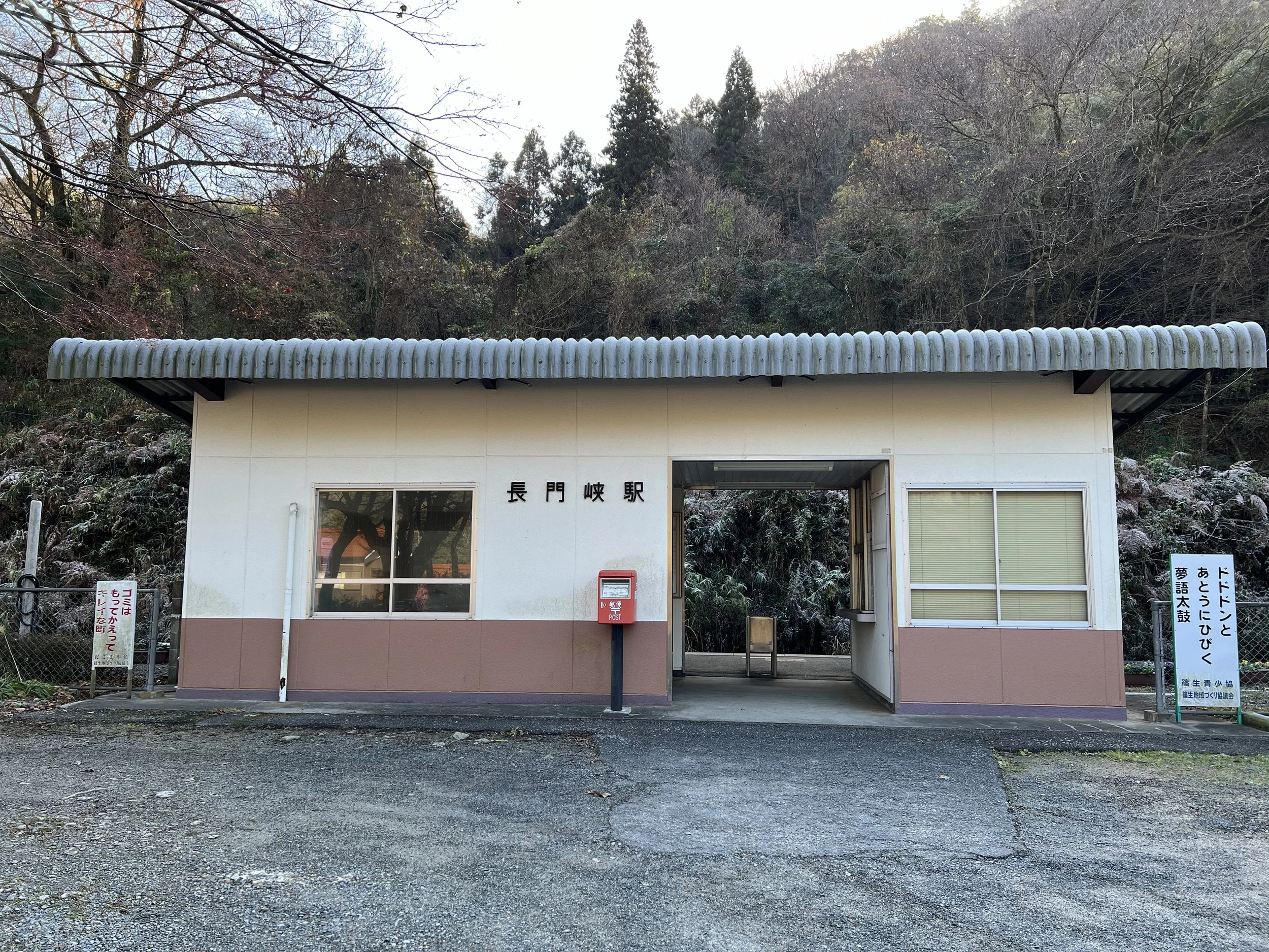
I came across Chomonkyo while researching hiking trails in the region and confirmed the details at the tourist information centre in Shin-Yamaguchi Station. The nearest stop is Chomonkyo Station, though not all trains stop there, making a transfer at Yamaguchi Station necessary.
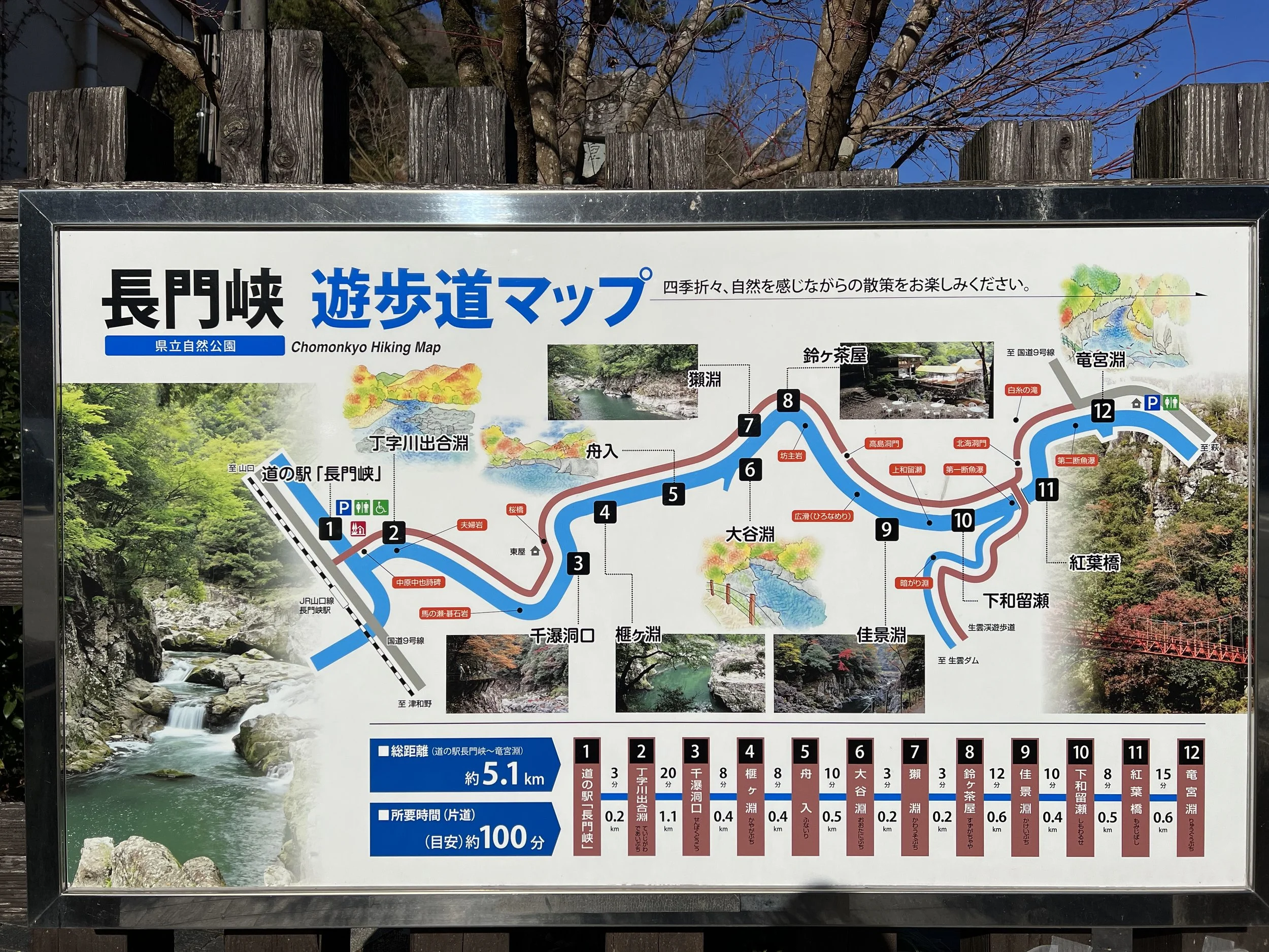
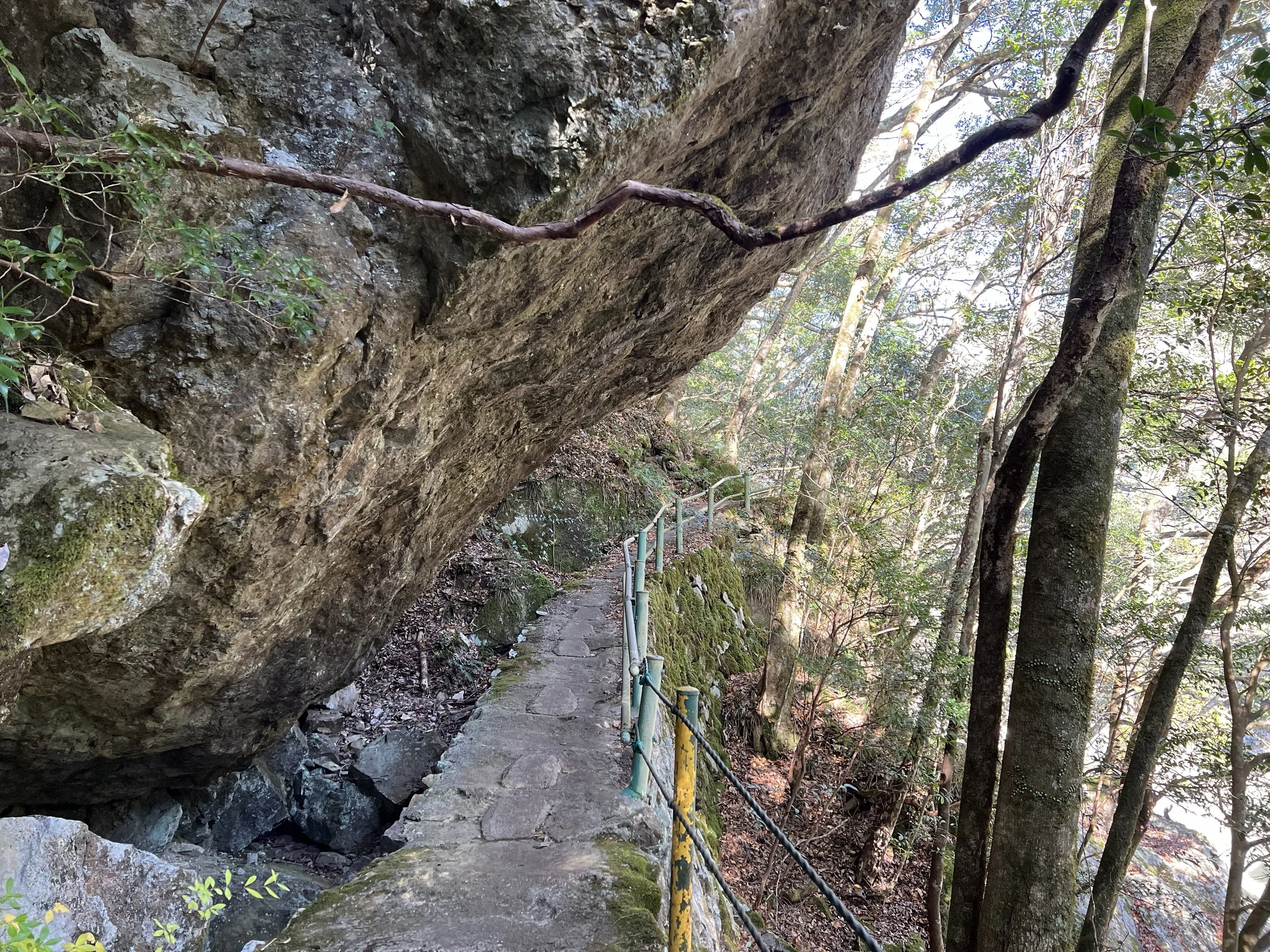
Arriving at the small, quiet station, I took a photo of the train timetable before heading out, knowing service here is infrequent. A detailed hiking map is posted right at the trailhead, clearly marking distances and points of interest, which made navigation straightforward from the start.
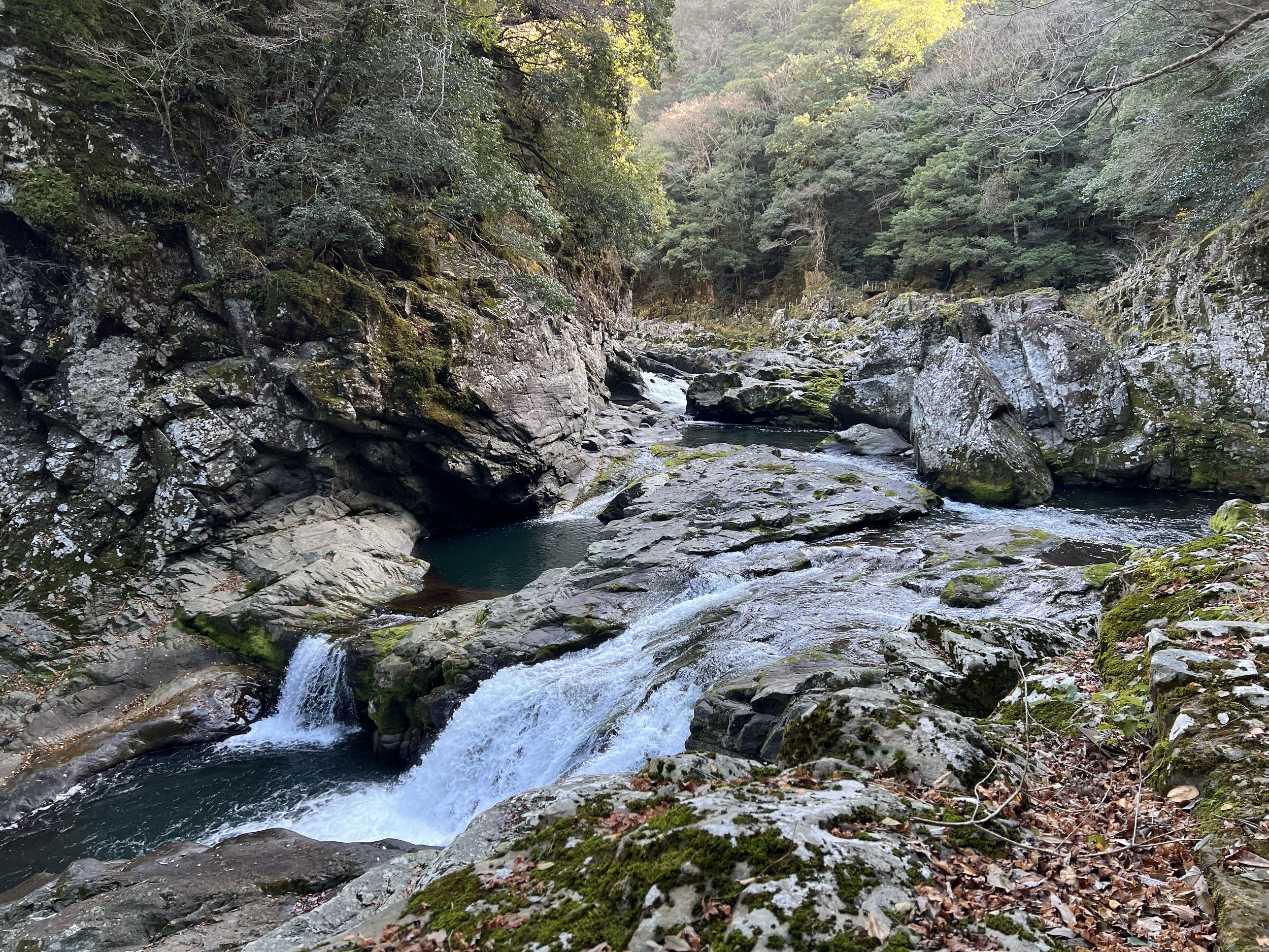
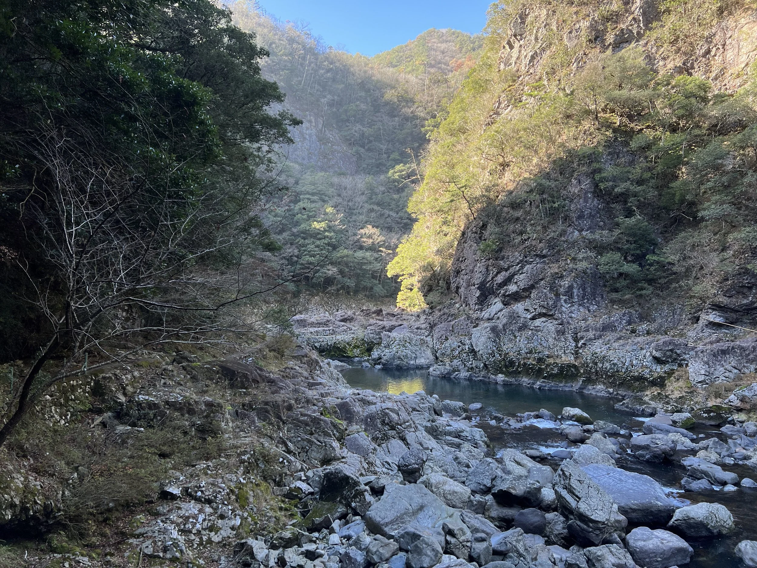
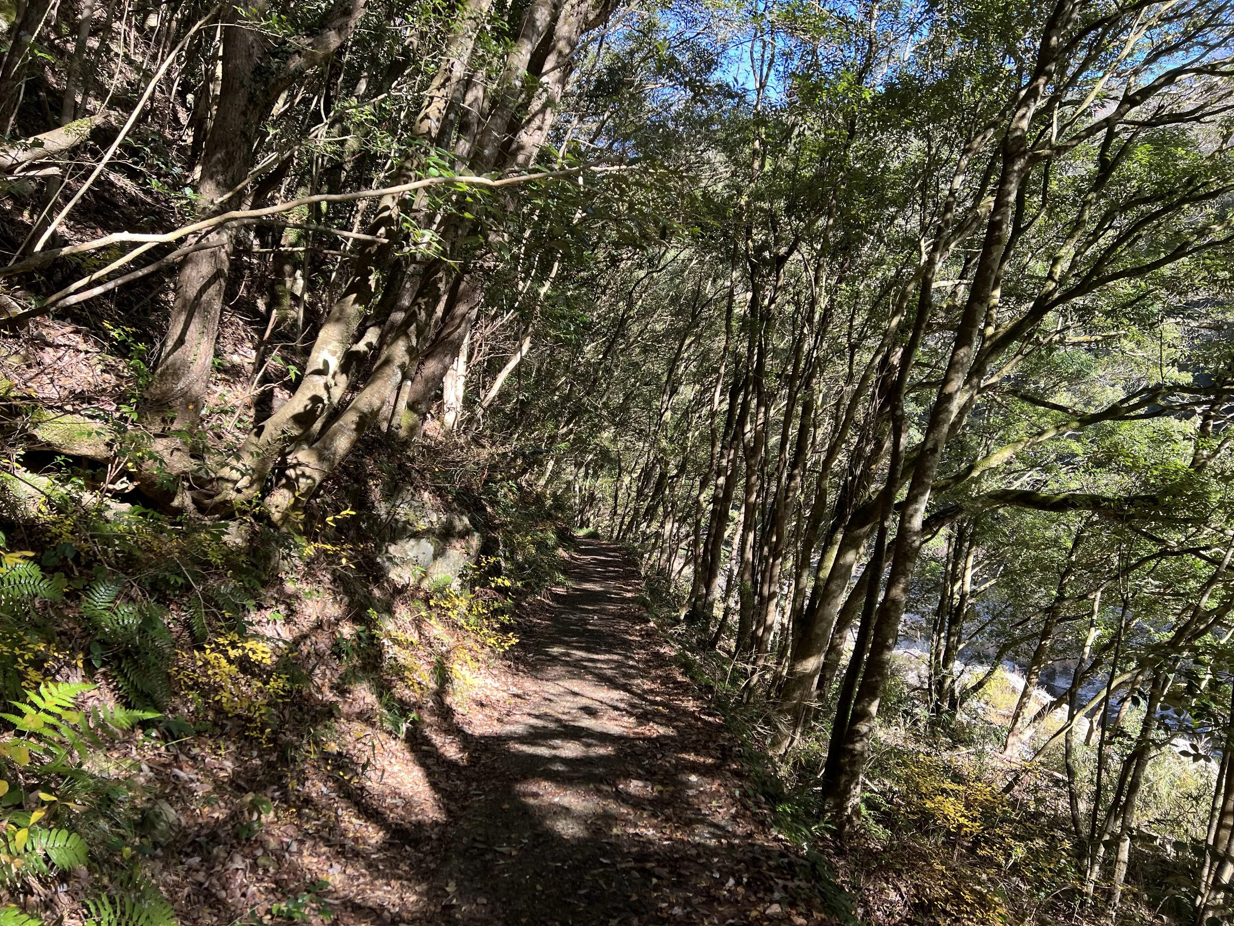
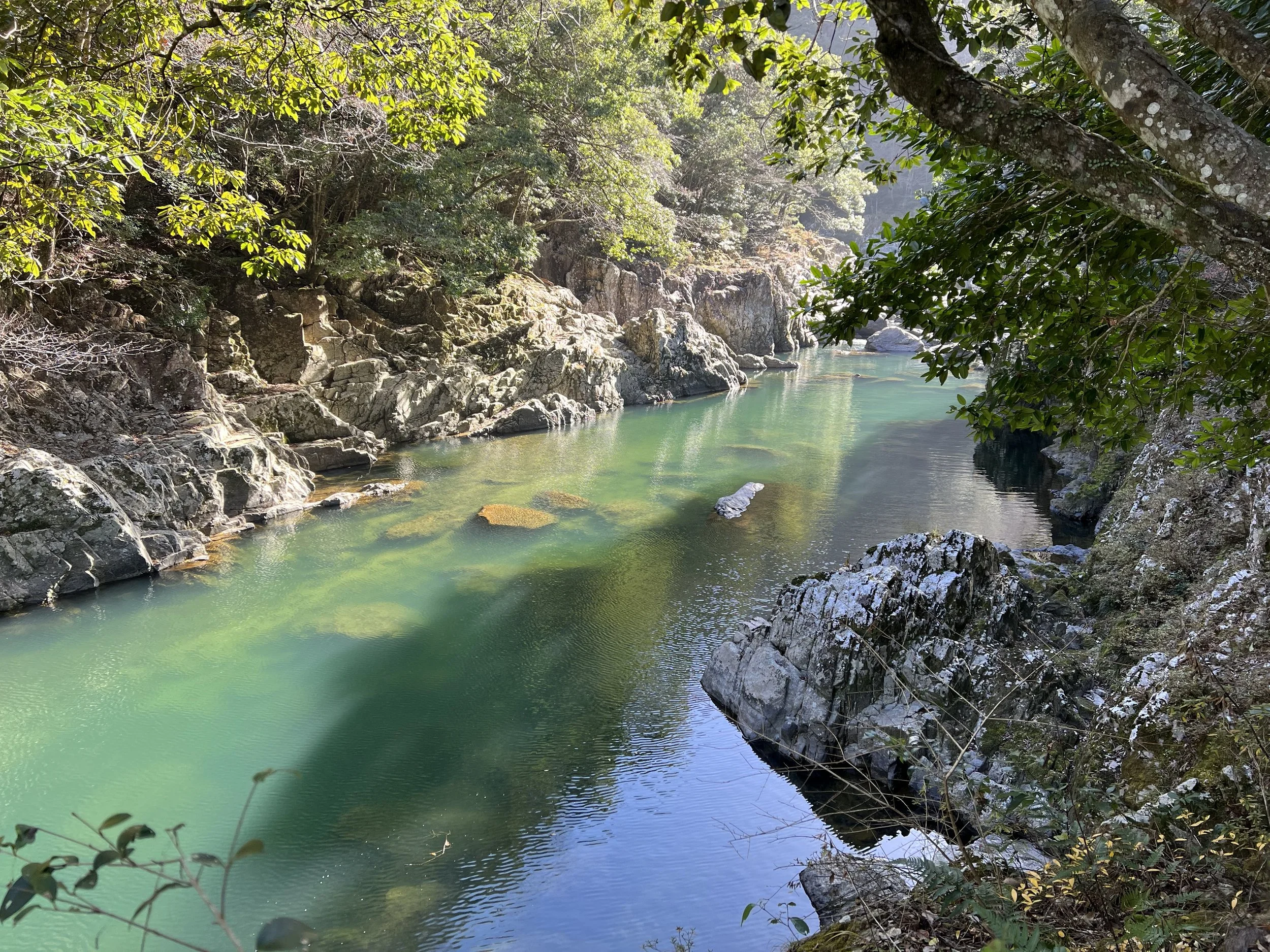
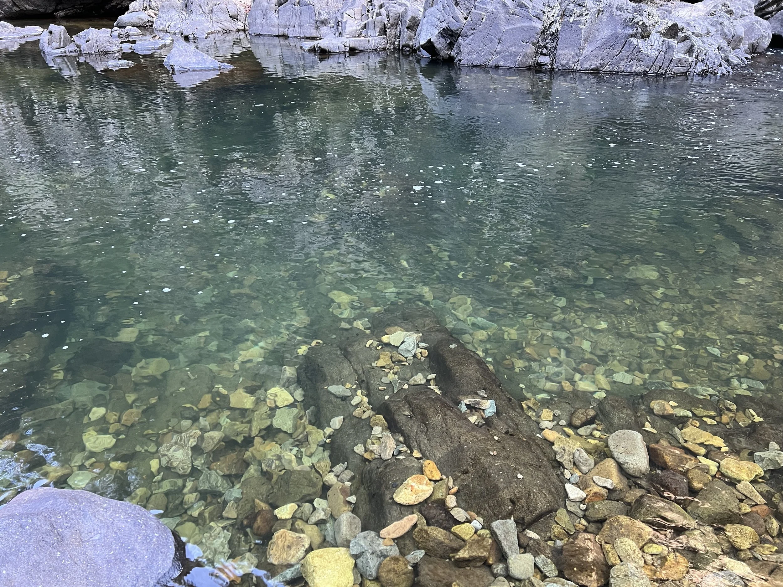
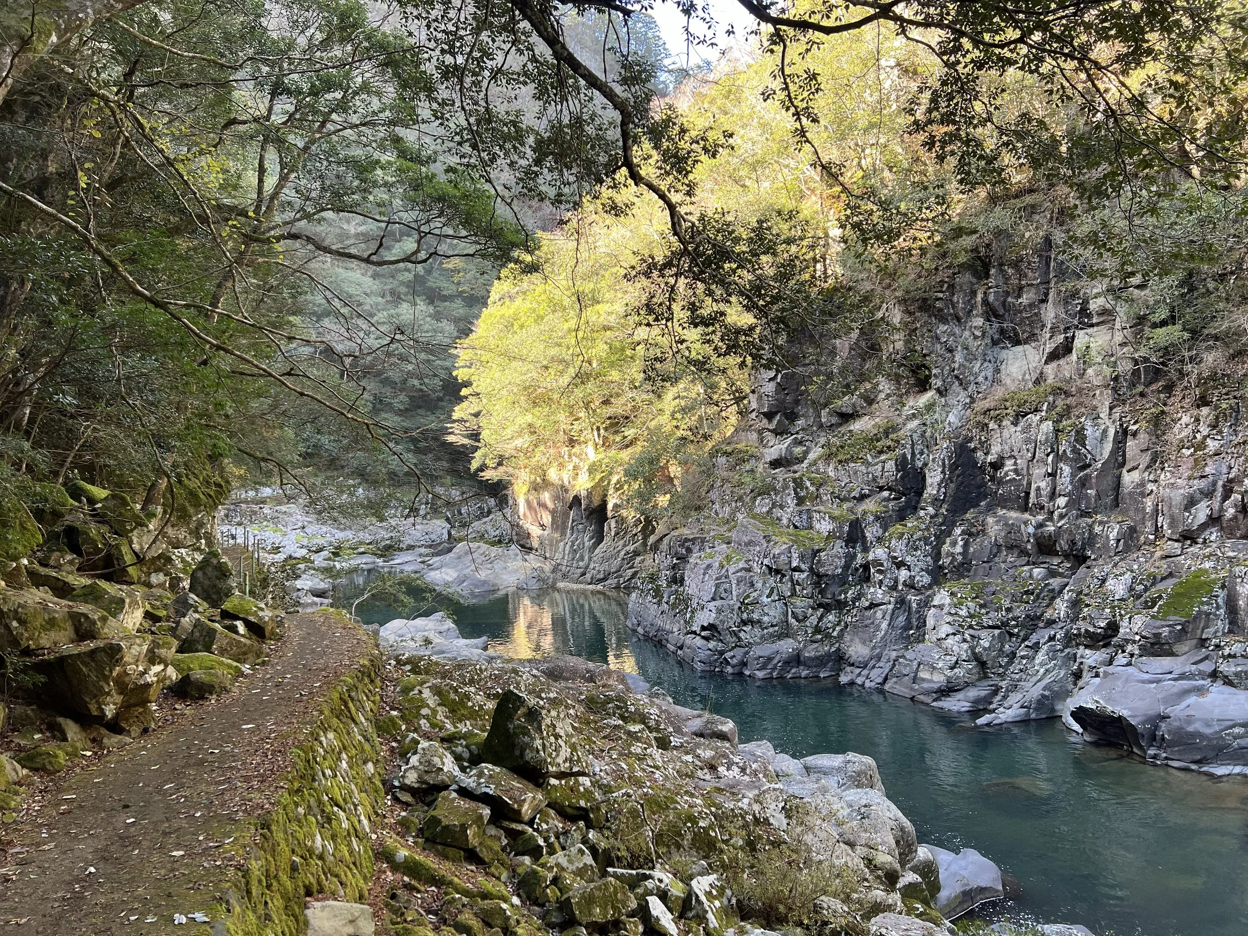
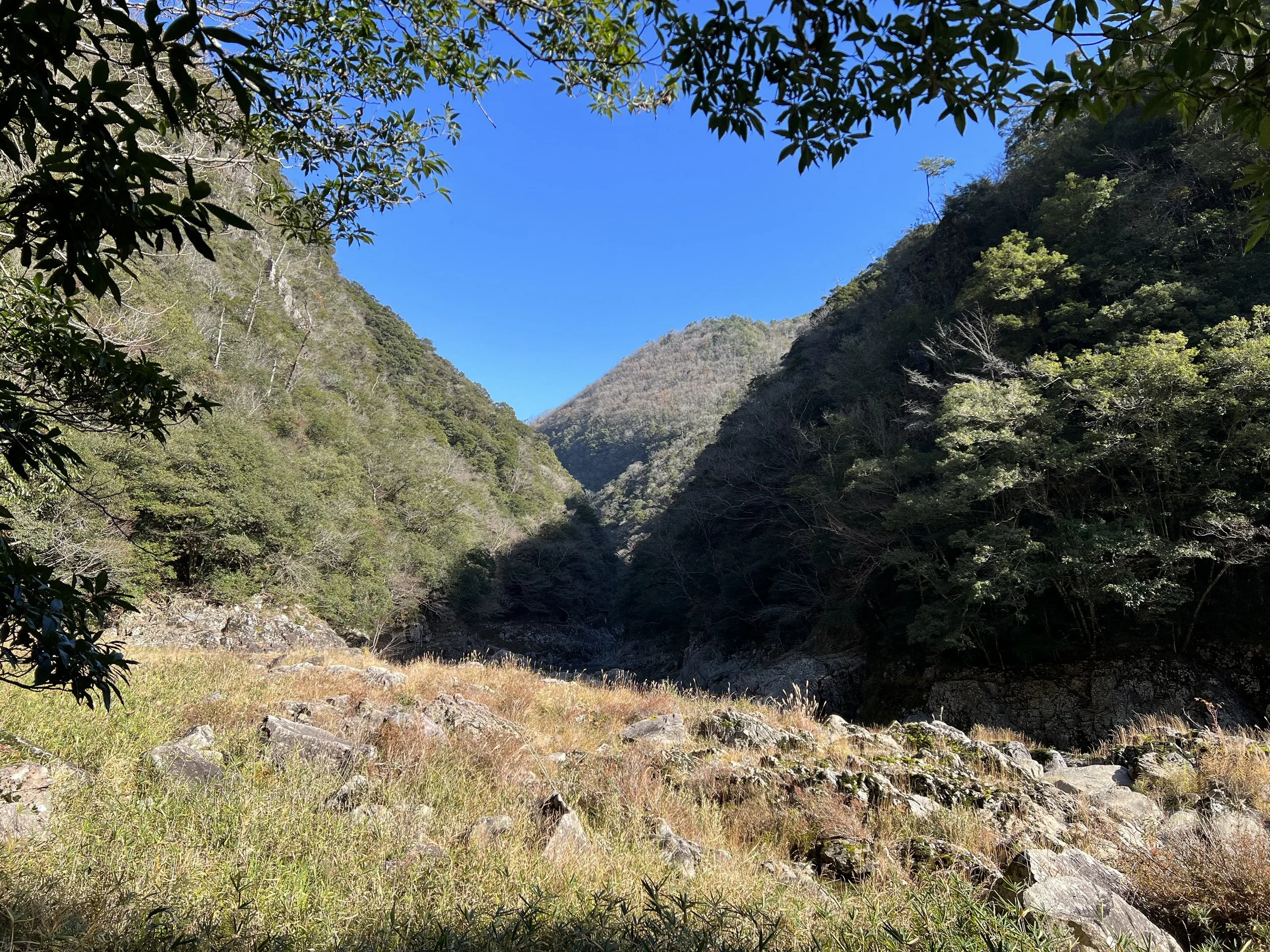
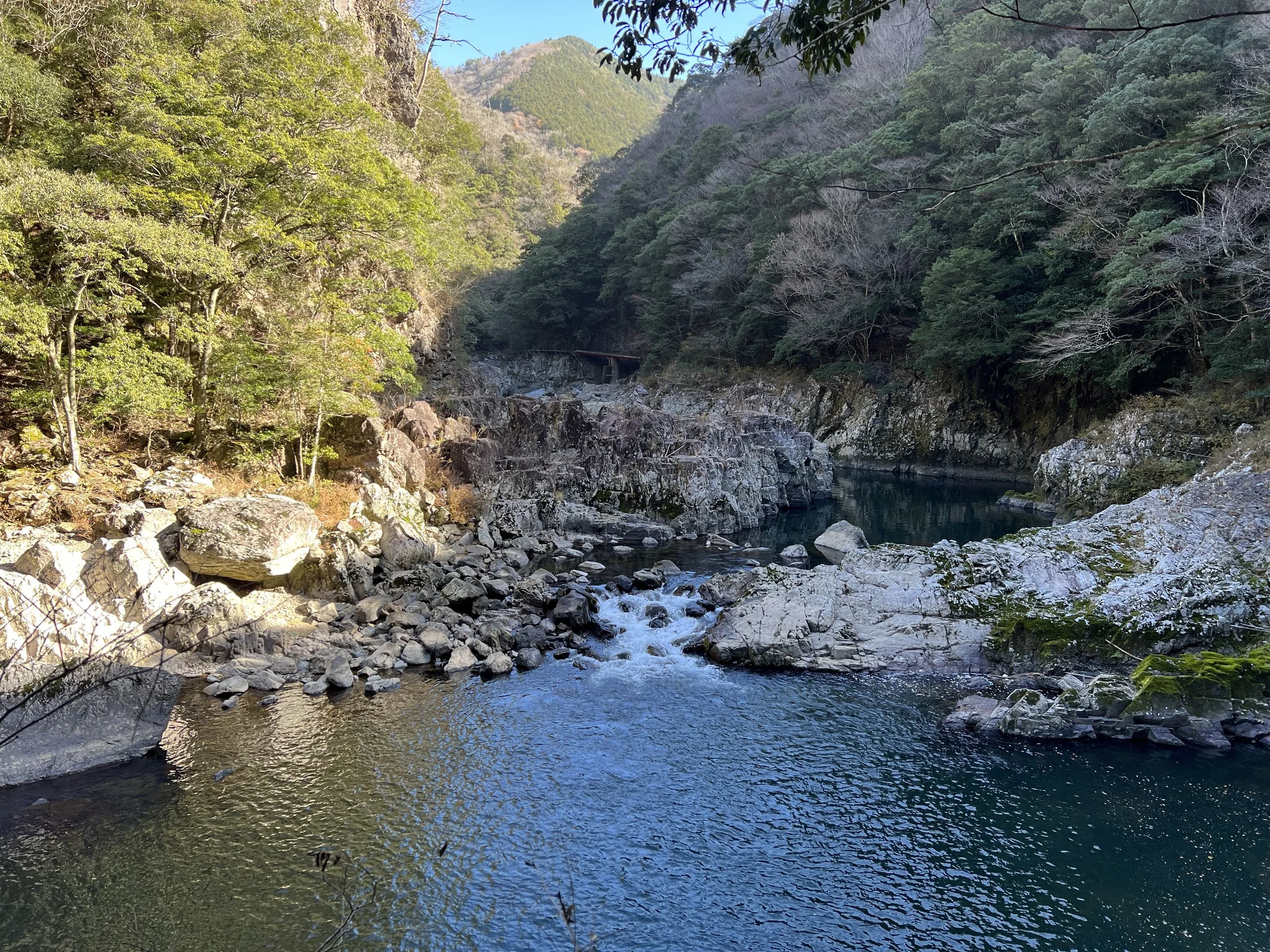
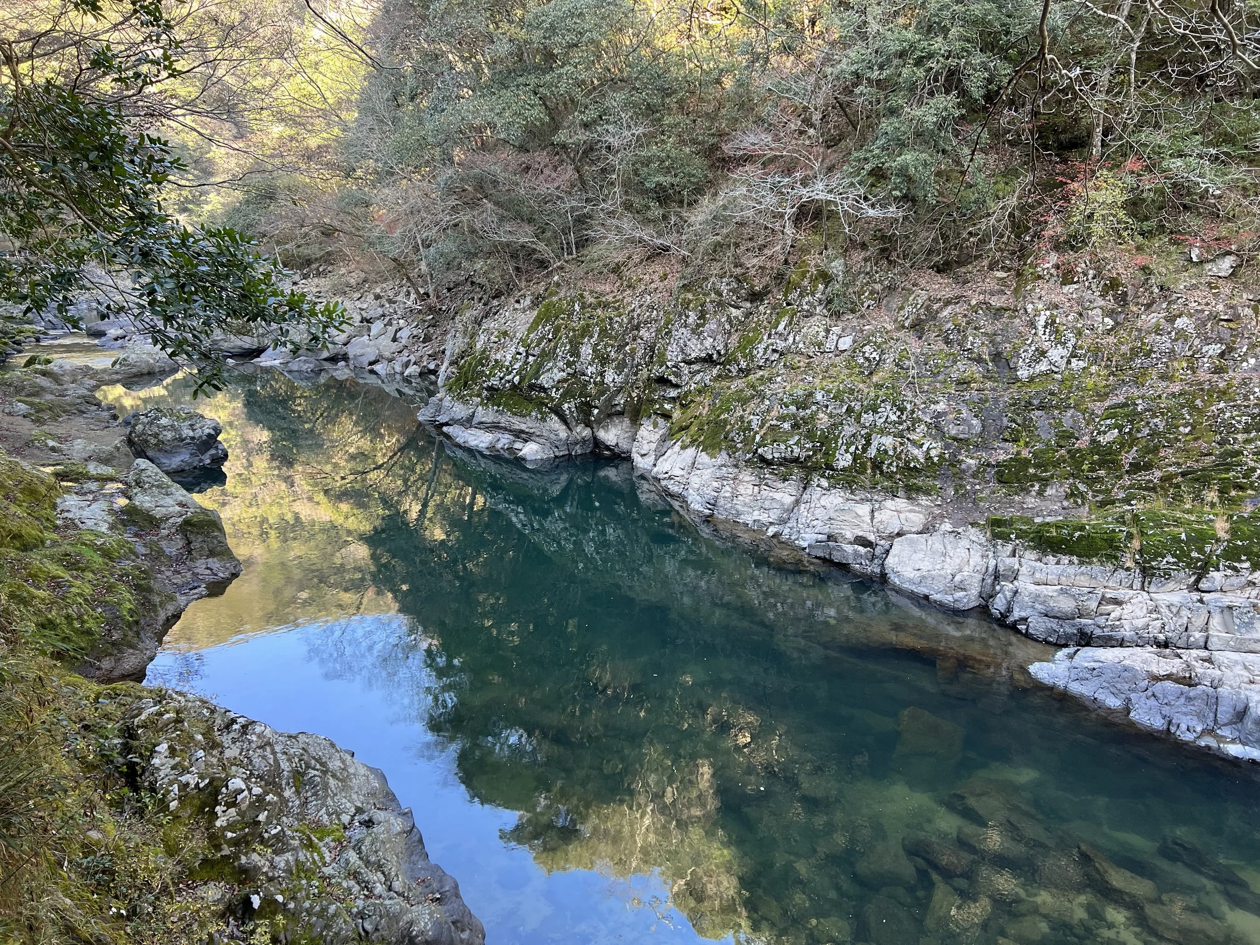
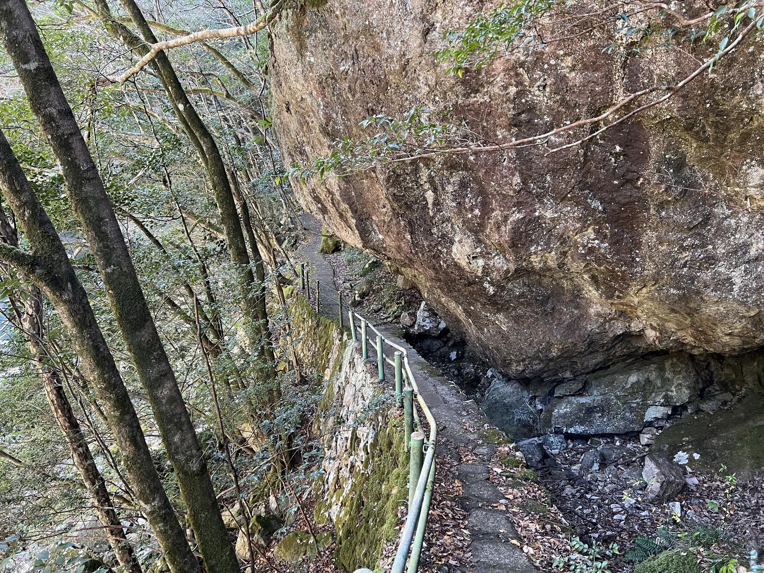
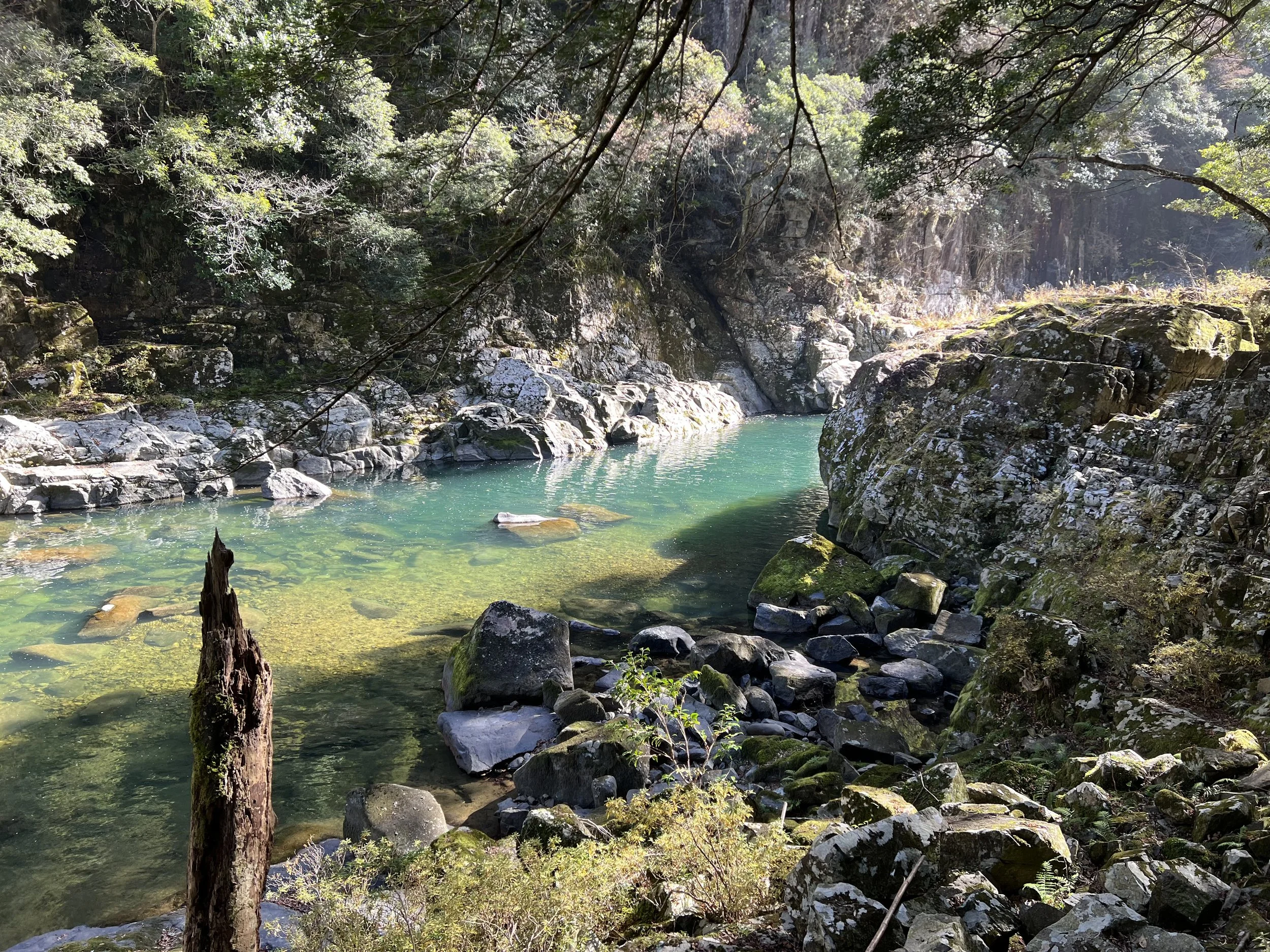
The trail itself was easy to follow and well maintained, running alongside the Abu River for most of its length. The emerald-coloured water paired with dense greenery immediately set the tone. Chomonkyo is known for its seasonal variety—cherry blossoms, wisteria, and magnolias in spring; deep greens in summer; vibrant autumn foliage; and occasional snow in winter. Visiting in December felt like catching the space between seasons, with most of the autumn colours already faded and winter not yet fully settled in. Even so, the scenery remained striking and serene.
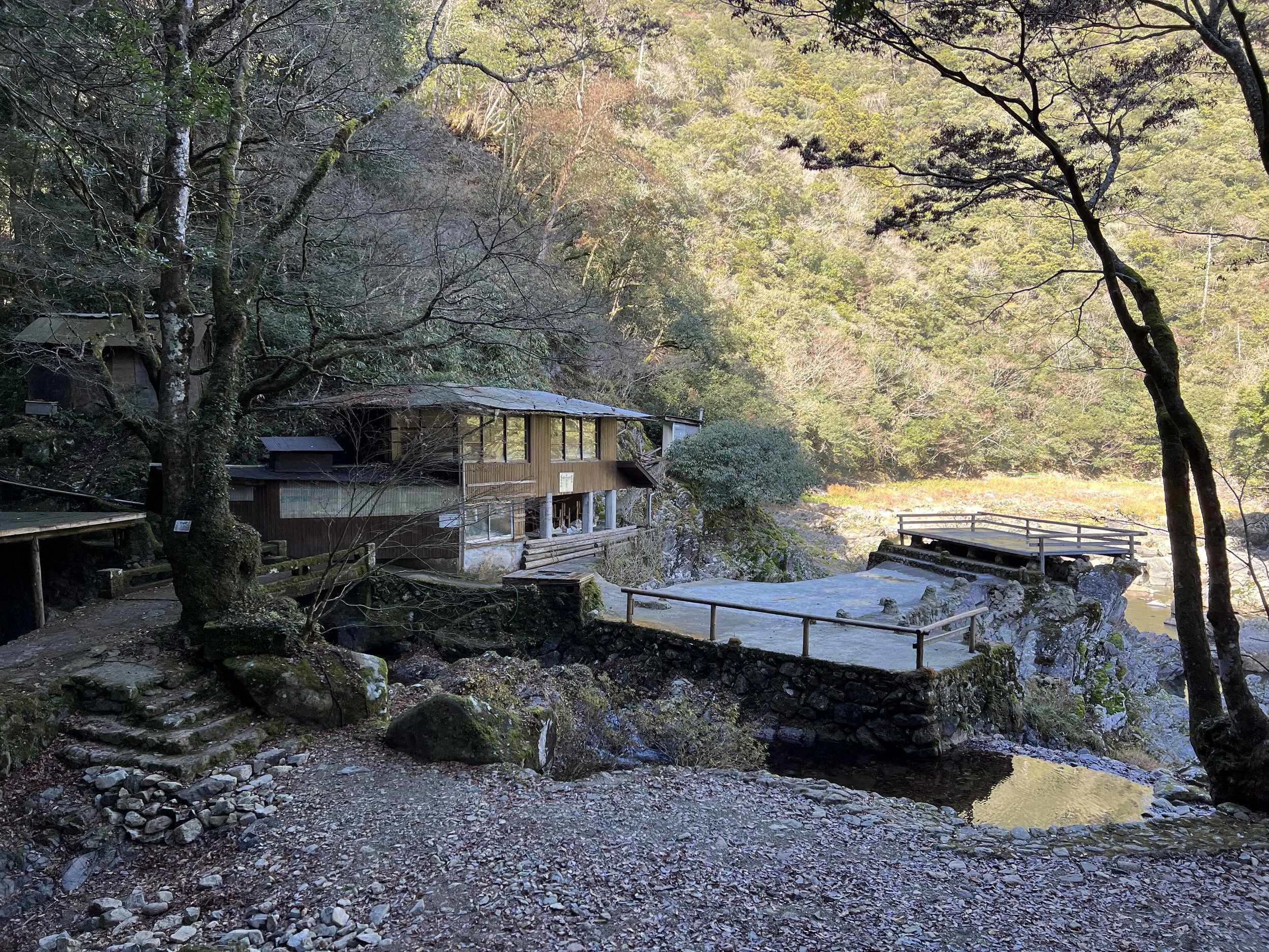
One feature I particularly appreciated was the numbered markers along the trail, each corresponding to points of interest shown on the map. This made it easy to anticipate what was coming next. I knew there were two teahouses along the route, and I had initially planned to stop at Suzuga Teahouse for a short break. However, both teahouses were closed for the winter season. The viewing deck at Suzuga Teahouse remained accessible, though, and it offered a beautiful vantage point over the river and gorge.
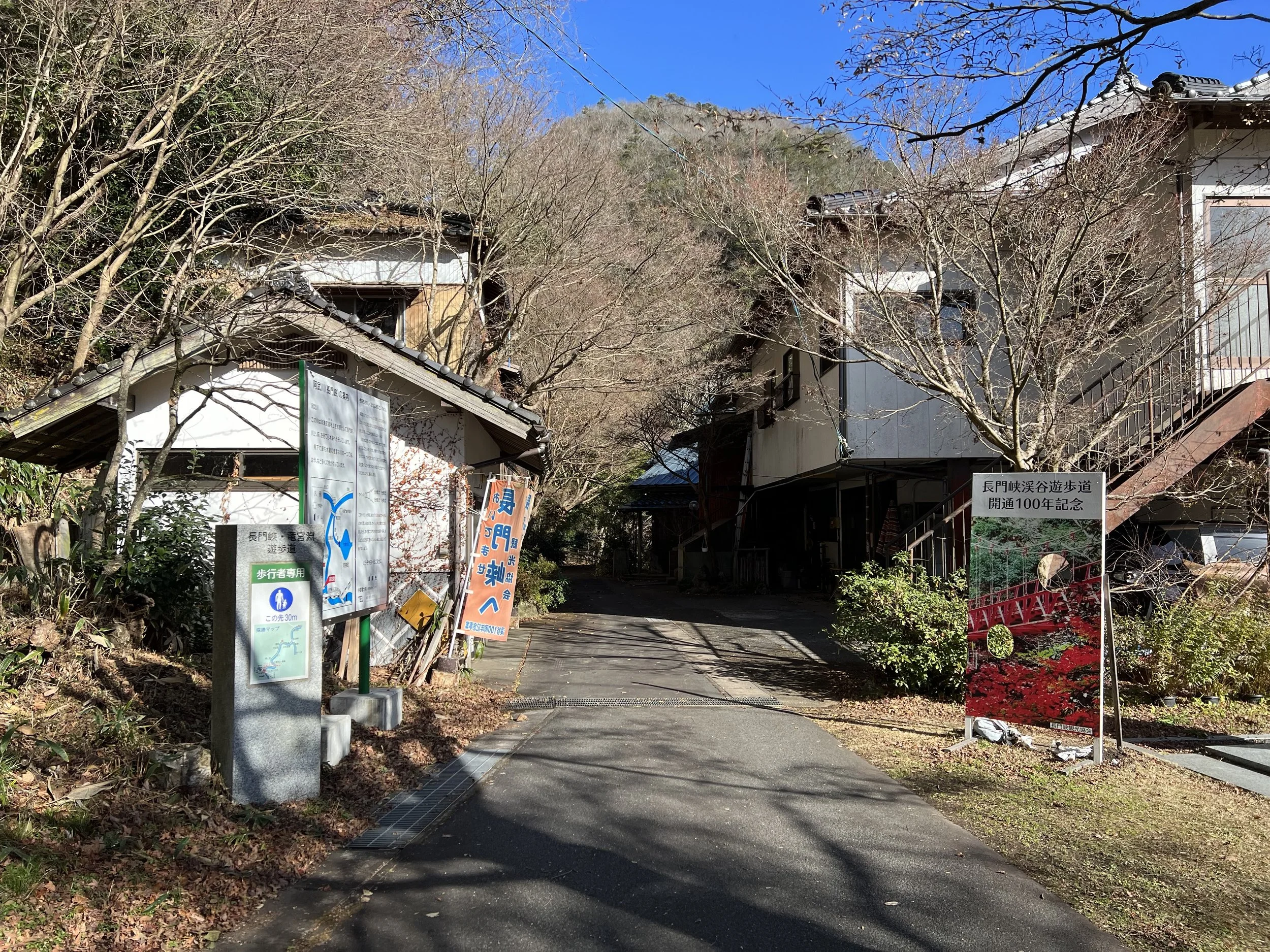
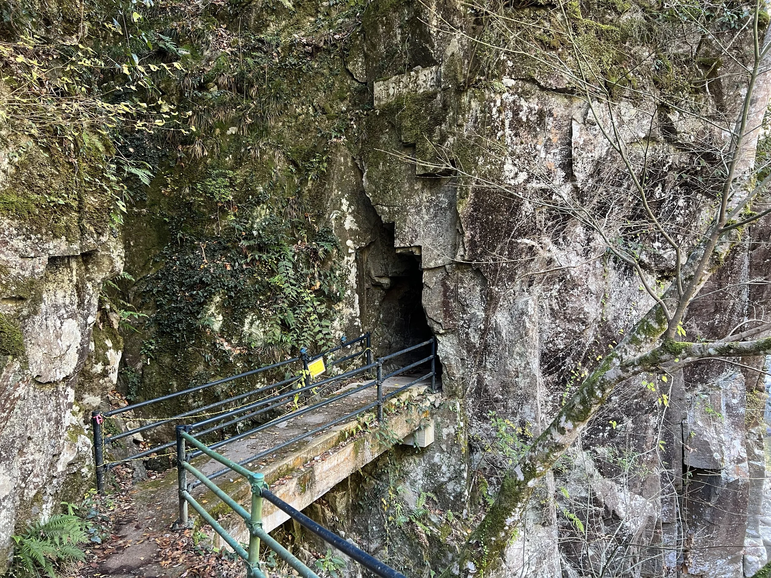
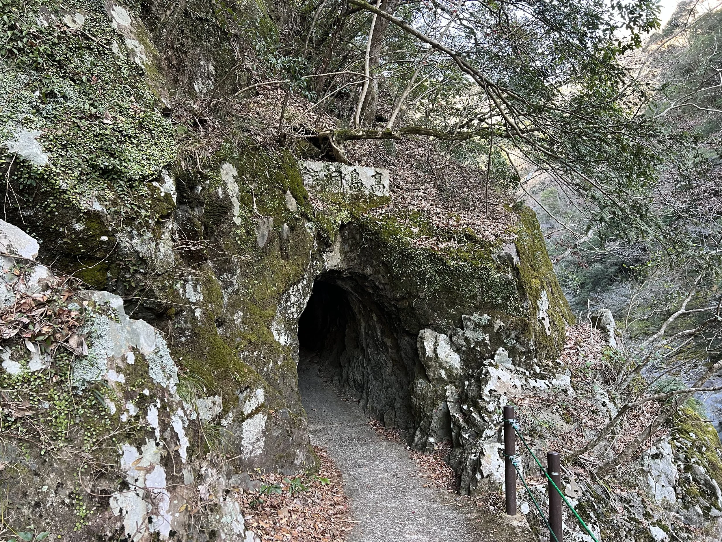
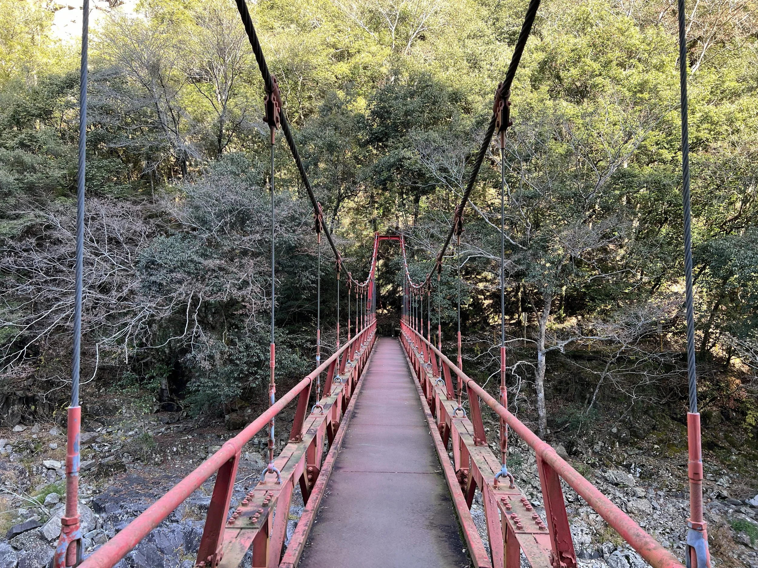
Continuing onward, I passed a small cave running alongside the trail and crossed a modest suspension bridge. Near the far end of the trail, there was a small waterfall, though the low winter runoff made it easy to miss. Shortly after, I reached the second teahouse and the end of the maintained path. This area appeared to be the more popular access point for drivers, as the parking lot here was significantly larger. I took a break to take in the river and used the washroom facilities before turning back.
The return hike felt both familiar and slightly different, with changing light and fewer photo stops making the walk feel noticeably quicker. As I walked, I tried to check transit options, only to realize there was no mobile signal in the gorge. Based on the train timetable photo I had taken earlier, the next train was still hours away. Once back at the trailhead, I walked to the nearby roadside rest area, where I was able to look up transit options properly. I had the choice of waiting two hours for a train or taking a bus with a one-hour wait and a transfer. I opted for the bus and, with time to spare, relaxed at the roadside station restaurant.
Public transportation to Chomonkyo is limited and requires some planning, but the peaceful atmosphere and natural beauty of the gorge made the effort well worth it.
Background
Chomonkyo Gorge (長門峡) is a natural ravine carved by the Abu River over millions of years, cutting through layers of volcanic rock in northern Yamaguchi Prefecture. The gorge stretches for approximately 5 kilometres and is characterized by its steep cliffs, unusual rock formations, and clear river water flowing between narrow passages. The name Chomonkyo, which roughly translates to “Long Gate Gorge,” reflects the way the cliffs rise and close in around the river, creating a series of natural corridors.
The area has long been appreciated for its scenic value, but it gained wider recognition in the early 20th century when it was designated a Place of Scenic Beauty by the Japanese government. Its geological features are closely tied to volcanic activity from Mount Aono and surrounding highlands, which shaped the layered rock formations visible along the gorge today.
Chomonkyo is also deeply connected to Yamaguchi’s seasonal landscape. During autumn, the gorge becomes one of the region’s most popular spots for fall foliage, with maple trees lining the riverbanks and trails. In spring and summer, the area is known for its lush greenery and cool river air, making it a popular retreat from the heat.
Today, Chomonkyo lies within the boundaries of Akiyoshidai Quasi-National Park and is protected for both its natural and cultural value. Well-maintained walking trails allow visitors to explore the gorge at river level, offering an accessible way to experience one of western Japan’s most impressive natural formations while preserving the landscape for future generations.
Getting There
Chomonkyo is accessed via JR Chomonkyo Station on the JR Yamaguchi Line. From Shin-Yamaguchi Station, travel to Yamaguchi Station, then transfer to a local train bound for Tsuwano or Masuda, noting that not all services stop at Chomonkyo Station. From the station, the trailhead is a short walk away. Bus connections are also available via nearby roadside stations, though service is infrequent.
Route Overview
Distance: 11.84 km out & back (Chomonkyo Station)
Total elevation gain: 227 m
Duration: 2 hr 35 min (with breaks 2 hr 42 min)
Difficulty: Intermediate
Cost Breakdown
Train: Shin-Yamaguchi Station → Yamaguchi Station — ¥240
Train: Yamaguchi Station → Chomonkyo Station — ¥330
Food: ¥1,000