Yakushidani Ravine - Ehime, Japan
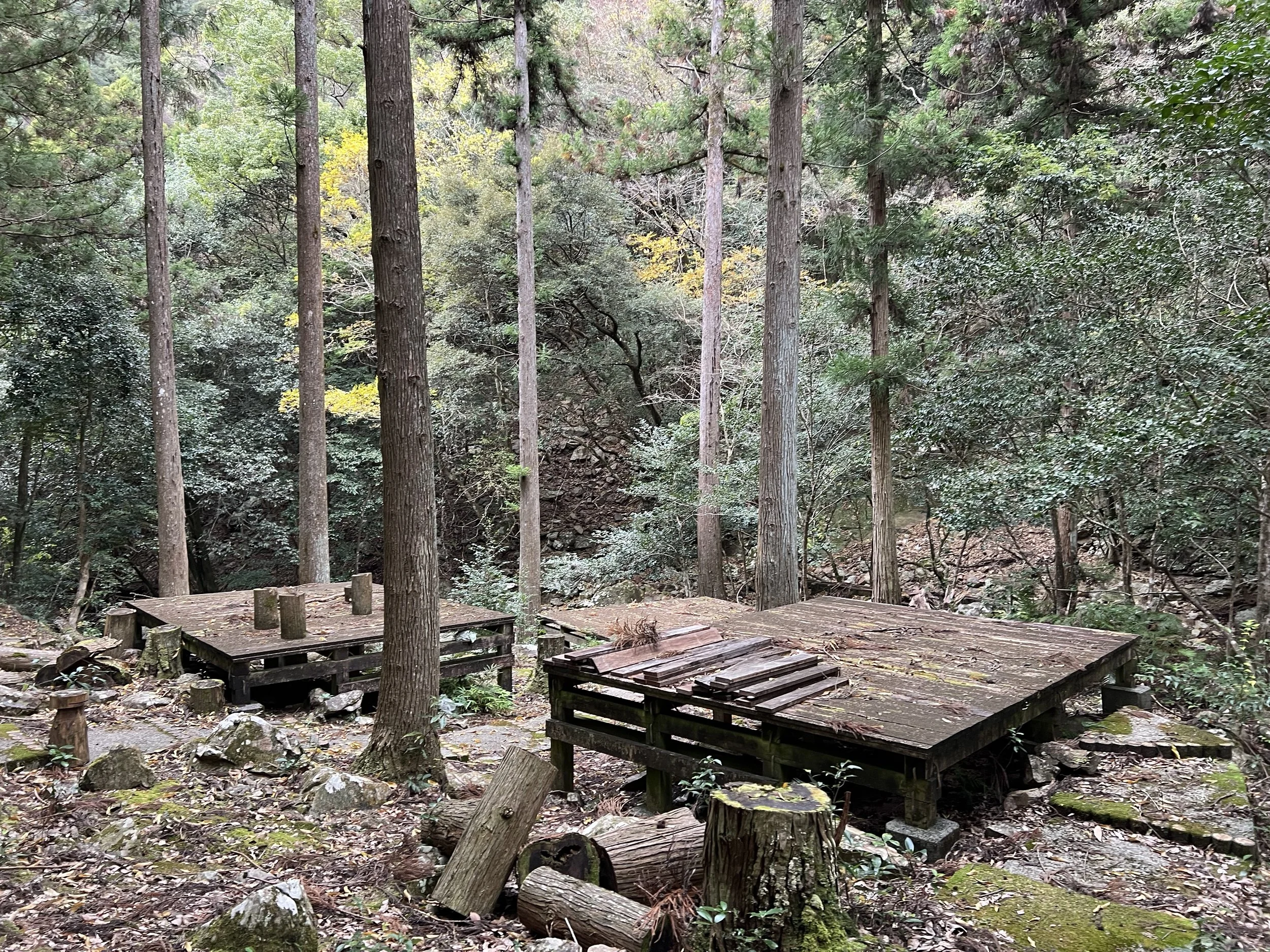
I discovered Yakushidani Ravine while searching for hiking spots near Uwajima. From the little information I found, it seemed popular in summer for its campsites, BBQ areas, and clear river. Since buses were infrequent, I took one to a stop about 3.5 km away and walked the rest of the way.
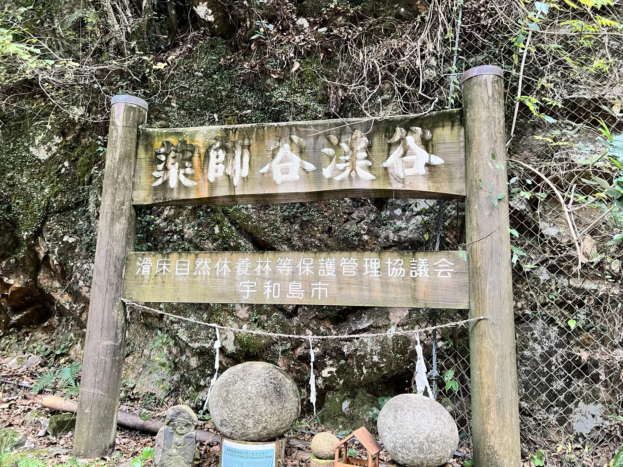
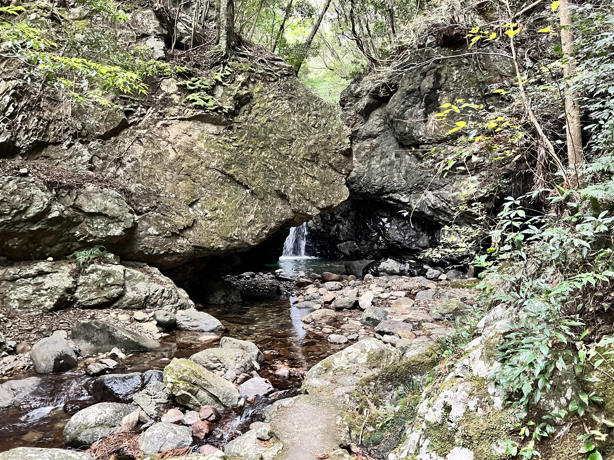
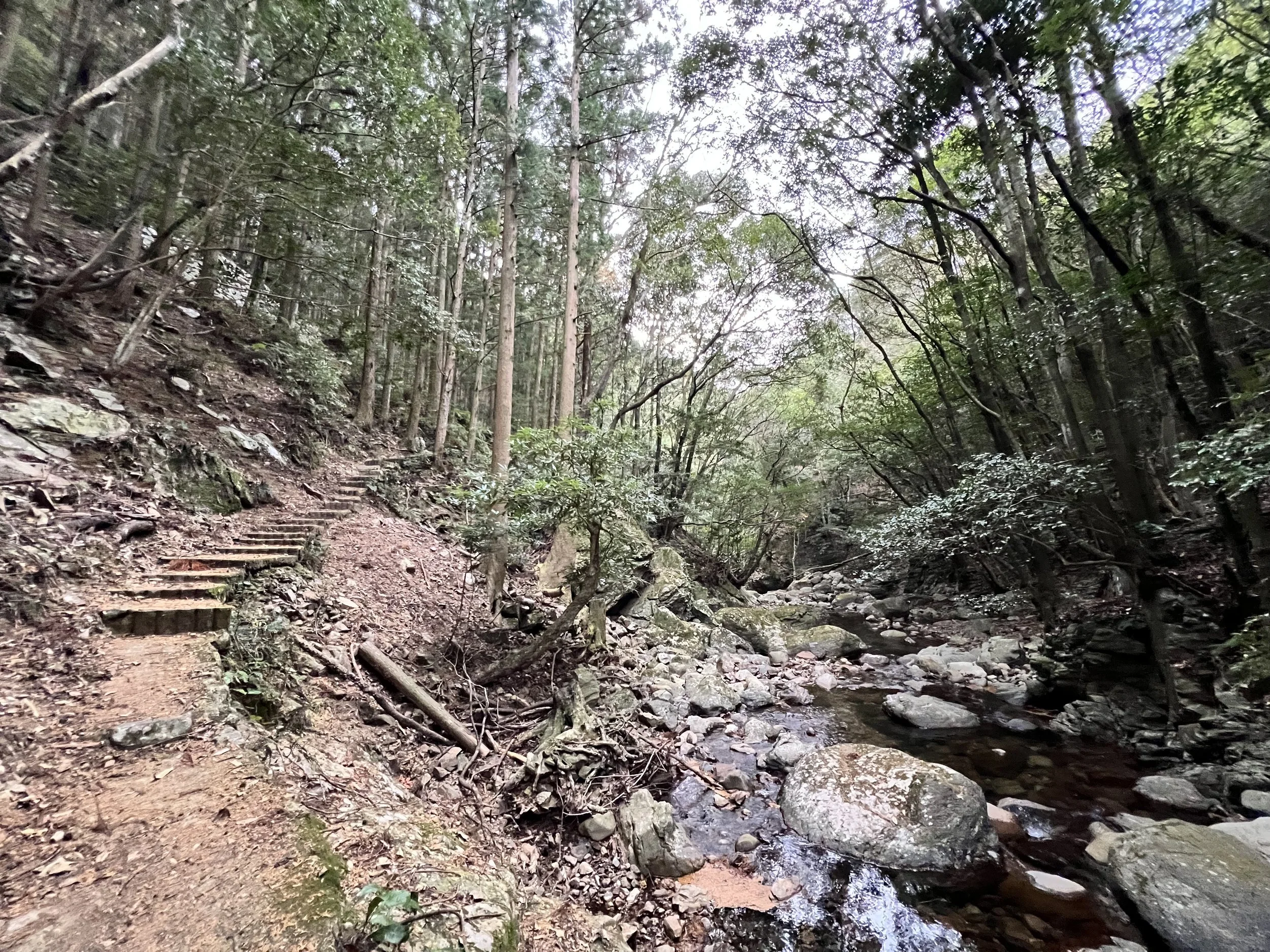
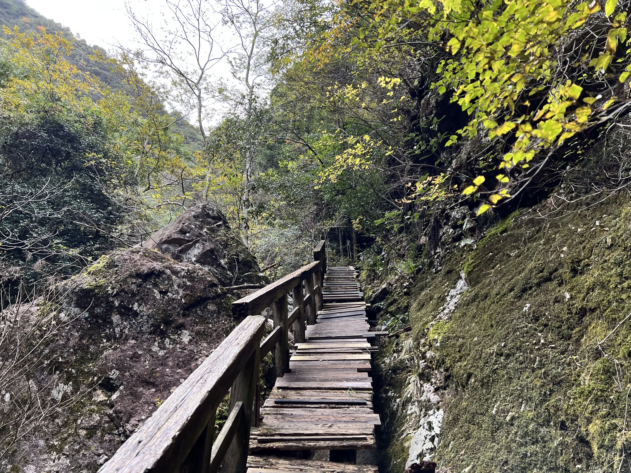
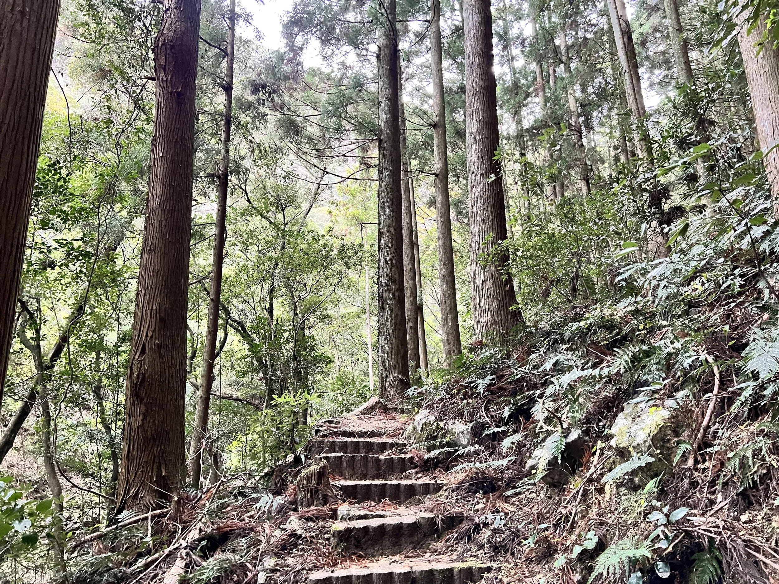
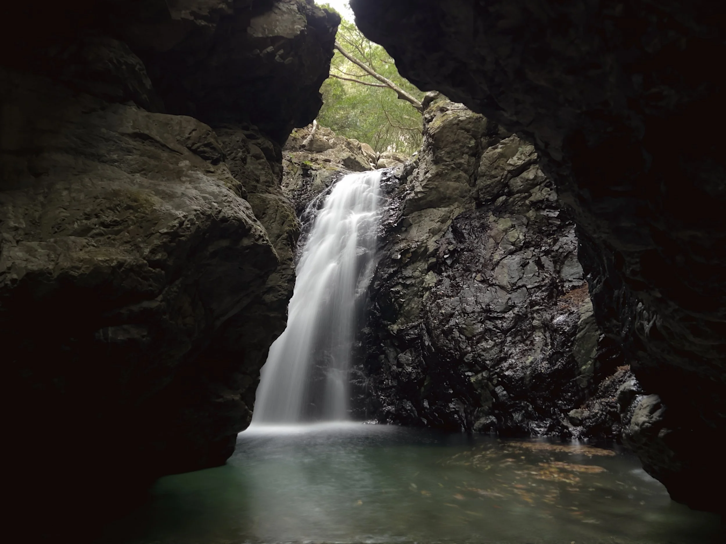
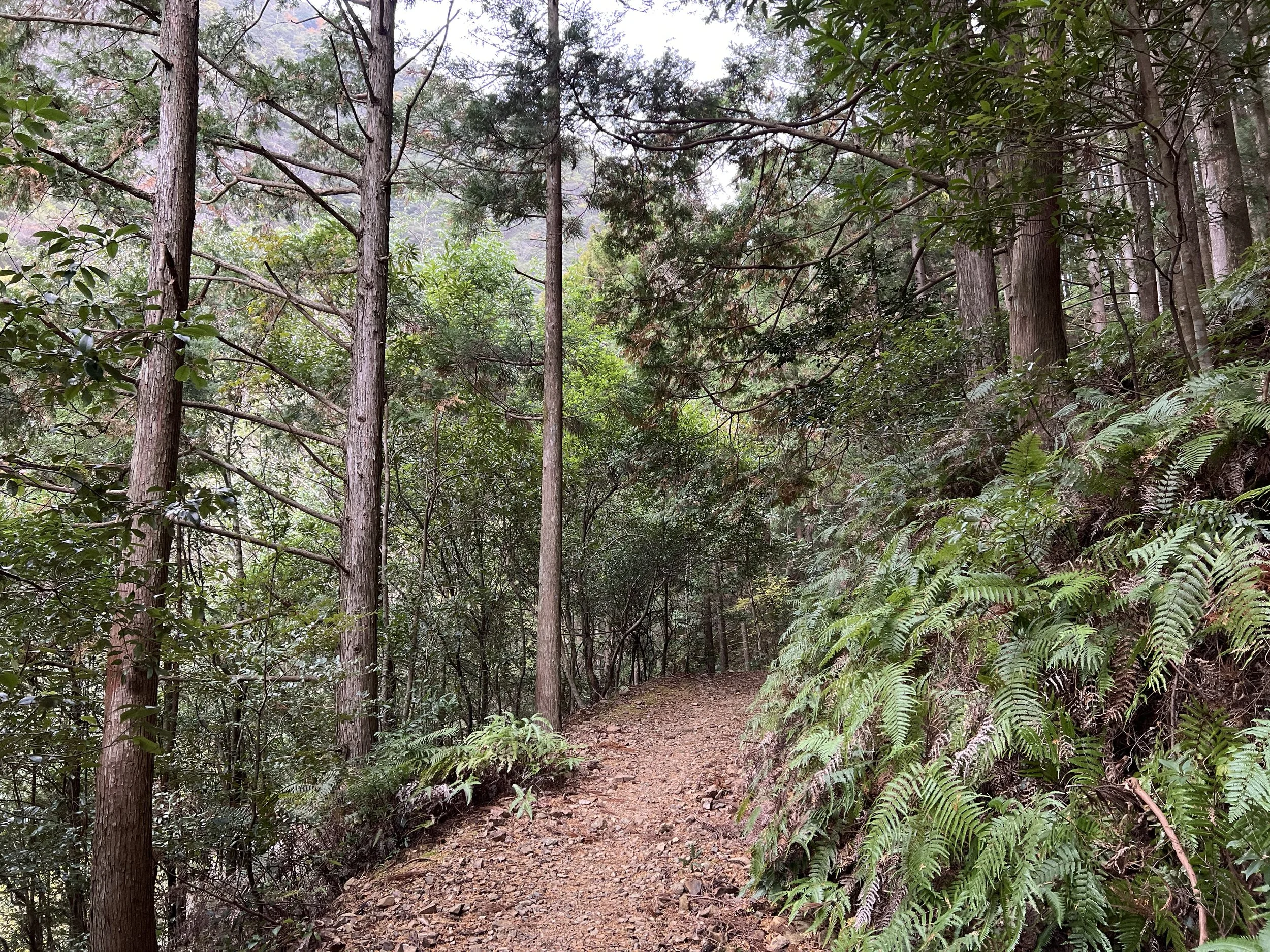
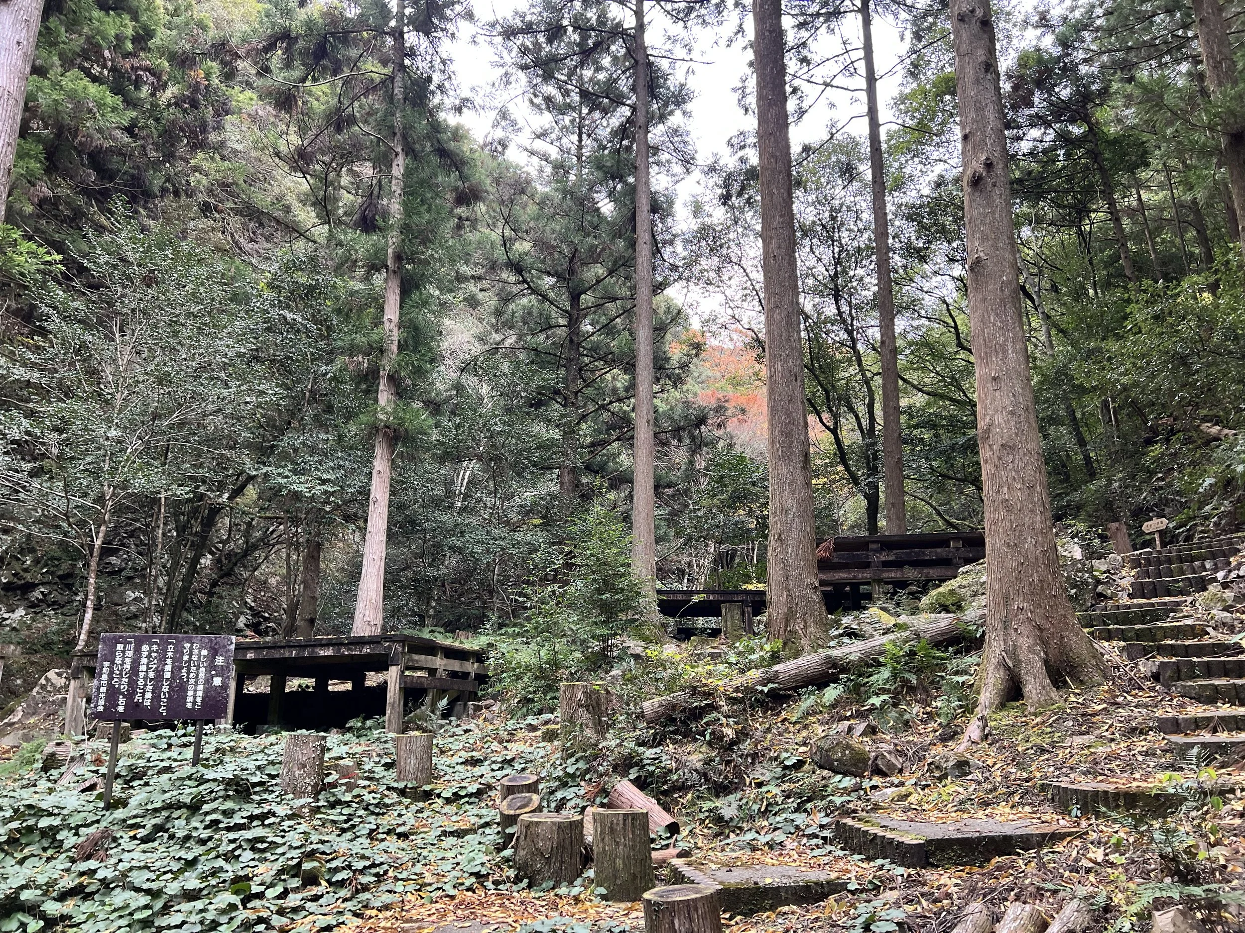
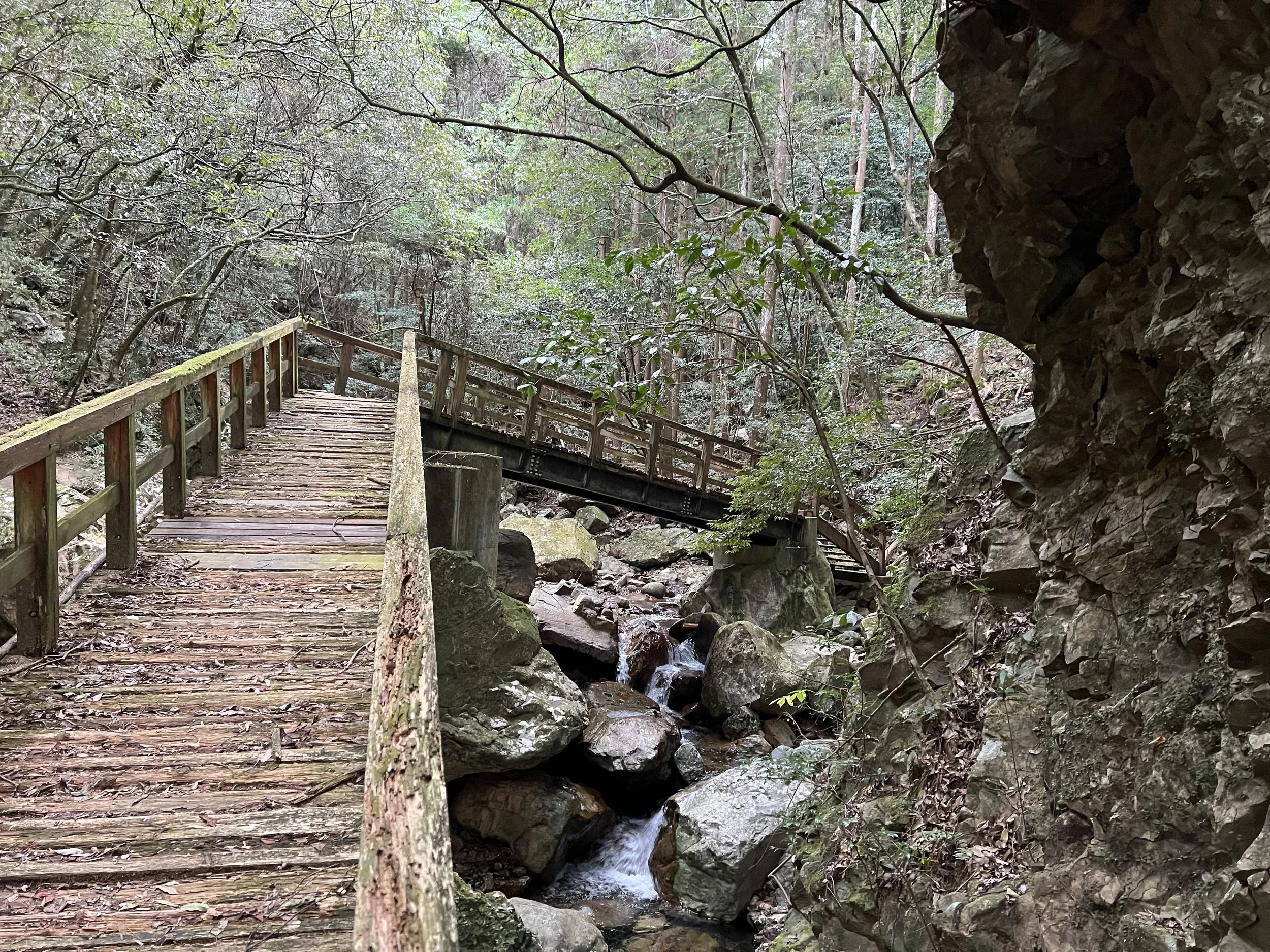
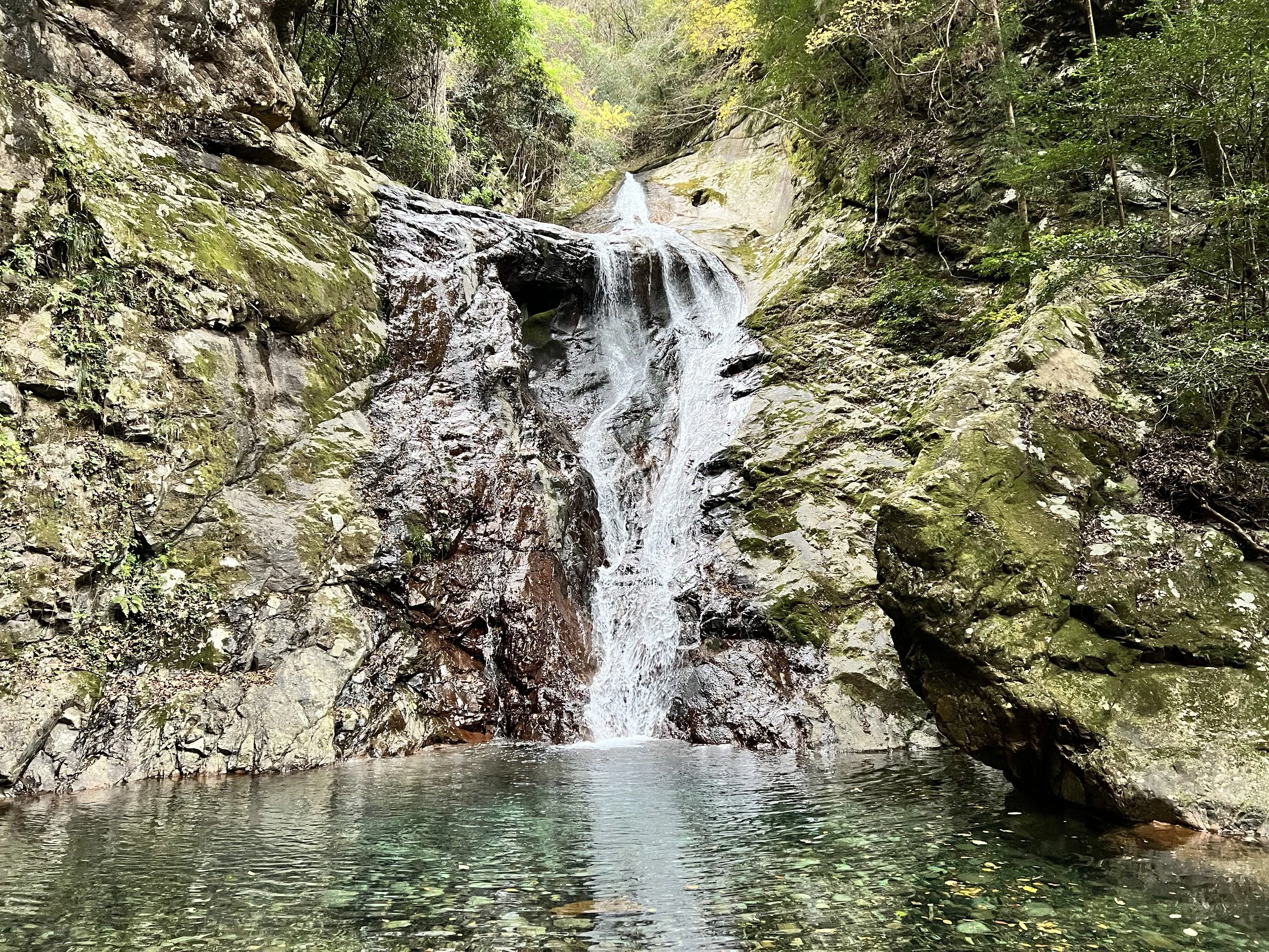
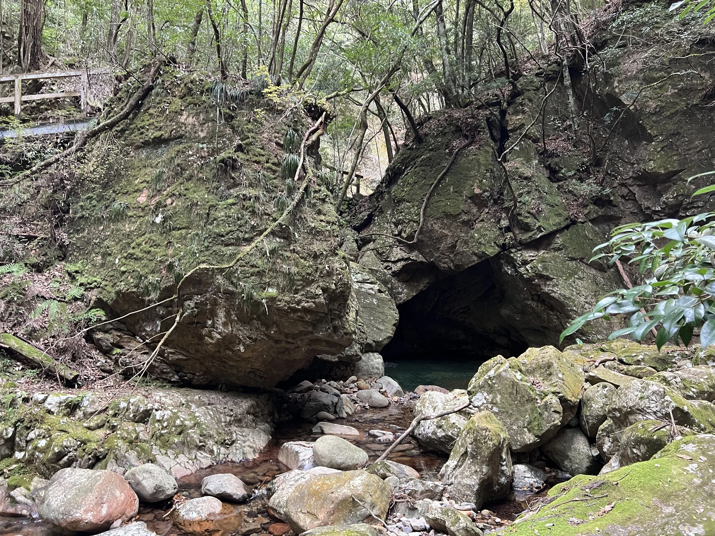
At the trailhead, a sign warned that the trail was in rough condition due to past mudslides, so I decided to see how far I could go. The first section wasn’t too bad—just muddy in places, with moss-covered rocks that made footing slippery. As I continued, I noticed the wooden bridges, stairs, and campsites were in poor shape, some even beginning to rot. I moved carefully and managed to reach two waterfalls before the path became too unstable with rocks, debris, and more mud. At that point, I decided to turn back.
The trail isn’t well-maintained now, but it’s a beautiful area, and I hope it’s restored someday. There’s a quiet charm here, with the sound of waterfalls echoing through the ravine and the scent of damp forest air all around.
History & Background
Yakushidani Ravine (薬師谷渓谷) lies in the mountains north of Uwajima, Ehime Prefecture. Known for its clear streams, mossy rocks, and lush forests, it was once a popular local getaway for camping and summer recreation. The name “Yakushidani” comes from Yakushi Nyorai, the Buddha of healing, and the area was historically visited for its believed spiritual and natural restorative powers.
Getting There
From Uwajima Station, it’s about a 30-minute bus ride to the nearest stop. Buses aren’t frequent, so you may need to walk part of the way to the trailhead.
Route Overview
Distance: 11.13 km out & back (Ideguchi Bus Stop)
Total elevation gain: 277 m
Duration: 2 hr 41 min (with breaks 3 hr 10 min)
Difficulty: Easy
Cost Breakdown
Bus: Uwajima Station → Ideguchi Bus Stop — ¥340