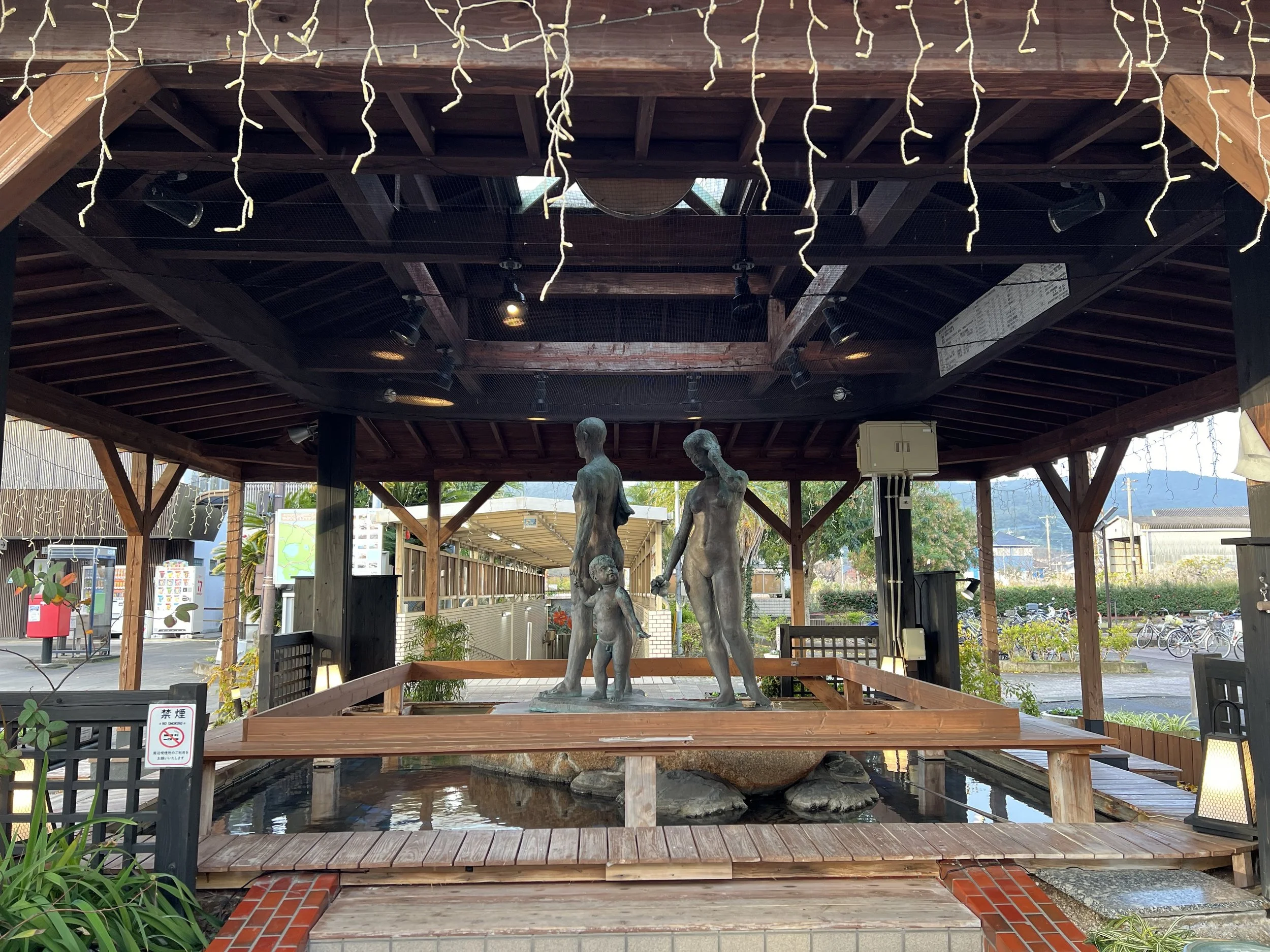
Ibusuki and Southern Coastline – Kagoshima, Japan
My original plan for the day had been to drive the rental car onto the ferry and cross over to Cape Sata. However, strong winds rolled in overnight and the ferry was cancelled. With the car already booked, I decided to pivot and make the most of the day with a revised coastal road trip around southern Kagoshima.
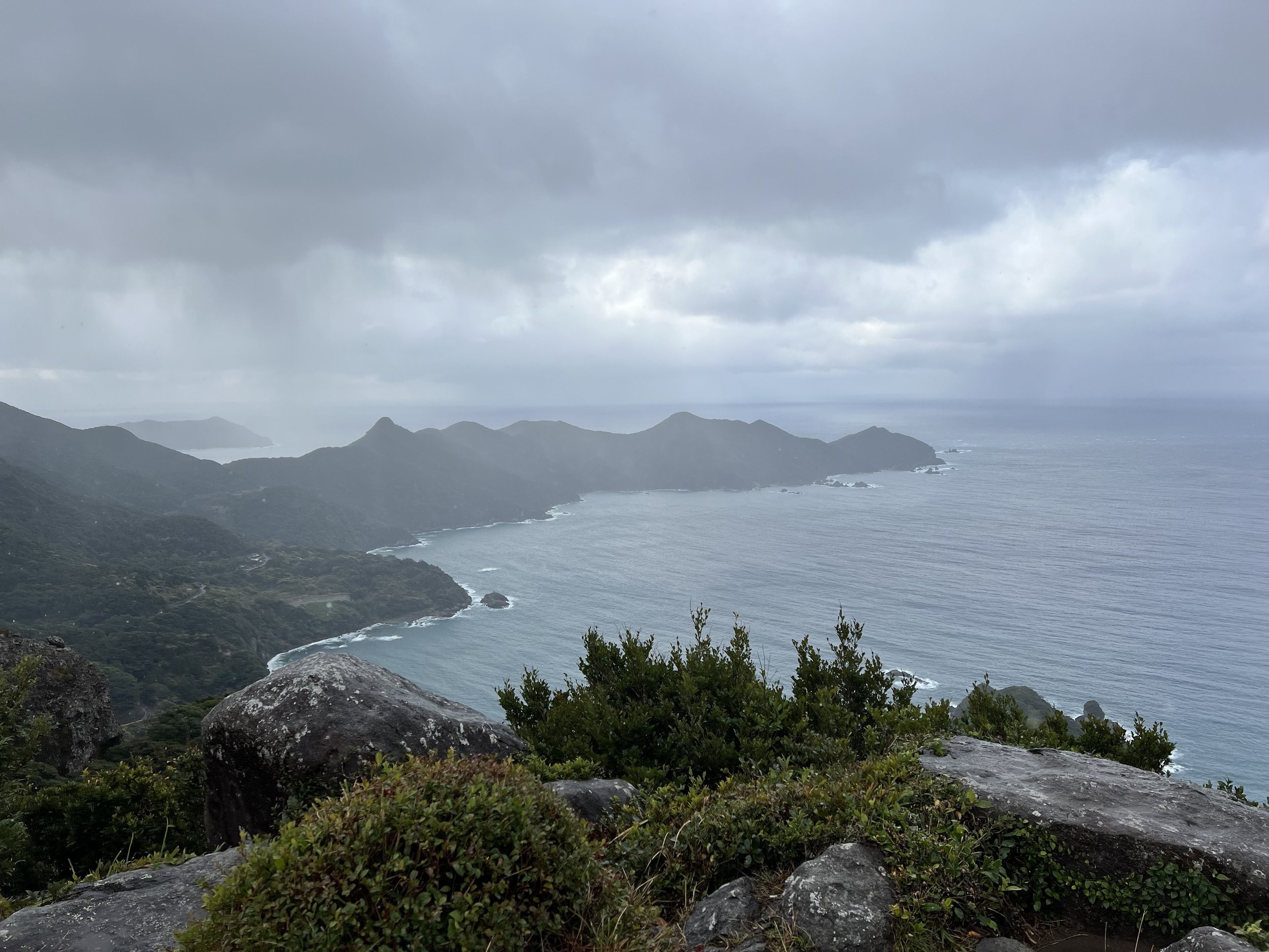
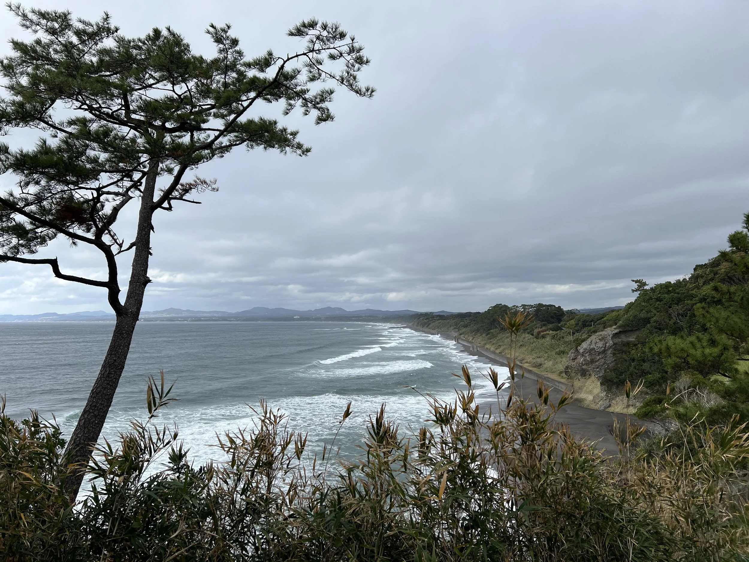
From Ibusuki, I headed west towards Kamegaoka Hill in Minamisatsuma. There are two observatories here, both offering sweeping views over the East China Sea and located only a short drive from one another. The weather was temperamental — a brief spell of hail greeted me as I climbed into the hills — but it passed quickly. I made the short hike up to the first observatory, and even under brooding skies, the panorama was stunning. The ocean stretched endlessly into the horizon, waves breaking against the rugged coastline below.
I then drove to the second viewpoint. The road became narrow and a little rough in places, barely wide enough for one car, and although it appeared to continue further up, the lack of clear signage made me cautious. I decided not to push my luck. From what I’ve read, these observatories are considered among the best sunset spots in Kyushu, and on a clear day, the view must be extraordinary. Even with the moody weather, the dramatic coastline made the detour worthwhile.
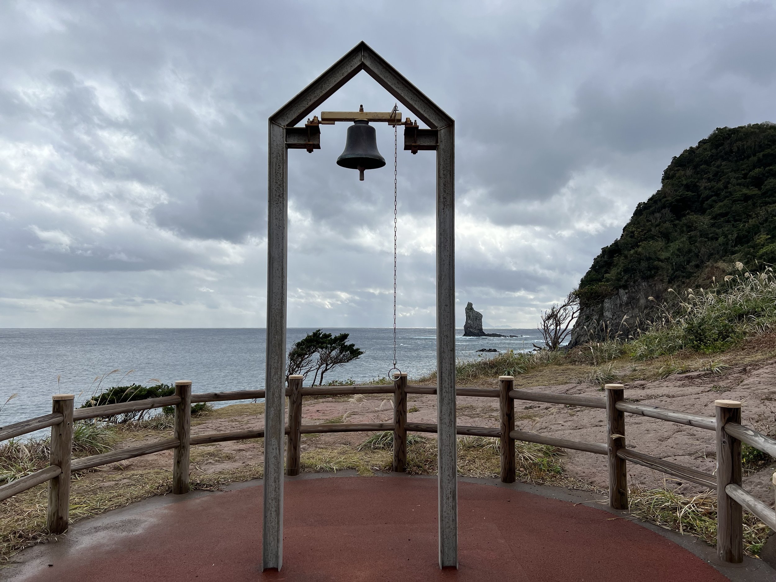
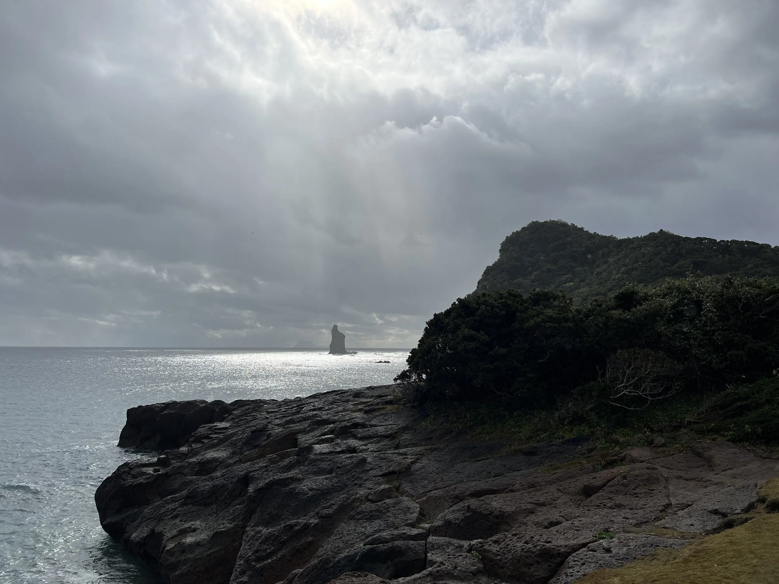
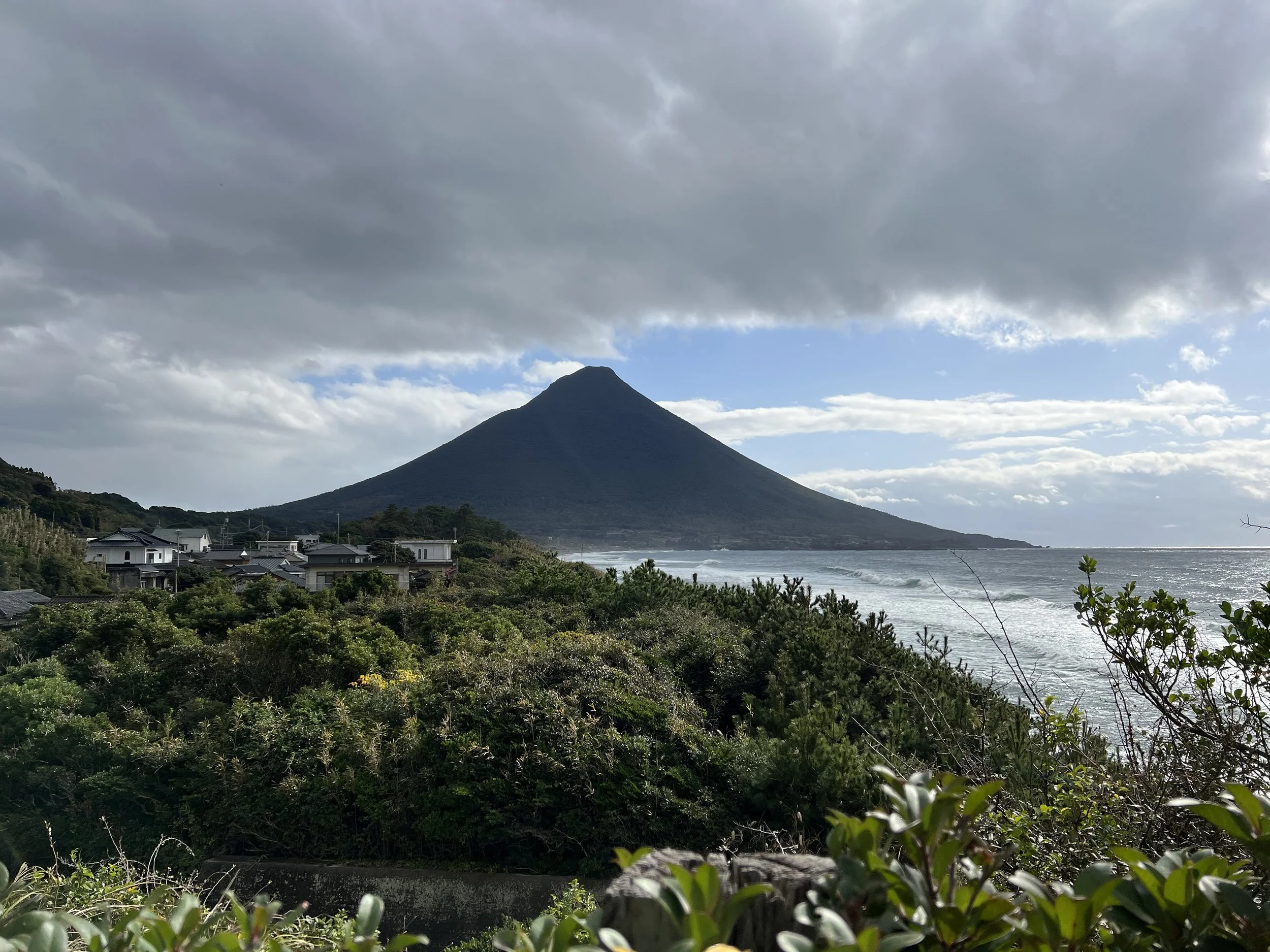
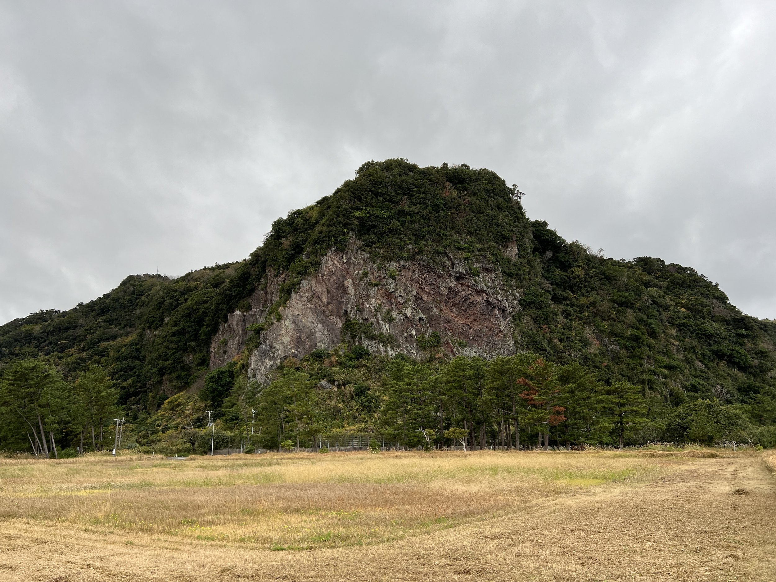
After reaching the furthest point on my adjusted itinerary, I began making my way back towards Ibusuki, stopping at Hinokami Park in Makurazaki. Just offshore stands Tategami Rock, a 42-metre-high needle-shaped sea stack that has been referenced in classical Japanese literature. From the park, you can also see Kaimondake — often called the “Satsuma Fuji” for its near-perfect cone shape — rising in the distance.
Despite the grey skies and light rain, two groups were camping in the park, barbecuing and enjoying the rugged coastal atmosphere. I followed the park trail along the cliffs until I reached the coastline viewpoint. At just the right moment, the clouds parted above Tategami Rock, allowing a shaft of light to illuminate it. For a brief instant, it looked almost ethereal — a dramatic, solitary pillar rising from the sea.
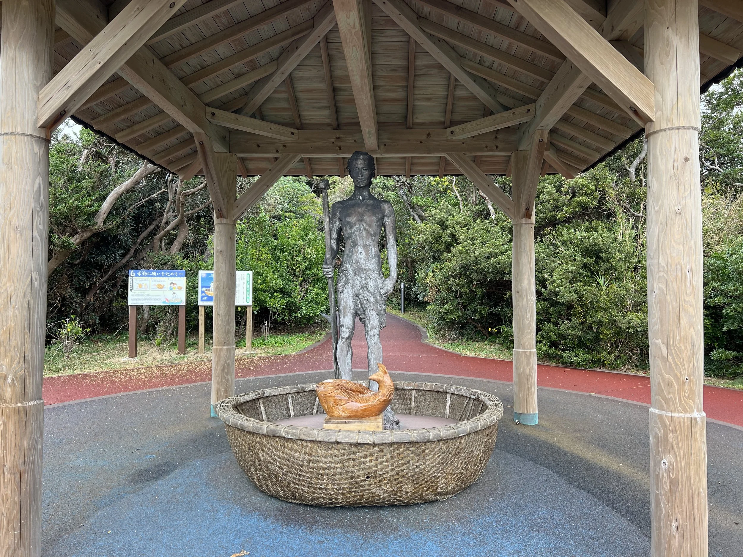
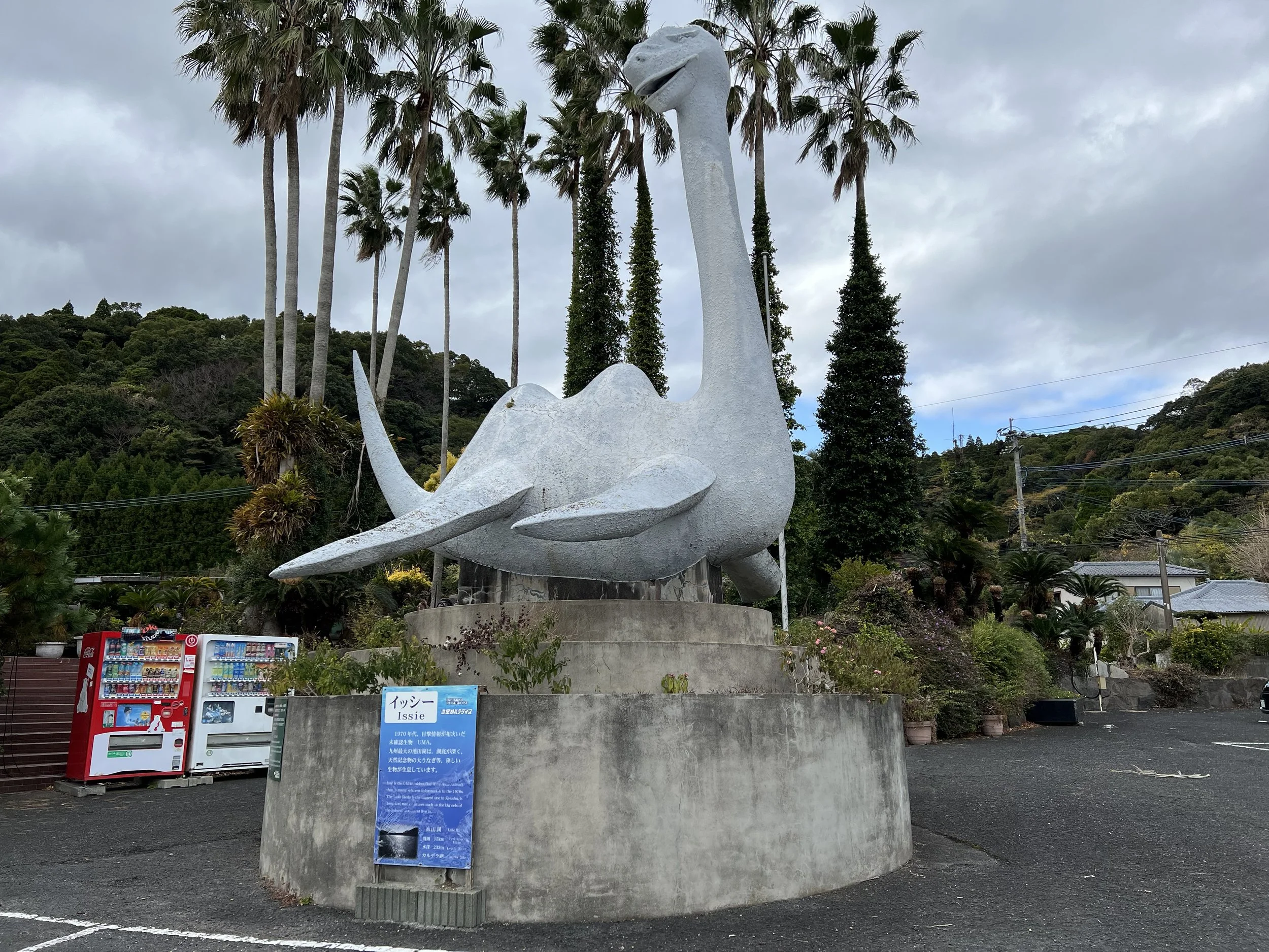
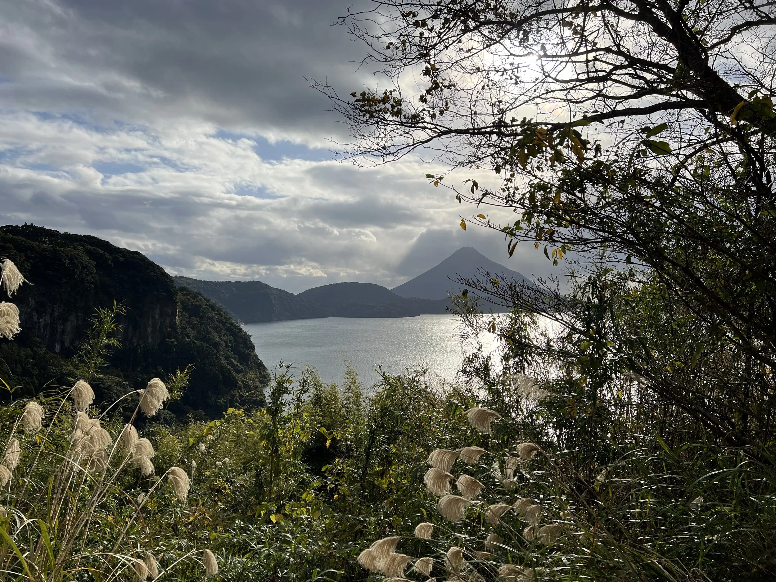
From there, I continued on to Lake Ikeda. The lake is famous for its mythical creature, Issie — Kagoshima’s answer to Scotland’s Loch Ness Monster. According to legend, a grieving white horse leapt into the lake after her foal was stolen and transformed into a monster to continue searching for her child. The last major sighting was reported in September 1978, when more than 30 people claimed to see a large creature in the water. A few months later, a photograph taken by Toshiaki Matsuhara showed a mysterious dark shape beneath the surface.
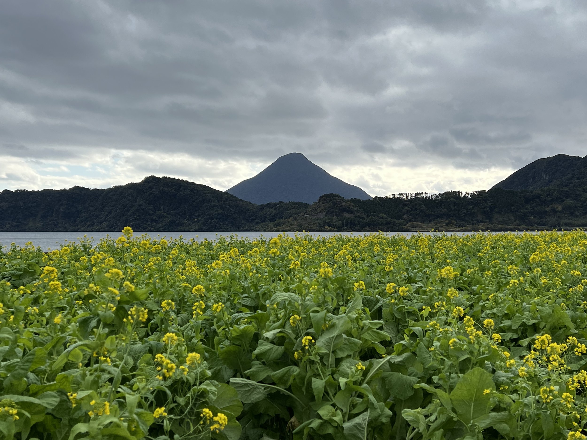
At the lakeside parking area stands a statue of Issie, which I couldn’t resist photographing before strolling along the shore. Rapeseed flowers were in bloom, carpeting the foreground in bright yellow. With Lake Ikeda shimmering under shifting light and Kaimondake rising in the distance, it created one of the most picturesque scenes of the day.
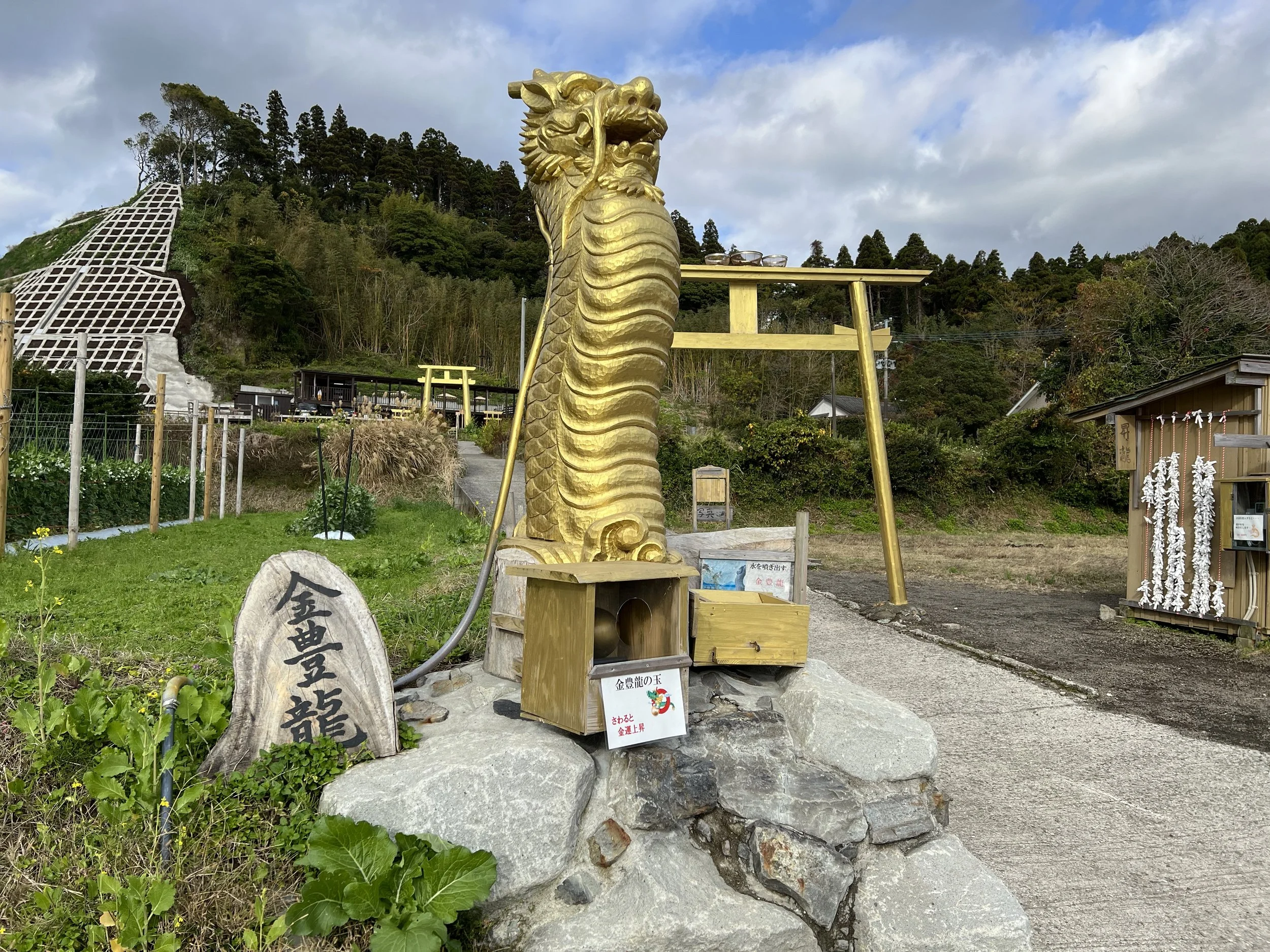
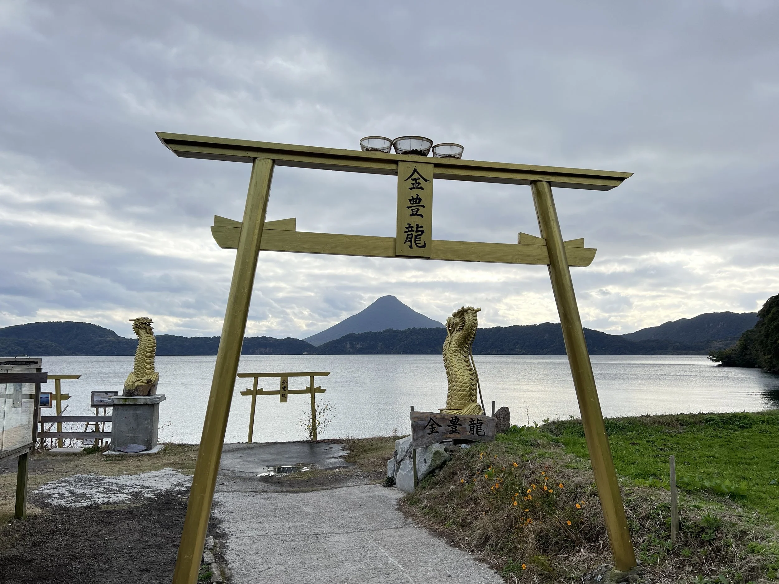
Nearby is the Golden Torii — a striking shrine gate adorned in gold, complete with golden dragons and even a vending machine selling gold-themed souvenirs. What drew me here was the composition: frame the torii just right, and Kaimondake appears perfectly centred in the background. It’s a fun and slightly quirky stop that contrasts nicely with the surrounding natural scenery.
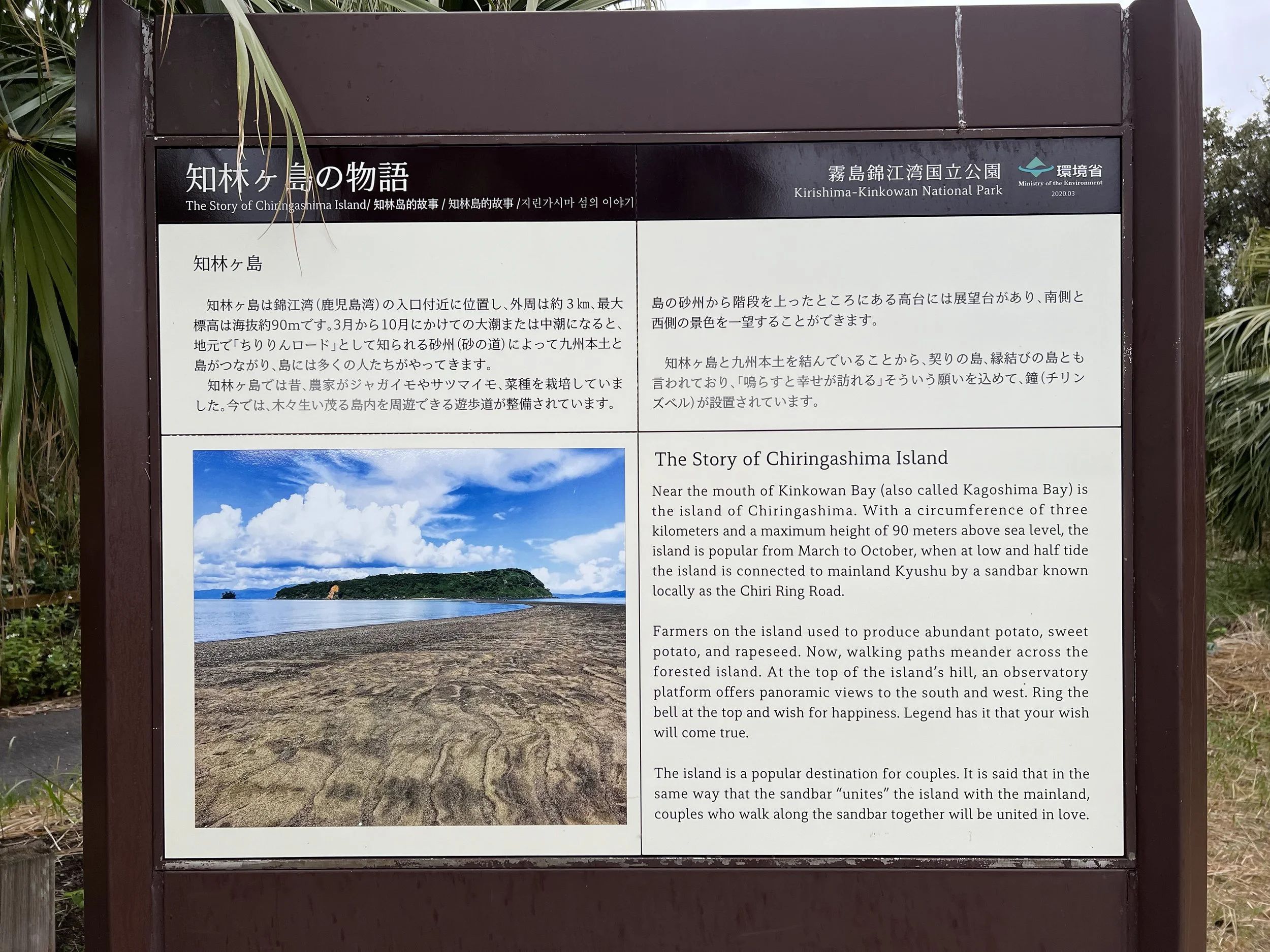
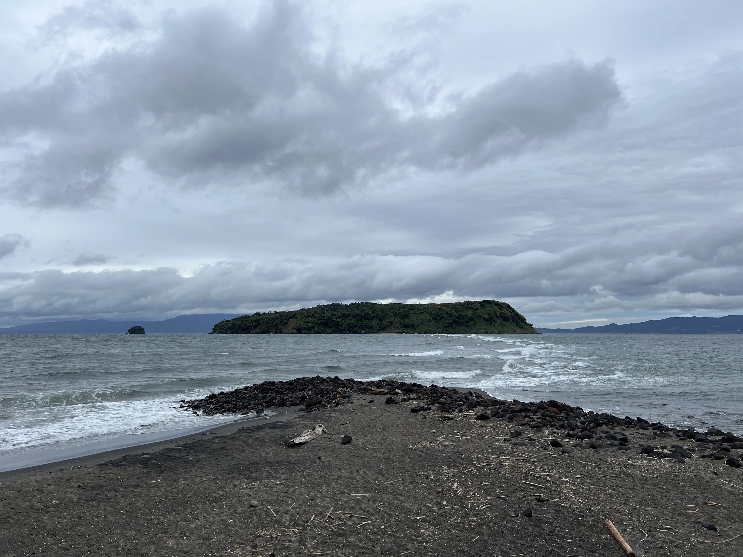
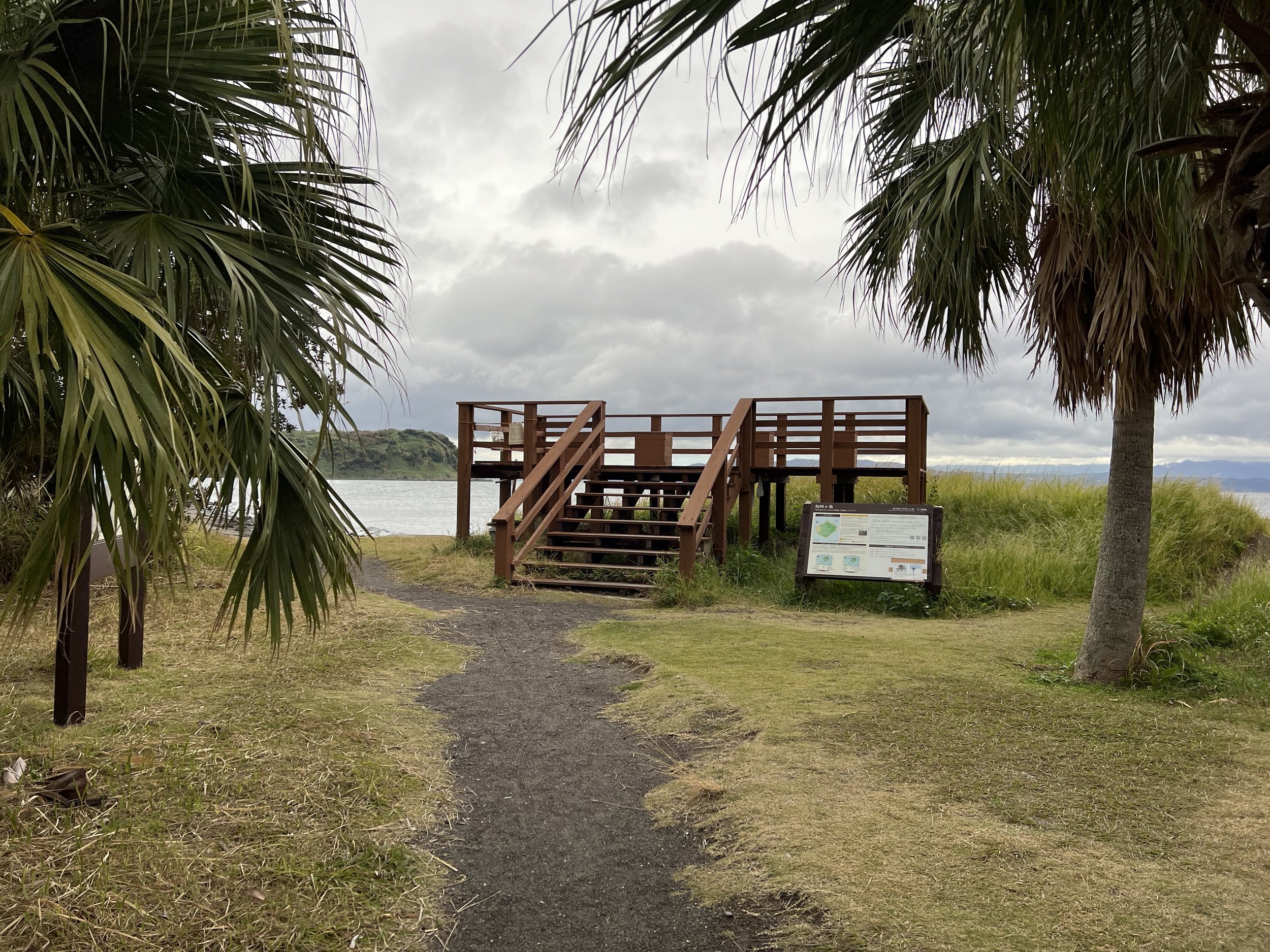
Next, I drove to Tara Beach, known for views of Chiringashima — an uninhabited island in Kinko Bay, roughly three kilometres in circumference and 90 metres high. Known as the “Island of Mystery,” Chiringashima is connected to Kyushu by a sandbar that appears during low tide between March and October. The sandbar stretches about 800 metres and is only visible for one to four hours per day, depending on tidal conditions.
During my visit, it was high tide and not the right season, so the sandbar was mostly submerged. I walked out as far as I could before turning back, imagining what it would be like to cross over to the island. It’s definitely something to plan carefully around tide schedules if you hope to walk across.
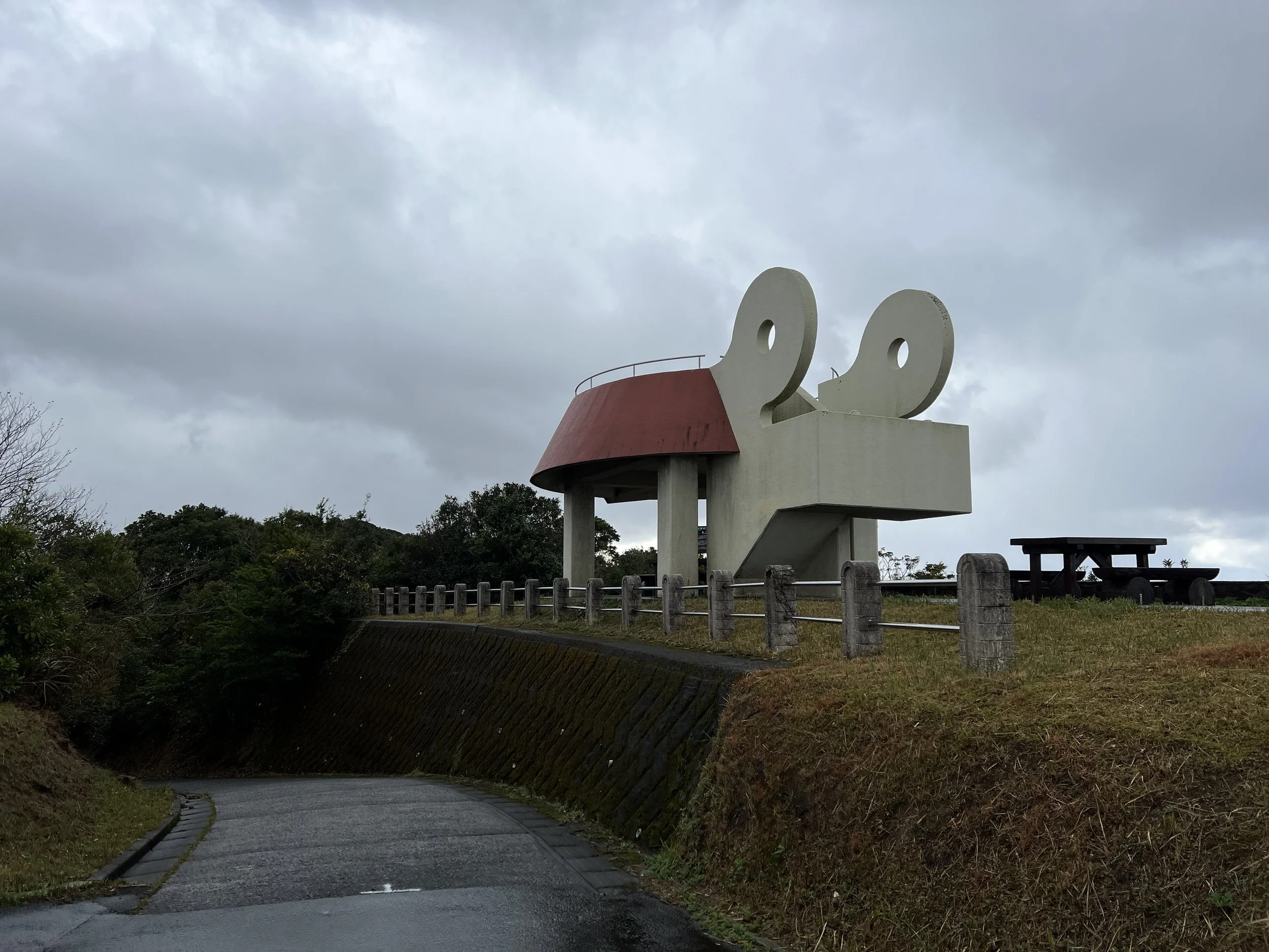
My final stop was Mount Uomidake, which offers an elevated observatory with sweeping views over Ibusuki and Chiringashima. From above, you can clearly see where the sandbar forms. By this point, the clouds were beginning to lift, and patches of blue sky were emerging. I considered staying for sunset — this would undoubtedly be a spectacular spot for it — but I needed to return the rental car before closing.
Although the ferry cancellation altered my plans, the day turned into a scenic exploration of Kagoshima’s coastline, volcanic landscapes, and local legends. Sometimes, the unplanned route reveals just as much magic as the one you originally intended.
History & Background
Kamegaoka Hill (亀ヶ丘) is located in Minamisatsuma City along the Satsuma Peninsula and is best known for its sweeping views over the East China Sea. The name Kamegaoka translates roughly to “Turtle Hill,” a reference to the rounded shape of the terrain. The area forms part of Kagoshima’s rugged coastal geography, shaped by volcanic activity and centuries of erosion. Today, the East China Sea Observatory and the Hoshi-Furu-Oka (Starfall Hill) Observatory are popular scenic lookouts, particularly at sunset. On clear days, the horizon seems endless, and the location has gained recognition as one of Kyushu’s notable sunset viewpoints.
Hinokami Park (火之神公園) sits along the dramatic coastline of Makurazaki, facing the East China Sea. Offshore stands Tategami Rock (立神岩), a 42-metre-high sea stack formed by volcanic rock and shaped by wave erosion. The name Tategami means “standing mane,” referencing its resemblance to a horse’s mane rising from the sea. The rock appears in classical Japanese literature and local folklore, contributing to its cultural significance. The park itself is also a well-known coastal campground, offering views of both Tategami Rock and Kaimondake volcano — a combination that makes it one of southern Kagoshima’s most photogenic seaside spots.
Lake Ikeda (池田湖) is the largest lake in Kyushu, formed within a volcanic caldera approximately 6,400 years ago. It reaches depths of about 233 metres, making it one of Japan’s deepest lakes. The lake is famous for the legend of Issie, a mythical creature said to inhabit its waters — often compared to Scotland’s Loch Ness Monster.
The most widely shared legend tells of a grieving white mare who leapt into the lake after losing her foal and transformed into a monster. Reports of sightings peaked in 1978, when dozens of people claimed to have seen a large creature in the water. Although no scientific evidence has confirmed Issie’s existence, the legend remains a beloved part of local culture and tourism.
The lakeside is also known for early-blooming rapeseed flowers in winter and spring, with Kaimondake volcano rising dramatically in the background — an iconic Kagoshima landscape.
The Golden Torii (黄金の鳥居) near Lake Ikeda is a relatively modern installation that has gained popularity for its striking appearance and unique photo composition with Kaimondake in the distance. Unlike traditional vermillion torii gates seen across Japan, this one is painted gold and adorned with decorative golden dragons. It reflects a blend of Shinto symbolism and contemporary tourism appeal. While small in scale, it has become a recognizable roadside stop for visitors exploring the Ibusuki area.
Tara Beach (田良浜) offers views of Chiringashima (知林ヶ島), an uninhabited island located in Kinko Bay. The island spans roughly three kilometres in circumference and rises about 90 metres at its highest point. Historically referred to as the “Island of Mystery,” Chiringashima is connected to the mainland by a natural sandbar that appears during low tide between March and October.
The sandbar stretches approximately 800 metres and is visible for only one to four hours per day depending on tidal conditions. Because of its fleeting appearance, it has become associated with romance and is sometimes referred to as a “matchmaking” or “lover’s road,” similar to other seasonal sandbar sites in Japan.
Mount Uomidake (魚見岳), meaning “Fish-Viewing Peak,” rises above Ibusuki and provides panoramic views over Kinko Bay, Chiringashima, and the surrounding coastline. Historically, elevated coastal points like Uomidake were used to observe fish movements and maritime activity. Today, it is valued primarily as a scenic lookout.
In spring, the mountain is also known for cherry blossoms, making it a seasonal hanami destination. The observatory platform offers one of the best vantage points in the region to view the sandbar connecting to Chiringashima.
Getting There
Ibusuki is located on the Satsuma Peninsula in southern Kagoshima Prefecture. The nearest major transportation hub is Kagoshima-Chūo Station, which is served by the Kyushu Shinkansen and regional JR lines.
Route Overview
Itinerary: Ibusuki Toyota Car Rental → Kamegaoka Hill East China Sea Observatory 亀ヶ丘東シナ海展望所 → Kamegaoka Hill Hoshi-Furu-Oka Observatory 亀ヶ丘星降る丘展望所→ Hinokami Park 火之神公園 → Lake Ikeda 池田湖 → Golden Torii 黄金の鳥居 → Tara Beach 田良浜 → Mt.Uomidake 魚見岳 → Ibusuki Toyota Car Rental
Distance: 150 km out & back (Ibusuki Toyota Car Rental)
Duration: 5 hr (Sightseeing + breaks)
Difficulty: Easy
Cost Breakdown
Car Rental + Insurance: ¥7,920
Gas: ¥2,014
Entrance Fee: Golden Torii — ¥100
Food: ¥944