Mount Ashiwadayama - Yamanashi, Japan
I wanted to make the most of my time in the Fujikawaguchiko area, so I took the earliest highway bus from Tokyo and arrived about two hours later. After getting off at Kawaguchiko Station, I stopped by the bus counter to pick up my two-day sightseeing bus pass—but the line was long, and I started to worry I might miss my connection. Luckily, one of the staff members went down the line collecting everyone’s details, and I managed to grab my pass just in time. The bus even left a minute late, and I boarded with seconds to spare.
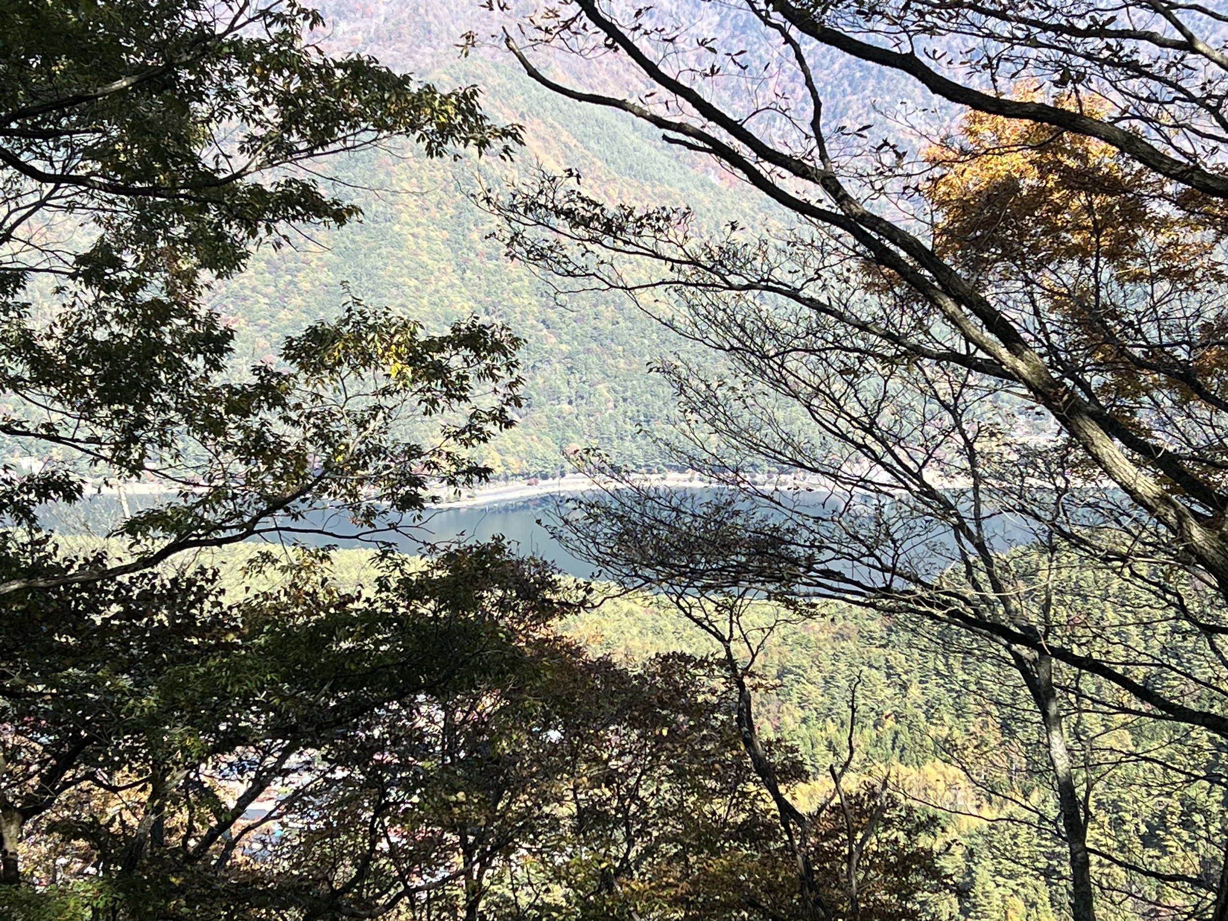
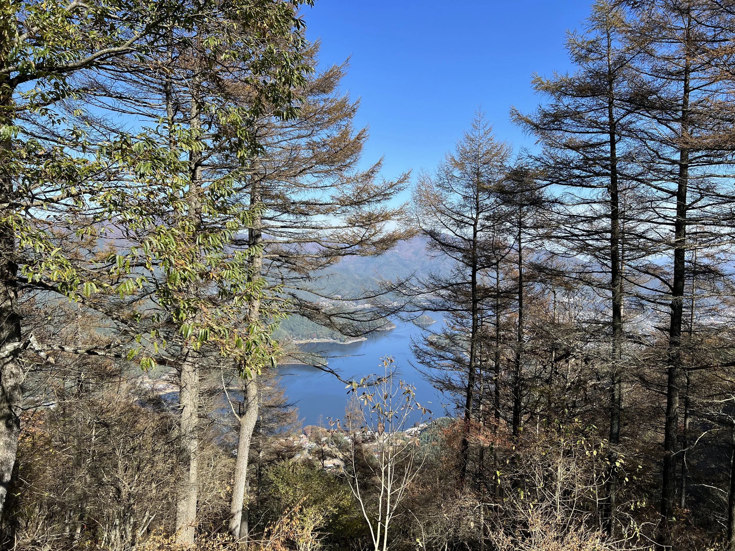
I hadn’t packed much water but figured there would be vending machines or small shops near the Koyodai Observatory, so I rolled with it. I chose this trail for the autumn leaves, the view of Mount Fuji, and the chance to see three lakes along the way—Kawaguchi, Saiko, and Shoji. The bus dropped me off a few minutes from the trailhead, but since there weren’t any clear signs, a few other hikers and I teamed up to find it together.
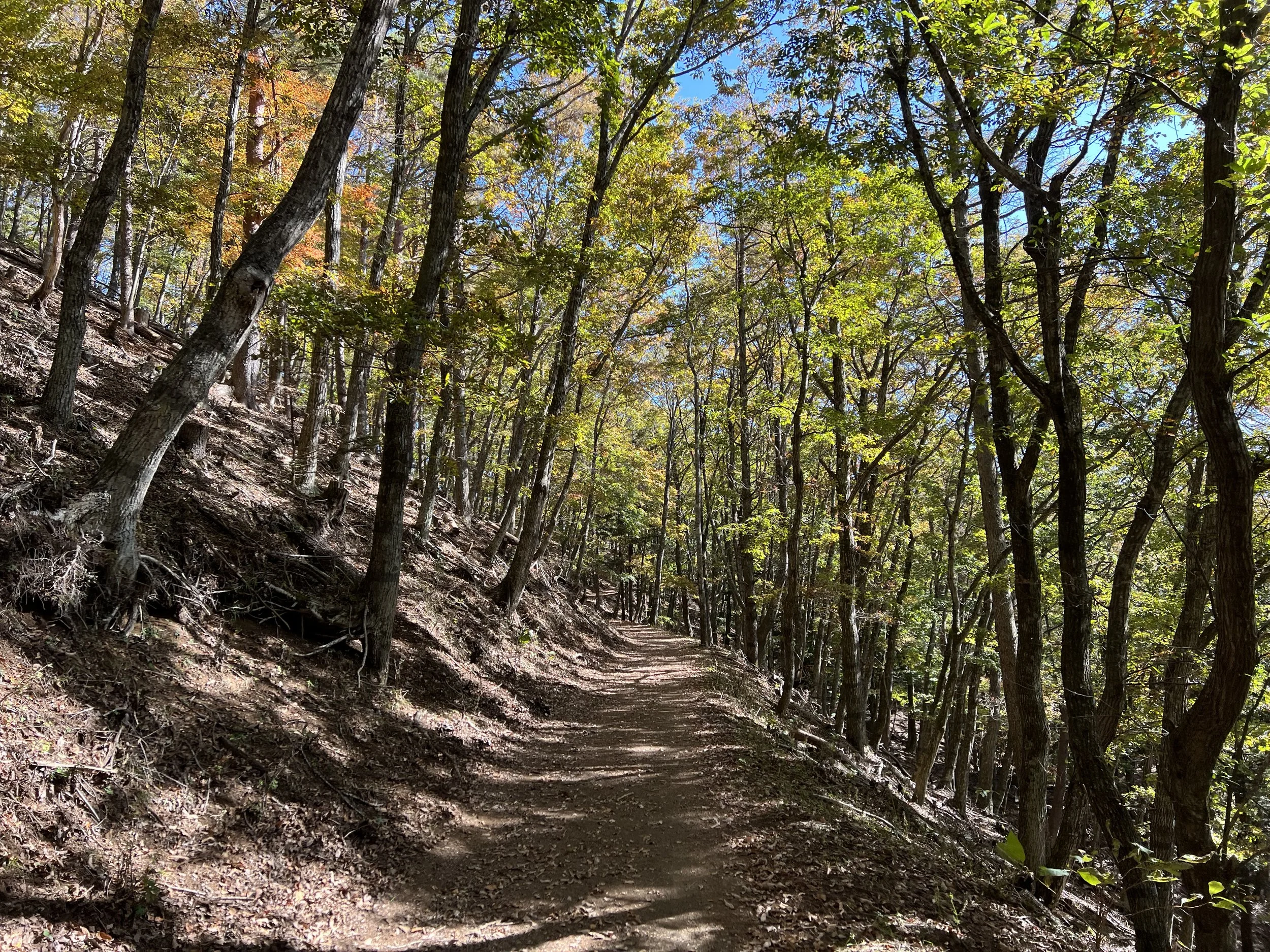
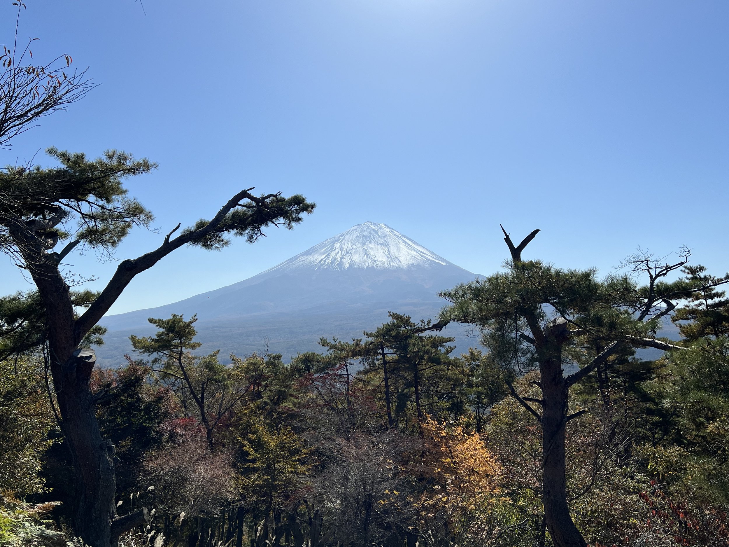
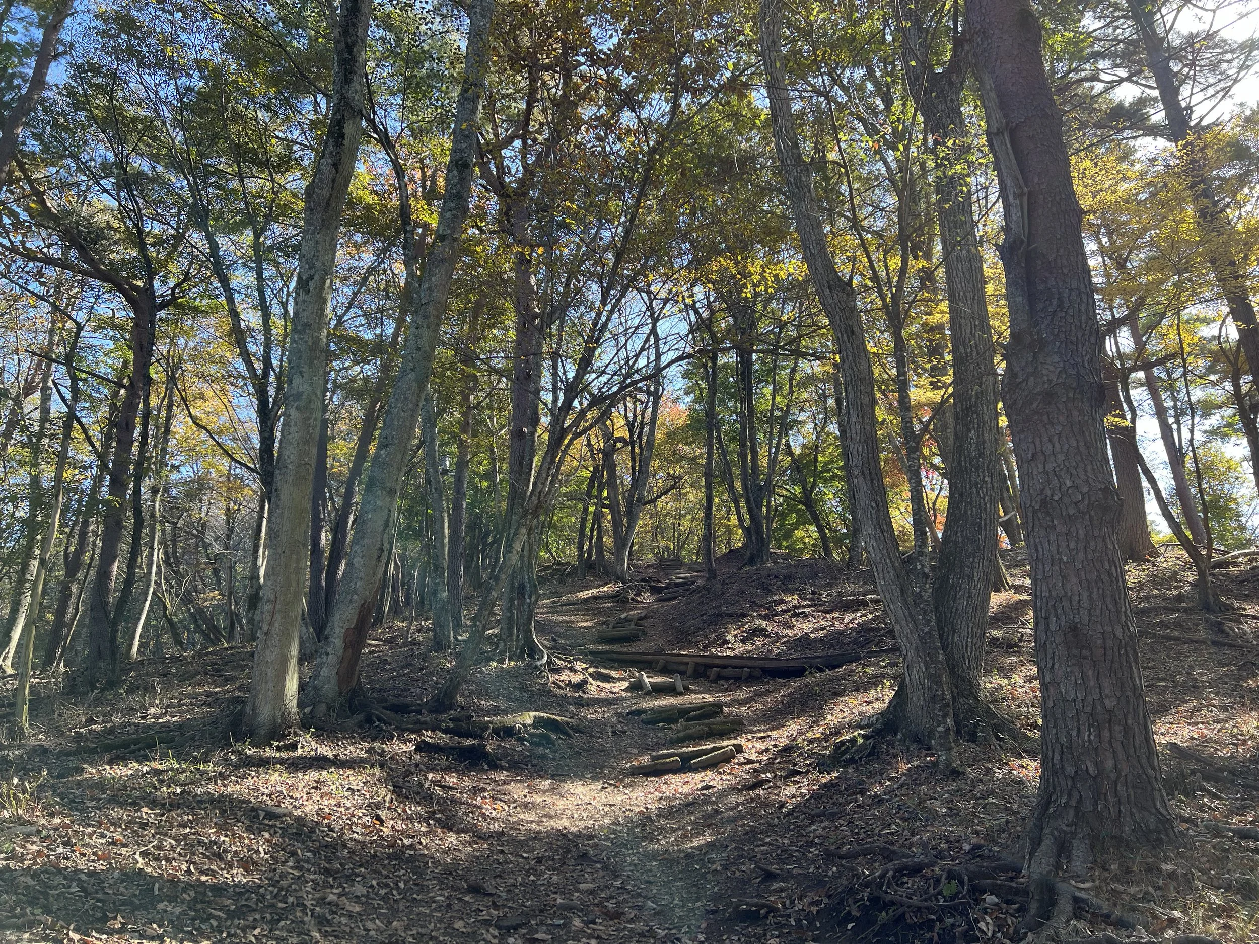
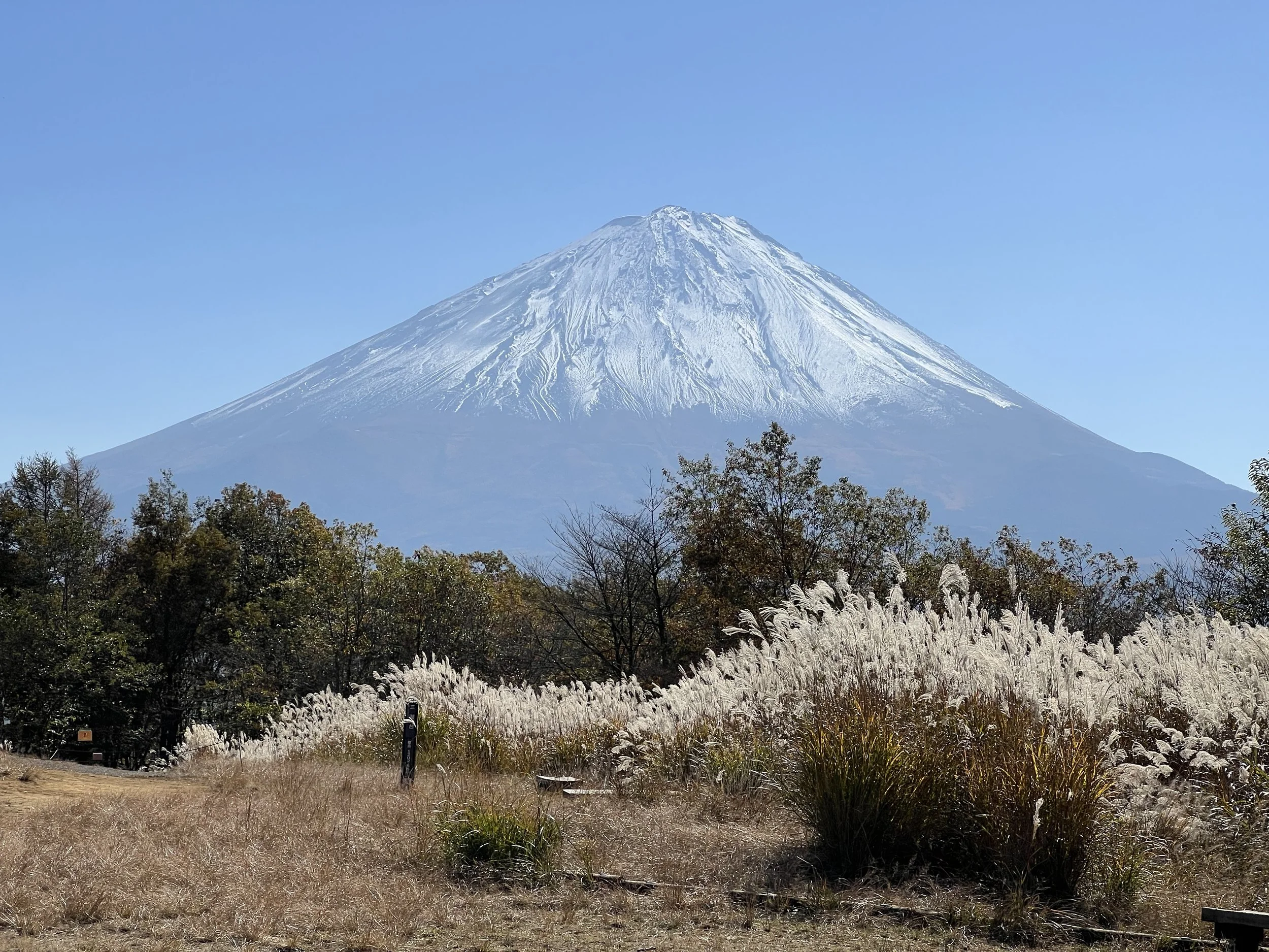
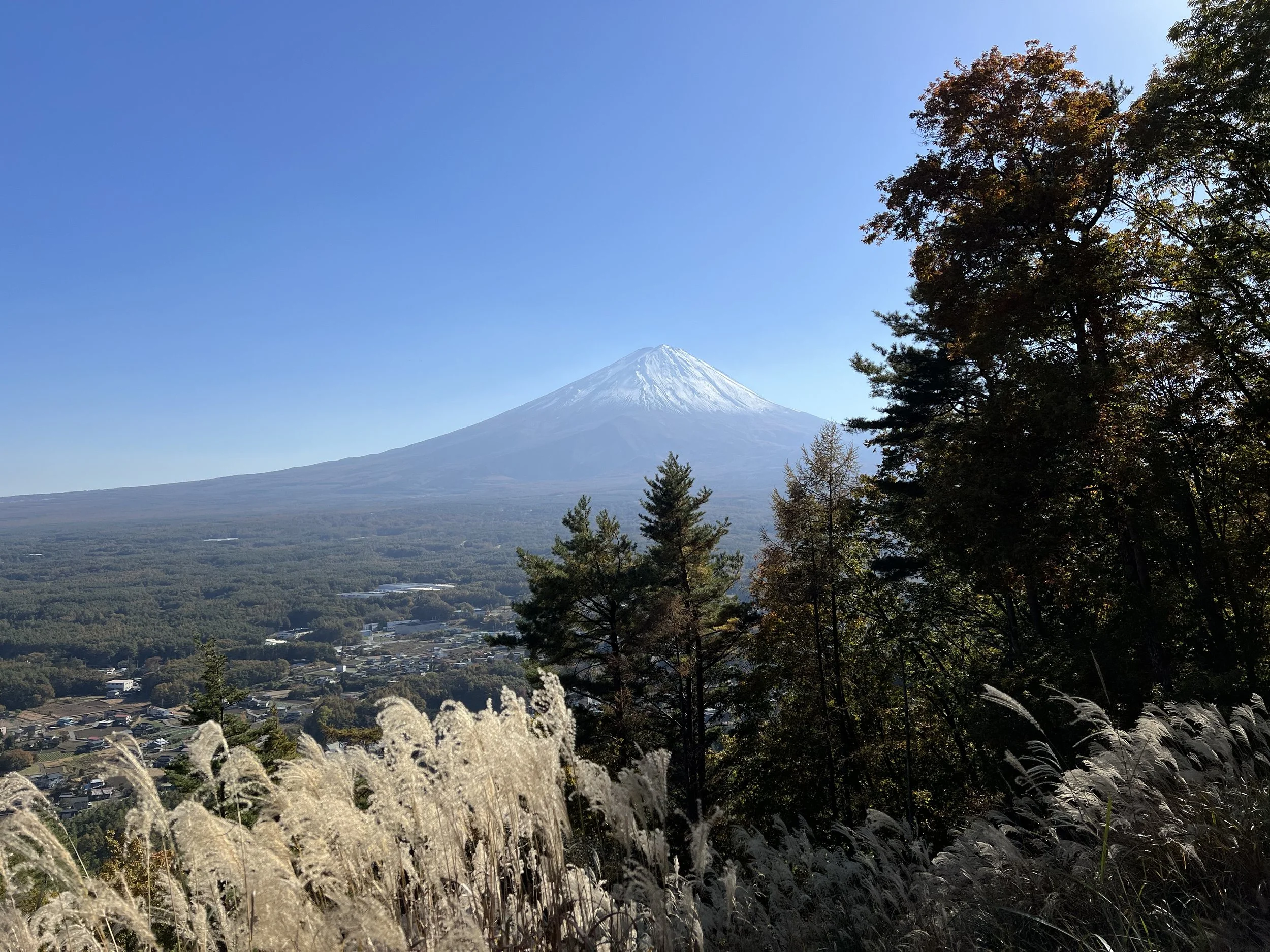
The trail began with a steady incline, and partway up, a few trail workers quickly passed us, pausing just long enough to warn that the sandy path could be slippery. It didn’t take long to reach Koyodai, where I took countless photos from a spot framed by pine trees with Mount Fuji in the background. There was a small shop nearby, so I grabbed a bottle of water and a sports drink before continuing.
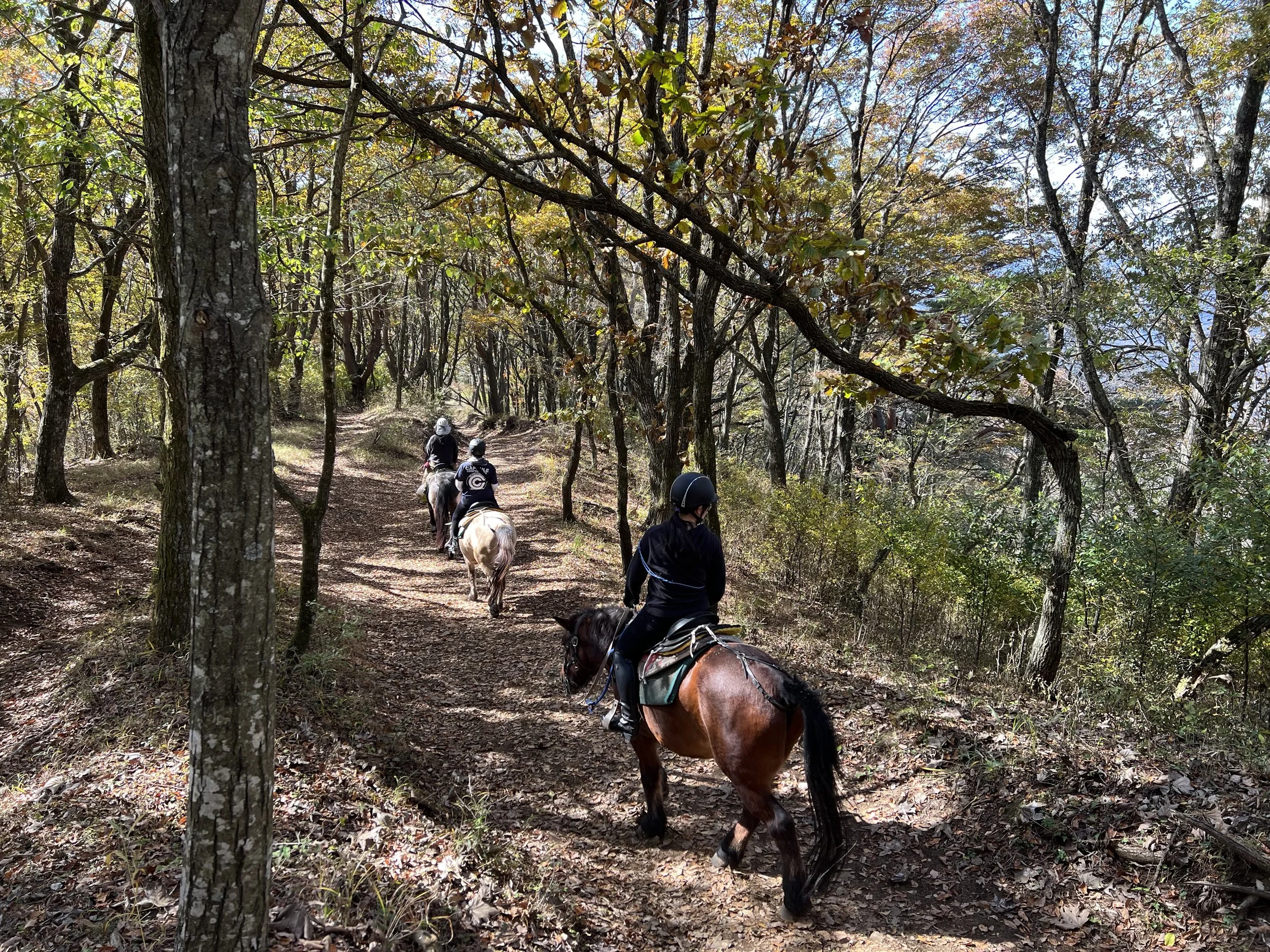
Although the autumn colours were past their peak, the forest was still beautiful—I can only imagine how stunning it must be at its height. On the way to Sankodai Observatory, I passed a few people on horseback and learned you could rent horses for guided rides here. I wish I knew how to ride so I could have joined them.
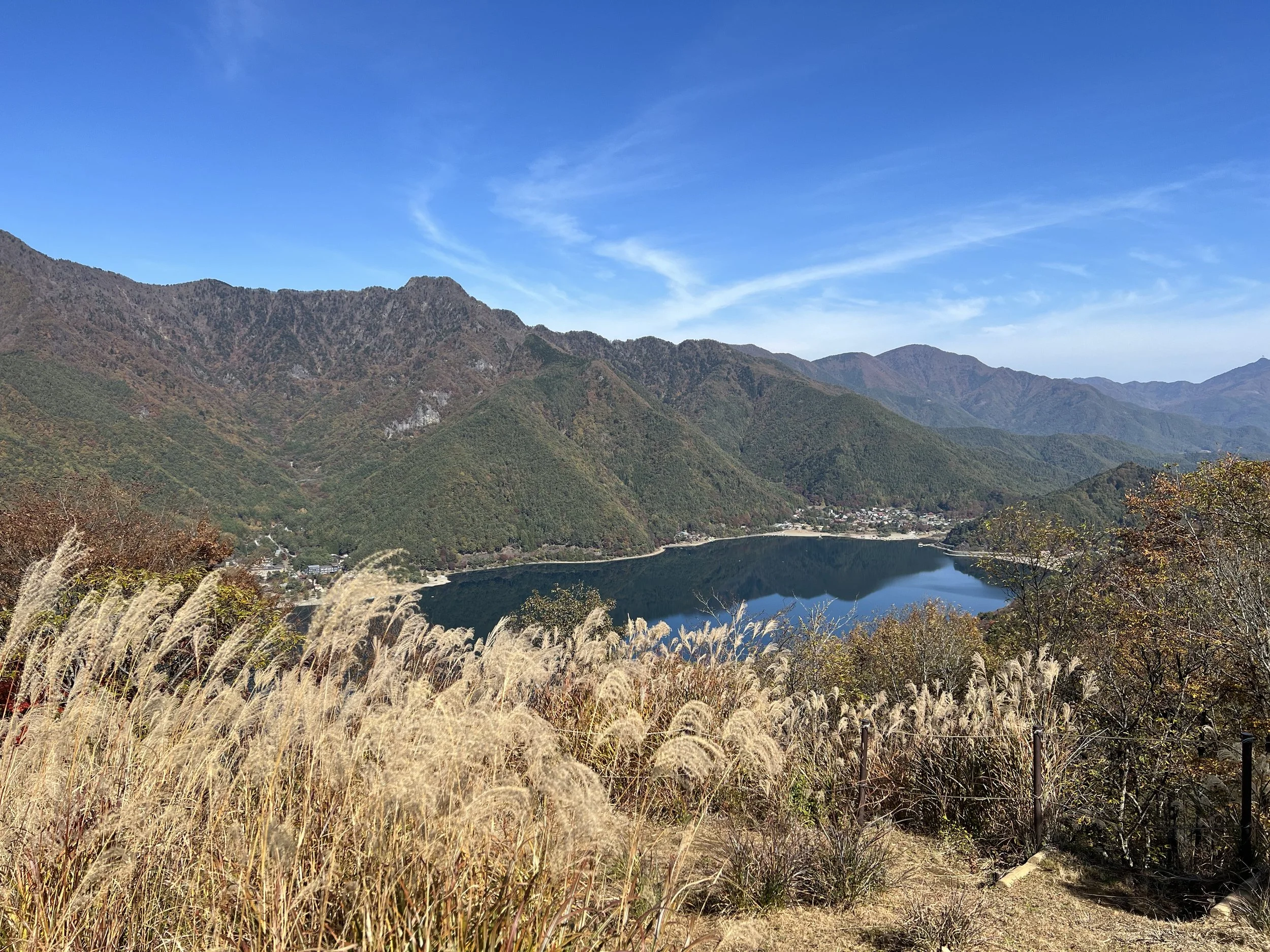
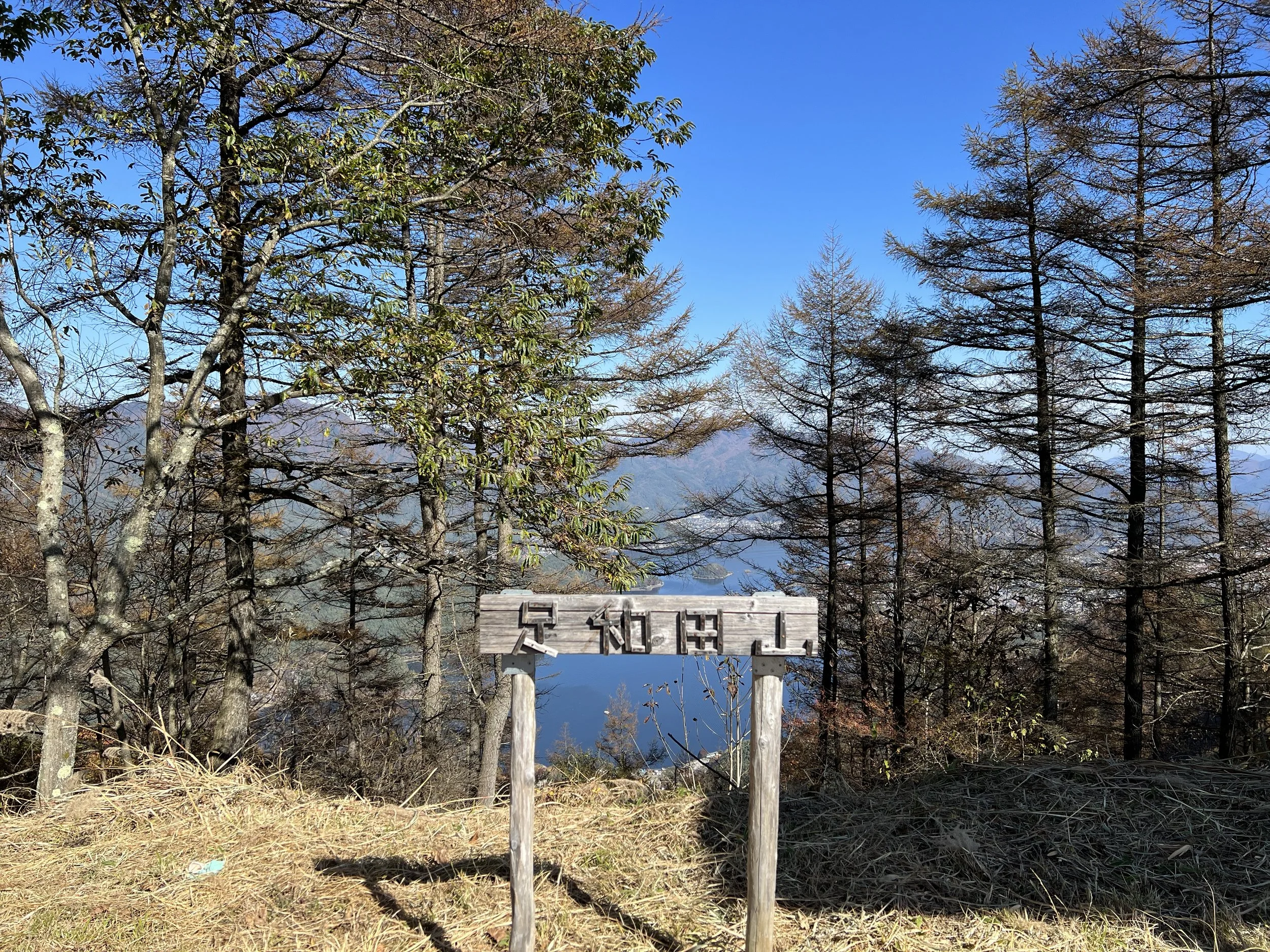
Sankodai Observatory had the most breathtaking view of Mount Fuji. I took a short break here to enjoy the rice balls I’d packed for breakfast and chatted with a couple of Japanese hikers who kindly shared their snacks with me. Many people turned back at Sankodai, but I had enough time to continue to Mount Ashiwadayama. Along the way, I passed a large group of cheerful students in uniform hiking toward Sankodai, singing as they climbed—it was such a fun and contagious energy that gave me a boost for the final stretch.
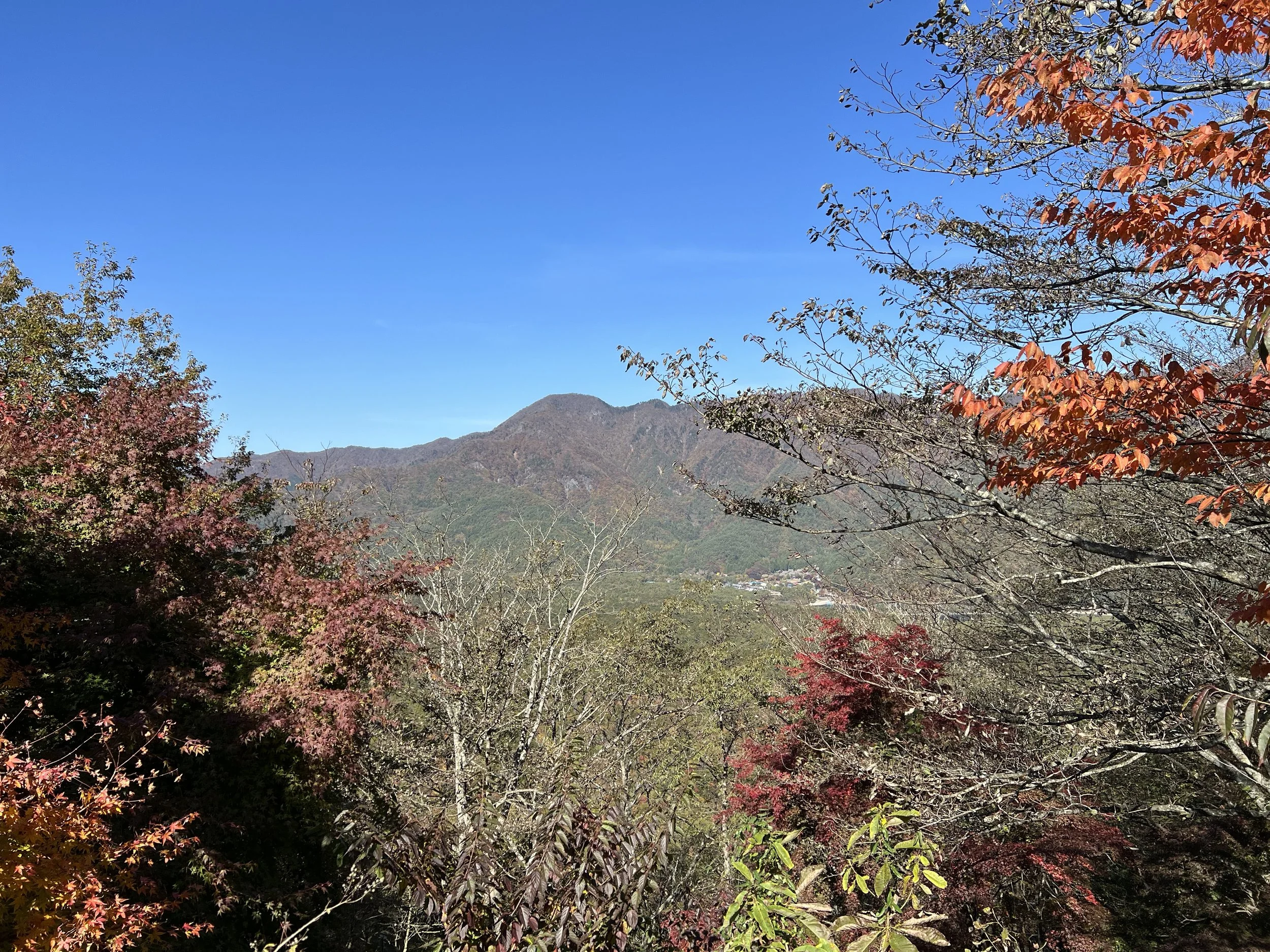
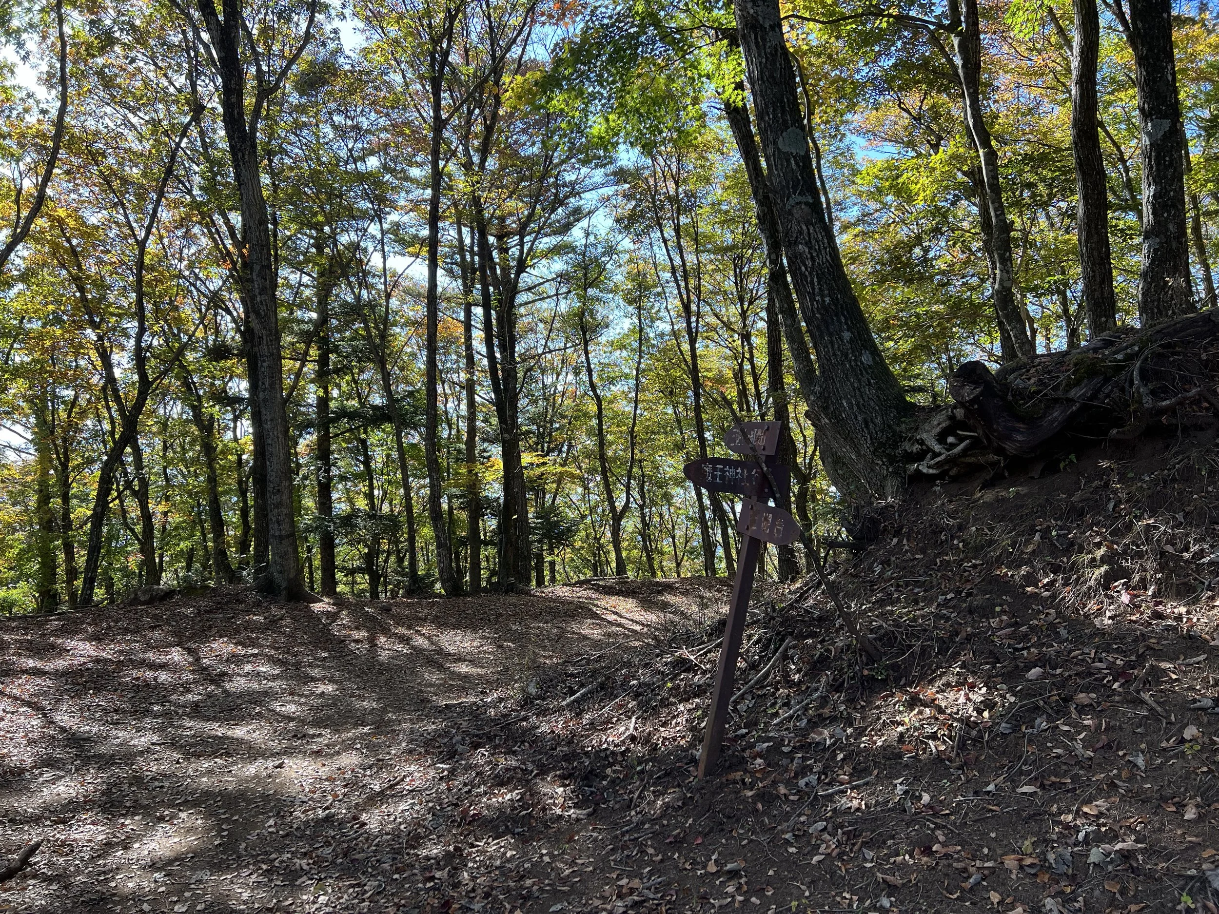
The view from Mount Ashiwadayama was wide and open, though Mount Fuji wasn’t visible from this angle. I stayed for about twenty minutes to rest before beginning my descent. The trail down was clearly less travelled, covered in fallen leaves that made it quite slippery, but I made it down safely and reached Lake Kawaguchi just in time to catch the bus.
History & Background
Koyodai (紅葉台) – Known as the “Autumn Leaves Plateau,” Koyodai offers one of the best vantage points for Mount Fuji, especially during the fall season when the forest bursts into colour. The area is part of Fuji-Hakone-Izu National Park and has long been admired by painters and photographers alike.
Sankodai (三湖台) – Literally meaning “Three Lakes Observatory,” Sankodai lives up to its name with panoramic views of Lakes Kawaguchi, Saiko, and Shoji. The ridge trail here was historically used by locals to travel between villages before roads were built, and today it’s one of the region’s most scenic hiking routes.
Mount Ashiwadayama (足和田山, 1,355m) – Rising between the Fuji Five Lakes, Mount Ashiwadayama has been part of Fuji’s cultural and spiritual landscape for centuries. It’s said to have served as a boundary marker in the Edo period and remains a peaceful, lesser-visited peak ideal for those seeking quiet forest trails and sweeping ridgeline views.
Getting There
From Tokyo, the easiest way to reach Fujikawaguchiko is by highway bus, which you can conveniently reserve online. For a more scenic journey, you can also take the train from Shinjuku, though it costs nearly twice as much as the bus.
From Kawaguchiko Station, local and sightseeing bus (blue line) run to stops near the Koyodai trailhead. If you plan to stay in the area for a few days, consider getting the Sightseeing Bus Pass — it offers unlimited rides and covers all the major attractions.
Route Overview
Distance: 9.33 km (Koyodai Trailhead → Okukawaguchiko Trailhead)
Total elevation gain: 397 m
Duration: 2 hr 30 min (with breaks 3 hr 49 min)
Difficulty: Intermediate
Peaks: Koyodai Observatory 紅葉台展望 1165m, Sankodai Observatory 三湖台 1202m, Mt Ashiwadayama 足和田山 1355m
Cost Breakdown
Bus Pass: Kawaguchiko 2-Day Sightseeing Bus Ticket — ¥1,700
Food: ¥572