Karuizawa - Nagano, Japan
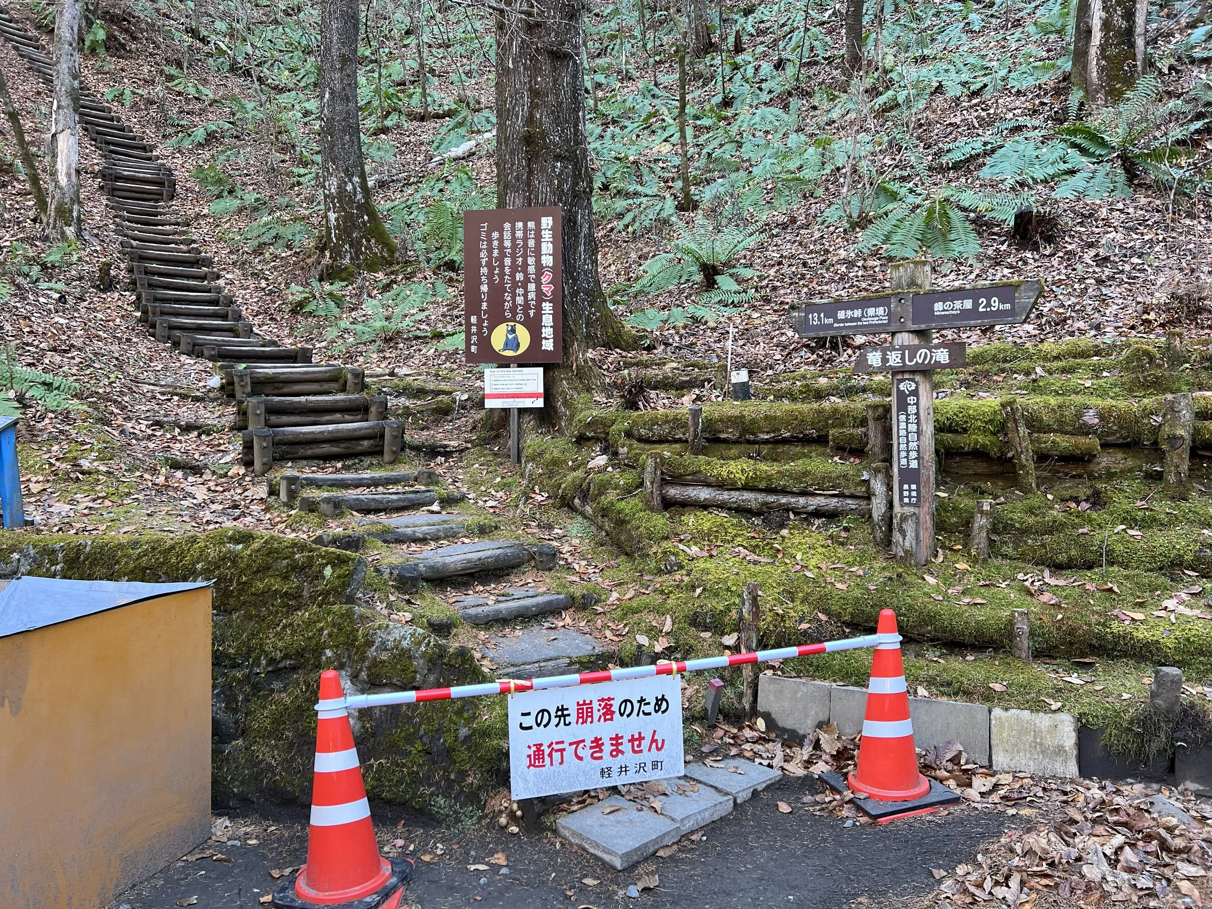
I had originally planned to hike in the Shiraito Waterfall area, but those plans shifted shortly after I arrived. Karuizawa is an easy Shinkansen ride from Nagano, and once there, I boarded a bus bound for Shiraito Waterfall. Aside from the waterfall itself, I was hoping to explore the surrounding trails, but upon arrival, signs indicated that sections of the trail network were damaged and currently closed.
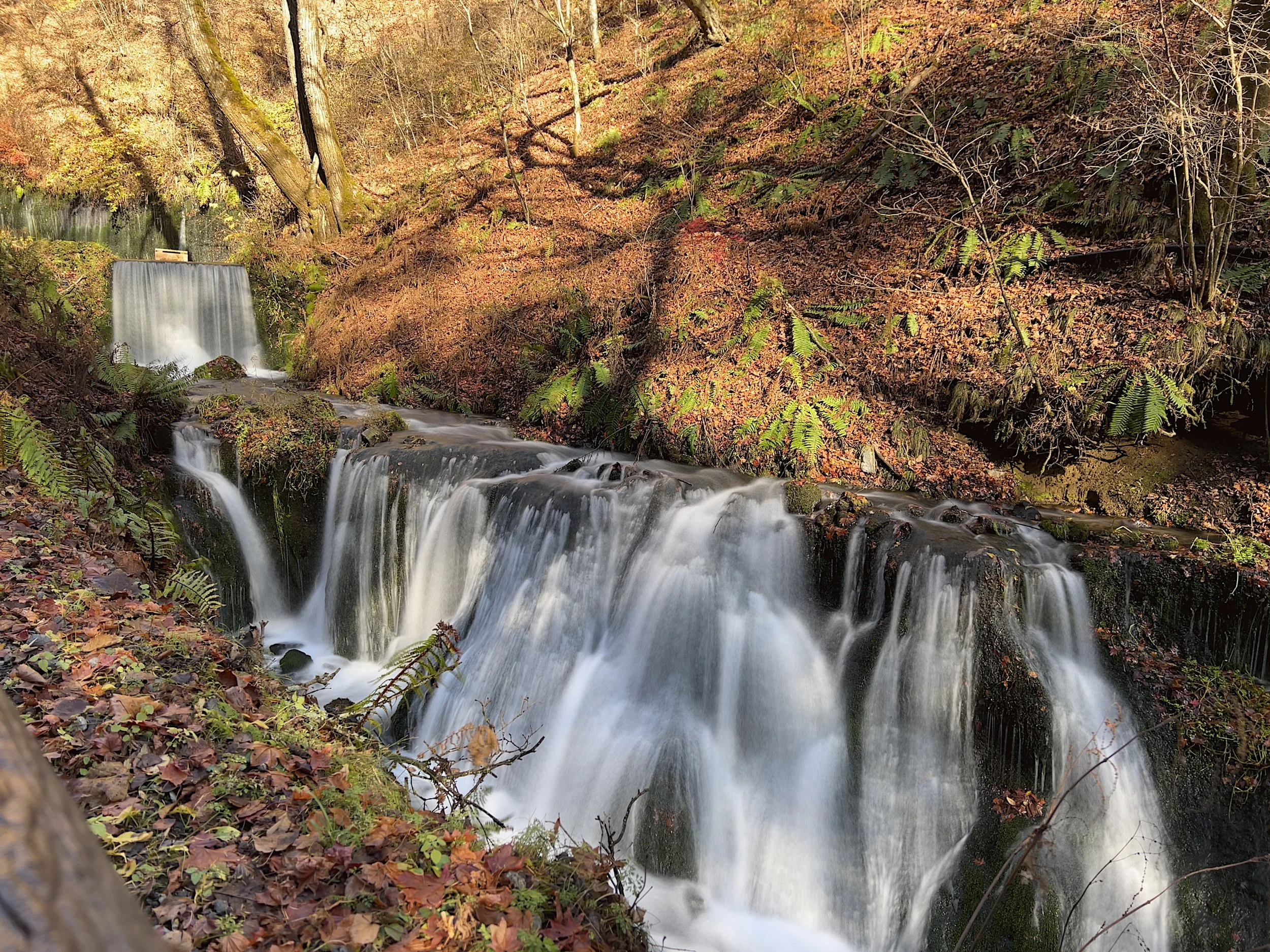
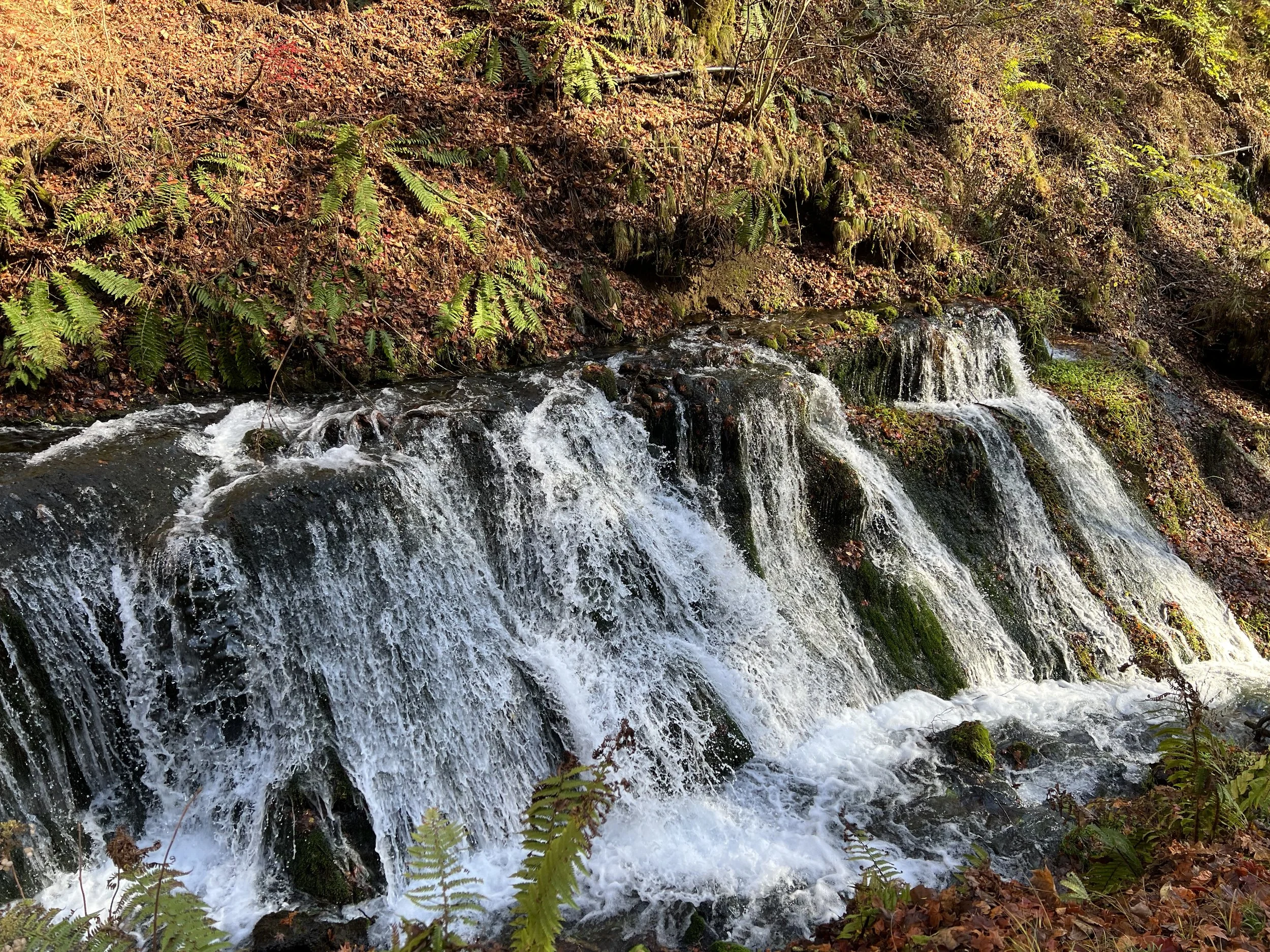
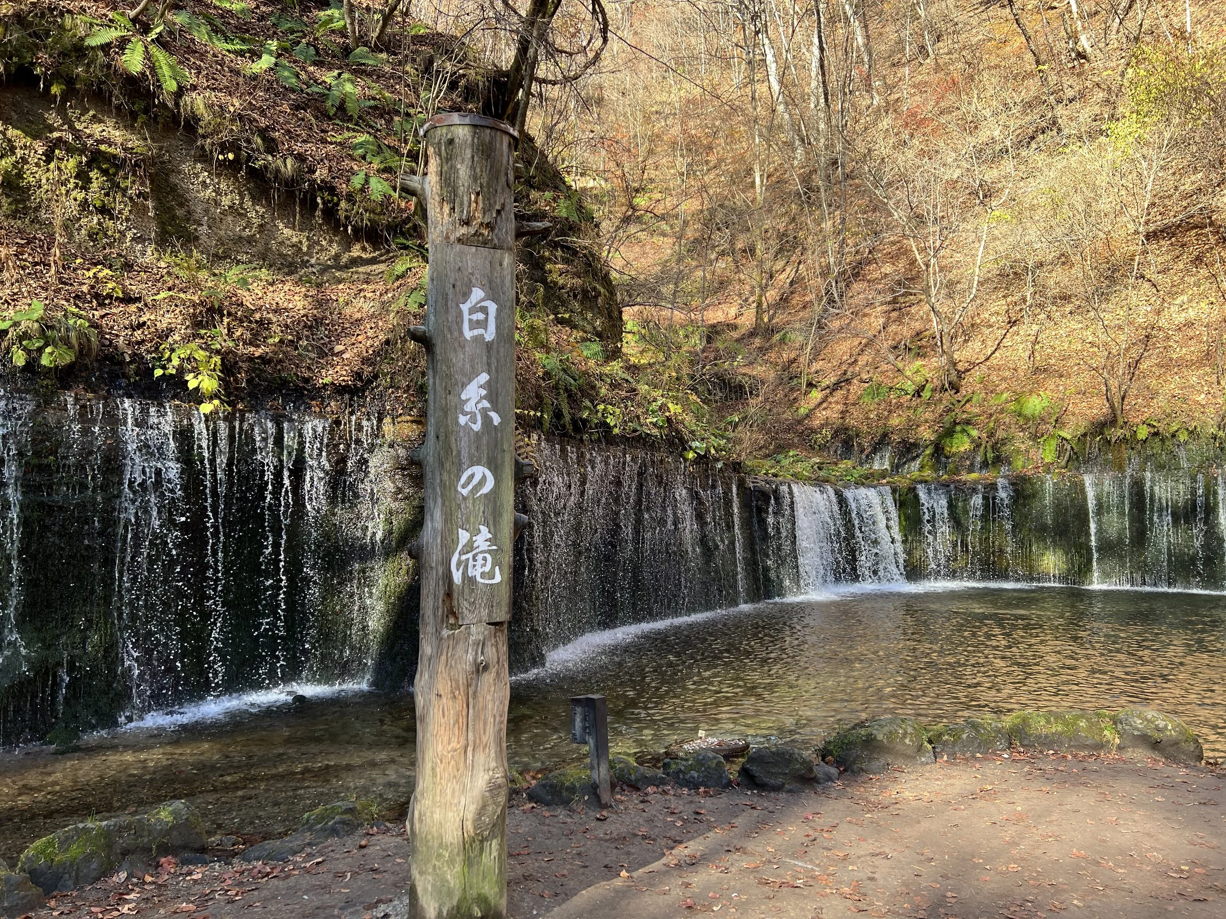
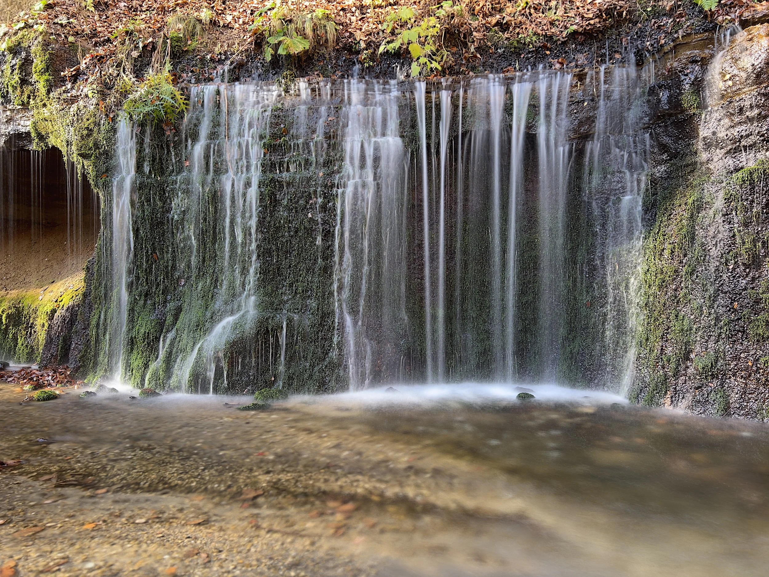
Shiraito Waterfall—literally translated as “White Thread Waterfall”—isn’t particularly tall, standing at only three metres, but it stretches roughly 70 metres wide. The geology here is what makes it unique. Groundwater flows through a volcanic layer in the mountain above before emerging evenly across the rock face, which is why no river feeds into the waterfall. From a distance, it looks like a white curtain draped across the cliff.
There were a handful of photographers spread out across the viewing area, each trying to capture the waterfall from a slightly different angle. I did the same, moving around until I found a spot that worked. With the hiking portion of my plan no longer an option, I made my way back toward the bus stop, picked up a deer meat bun, and waited for the return bus.
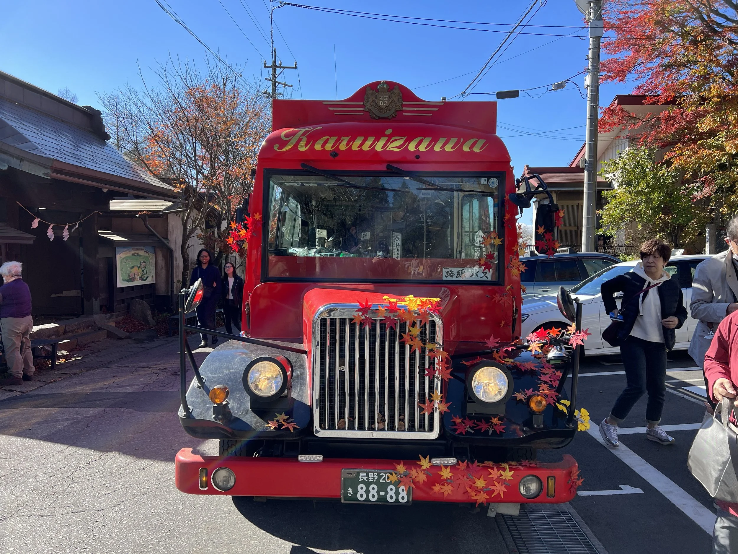
Back at Karuizawa Station, I walked toward Old Karuizawa Ginza Street. The area is filled with shops and restaurants and still carries the feel of a resort town from an earlier era. More importantly, this is where I needed to catch the red sightseeing bus heading toward Usui Pass.
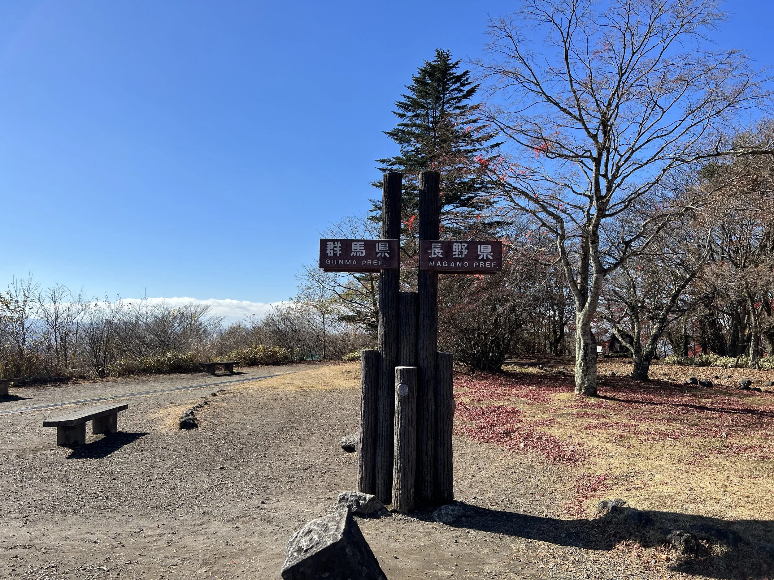
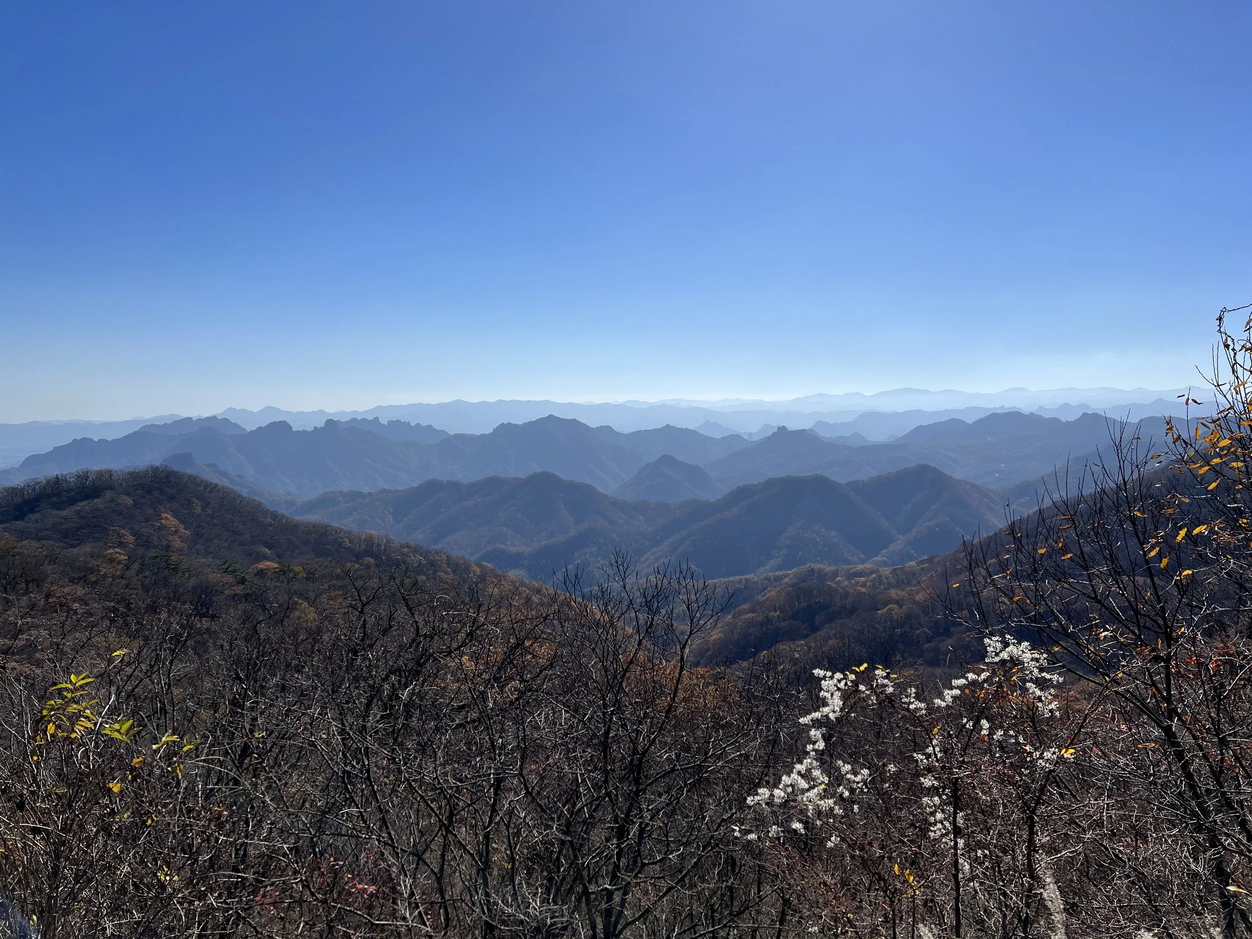
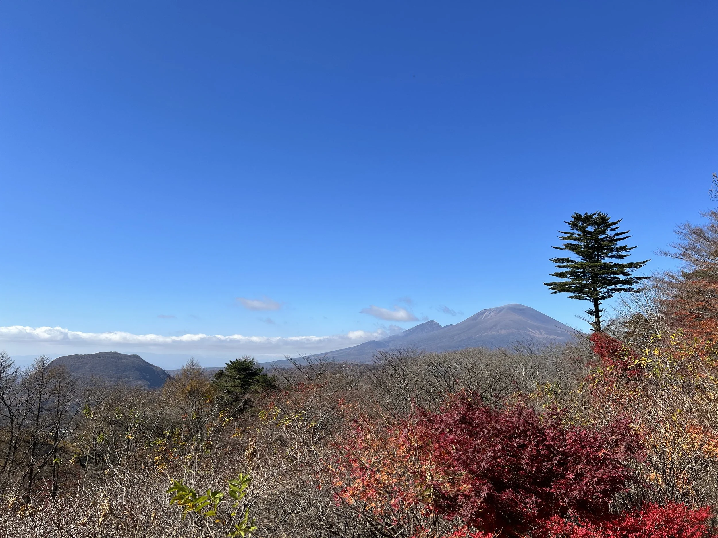
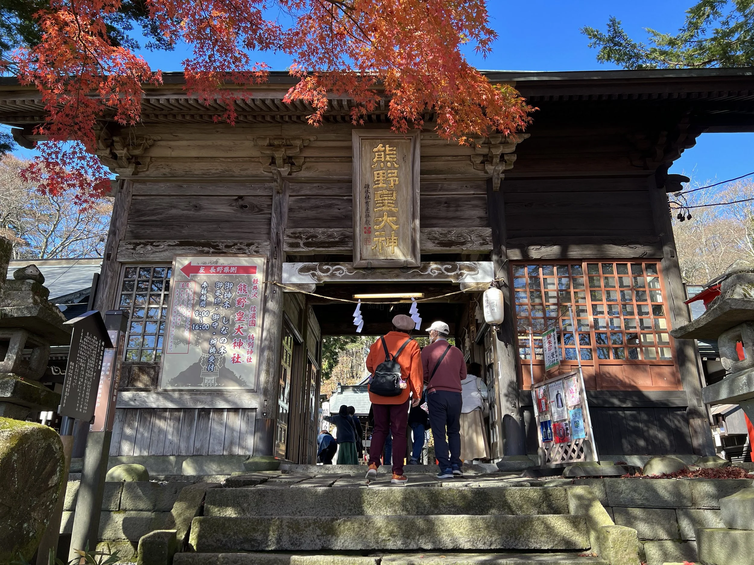
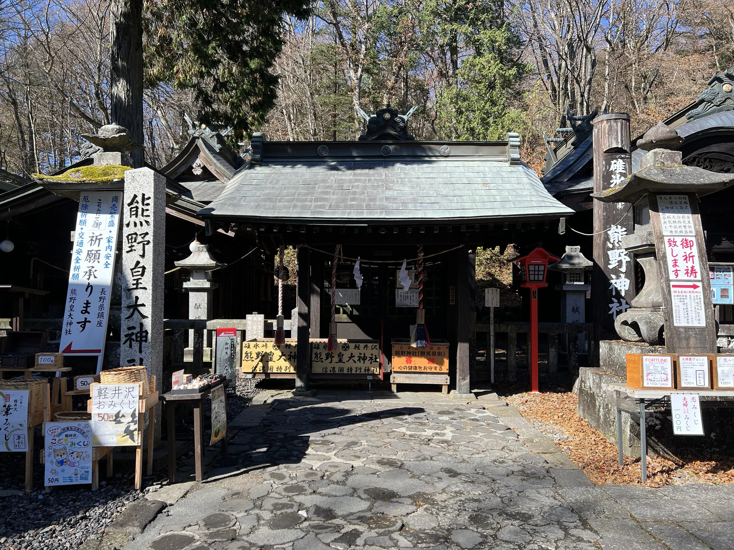
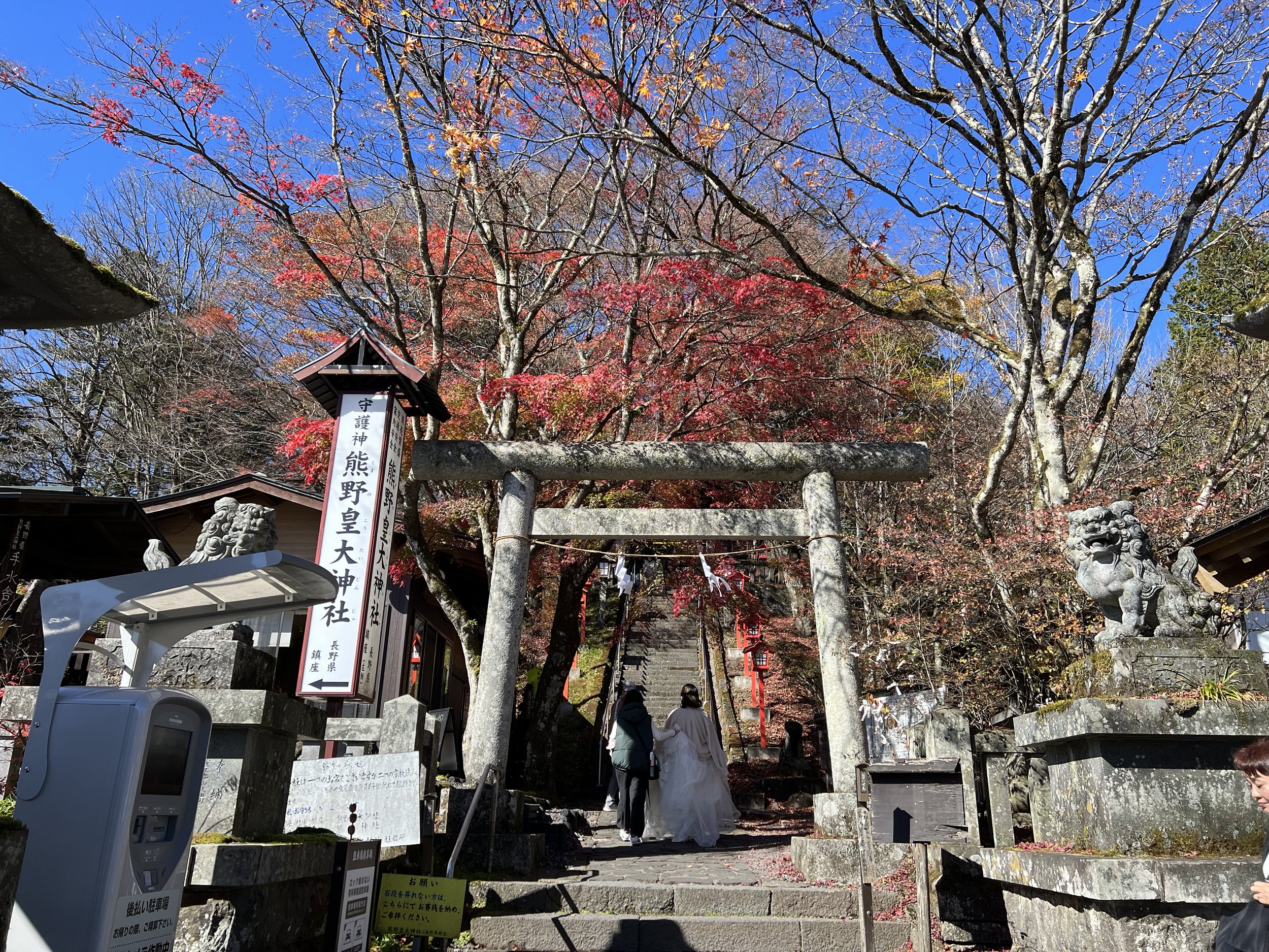
The Usui Pass observation area offers wide, open views across two prefectures. From the lookout, you can see into Gunma Prefecture on one side and toward Mount Asama on the Nagano Prefecture side. I spent some time wandering around and taking in the scenery before walking toward Kumano Kotai Shrine, which sits directly on the border between the two prefectures.
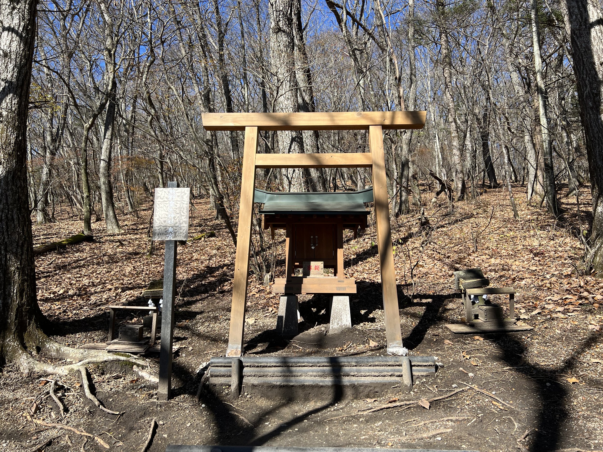
What makes this shrine particularly interesting is its layout. Although it is a single shrine, it has three halls: the main hall sits directly on the prefectural boundary, the Nachi Hall lies on the Nagano side to the left, and the Shingu Hall is on the Gunma side to the right. Walking behind the shrine, a short uphill path leads to several smaller shrines scattered along the hillside. Despite being one complex, the different sides traditionally worship different deities, giving the shrine a unique dual identity.
The shrine is also known for its 1,000-year-old shina tree, or Japanese linden, which is considered a sacred symbol of marriage, good fortune, and long-lasting relationships. It’s a popular destination for couples, and during my visit, I saw a couple taking wedding photos in the area.
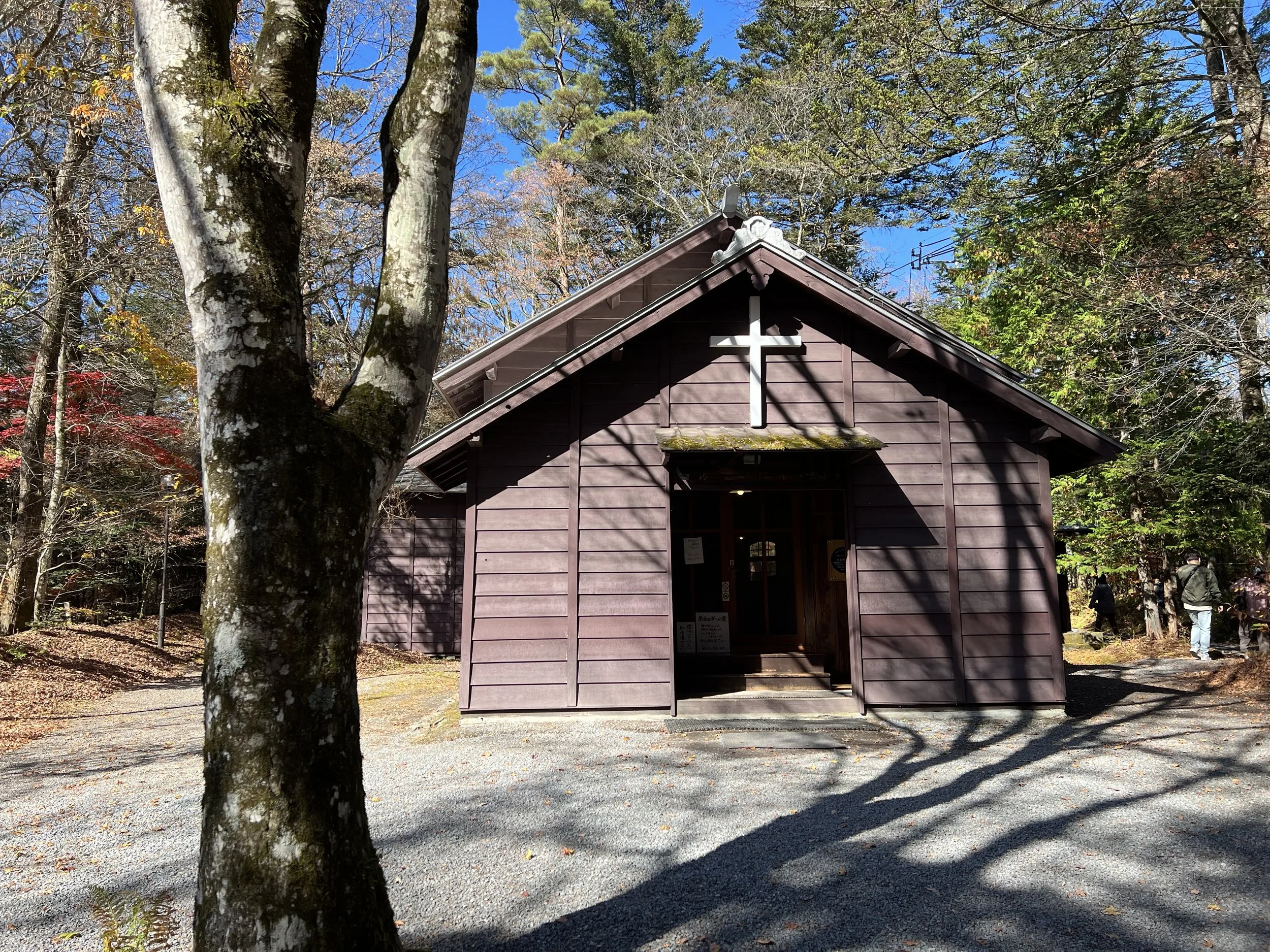
After leaving the Usui Pass area, I made my way back down the mountain and stopped at Karuizawa Shaw Memorial Church, located at the foothills. Built in 1895 by an Anglican priest, it is the oldest church in the area. Set within a quiet forest grove, the grounds felt calm and reflective, a noticeable contrast to the busier areas I had visited earlier.
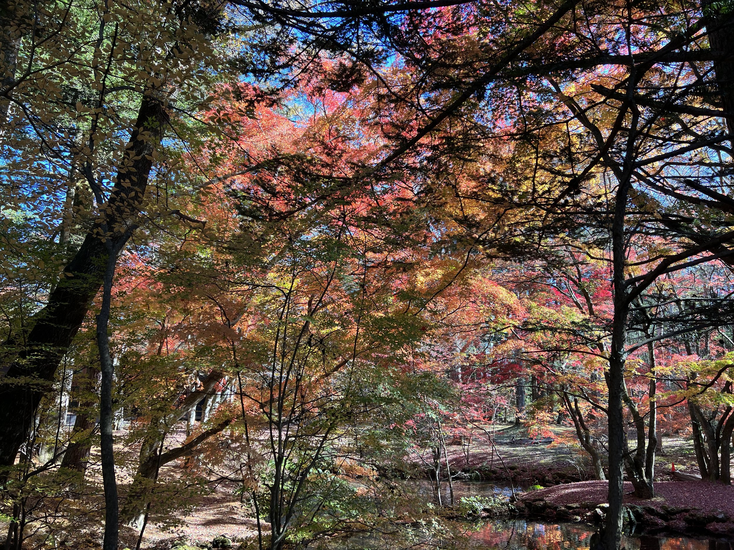
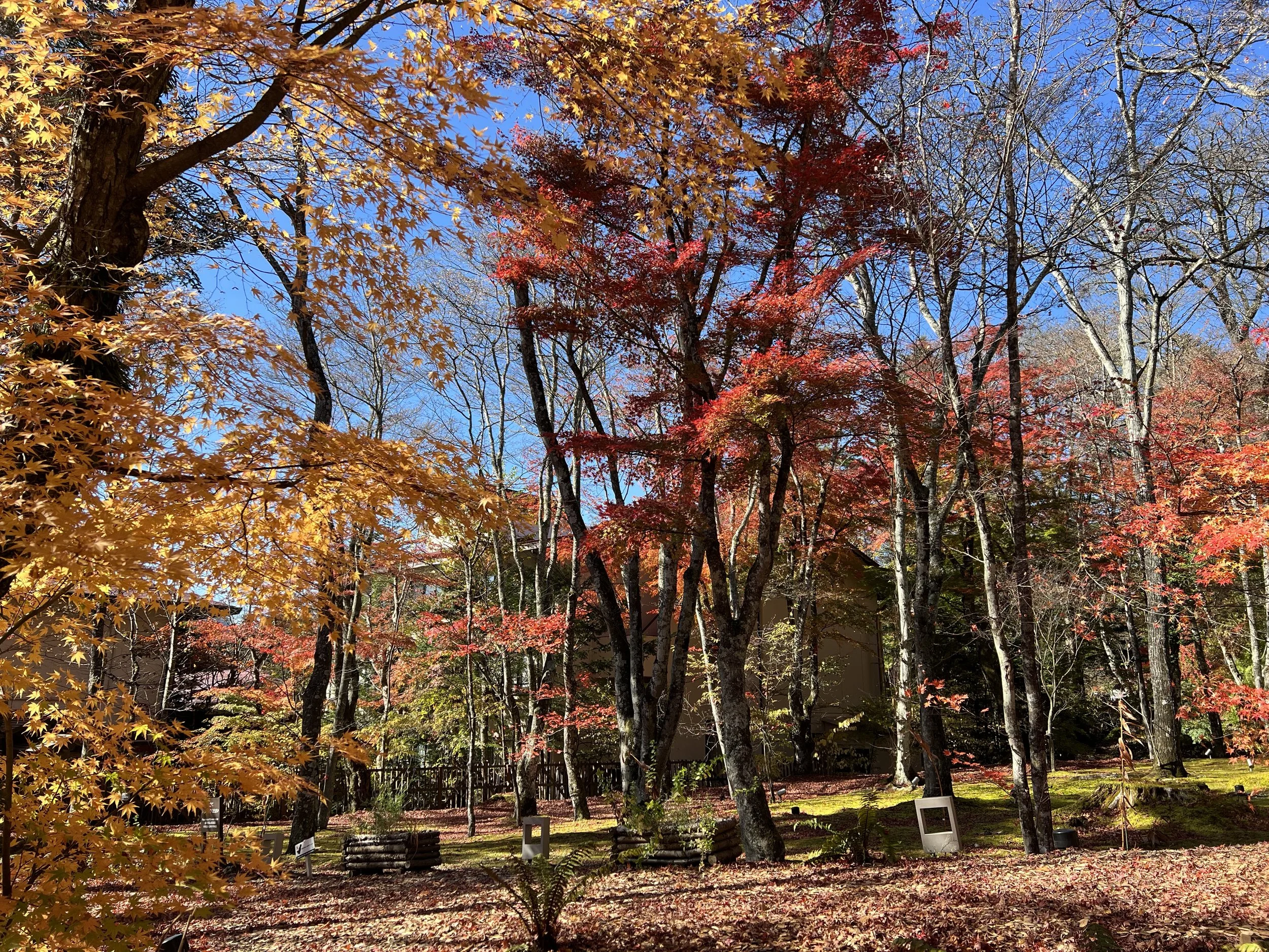
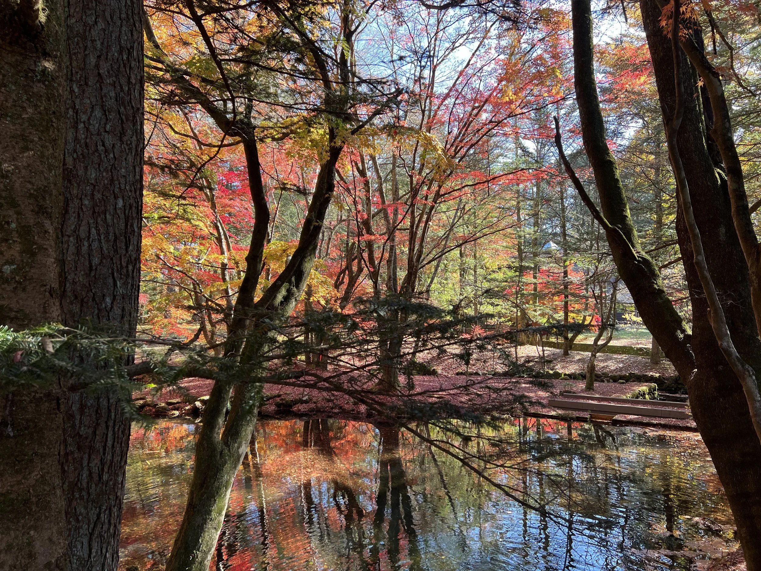
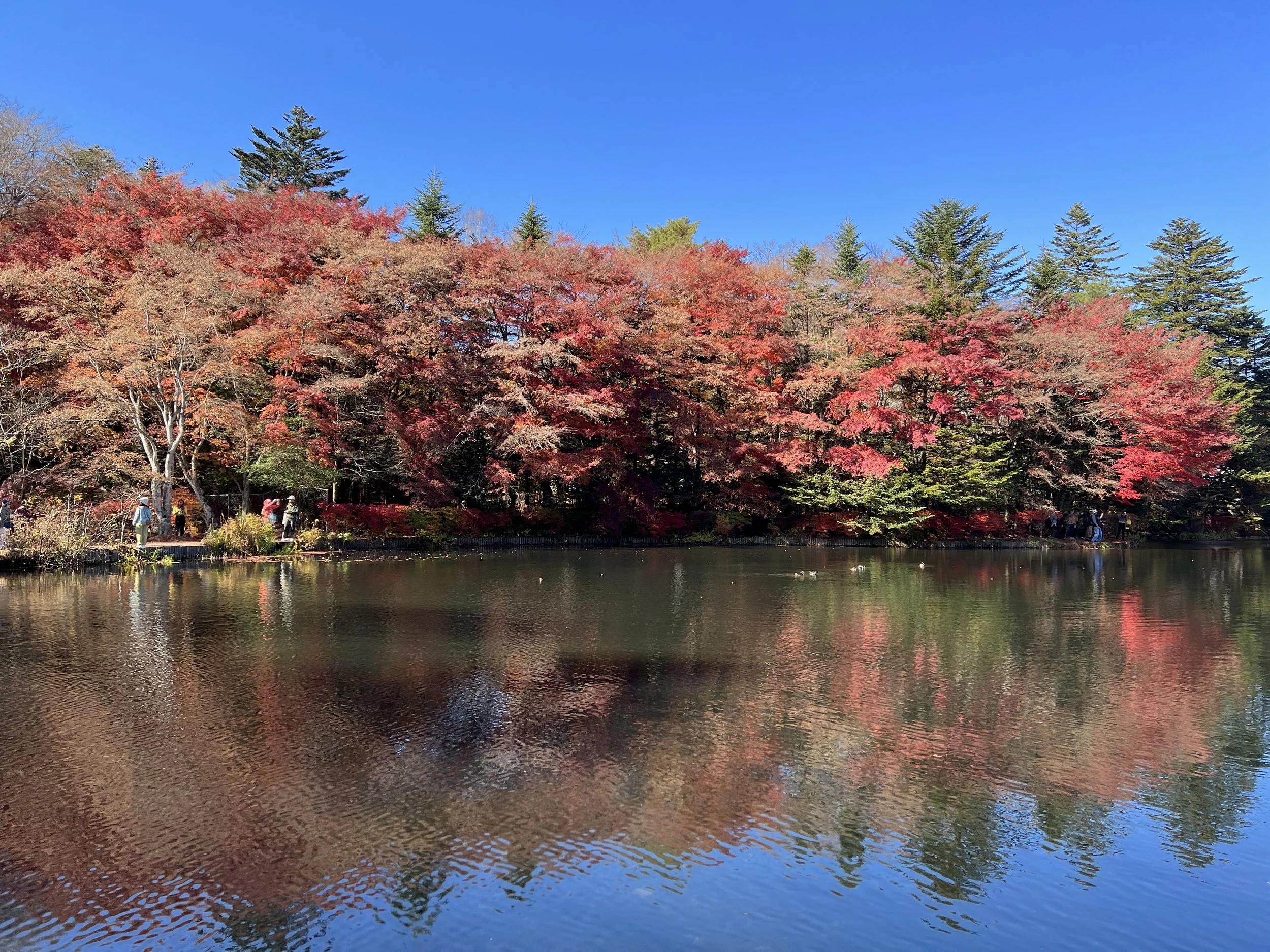
From there, I continued on to Kumoba Pond. Visiting during peak autumn colours, the pond is known for offering some of the best seasonal views in Karuizawa. Often referred to as “Swan Lake” due to its shape, the pond acts like a mirror, reflecting the surrounding foliage. When I arrived, however, it was far more crowded than I expected, with multiple tour buses, wedding photo shoots, and photographers all gathered in the same area.
I walked the trail around the pond in search of a quieter spot. The path is just over a kilometre long, well maintained, and easy to follow. I noticed that the further I walked from the main entrance, the thinner the crowds became. Since the most dramatic views are right near the entrance, many visitors don’t continue much further. After taking enough photos, I headed back toward Karuizawa Station.
I didn’t manage to see everything Karuizawa has to offer—there are numerous museums, hiking trails, and historical sites scattered throughout the area—but for a quick one-day visit, I felt like I covered the highlights.
History & Background
Karuizawa (軽井沢) developed as a mountain resort town in the late 19th century, particularly after the opening of the railway and the influence of foreign missionaries and diplomats. Its cool climate made it a popular summer retreat, especially for residents of Tokyo seeking relief from the heat.
The surrounding area is shaped by volcanic activity from nearby Mount Asama, one of Japan’s most active volcanoes. This geology influences many of Karuizawa’s natural features, including Shiraito Waterfall. Over time, the town has grown into a mix of natural scenery, historic architecture, religious sites, and cultural attractions, while still retaining its identity as a highland retreat.
Getting There
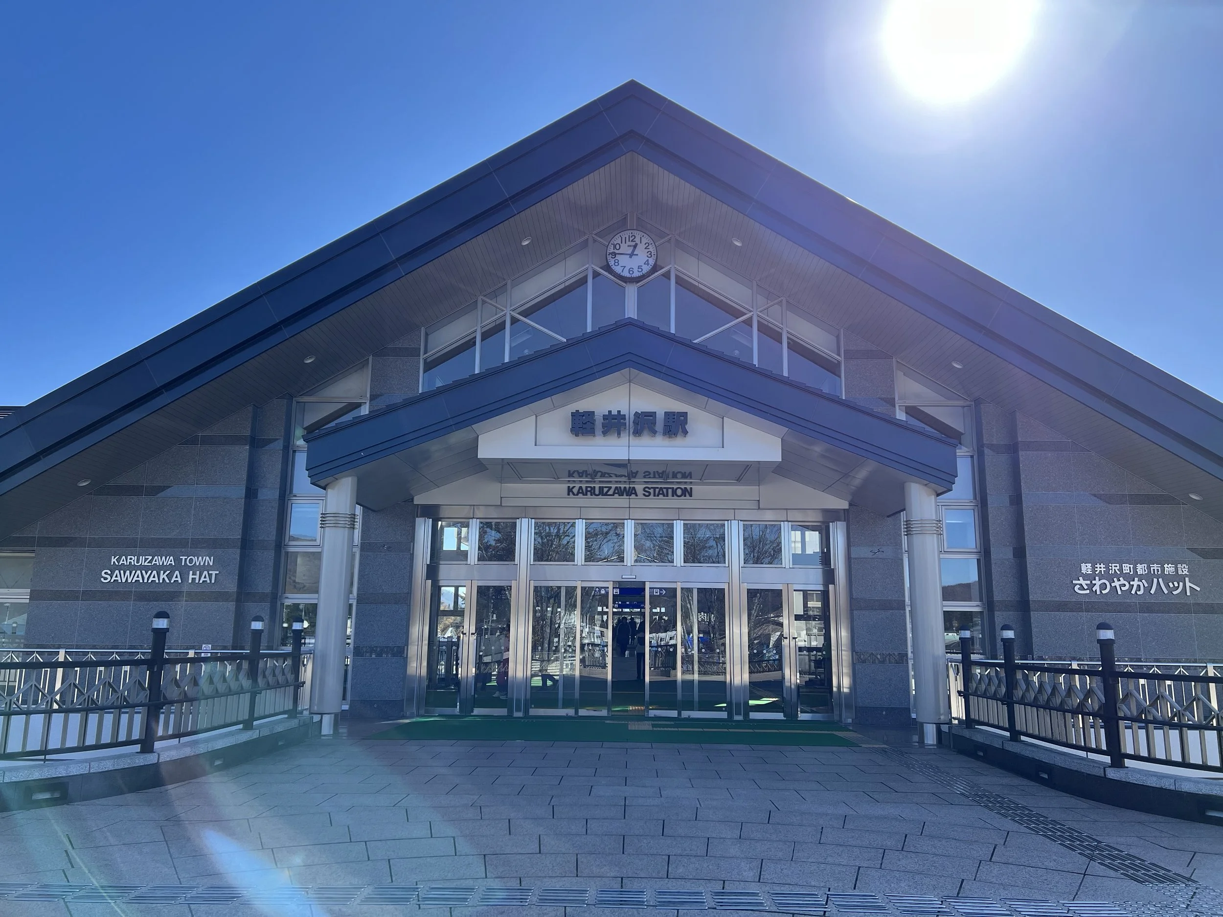
Karuizawa is accessible via Karuizawa Station on the Hokuriku Shinkansen line. From Tokyo Station, the Hokuriku Shinkansen provides direct service to Karuizawa, with a travel time of approximately 70 to 80 minutes. From Nagano Station, Karuizawa can be reached by the same Shinkansen line in about 30 minutes. Karuizawa Station serves as the primary transportation hub for the area, with local buses and sightseeing buses providing onward connections to destinations throughout Karuizawa and its surrounding areas.
Route Overview
Distance: 5.51 km out & back (Karuizawa Station)
Total elevation gain: 88 m
Duration: 1 hr 12 min (with breaks 1 hr 18 min)
Difficulty: Easy
Cost Breakdown
Train: Nagano Station → Karuizawa Station — ¥3,210
Bus: Karuizawa Station → Shiraitonotaki Bus Stop — ¥720
Bus: Shiraitonotaki Bus Stop → Karuizawa Station — ¥720
Red Bus: Karuizawa Station → Usui Pass — ¥500
Red Bus: Usui Pass → Karuizawa Shaw Memorial Church — ¥500
Food: ¥400